Влезте
Всички ресурси
Създаване на дизайн
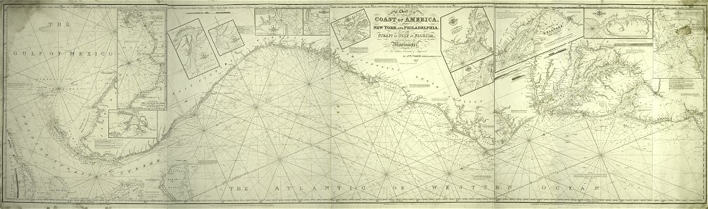
A chart of the coast of America - from New York and Philadelphia to the Strait or Gulf of Florida, and from thence to the Mississippi - a new edition corrected and improved by J.W. Norie, NYPL434117
Изтегляне
Редактиране на изображение
Публикувано от:
Creazilla
Автор:
J.W. Norie and Co. -- Publisher; Norie, J. W. (John William), 1772-1843 -- Surveyor
Източник:
commons.wikimedia.org
Loading...
0 stažení
Печат
Копиране на изображение
Зареждане...
map images supported by wikimedia uk
1856 maps
maps of the eastern united states
old maps of new york city
maps by john william norie
1837 maps
nypl maps of new york (state)
ПОДОБНИ