Влезте
Всички ресурси
Създаване на дизайн
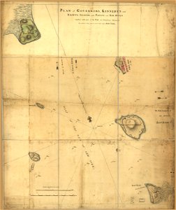
Plan of Governor's, Kennedy's, and Brown's Islands, with Paulus and Red Hook together with part of the bay and soundings shewing the position they bear to each ether (sic) and to New York. LOC 73691702
Изтегляне
Редактиране на изображение
Публикувано от:
Creazilla
Автор:
Montrésor, John
Източник:
commons.wikimedia.org
Loading...
0 stažení
Печат
Копиране на изображение
Зареждане...
old maps of new york (state)
maps in the library of congress
1766 maps
ПОДОБНИ