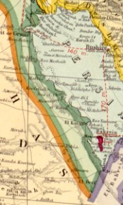
A map of the countries between Constantinople and Calcutta including Turkey in Asia, Persia, Afghanistan and Turkestan (cropped-Ahsa region)

A map of the countries between Constantinople and Calcutta including Turkey in Asia, Persia, Afghanistan and Turkestan (cropped-Ahsa region)

Edit image
Published by:
Creazilla
Author: Contributor Names Edward Stanford Ltd. Created / Published London : Edward Stanford, 1912.Source: commons.wikimedia.org

Loading...

0 downloads
Loading...
historyhistoricalskiptagmaps in the library of congressal-ahsa competition1912 maps of asiamaps of arabia1912 maps of saudi arabiamaps of the ottoman empire in the 20th-centurymaps of al-ahsa governorate

MORE LIKE THIS

Creazilla logo
Over 10 million free graphic resources for content creators and designers.
© 2018 - 2025 Creazilla
Our resourcesAll imagesPhotosDigital illustrationsClipartIconsPNG ImagesEmojisSilhouettesTraditional Art3D ModelsVectorsFontsColor namesColor palettesGradientsAudioAnimationVideosTemplates
InformationAbout CreazillaTerms of useTech teamPrivacy policyLicence Information
FeedbackContact Us