Log in
All resources
Create a design
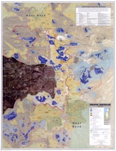
Greater Jerusalem May 2006 CIA remote-sensing map
Download
Edit image
Published by:
Creazilla
Author:
CIA
Source:
commons.wikimedia.org
Loading...
1 download
Print it
Copy image
Loading...
history
historical
skiptag
maps of jerusalem from 1949
maps in the library of congress
east jerusalem
satellite pictures of the middle east
maps showing israeli settlements in greater jerusalem
satellite pictures by spot-5
israeli-occupied territories
MORE LIKE THIS