Log in
All resources
Create a design
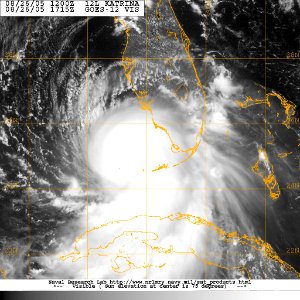
US Navy 050826-N-0000W-001 Satellite imagery showing the anticipated track of Hurricane Katrina. The storm crossed South Florida Thursday and headed back to sea in the Gulf of Mexico
Download
Edit image
Published by:
Creazilla
Author:
U.S. Navy photo
Source:
commons.wikimedia.org
Loading...
0 downloads
Print it
Copy image
Loading...
satellite pictures of hurricane katrina
satellite pictures of the gulf of mexico
MORE LIKE THIS