Log in
All resources
Create a design
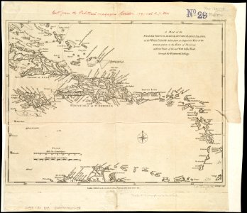
A map of the English, French, Spanish, Dutch, and Danish Islands, in the West Indies, taken from an improved map of the geographer to the King of France, with the tract of the last West India Fleet, (4587172518)
Download
Edit image
Published by:
Creazilla
Author:
Norman B. Leventhal Map Center at the BPL
Source:
commons.wikimedia.org
Loading...
0 downloads
Print it
Copy image
Loading...
1780s maps of the caribbean
18th-century maps of hispaniola
john lodge (engraver)
1781 maps
old maps of the caribbean from the norman b. leventhal map center
history of jamaica
cuba in the 18th century
1781 in the caribbean
MORE LIKE THIS