Log in
All resources
Create a design
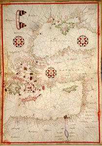
1590 Portolan chart of the Eastern Mediterranean, the Aegean and the Black Sea by Joan Oliva
Download
Edit image
Published by:
Creazilla
Author:
Oliva, Joan
Source:
commons.wikimedia.org
Loading...
0 downloads
Print it
Copy image
Loading...
maps in the library of congress
16th-century maps of the black sea
old maps of turkey
old maps of the aegean sea
16th-century maps of the mediterranean sea
portolan charts made in the 16th century
MORE LIKE THIS