Log in
All resources
Create a design
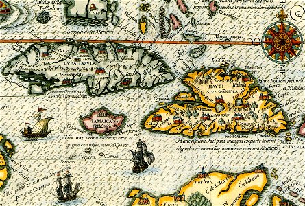
DeBry Map of Caribbean & Florida1594
Download
Edit image
Published by:
Creazilla
Author:
Theodor de Bry (1528–1598)
Source:
commons.wikimedia.org
Loading...
2 downloads
Print it
Copy image
Loading...
theodor de bry
old maps of colombia
old maps of panama
old maps of guatemala
colonial florida
colonial cuba
old maps of the history of venezuela
1594 maps of north america
16th-century maps of the spanish empire
16th-century maps of cuba
caribbean sea in art
16th-century maps of puerto rico
16th-century maps of hispaniola
1590s maps of the caribbean
watts' west indies and virginia expedition
MORE LIKE THIS