Log in
All resources
Create a design
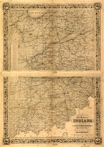
Colton's map of the state of Indiana, compiled from the United States surveys & other authentic sources, exhibiting sections, fractional sections, railroads, canals etc. LOC 98688473
Download
Edit image
Published by:
Creazilla
Author:
Colton, J. H. (Joseph Hutchins); Colton, J. H.
Source:
commons.wikimedia.org
Loading...
0 downloads
Print it
Copy image
Loading...
maps in the library of congress
1860 maps
old maps of indiana
MORE LIKE THIS