Log in
All resources
Create a design
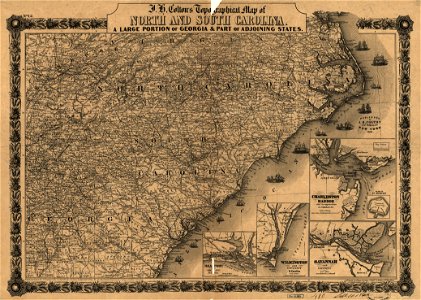
J. H. Colton's topographical map of North and South Carolina. A large portion of Georgia & part of adjoining states. Entered according to Act of Congress in the year 1861 by J.H. Colton. LOC 99447015
Download
Edit image
Published by:
Creazilla
Author:
Colton, J. H. (Joseph Hutchins); Colton, J. H.
Source:
commons.wikimedia.org
Loading...
0 downloads
Print it
Copy image
Loading...
maps in the library of congress
1861 maps of south carolina
1861 maps of north carolina
1861 maps of georgia (u.s. state)
MORE LIKE THIS