Log in
All resources
Create a design
Tools
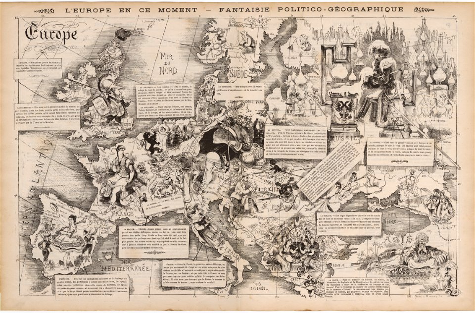
134 Free Images of 1872 Maps
pages with maps
cc-zero
archibald fullarton
voyage dans la russie méridionale et la crimée (1840-1842) par anatolii nikolaevich demidov
old maps of viceroyalty of the caucasus
1870s maps of the caucasus
19th-century maps of the black sea
history
historical
g. h. swanston
architecture
facade
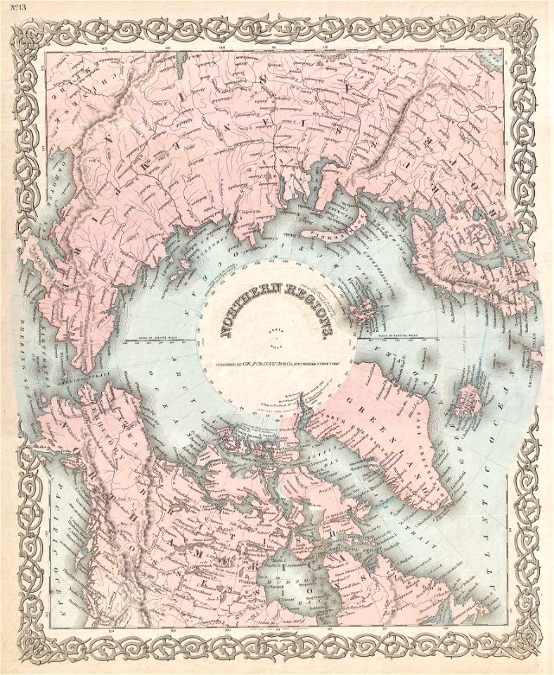
old maps of the arctic
1872 maps
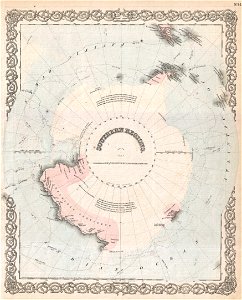
old maps of antarctica
1872 maps
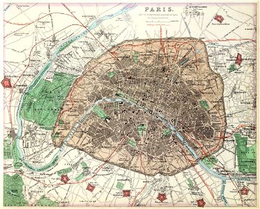
maps of paris from the david rumsey historical map collection
1872 maps
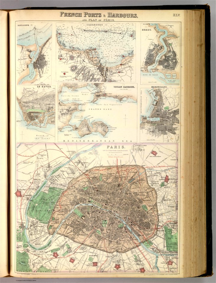
port of cherbourg
france
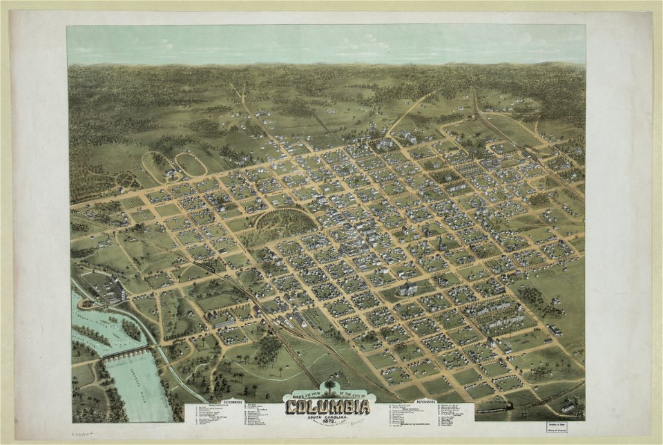
south carolina in the 19th century
columbia
south carolina in the 19th century
columbia
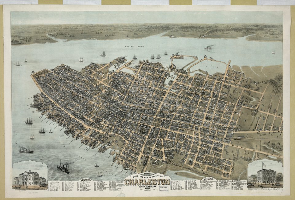
south carolina
charleston
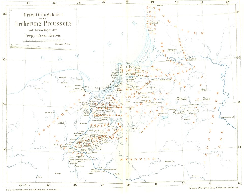
maps of prussia
1872 maps
1872 engravings
wood engraving
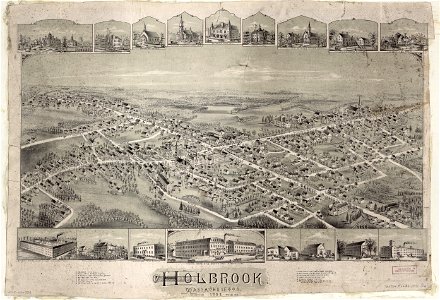
old maps of massachusetts
o. h. bailey
old weather and climate maps
1872 maps
self-published work
pages with maps
1872 paintings
cc-pd-mark
self-published work
pages with maps
1872 paintings
cc-pd-mark
self-published work
pages with maps
self-published work
village
self-published work
roof
self-published work
pages with maps
self-published work
vehicle
self-published work
town
architecture
facade
franco-prussian war
prussia
self-published work
pages with maps
self-published work
pages with maps
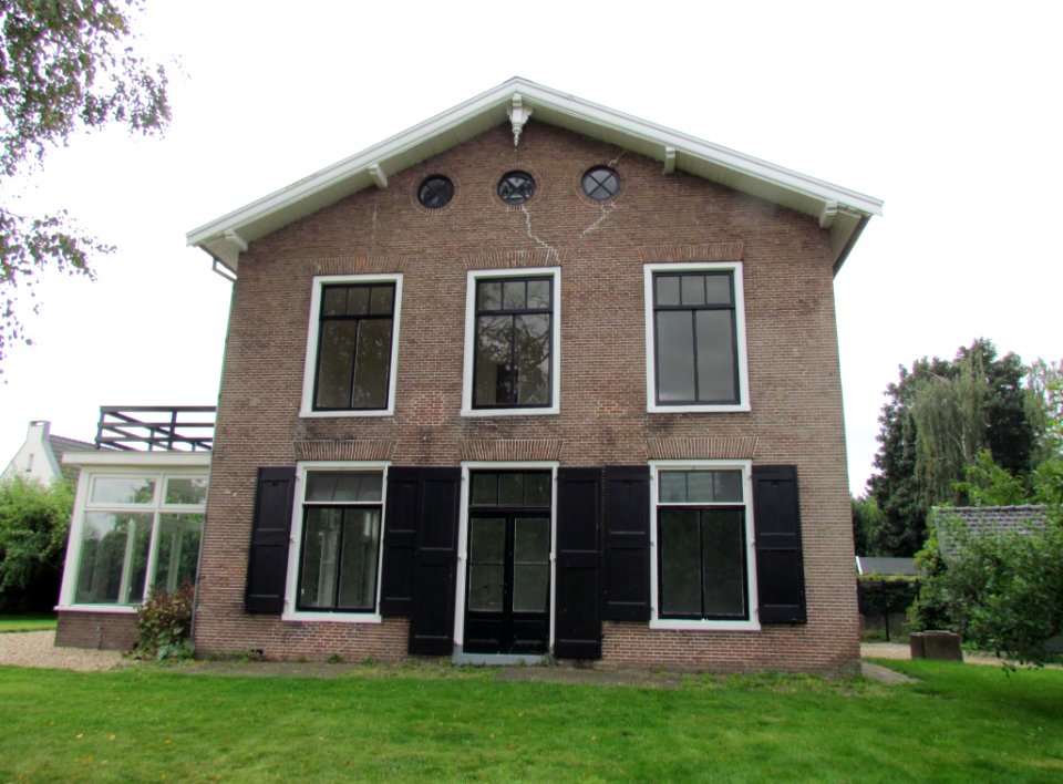
self-published work
architecture
self-published work
lawn
architecture
city
self-published work
pages with maps
village
roof
self-published work
pages with maps
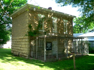
building structure
architecture
19th-century maps of the black sea
1870s maps of the caucasus
engravings of hannover
wood engravings
19th-century maps of the black sea
g. h. swanston
19th-century maps of the black sea
1870s maps of the caucasus
19th-century maps of the black sea
1870s maps of the caucasus
19th-century maps of the black sea
1870s maps of the caucasus
illustrations by true williams
roughing it (1872)
old maps of kobe
1872 in kobe
19th-century maps of the black sea
g. h. swanston
friedrich wilhelm delkeskamp
old maps of the rhineland
maps of kodagu district
edward weller
1870s maps of the caucasus
g. h. swanston
maps of mysore
edward weller
19th-century maps of the black sea
1870s maps of the caucasus
19th-century maps of crimea
g. h. swanston
1870s maps of the caucasus
g. h. swanston
1870s maps of the caucasus
g. h. swanston
1870s maps of the atlantic ocean
the bottom of the sea (1870)
19th-century maps of the mediterranean sea
the bottom of the sea (1870)
engravings from the adventures of three englishmen and three russians in south africa by françois pannemaker
illustrations from the adventures of three englishmen and three russians in south africa by jules férat
old maps of viceroyalty of the caucasus
19th-century maps of crimea
old maps of south africa
1879 maps of africa
harper's weekly illustrations by thomas nast
harper's weekly, 1872
alonzo chappel
library of congress
maps
illustrations from around the world in eighty days by neuville and benett
1872 maps
the bottom of the sea (1870)
maps of submarine cables
artis in de 19e eeuw
maps of artis
the bottom of the sea (1870)
distance
austro-hungarian north pole expedition
maps of franz joseph land
artis in de 19e eeuw
maps of artis
the bottom of the sea (1870)
maps of the adriatic sea
historical
history
maps by thomas nast
1872 maps of texas
portraits by charles-philippe larivière
neoclassicism
the bottom of the sea (1870)
maps of the strait of dover
bird's eye view of knoxville, tennessee, 1886
maps in the library of congress
admiralty charts region b: england wales ireland english channel southern north sea
admiralty charts 1401-1600
maps of orșova
vince grimm
historical
history
constantinople - and the scenery of the seven churches of asia minor (1839)
1830s maps of turkey
picturesque america; or, the land we live in (1872)
1872 maps
historical
history
historical
history
takashima (yokohama)
port of yokohama
admiralty charts 1801-2000
maps of tawi-tawi
historical
history
1877 maps of the united states
1870s maps of utah
voyage dans la russie méridionale et la crimée (1840-1842) par anatolii nikolaevich demidov
19th-century maps of crimea
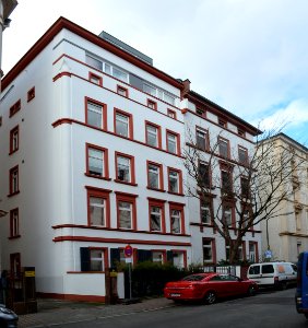
palais rothschild (bockenheimer landstraße)
bockenheimer landstraße (frankfurt am main)
historical
history
adrianus johannes bik
diponegoro
neues palais an der grünen burg
maps of grüneburgpark
works by tadeusz stryjeński
old maps of kraków
historical
history
flatbush reformed dutch church complex
art nouveau
huis ter kleef in art
siege of haarlem
the cradle of mankind; life in eastern kurdistan (1922)
edgar thomas ainger wigram
drawings by théo van rysselberghe
neo-impressionism
old maps of haarlem
siege of haarlem
old maps of haarlem
siege of haarlem
collections of musée de la vie romantique
romanticism
collections of musée de la vie romantique
romanticism
collections of musée de la vie romantique
romanticism
collections of musée de la vie romantique
romanticism
collections of musée de la vie romantique
romanticism
collections of musée de la vie romantique
romanticism
1 - 100 of 134
Next page
/ 2