Log in
All resources
Create a design
36 Free Images of 1890 Maps Of New York (state)
maps in the library of congress
town maps by l. r. burleigh
l. r. burleigh
old maps of new york (state)
bird's eye view maps of new york (state)
pages with maps
cc-zero
maps of oswego county
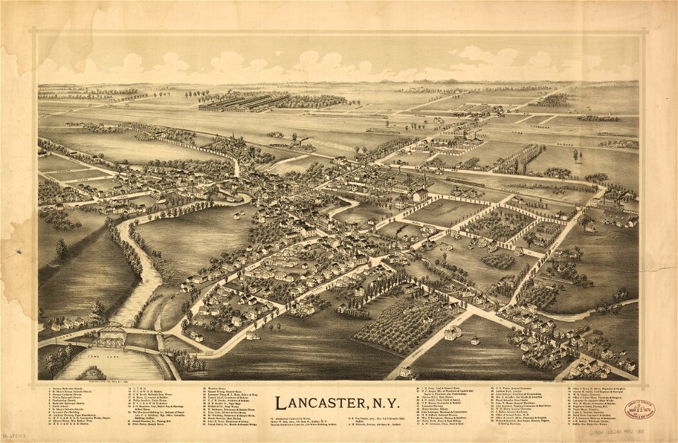
erie county
new york in the 1890s
old maps of new york (state)
new york
maps in the library of congress
old maps of new york (state)
old maps of new york (state)
new york
erie county
new york
erie county
new york
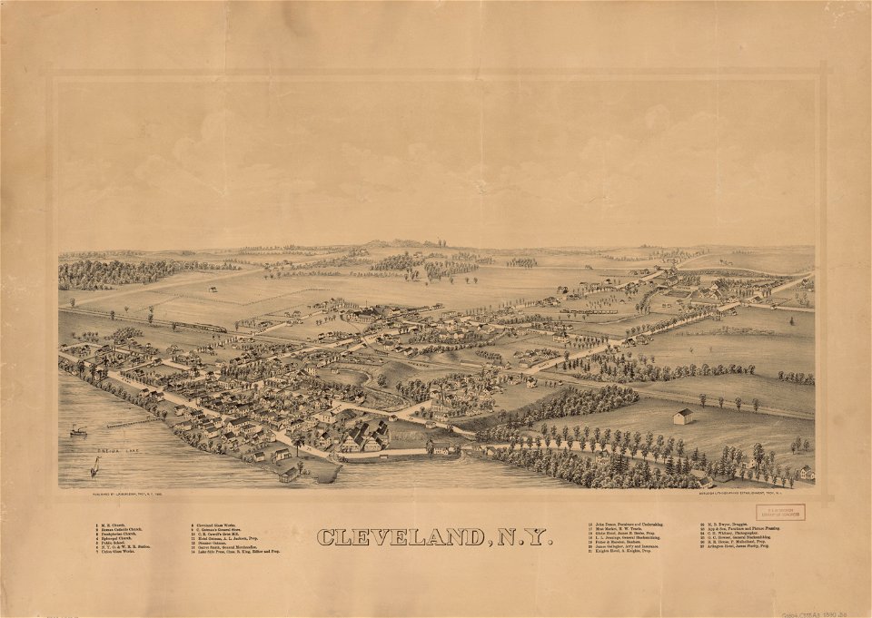
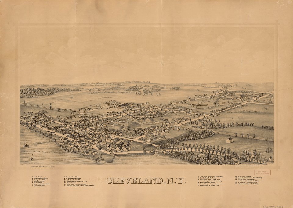
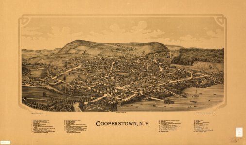
cleveland
new york
new york
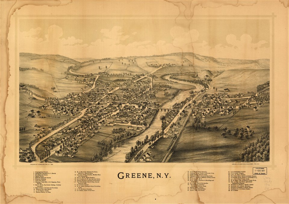
green
maps in the library of congress
1890 maps of new york (state)
maps in the library of congress
1890 maps of new york (state)
maps in the library of congress
1890 maps of new york (state)
maps in the library of congress
1890 maps of new york (state)
maps in the library of congress
1890 maps of new york (state)
maps in the library of congress
1890 maps of new york (state)
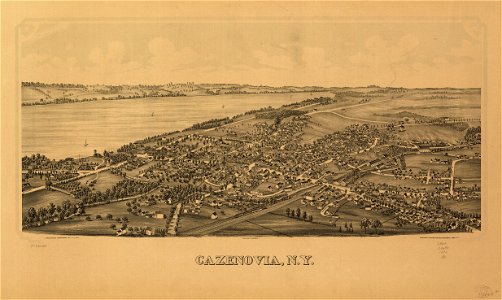
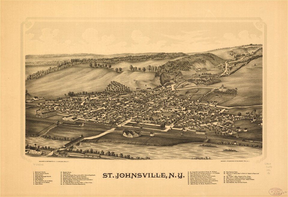
cazenovia
new york
new york
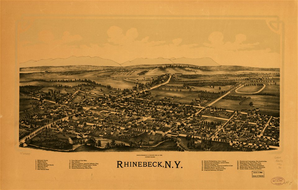
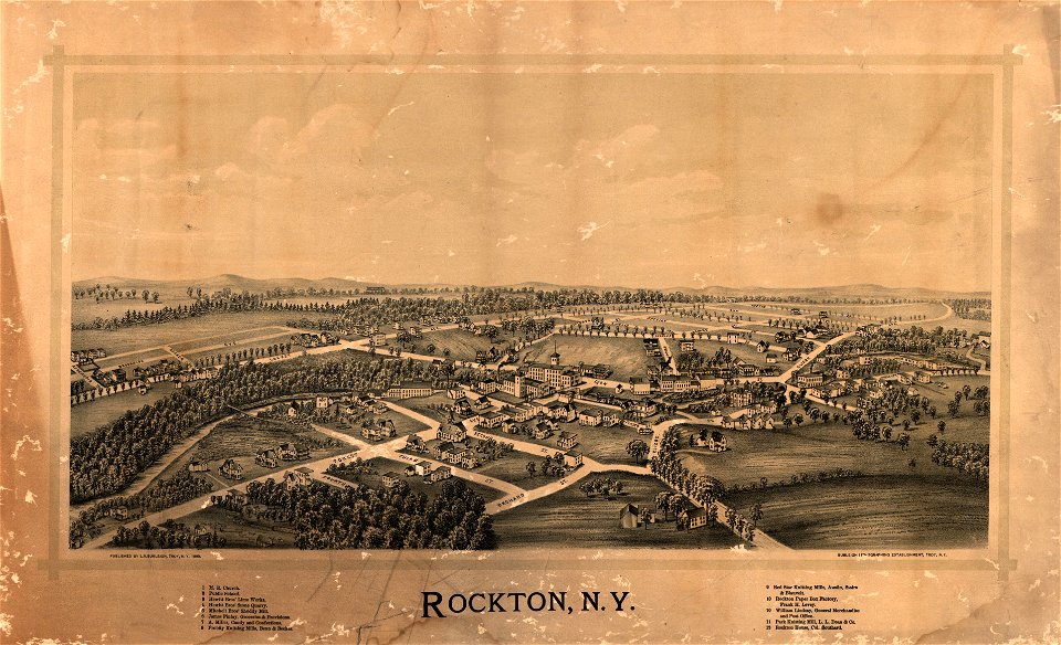
rockton
new york
green
maps in the library of congress
new york
new york
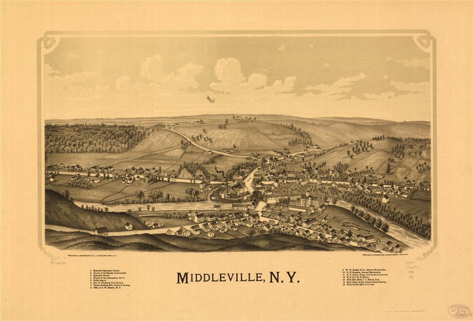
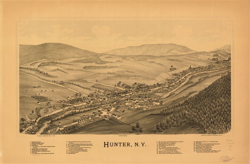
hunter
new york
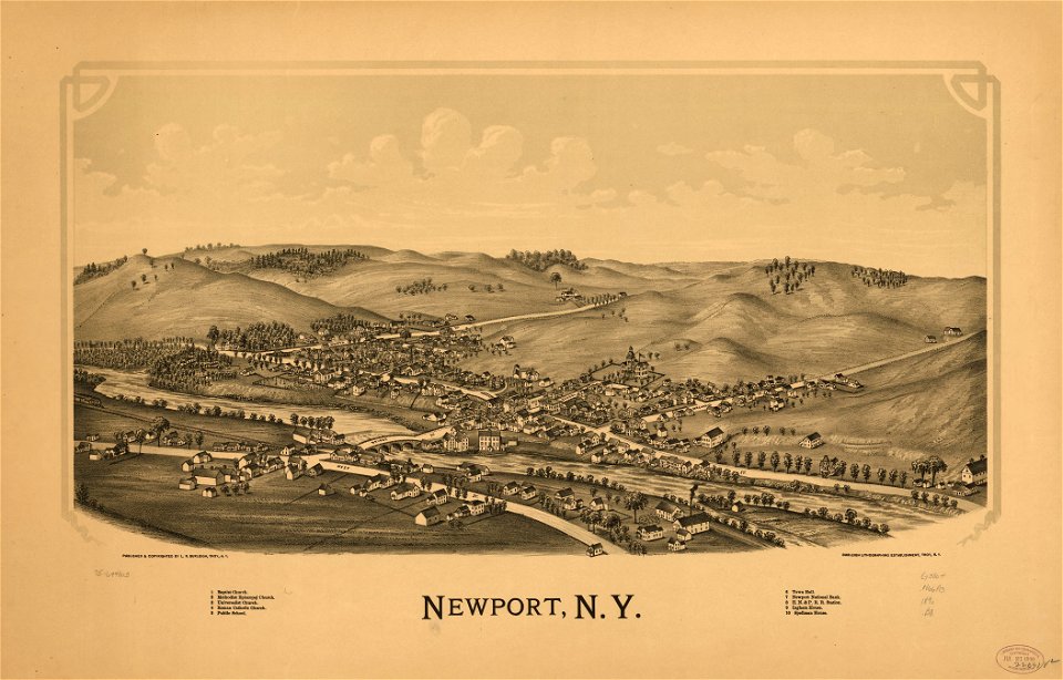
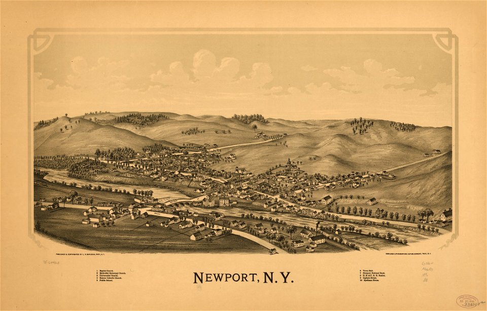
newport
new york
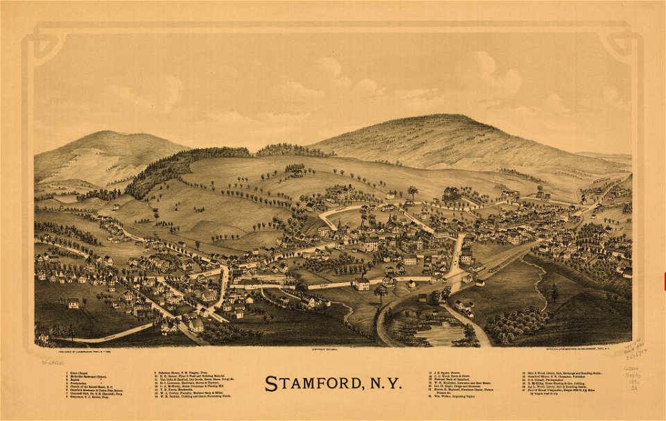
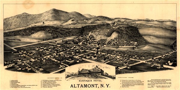
altamont
maps in the library of congress
new york
maps in the library of congress
new york
maps in the library of congress
town maps by l. r. burleigh
maps in the library of congress
town maps by l. r. burleigh
maps in the library of congress
town maps by l. r. burleigh
maps in the library of congress
new york
new york
hunter
cazenovia
new york
new york
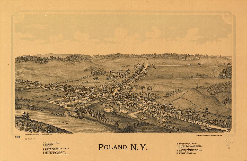
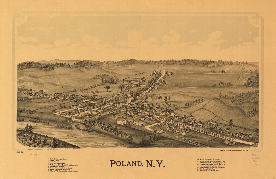
poland
maps in the library of congress
new york
maps in the library of congress
o. h. bailey
maps in the library of congress
o. h. bailey
self-published work
sidewalk
self-published work
architecture
pages with maps
architecture
cornell university library
new york city in the 1890s
1 - 36 of 36
/ 1