Log in
All resources
Create a design
Tools
3,563 Free Images of Chart
topographic map of france, 1864
lemercier & cie.
history
graph
historical
diagram
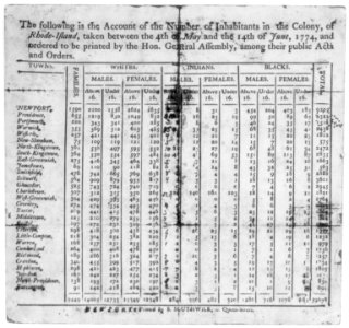
statistics
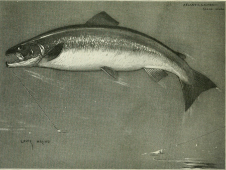
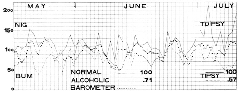
fisherman's lures and game-fish food (1920)
growth
progress
historical
history
historical
history
historical
history
maps in the topographia austriacarum (merian)
baroque
maps in the topographia austriacarum (merian)
baroque
business
success
1620s maps of the iberian peninsula
maps by willem and johannes blaeu
topographic map of france, 1864
lemercier & cie.
topographic map of france, 1864
lemercier & cie.
topographic map of france, 1864
lemercier & cie.
topographic map of france, 1864
lemercier & cie.
topographic map of france, 1864
lemercier & cie.
topographic map of france, 1864
lemercier & cie.
topographic map of france, 1864
lemercier & cie.
topographic map of france, 1864
lemercier & cie.
topographic map of france, 1864
lemercier & cie.
topographic map of france, 1864
lemercier & cie.
topographic map of france, 1864
lemercier & cie.
topographic map of france, 1864
lemercier & cie.
topographic map of france, 1864
lemercier & cie.
topographic map of france, 1864
lemercier & cie.
topographic map of france, 1864
lemercier & cie.
topographic map of france, 1864
lemercier & cie.
topographic map of france, 1864
lemercier & cie.
topographic map of france, 1864
lemercier & cie.
topographic map of france, 1864
lemercier & cie.
topographic map of france, 1864
lemercier & cie.
topographic map of france, 1864
lemercier & cie.
topographic map of france, 1864
lemercier & cie.
topographic map of france, 1864
lemercier & cie.
topographic map of france, 1864
lemercier & cie.
topographic map of france, 1864
lemercier & cie.
topographic map of france, 1864
lemercier & cie.
history
theory
galicia (spain) in the 1390s
galicia in portolan charts
😃 emoji
office
😃 emoji
office
1884 pacific typhoon season track maps
1884 in taiwan
historical
history
historical
history
historical
history
zondicons pack
chart
maps by thomas kitchin
1782 maps of africa
business
success
css pack
chart
picon pack
chart
😃 emoji
office
😃 emoji
office
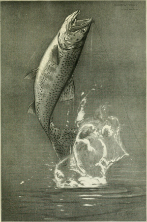
fisherman's lures and game-fish food (1920)
pain in fish
portolan charts made in the 17th century
maps by willem and johannes blaeu
iwwa pack
chart
lawrence h. slaughter collection of english maps, charts, globes, books and atlases
covens en mortier
history
theory
historical
history
lawrence h. slaughter collection of english maps, charts, globes, books and atlases
1700s maps of north america
18th-century maps of borneo
1780s maps of indonesia
business
symbol
exhibition
maryland
circle
music
lawrence h. slaughter collection of english maps, charts, globes, books and atlases
de nieuwe en onbekende weereld
navy
rota
historical
history
historical
history
history
theory
business
gear
fisherman's lures and game-fish food (1920)
esociformes illustrations
early renaissance,florentine school
inferno canto 11
carta hydrographica y chorographica de las yslas filipinas
baroque painting
the bottom of the sea (1870)
strait of gibraltar
historical
history
history
theory
ornament prints printed by martin engelbrecht
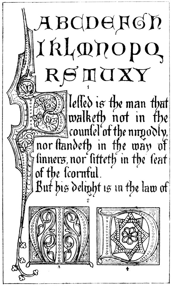
latin alphabet charts
solid
chart
simple line pack
chart
codex vallardi - drawings by pisanello
veronese school,renaissance
full hd video
draft
chart
line
historical
history
paintings of the qing dynasty in the palace museum
yu sheng
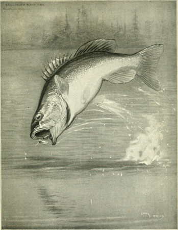
fisherman's lures and game-fish food (1920)
fisherman's lures and game-fish food (1920)
fisherman's lures and game-fish food (1920)
castle
france
international fire exhibition in konnogvardeysky manege, may 19, 1912
classicism
history
theory
fisherman's lures and game-fish food (1920)
fisherman's lures and game-fish food (1920)
fisherman's lures and game-fish food (1920)
fisherman's lures and game-fish food (1920)
fisherman's lures and game-fish food (1920)
astrology
horoscope
😃 emoji
office
office
data
😃 emoji
office
lawrence h. slaughter collection of english maps, charts, globes, books and atlases
1700 maps of the atlantic ocean
lawrence h. slaughter collection of english maps, charts, globes, books and atlases
1700 maps of the atlantic ocean
1782 maps of the caribbean
maps by juan lopez
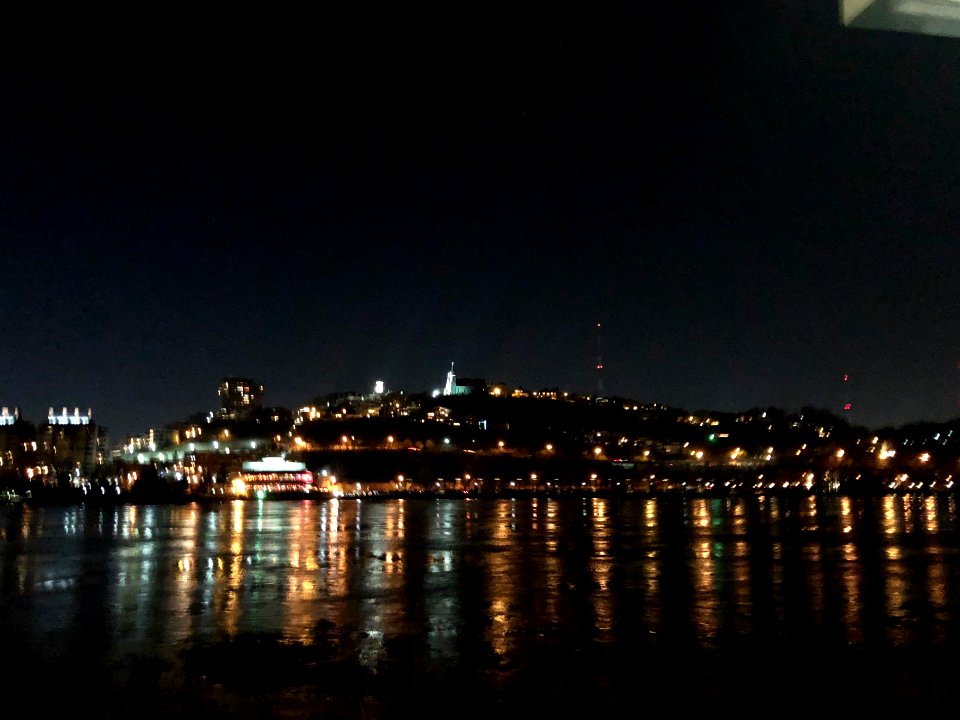
cityscape
city
business
arrow
business
arrow
2101 - 2200 of 3,563
Next page
/ 36


![Novi Belgii, quod nunc Novi Jorck vocatur, Novae q[ue] Angliae & partis Virginiae: accuratissima et novissima delineatio., 1671](https://cdn.creazilla.com/illustrations/10000934523/novi-belgii-quod-nunc-novi-jorck-vocatur-novae-que-angliae-partis-virginiae-accuratissima-et-novissima-delineatio-1671-sm.webp)