Log in
All resources
Create a design
Tools
7,179 Free Images of Gemeente
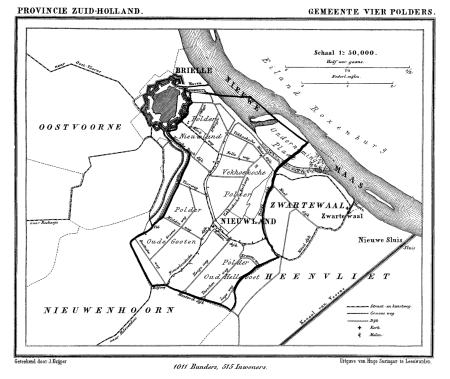
gemeente atlas van nederland - south holland
1860s maps of south holland
gemeente atlas van nederland - north holland
1860s maps of north holland
holland
1900 in haarlem
south holland
spanjaardslaan, haarlem
hertenkamp, haarlemmerhout
19th-century maps of rotterdam
gemeente atlas van nederland - south holland
1860s maps of south holland
gemeente atlas van nederland - south holland
19th-century maps of rotterdam
gemeente atlas van nederland - south holland
old maps of brielle
gemeente atlas van nederland - south holland
1860s maps of south holland
gemeente atlas van nederland - south holland
1860s maps of south holland
gemeente atlas van nederland - south holland
maps of haastrecht
gemeente atlas van nederland - south holland
1860s maps of south holland
grote markt, haarlem
classicism
gemeente atlas van nederland - south holland
1860s maps of south holland
gemeente atlas van nederland - north holland
maps of beets, north holland
gemeente atlas van nederland - north holland
maps of venhuizen
gemeente atlas van nederland - north holland
maps of beemster
media from regionaal archief alkmaar
old maps of koedijk
collection drawings and prints from het utrechts archief
exterior of the soestdijk palace
gemeente atlas van nederland - north holland
maps of bergen, north holland
spanjaardslaan, haarlem
1900 in haarlem
hertenkamp, haarlemmerhout
1900 in haarlem
hertenkamp, haarlemmerhout
1900 in haarlem
hertenkamp, haarlemmerhout
1900 in haarlem
hertenkamp, haarlemmerhout
1900 in haarlem
gemeente atlas van nederland - south holland
maps of heerjansdam
gemeente atlas van nederland - south holland
1860s maps of south holland
gemeente atlas van nederland - south holland
1860s maps of south holland
animals
holland
holland
sky
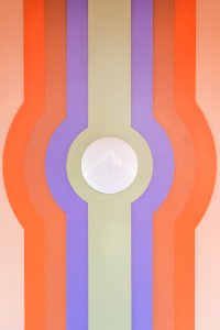
geometric
symmetry
scheveningen
holland
shuttle
holland
holland
ns
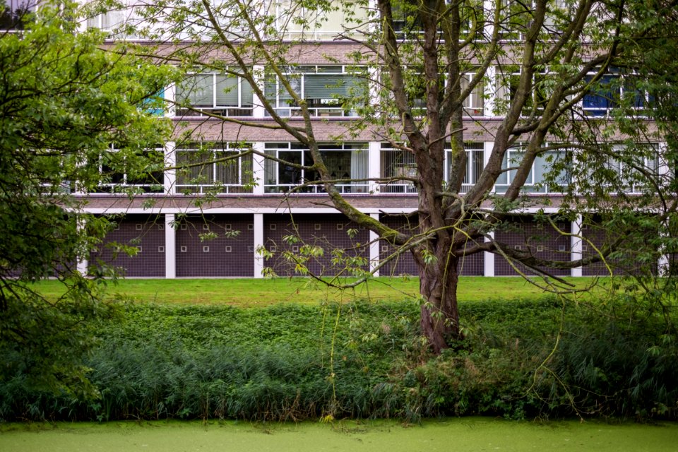
garden
grass
force
one
gemeente atlas van nederland - south holland
old maps of gouda
gemeente atlas van nederland - north holland
bennebroek
gemeente atlas van nederland - south holland
1860s maps of south holland
media from regionaal archief alkmaar
maps of heiloo
netherlands
light
water
boat
architecture
thorn
architecture
holland
architecture
holland
gemeente atlas van nederland - north holland
old maps of hoorn, north holland
gemeente atlas van nederland - south holland
old maps of gouda
gemeente atlas van nederland - south holland
old maps of brielle
drawings by cornelis pronk
heemskerk in the 1740s
gemeente atlas van nederland - south holland
1860s maps of south holland
gemeente atlas van nederland - south holland
1860s maps of south holland
gemeente atlas van nederland - south holland
1860s maps of south holland
gemeente atlas van nederland - south holland
1860s maps of south holland
gemeente atlas van nederland - south holland
maps of 's-gravenzande
pieter barbiers (ii)
bloemendaal in art
statue laurens janszoon coster
classicism
paintings by gillis gillisz. de bergh
1630s paintings in the netherlands
gemeente atlas van nederland - south holland
maps of hendrik-ido-ambacht
collection drawings and prints from het utrechts archief
kasteel maarsbergen
gemeente atlas van nederland - south holland
1860s maps of south holland
gemeente atlas van nederland - south holland
1860s maps of south holland
gemeente atlas van nederland - overijssel
spanjaardslaan, haarlem
1860 in haarlem
brouwerskolk in art
willem writs
grote markt, haarlem
classicism
media from regionaal archief alkmaar
maps of heerhugowaard
gemeente atlas van nederland - north holland
maps of broek in waterland
gemeente atlas van nederland - south holland
old maps of leiden
gemeente atlas van nederland - south holland
old maps of the hague
gemeente atlas van nederland - south holland
19th-century maps of rotterdam
landscape drawings of the netherlands
george pieter westenberg
maps of nieuwpoort, south-holland
vestingwerken nieuwpoort
gemeente atlas van nederland - zeeland
bommenede
gemeente atlas van nederland - south holland
1860s maps of south holland
grote markt, haarlem
classicism
gemeente atlas van nederland - south holland
1860s maps of south holland
gemeente atlas van nederland - south holland
1860s maps of south holland
gemeente atlas van nederland - south holland
1860s maps of south holland
gemeente atlas van nederland - south holland
1860s maps of south holland
gemeente atlas van nederland - north holland
maps of uithoorn
media from regionaal archief alkmaar
scharwoude
gemeente atlas van nederland - south holland
old maps of eiland van dordrecht
gemeente atlas van nederland - south holland
maps of zoeterwoude
gemeente atlas van nederland - south holland
1860s maps of south holland
vincent jansz. van der vinne
elswout
paviljoen welgelegen
haarlemmerhout
brouwerskolk in art
willem writs
gemeente atlas van nederland - south holland
1860s maps of south holland
gemeente atlas van nederland - south holland
1860s maps of south holland
gemeente atlas van nederland - south holland
maps of wassenaar
gemeente atlas van nederland - south holland
1860s maps of south holland
gemeente atlas van nederland - north holland
maps of muiden
gemeente atlas van nederland - south holland
maps of kedichem
gemeente atlas van nederland - north holland
old maps of haarlem
gemeente atlas van nederland - north holland
maps of zandvoort
gemeente atlas van nederland - north holland
maps of bloemendaal
pieter barbiers (ii)
spanjaardslaan, haarlem
1900 in haarlem
spanjaardslaan, haarlem
1900 in haarlem
hertenkamp, haarlemmerhout
1900 in haarlem
hertenkamp, haarlemmerhout
1900 in haarlem
hermanus fock (1766-1822)
brouwerskolk in art
spanjaardslaan, haarlem
1861 in haarlem
spanjaardslaan, haarlem
1870 in haarlem
hendrik tavenier
3101 - 3200 of 7,179
Next page
/ 72