Log in
All resources
Create a design
Tools
16,724 Free Images of Language
bibliothèque nationale de france
atlante geografico del regno di napoli (1812)
maps
astronomy
geology
united states
american
survey
natural history
smithsonian libraries
1943 in poland
hans frank
maps of provence by pierre-jean de bompar
bibliothèque nationale de france
atlas sive cosmographicae (gerardus mercator, 1630)
maps of île-de-france by françois de la guillotière
bibliothèque nationale de france
antverpia, urbs belgica (1556)
maps of damascus by braun & hogenberg
bibliothèque nationale de france
bibliothèque nationale de france
clément-pierre marillier
maps of hrodna by braun & hogenberg
bibliothèque nationale de france
maps of île-de-france by françois de la guillotière
bibliothèque nationale de france
maps of asia minor by mercator-hondius
bibliothèque nationale de france
bibliothèque nationale de france
guillaume sanson
maps by willem and johannes blaeu
chami empire
eran laor cartographic collection
isaak tirion
soviet posters of the civil war of russia
post-impressionism
old maps of atlantis
island of california
buda in the 17th century
baroque
maps of barcelona by braun & hogenberg
barcelona in the 17th century
maps of hamburg by braun & hogenberg
maps of lübeck by braun & hogenberg
maps of sandomierz by braun & hogenberg
maps of biecz by braun & hogenberg
18th-century maps of madagascar
pierre mortier
bibliothèque nationale de france
antverpia, urbs belgica (1556)
maps of sandomierz by braun & hogenberg
maps of biecz by braun & hogenberg
maps of flensburg by braun & hogenberg
maps of itzehoe by braun & hogenberg
maps of paris by braun & hogenberg
bibliothèque nationale de france
eran laor cartographic collection
philippe de la rué
illustrations by émile bayard in sans famille (1880)
academic art
animals
food
christmas
food
arnold van langren map of southwest africa
1600 maps of africa
old maps of whole wales (alone)
1640s maps of wales
maps of asia minor by mercator-hondius
context files from gallica
17th-century maps of the strait of magellan
maps by jodocus hondius
posters by giovanni maria mataloni
advertising
historical images of dubrovnik
baroque
media from regionaal archief alkmaar
old maps of north holland
flashcards
alphabet
alphabet
r
ribbon
blue
ribbon
blue
ribbon
blue
ornament
letter k
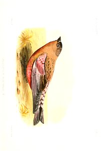
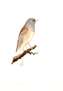
bird
maps
bird
maps
bird
maps
astronomy
maps
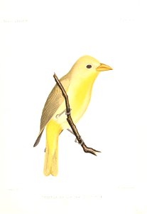
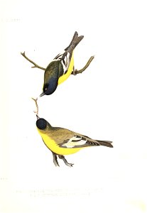
bird
maps
bird
maps
bird
maps
astronomy
maps
astronomy
maps
bird
maps
bird
maps
1720s maps showing history
1727 maps of africa
book covers from france
anne rice
eran laor cartographic collection
gottfried hensel
eran laor cartographic collection
romeyn de hooghe
eran laor cartographic collection
pieter schenk (ii)
eran laor cartographic collection
german renaissance
eran laor cartographic collection
maps by tomas lopez
an account of the laplanders of finmark, their language, manners, and religion (nmk.2021.0112)
reindeer sleds in art
an account of the laplanders of finmark, their language, manners, and religion (nmk.2021.0112)
reindeer in art
an account of the laplanders of finmark, their language, manners, and religion (nmk.2021.0112)
reindeer in art
an account of the laplanders of finmark, their language, manners, and religion (nmk.2021.0112)
national museum of art, architecture and design
an account of the laplanders of finmark, their language, manners, and religion (nmk.2021.0112)
sami clothing in art
an account of the laplanders of finmark, their language, manners, and religion (nmk.2021.0112)
sami clothing in art
an account of the laplanders of finmark, their language, manners, and religion (nmk.2021.0112)
sami clothing in art
world war i posters in the library of congress
louis oppenheim
an account of the laplanders of finmark, their language, manners, and religion (nmk.2021.0112)
sami clothing in art
bibliothèque nationale de france
guillaume sanson
atlante geografico del regno di napoli (1812)
bibliothèque nationale de france
atlante geografico del regno di napoli (1812)
bibliothèque nationale de france
old maps of europe
achille belloguet
atlante geografico del regno di napoli (1812)
bibliothèque nationale de france
atlante geografico del regno di napoli (1812)
bibliothèque nationale de france
bibliothèque nationale de france
maps by jakob van der schley
atlante geografico del regno di napoli (1812)
bibliothèque nationale de france
atlante geografico del regno di napoli (1812)
bibliothèque nationale de france
bibliothèque nationale de france
félix robaut
atlante geografico del regno di napoli (1812)
bibliothèque nationale de france
old maps of europe
achille belloguet
atlante geografico del regno di napoli (1812)
bibliothèque nationale de france
bibliothèque nationale de france
carolus allard
atlante geografico del regno di napoli (1812)
bibliothèque nationale de france
atlante geografico del regno di napoli (1812)
bibliothèque nationale de france
bibliothèque nationale de france
cartouches by tomas lópez
atlante geografico del regno di napoli (1812)
bibliothèque nationale de france
atlante geografico del regno di napoli (1812)
bibliothèque nationale de france
bibliothèque nationale de france
tranquillo mollo
atlante geografico del regno di napoli (1812)
bibliothèque nationale de france
maps of blâmont by braun & hogenberg
bibliothèque nationale de france
atlante geografico del regno di napoli (1812)
bibliothèque nationale de france
atlante geografico del regno di napoli (1812)
bibliothèque nationale de france
bibliothèque nationale de france
tranquillo mollo
atlante geografico del regno di napoli (1812)
bibliothèque nationale de france
1667 map of madagascar by guillaume sanson
bibliothèque nationale de france
bibliothèque nationale de france
1667 sanson map of africa
atlante geografico del regno di napoli (1812)
bibliothèque nationale de france
atlante geografico del regno di napoli (1812)
bibliothèque nationale de france
atlante geografico del regno di napoli (1812)
bibliothèque nationale de france
bibliothèque nationale de france
guillaume sanson
maps by willem and johannes blaeu
17th-century maps of xaintonge
11201 - 11300 of 16,724
Next page
/ 168


![Antverpia, urbs belgica, ad Scaldim sita Europae decus / F[ranciscus] H[uys], 1556](https://cdn.creazilla.com/illustrations/10001067434/antverpia-urbs-belgica-ad-scaldim-sita-europae-decus-franciscus-huys-1556-md.jpg)


![L'Isle de France. Parisiensis agri descrip[tio]. Fr. Guilloterius... describebat..., 1598](https://cdn.creazilla.com/illustrations/10001295929/l-isle-de-france-parisiensis-agri-descrip-tio-fr-guilloterius-describebat-1598-md.jpg)


![Antverpia, urbs belgica, ad Scaldim sita Europae decus / F[ranciscus] H[uys], 1556](https://cdn.creazilla.com/illustrations/10000974365/antverpia-urbs-belgica-ad-scaldim-sita-europae-decus-f-ranciscus-h-uys-1556-md.jpg)


![Wallia principatus, vulgo Wales. Serenmo Domino Carolo, Magnae Britanniae, etc. principi Joh. Blaeu / [Excudit J. Blaeu.], 1645](https://cdn.creazilla.com/illustrations/10001591803/wallia-principatus-vulgo-wales-serenmo-domino-carolo-magnae-britanniae-etc-principi-joh-blaeu-excudit-j-blaeu-1645-md.jpg)
![Natoliae sive Asia minor / [Mercator], 1606](https://cdn.creazilla.com/illustrations/10001477494/natoliae-sive-asia-minor-mercator-1606-md.jpg)


![Xaintonge and Angoumois / [Blaeu], 1635](https://cdn.creazilla.com/illustrations/10000256086/xaintonge-and-angoumois-blaeu-1635-sm.webp)