Log in
All resources
Create a design
8,995 Free Images of Scale
bibliothèque nationale de france
l'asie, en plusieurs cartes nouvelles, et exactes, &c. en divers traitez de geographie, et d'histoire. là où sont descrits succinctement, & avec une belle methode, & facile. ses empires, ses... - btv1b55013761m
reverse sides from gallica
marco boschini
maps of the islands of greece by marco boschini (1658)
baroque
maps of ports and fortresses of the mediterranean by marco boschini (1651)
old maps of kiel
kieler hafen als künftiger kriegshafen
maps by matthäus merian
robert cordier (engraver)
maps by guillaume sanson
maps of the land of valkenburg
guillaume sanson
maps of archidona by braun & hogenberg
bibliothèque nationale de france
l'asie, en plusieurs cartes nouvelles, et exactes, &c. en divers traitez de geographie, et d'histoire. là où sont descrits succinctement, & avec une belle methode, & facile. ses empires, ses... - btv1b55013761m
reverse sides from gallica
l'asie, en plusieurs cartes nouvelles, et exactes, &c. en divers traitez de geographie, et d'histoire. là où sont descrits succinctement, & avec une belle methode, & facile. ses empires, ses... - btv1b55013761m
reverse sides from gallica
maps of blâmont by braun & hogenberg
bibliothèque nationale de france
maps from gallica
guides joanne
1700s maps of rhineland-palatinate
maps of vangiones by sanson
l'asie, en plusieurs cartes nouvelles, et exactes, &c. en divers traitez de geographie, et d'histoire. là où sont descrits succinctement, & avec une belle methode, & facile. ses empires, ses... - btv1b55013761m
reverse sides from gallica
l'asie, en plusieurs cartes nouvelles, et exactes, &c. en divers traitez de geographie, et d'histoire. là où sont descrits succinctement, & avec une belle methode, & facile. ses empires, ses... - btv1b55013761m
reverse sides from gallica
map of the circle of bavaria by sanson
bibliothèque nationale de france
bibliothèque nationale de france
guillaume sanson
maps of the islands of greece by marco boschini (1658)
bibliothèque nationale de france
l'asie, en plusieurs cartes nouvelles, et exactes, &c. en divers traitez de geographie, et d'histoire. là où sont descrits succinctement, & avec une belle methode, & facile. ses empires, ses... - btv1b55013761m
reverse sides from gallica
aqueduc saint-clément (montpellier)
bibliothèque nationale de france
l'asie, en plusieurs cartes nouvelles, et exactes, &c. en divers traitez de geographie, et d'histoire. là où sont descrits succinctement, & avec une belle methode, & facile. ses empires, ses... - btv1b55013761m
reverse sides from gallica
l'asie, en plusieurs cartes nouvelles, et exactes, &c. en divers traitez de geographie, et d'histoire. là où sont descrits succinctement, & avec une belle methode, & facile. ses empires, ses... - btv1b55013761m
reverse sides from gallica
maps of ports and fortresses of the mediterranean by marco boschini (1651)
bibliothèque nationale de france
l'asie, en plusieurs cartes nouvelles, et exactes, &c. en divers traitez de geographie, et d'histoire. là où sont descrits succinctement, & avec une belle methode, & facile. ses empires, ses... - btv1b55013761m
reverse sides from gallica
l'asie, en plusieurs cartes nouvelles, et exactes, &c. en divers traitez de geographie, et d'histoire. là où sont descrits succinctement, & avec une belle methode, & facile. ses empires, ses... - btv1b55013761m
reverse sides from gallica
maps of lizarrate by braun & hogenberg
bibliothèque nationale de france
maps of ports and fortresses of the mediterranean by marco boschini (1651)
bibliothèque nationale de france
maps of ports and fortresses of the mediterranean by marco boschini (1651)
bibliothèque nationale de france
maps of ports and fortresses of the mediterranean by marco boschini (1651)
bibliothèque nationale de france
l'asie, en plusieurs cartes nouvelles, et exactes, &c. en divers traitez de geographie, et d'histoire. là où sont descrits succinctement, & avec une belle methode, & facile. ses empires, ses... - btv1b55013761m
reverse sides from gallica
plan au rez de chaussée de l'eglise de la sorbonne - btv1b531815938
plans of churches in paris
maps of lizarrate by braun & hogenberg
bibliothèque nationale de france
maps of the islands of greece by marco boschini (1658)
history of serifos
maps of the islands of greece by marco boschini (1658)
history of tinos
fisher's drawing room scrap book plates
thomas allom
united states
travel
united states
arizona
fleet collection
atago
yellowstone national park
yellowstone
food
meal
water sport
wave
fleet collection
atago
sword art online
asuna
maps of wissembourg by braun & hogenberg
maps of colmar by braun & hogenberg
mountain
nature
bibliothèque nationale de france
braun/hogenberg dreizehn orte
maps of ardales by braun & hogenberg
maps of cártama by braun & hogenberg
maps of london by braun & hogenberg
bibliothèque nationale de france
maps of mannersdorf by braun & hogenberg
maps of eisenstadt by braun & hogenberg
maps of werden by braun & hogenberg
maps of essen by braun & hogenberg
kieler hafen als künftiger kriegshafen
old maps of kiel
old maps of utrecht (city)
baroque
maps of besançon by braun & hogenberg
bibliothèque nationale de france
kieler hafen als künftiger kriegshafen
old maps of kiel
maps of windsor by braun & hogenberg
maps of oxford by braun & hogenberg
maps of innsbruck by braun & hogenberg
innsbruck in the 17th century
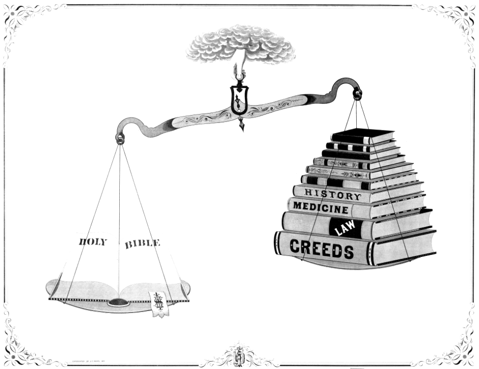
balance scales in paintings
george forster
grenzkarte der preussischen, russischen und oestreichischen monarchien (1796)
maps of kovno governorate
library of congress - misc
checkflicr2
maps of eckernförde by braun & hogenberg
bibliothèque nationale de france
17th-century maps of maastricht
baroque
maps of the islands of greece by marco boschini (1658)
old maps of serifos
maps of orléans by braun & hogenberg
bibliothèque nationale de france
chorographia britanniae (1741-1742)
bibliothèque nationale de france
bibliothèque nationale de france
braun/hogenberg dreizehn orte
maps of brielle by braun & hogenberg
brielle in the 16th century
kieler hafen als künftiger kriegshafen
old maps of kiel
maps of tønder by braun & hogenberg
maps of eutin by braun & hogenberg
maps of grenoble by braun & hogenberg
maps of romans by braun & hogenberg
maps of rotterdam by berckenrode
baroque
maps of amsterdam by braun & hogenberg
bibliothèque nationale de france
maps of innsbruck by braun & hogenberg
bibliothèque nationale de france
old maps of emmerich am rhein
baroque
chorographia britanniae (1741-1742)
bibliothèque nationale de france
maps of cadiz by braun & hogenberg
bibliothèque nationale de france
maps of bergen op zoom by braun & hogenberg
bibliothèque nationale de france
maps of groningen by braun & hogenberg
bibliothèque nationale de france
cartouche (cartography)
jean-claude dezauche
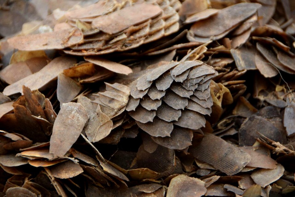
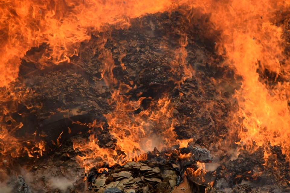
pangolin
brown
pangolin
orange
the antiquities of athens, vol. ii
greek revival architecture
religious drawings in the metropolitan museum of art
gregorio pagani
animals
insects
maps in the library of congress
1861 maps
maps of bremen by braun & hogenberg
maps of stade by braun & hogenberg
frescos in stiftskirche reichersberg
camaïeu
sri lanka
insects
maps of massachusetts from the norman b. leventhal map center
maps of becket, massachusetts
kieler hafen als künftiger kriegshafen
old maps of kiel
map collection of leibniz-institut für länderkunde
19th-century maps of the bosphorus
bibliothèque nationale de france
braun/hogenberg dreizehn orte
maps of nevers by braun & hogenberg
maps of autun by braun & hogenberg
august kneisel
east prussia
maps of paris by braun & hogenberg
bibliothèque nationale de france
maps of exeter by braun & hogenberg
bibliothèque nationale de france
maps of the islands of greece by marco boschini (1658)
old maps of tinos
maps of bornos by braun & hogenberg
maps of zahara by braun & hogenberg
1629 in wesel
baroque
maps of hamburg by braun & hogenberg
maps of lübeck by braun & hogenberg
maps of london by braun & hogenberg
bibliothèque nationale de france
landscape
mountain
1800 maps of the atlantic ocean
1800s maps of the americas
4801 - 4900 of 8,995
Next page
/ 90


![Part of the St Clément aqueduct in Montpellier [Peyrou section, plan and elevation]](https://cdn.creazilla.com/illustrations/10000498243/part-of-the-st-clment-aqueduct-in-montpellier-peyrou-section-plan-and-elevation-sm.webp)


![The Sierra de Sant Adrian in Vizcaya / by Georgio Houfnaglio painting. Anno Domini M.D.LXVII [1567], between 1567 and 1640](https://cdn.creazilla.com/illustrations/10001429518/the-sierra-de-sant-adrian-in-vizcaya-by-georgio-houfnaglio-painting-anno-domini-mdlxvii-1567-between-1567-and-1640-sm.webp)


![The Sierra de Sant Adrian in Vizcaya / by Georgio Houfnaglio painting. Anno Domini M.D.LXVII [1567], between 1567 and 1640](https://cdn.creazilla.com/illustrations/10001412555/the-sierra-de-sant-adrian-in-vizcaya-by-georgio-houfnaglio-painting-anno-domini-m-d-lxvii-1567-between-1567-and-1640-sm.jpg)


![Oxonium [...]; Vindesorium [...], between 1640 and 1645](https://cdn.creazilla.com/illustrations/10001544887/oxonium-vindesorium-between-1640-and-1645-md.jpg)


![Rotterdam / [M. Merian], Matthäus Merian](https://cdn.creazilla.com/illustrations/10000529192/rotterdam-m-merian-matth-us-merian-md.jpg)


![A Table of all the Cross Roads in England and Wales.To follow Plate 4 / [Badeslade]; W.H. Toms sculp., 1741](https://cdn.creazilla.com/illustrations/10001514902/a-table-of-all-the-cross-roads-in-england-and-walesto-follow-plate-4-badeslade-wh-toms-sculp-1741-md.jpg)
![Gades ab occiduis insulae partibus: captus hic anno 1564 / Depingebat Georg[ius] Houfnaglius, between 1564 and 1640](https://cdn.creazilla.com/illustrations/10001498652/gades-ab-occiduis-insulae-partibus-captus-hic-anno-1564-depingebat-georg-ius-houfnaglius-between-1564-and-1640-md.jpg)