Log in
All resources
Create a design
8,935 Free Images of Scale
bibliothèque nationale de france
maps in the library of congress
maps from university of amsterdam special collections
atlas der neederlanden
copperplate print
special collections of the university of amsterdam
hendrik de leth
john rocque 1746 crops from library of congress
john rocque's maps of london
john rocque
prints by gilles demarteau from numelyo
gilles demarteau
1670s maps of the iberian peninsula
georg widmann
la rioja (spain) in the 18th century
old maps of la rioja (spain)
map of the upper rhenian circle by sanson
maps by nicolas sanson
fish with tribal pattern
tribal fish
fish with tribal pattern
tribal fish
service
icons
icons
db
maps by jean-baptiste bourguignon d'anville
1727 maps of africa
map of the upper rhenian circle by sanson
1700s maps of north rhine-westphalia
maps of the islands of greece by marco boschini (1658)
history of kythira
old maps of the region of murcia
maps of spain by tomas lopez
maps from university of amsterdam special collections
atlas der neederlanden
maps from university of amsterdam special collections
atlas der neederlanden
maps from university of amsterdam special collections
atlas der neederlanden
maps from university of amsterdam special collections
atlas der neederlanden
maps from university of amsterdam special collections
atlas der neederlanden
maps from university of amsterdam special collections
atlas der neederlanden
maps from university of amsterdam special collections
atlas der neederlanden
maps from university of amsterdam special collections
atlas der neederlanden
statues of abraham lincoln (1915)
statues in florence
statues of abraham lincoln (1915)
emancipation memorial (boston)
emancipation memorial (washington, d.c.)
statues of abraham lincoln (1915)
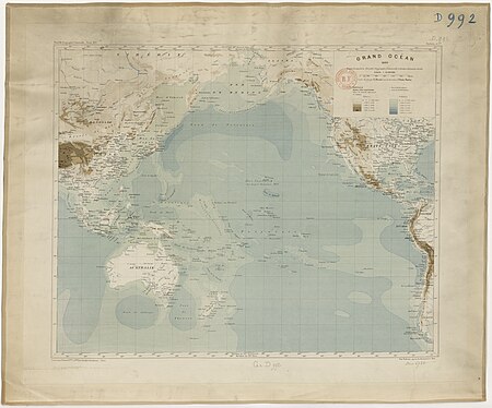
considérations géographiques et physiques sur les nouvelles découvertes au nord de la grande mer
isla de los estados
maps facing east
anton wied
science
italy
scale
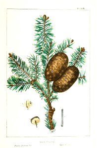
tree
gustav freytag (cartographer)
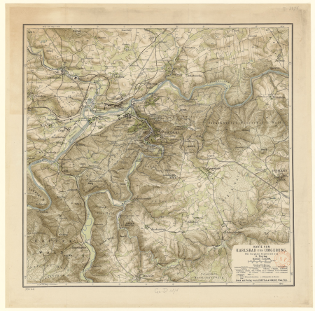
old maps of karlovy vary
old maps of norway
guillaume sanson
general charte der in den herzoglich bremen - und verdenschen aemtern und gerichten ottersberg, osterholtz, lilienthal, bremervörde, rotenburg und achim belegenen mööre, und der seit 1750 darin... - btv1b531196435
bibliothèque nationale de france
antoine-françois tardieu
pierre antoine tardieu
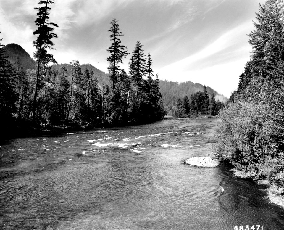
landscape
vancouver
nature
fish
high renaissance
pirro ligorio
maps by willem and johannes blaeu
1640s maps of ukraine
gateway
apis
bibliothèque nationale de france
guillaume sanson
general charte der in den herzoglich bremen - und verdenschen aemtern und gerichten ottersberg, osterholtz, lilienthal, bremervörde, rotenburg und achim belegenen mööre, und der seit 1750 darin... - btv1b531196435
bibliothèque nationale de france
maps in the library of congress
1718 maps of north america
le comté de zélande dressé sur les memoires les pl. nouveaux - par le sr sanson... - btv1b53213970d
guillaume sanson
maps of the course of the rhine by guillaume sanson
bibliothèque nationale de france
bibliothèque nationale de france
cartouches by tomas lópez
general charte der in den herzoglich bremen - und verdenschen aemtern und gerichten ottersberg, osterholtz, lilienthal, bremervörde, rotenburg und achim belegenen mööre, und der seit 1750 darin... - btv1b531196435
bibliothèque nationale de france
bibliothèque nationale de france
guillaume sanson
nouvelle géographie universelle, vol. xiv
bibliothèque nationale de france
maps of ports and fortresses of the mediterranean by marco boschini (1651)
bibliothèque nationale de france
old maps of norway
guillaume sanson
maps of spain by tomas lopez
1769 maps of spain
maps of spain by tomas lopez
1768 maps of spain
background
abstract
maps from university of amsterdam special collections
atlas der neederlanden
maps from university of amsterdam special collections
atlas der neederlanden
maps from university of amsterdam special collections
atlas der neederlanden
maps from university of amsterdam special collections
atlas der neederlanden
service
icons
maps from university of amsterdam special collections
atlas der neederlanden
old maps of norway
guillaume sanson
maps from gallica
guides joanne
sanson maps of the circles of germany
bibliothèque nationale de france
bibliothèque nationale de france
guillaume sanson
maps by willem and johannes blaeu
old maps of quercy
general charte der in den herzoglich bremen - und verdenschen aemtern und gerichten ottersberg, osterholtz, lilienthal, bremervörde, rotenburg und achim belegenen mööre, und der seit 1750 darin... - btv1b531196435
bibliothèque nationale de france
carte de la syrie by guillaume delisle (1764)
bibliothèque nationale de france
bibliothèque nationale de france
cartouches by tomas lópez
john rocque 1746 crops from library of congress
maps in the library of congress
john rocque 1746 crops from library of congress
maps in the library of congress
john rocque 1746 crops from library of congress
maps in the library of congress
chorographia britanniae (1741-1742)
18th-century maps of wiltshire
john rocque 1746 crops from library of congress
maps in the library of congress
john rocque 1746 crops from library of congress
maps in the library of congress
john rocque 1746 crops from library of congress
maps in the library of congress
franciscus gomarus
jacobus arminius
franciscus gomarus
jacobus arminius
franciscus gomarus
jacobus arminius
historical
history
landscape
tree
18th-century maps of the sea of marmara
18th-century maps of the dardanelles
maps from university of amsterdam special collections
atlas der neederlanden
maps from university of amsterdam special collections
atlas der neederlanden
1780s maps of berlin
1786 maps of berlin
17th-century maps of scotland
maps of islay
chorographia britanniae (1741-1742)
18th-century maps of essex
art of japan in the walters art museum
textiles in the walters art museum
art of japan in the walters art museum
textiles in the walters art museum
franciscus gomarus
jacobus arminius
john rocque 1746 crops from library of congress
maps in the library of congress
john rocque 1746 crops from library of congress
maps in the library of congress
john rocque 1746 crops from library of congress
maps in the library of congress
john rocque 1746 crops from library of congress
maps in the library of congress
maps in the library of congress
1747 maps of new jersey
geological maps of england
william smith (geologist)
john rocque 1746 crops from library of congress
maps in the library of congress
old maps of amsterdam
hendrik de leth
john rocque 1746 crops from library of congress
maps in the library of congress
john rocque 1746 crops from library of congress
maps in the library of congress
arnold van langren map of southwest africa
renaissance
van langren map of southeast asia
1595 maps of asia
map of ancient asia minor by philippe de la rué
bibliothèque nationale de france
bibliothèque nationale de france
guillaume sanson
maps by willem and johannes blaeu
17th-century maps of abruzzo
7301 - 7400 of 8,935
Next page
/ 90


![Kennemerland Water Board Map - Rijnland Water Board, Hendrik de Leth, [1729]](https://cdn.creazilla.com/illustrations/10000704117/kennemerland-water-board-map-rijnland-water-board-hendrik-de-leth-1729-md.jpg)
![Kennemerland Water Board Map - Rijnland Water Board, Hendrik de Leth, [1729]](https://cdn.creazilla.com/illustrations/10000761895/kennemerland-water-board-map-rijnland-water-board-hendrik-de-leth-1729-md.jpg)
![Kennemerland Water Board Map - Rijnland Water Board, Hendrik de Leth, [1729]](https://cdn.creazilla.com/illustrations/10000978808/kennemerland-water-board-map-rijnland-water-board-hendrik-de-leth-1729-md.jpg)
![Kennemerland Water Board Map - Rijnland Water Board, Hendrik de Leth, [1729]](https://cdn.creazilla.com/illustrations/10001059183/kennemerland-water-board-map-rijnland-water-board-hendrik-de-leth-1729-md.jpg)
![Kennemerland Water Board Map - Rijnland Water Board, Hendrik de Leth, [1729]](https://cdn.creazilla.com/illustrations/10001181332/kennemerland-water-board-map-rijnland-water-board-hendrik-de-leth-1729-md.jpg)
![Kennemerland Water Board Map - Rijnland Water Board, Hendrik de Leth, [1729]](https://cdn.creazilla.com/illustrations/10001456497/kennemerland-water-board-map-rijnland-water-board-hendrik-de-leth-1729-md.jpg)
![Kennemerland Water Board Map - Rijnland Water Board, Hendrik de Leth, [1729]](https://cdn.creazilla.com/illustrations/10001510543/kennemerland-water-board-map-rijnland-water-board-hendrik-de-leth-1729-md.jpg)
![Kennemerland Water Board Map - Rijnland Water Board, Hendrik de Leth, [1729]](https://cdn.creazilla.com/illustrations/10001356914/kennemerland-water-board-map-rijnland-water-board-hendrik-de-leth-1729-sm.webp)


![Kennemerland Water Board Map - Rijnland Water Board, Hendrik de Leth, [1729]](https://cdn.creazilla.com/illustrations/10001035907/kennemerland-water-board-map-rijnland-water-board-hendrik-de-leth-1729-md.jpg)
![Kennemerland Water Board Map - Rijnland Water Board, Hendrik de Leth, [1729]](https://cdn.creazilla.com/illustrations/10001040533/kennemerland-water-board-map-rijnland-water-board-hendrik-de-leth-1729-md.jpg)
![Kennemerland Water Board Map - Rijnland Water Board, Hendrik de Leth, [1729]](https://cdn.creazilla.com/illustrations/10001321586/kennemerland-water-board-map-rijnland-water-board-hendrik-de-leth-1729-md.jpg)
![Kennemerland Water Board Map - Rijnland Water Board, Hendrik de Leth, [1729]](https://cdn.creazilla.com/illustrations/10001117580/kennemerland-water-board-map-rijnland-water-board-hendrik-de-leth-1729-md.jpg)