Log in
All resources
Create a design
8,935 Free Images of Scale
bibliothèque nationale de france
chorographia britanniae (1741-1742)
maps from university of amsterdam special collections
atlas der neederlanden
copperplate print
special collections of the university of amsterdam
romeyn de hooghe
atlas der neederlanden deel ii: holland 1. zuid-holland
prints by romeyn de hooghe
historical
chorographia britanniae (1741-1742)
18th-century maps of rutland
prints by william hogarth in the british museum
realism
chorographia britanniae (1741-1742)
18th-century maps of bedfordshire
chorographia britanniae (1741-1742)
18th-century maps of derbyshire
chorographia britanniae (1741-1742)
1740s maps of wales
charts and maps of the royal museums greenwich
1584 maps
maps from university of amsterdam special collections
atlas der neederlanden
maps from university of amsterdam special collections
atlas der neederlanden
maps from university of amsterdam special collections
atlas der neederlanden
maps from university of amsterdam special collections
atlas der neederlanden
maps from university of amsterdam special collections
atlas der neederlanden
maps from university of amsterdam special collections
atlas der neederlanden
maps from university of amsterdam special collections
atlas der neederlanden
maps in the library of congress
old maps of france
evesché de la rochelle, dédié à... messire henry de laval, évesque de la rochelle par son très humble et très obéisfant serviteur - g. sanson... - btv1b53227146h
bibliothèque nationale de france
bibliothèque nationale de france
tranquillo mollo
l'alsace divisée en ses principales parties - sçavoir les landgraviats de haute, et basse alsace et le suntgaw - par le sr. sanson... ; cordier sculpsit - btv1b531794616
guillaume sanson
bibliothèque nationale de france
guillaume sanson
old maps of the rhineland
maps by gerard de jode
chorographia britanniae (1741-1742)
old county maps of county durham
chorographia britanniae (1741-1742)
18th-century maps of yorkshire
chorographia britanniae (1741-1742)
18th-century maps of lincolnshire
18th-century maps of buckinghamshire
chorographia britanniae (1741-1742)
18th-century maps of northamptonshire
chorographia britanniae (1741-1742)
chorographia britanniae (1741-1742)
18th-century maps of dorset
chorographia britanniae (1741-1742)
18th-century maps of somerset
chorographia britanniae (1741-1742)
18th-century maps of berkshire
old maps of whole wales (alone)
1670s maps of wales
venezuela, cum parte australi novae andalusiae - btv1b53196851w
17th-century maps of venezuela
18th-century maps of gloucestershire
chorographia britanniae (1741-1742)
historical
history
old maps of vermandois
maps of somme river
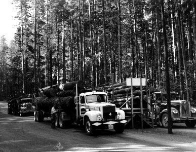
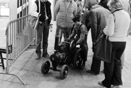
vehicle
toy
history
forest
western painting in the national gallery of victoria
renée delmas de pont-jest
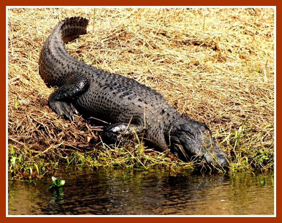
animals
water
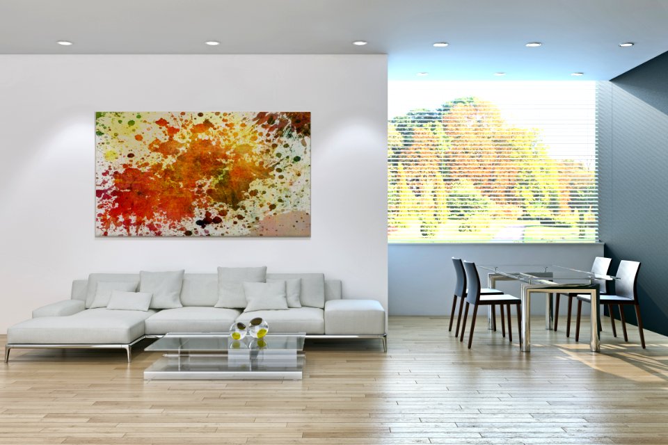
living room
roads
modern
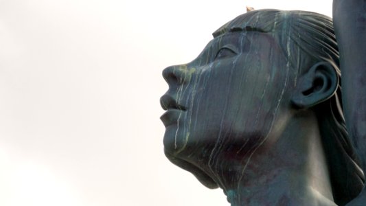
woman
charts and maps of the royal museums greenwich
1584 maps
illustration
woman
maps from university of amsterdam special collections
atlas der neederlanden
maps in the library of congress
1776 maps
1630s maps of rhineland-palatinate
nicolaes visscher i
17th-century maps of iceland
iceland map by joris carolus
animals
fish
old maps of scotland from the norman b. leventhal map center
old maps of ireland from the norman b. leventhal map center
17th-century maps of carmarthenshire
17th-century maps of pembrokeshire
chorographia britanniae (1741-1742)
18th-century maps of staffordshire
chorographia britanniae (1741-1742)
18th-century maps of hampshire
chorographia britanniae (1741-1742)
18th-century maps of hertfordshire
maps and topographical views by joris hoefnagel
1580s maps of spain
maps of rodrigues island
old maps of mauritius
chorographia britanniae (1741-1742)
18th-century maps of surrey
chorographia britanniae (1741-1742)
18th-century maps of leicestershire
chorographia britanniae (1741-1742)
18th-century maps of devon
maps from university of amsterdam special collections
atlas der neederlanden
maps from university of amsterdam special collections
atlas der neederlanden
maps from university of amsterdam special collections
atlas der neederlanden
maps from university of amsterdam special collections
atlas der neederlanden
maps from university of amsterdam special collections
atlas der neederlanden
maps from university of amsterdam special collections
atlas der neederlanden
historical
history
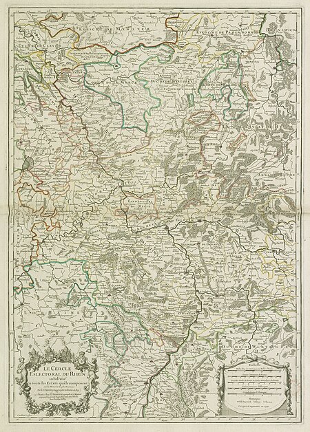
map of the circle of the rhineland by sanson
1730s maps of rhineland-palatinate
jean-fréderic phélypeaux
guillaume dheulland
jean-fréderic phélypeaux
guillaume dheulland
die zee custe van noorweghen tusschen der noess ende mardou, soe tzelfde landt aldaer in zijn wesen ende ghedaente is - (lucas ioannes aurigarius inventor) ; ioannes à doetecum fecit - btv1b532358494
bibliothèque nationale de france
bibliothèque nationale de france
maps of wales by humphrey llwyd
maps in the stadsarchief amsterdam
maps by carolus allard
china burma india theater (cbi)
allied armies
maps from university of amsterdam special collections
atlas der neederlanden
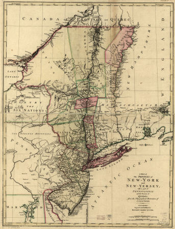
a map of the provinces of new york and new jersey, with a part of pennsylvania and the province of quebec
maps in the library of congress
die zee custe van noorweghen tusschen der noess ende mardou, soe tzelfde landt aldaer in zijn wesen ende ghedaente is - (lucas ioannes aurigarius inventor) ; ioannes à doetecum fecit - btv1b532358494
bibliothèque nationale de france
maps in the stadsarchief amsterdam
maps by carolus allard
creta insula plerumq deum natalibus, iovis iincunabulis, sepulchrocq - inclyta - adventu europae, minoe rege, pasiphaes et aridnae amoribus - minotavri feritate, fatoq - dardali labyrintho, et fuga -... - btv1b53214060x
guillaume sanson
die zee custe van noorweghen tusschen der noess ende mardou, soe tzelfde landt aldaer in zijn wesen ende ghedaente is - (lucas ioannes aurigarius inventor) ; ioannes à doetecum fecit - btv1b532358494
bibliothèque nationale de france
bibliothèque nationale de france
guillaume sanson
bibliothèque nationale de france
maps of limousin by jean fayen
architectural drawings from maastricht
maastricht in the 1800s
maps from university of amsterdam special collections
atlas der neederlanden
maps from university of amsterdam special collections
atlas der neederlanden
maps from university of amsterdam special collections
atlas der neederlanden
maps from university of amsterdam special collections
atlas der neederlanden
a plan of the operations of the king's army under the command of general sr. william howe, k.b. in new york and east new jersey, against the american forces commanded by general washington, from the 12th. of october, to the 28th. of november 1776
maps in the library of congress
1630s maps of the iberian peninsula
hessel gerritsz
vehicle
model
historical
history
woman
blue
woman
blue
wildlife
nature
historical
history
historical
history
old maps of the strait of gibraltar
hendrik de leth
drawings in the cooper–hewitt, smithsonian design museum
drawings by corrado giaquinto
16th-century maps of the western mediterranean
lucas janszoon waghenaer
fish with tribal pattern
tribal fish
18th-century maps of western europe
1754 maps of europe
bibliothèque nationale de france
félix robaut
beschrijvinghe vande zeeusche eijlanden, soe die op hare stromen geleghen zijn, met een deel vande zee custen van vlaenderen ennde hollant - btv1b532255648
bibliothèque nationale de france
le cercle de franconie, subdivisé en touts les estats qui le composent, dressé sur les mémoires les plus nouveaux - par le sr. sanson... - btv1b53202321v
map of the circle of franconia by sanson
maps of haguenau
carolus allard
7801 - 7900 of 8,935
Next page
/ 90


![A Map of North Wales: N. West from London / T. Badeslade delin[eavit]; W.H. Toms Sculp[sit], 1741](https://cdn.creazilla.com/illustrations/10001551176/a-map-of-north-wales-n-west-from-london-t-badeslade-delineavit-wh-toms-sculpsit-1741-md.jpg)

![Map of the old new lands in West Voorn / I. Luiken fecit cum aqua forti; A. Steyaart invented; I. Stemmer's sculpsit, Romeyn de Hooghe, [1701]](https://cdn.creazilla.com/illustrations/10000299995/map-of-the-old-new-lands-in-west-voorn-i-luiken-fecit-cum-aqua-forti-a-steyaart-invented-i-stemmers-sculpsit-romeyn-de-hooghe-1701-md.jpg)

![New map of the dike district of the eastern bailiwick of West Friesland, called Medenblick and the Vier Noorder Coggen / Pieter Straat inventor; made in copper by Hendrik de Leth, [1732]](https://cdn.creazilla.com/illustrations/10000394364/new-map-of-the-dike-district-of-the-eastern-bailiwick-of-west-friesland-called-medenblick-and-the-vier-noorder-coggen-pieter-straat-inventor-made-in-copper-by-hendrik-de-leth-1732-md.jpg)
![Private carte d'une partie de la Hollande, et du Brabant Hollandois, ou les environs de Breda, Boisleducq, Geertruydenberg, Heusden, Dordrecht, Bommel &c. / I. Condet f. 1748, Johannes Condet, [1748]](https://cdn.creazilla.com/illustrations/10000996562/private-carte-dune-partie-de-la-hollande-et-du-brabant-hollandois-ou-les-environs-de-breda-boisleducq-geertruydenberg-heusden-dordrecht-bommel-c-i-condet-f-1748-johannes-condet-1748-md.jpg)
![Carte des Isles Philippines, Celebes et Moluccas = Map of the Philippines, Celebes, and Moluccas Islands / J. v. Schley direct, Jakob van der Schley, [1747]](https://cdn.creazilla.com/illustrations/10001211531/carte-des-isles-philippines-celebes-et-moluccas-map-of-the-philippines-celebes-and-moluccas-islands-j-v-schley-direct-jakob-van-der-schley-1747-sm.webp)
![Map of Siam, Tonkin, Pegu, Ava, Arakan - J.V.S. Cartography, Jakob van der Schley, [1773]](https://cdn.creazilla.com/illustrations/10001321492/map-of-siam-tonkin-pegu-ava-arakan-j-v-s-cartography-jakob-van-der-schley-1773-sm.jpg)
![New map of the Kingdom of Bengal / J.V. Schley direct, Jakob van der Schley, [1773]](https://cdn.creazilla.com/illustrations/10001347432/new-map-of-the-kingdom-of-bengal-jv-schley-direct-jakob-van-der-schley-1773-md.jpg)
![[Map of the defeat of the Confederate ship Alabama by the U.S. steamer Kearsarge on June 19, 1864, off Cherbourg, France].](https://cdn.creazilla.com/illustrations/10001534884/map-of-the-defeat-of-the-confederate-ship-alabama-by-the-us-steamer-kearsarge-on-june-19-1864-off-cherbourg-france-md.jpg)


![Wallia principatus vulgo Wales: Seren[issi]mo Domino Carolo Magnae Britanniae, etc. Principi [signé] Joh. Blaeu, 1673](https://cdn.creazilla.com/illustrations/10001204343/wallia-principatus-vulgo-wales-serenissimo-domino-carolo-magnae-britanniae-etc-principi-sign-joh-blaeu-1673-md.jpg)


![The Course of the Somme in the vicinity of which course are situated, the Ponthieu, the Amienois, the Santerre and the Vermandois / By N. de Fer... Scale of Three Hours of Travel [=1: 139 200 ]; H. Van Loon sculp, Herman van Loon, 1709](https://cdn.creazilla.com/illustrations/10000794475/the-course-of-the-somme-in-the-vicinity-of-which-course-are-situated-the-ponthieu-the-amienois-the-santerre-and-the-vermandois-by-n-de-fer-scale-of-three-hours-of-travel-1-139-200-h-van-loon-sculp-herman-van-loon-1709-md.jpg)


![Carpetaniae partis descr. / [Georgius Hoefnaglius], Joris Hoefnagel, 1584](https://cdn.creazilla.com/illustrations/10000765930/carpetaniae-partis-descr-georgius-hoefnaglius-joris-hoefnagel-1584-sm.jpg)


![Maps of the coat of arms of Naters and Pancras Gors / A. Steyaart invenit; I. Stemmers sculpsit; I. Luiken fecit cum aqua forti, Romeyn de Hooghe, [1701]](https://cdn.creazilla.com/illustrations/10000526878/maps-of-the-coat-of-arms-of-naters-and-pancras-gors-a-steyaart-invenit-i-stemmers-sculpsit-i-luiken-fecit-cum-aqua-forti-romeyn-de-hooghe-1701-md.jpg)
![Map of the polders of Klein Oosterland and Kley-Burgh / A. Steyaart invenit; Heyman vander Dyck fecit; I. Stemmer's sculpsit; I. Shutters fecit cum aqua forti, Romeyn de Hooghe, [1701]](https://cdn.creazilla.com/illustrations/10000646707/map-of-the-polders-of-klein-oosterland-and-kley-burgh-a-steyaart-invenit-heyman-vander-dyck-fecit-i-stemmers-sculpsit-i-shutters-fecit-cum-aqua-forti-romeyn-de-hooghe-1701-md.jpg)
![Carte vande polder vande Nieuwe-Goote, Ao. 1696 / A. Steyaart invenit; I. Stemmer's sculpsit; I. Shutters fecit cum aqua forti, Romeyn de Hooghe, [1701]](https://cdn.creazilla.com/illustrations/10001048195/carte-vande-polder-vande-nieuwe-goote-ao-1696-a-steyaart-invenit-i-stemmer-s-sculpsit-i-shutters-fecit-cum-aqua-forti-romeyn-de-hooghe-1701-md.jpg)
![Map of the polder of Nieuwen Hoorn 1695 / I. Luyken fecit cum aqua forti; I. Stemmer's sculpsit; A. Steyaart invenit, Romeyn de Hooghe, [1701]](https://cdn.creazilla.com/illustrations/10001201060/map-of-the-polder-of-nieuwen-hoorn-1695-i-luyken-fecit-cum-aqua-forti-i-stemmers-sculpsit-a-steyaart-invenit-romeyn-de-hooghe-1701-md.jpg)
![General map and images of the eylande of West Voorn / I. Luiken fecit cum aqua forti; A. Steyaart invented; I. Stemmer's sculpsit, Romeyn de Hooghe, [1701]](https://cdn.creazilla.com/illustrations/10001191356/general-map-and-images-of-the-eylande-of-west-voorn-i-luiken-fecit-cum-aqua-forti-a-steyaart-invented-i-stemmer-s-sculpsit-romeyn-de-hooghe-1701-md.jpg)
![Map of the west new lant in West Voorne 1696 / I. Luiken fecit cum aqua forti; A. Steyaart invented; I. Stemmer's sculpsit; Heyman van Dyck fecit, Romeyn de Hooghe, [1701]](https://cdn.creazilla.com/illustrations/10000775784/map-of-the-west-new-lant-in-west-voorne-1696-i-luiken-fecit-cum-aqua-forti-a-steyaart-invented-i-stemmers-sculpsit-heyman-van-dyck-fecit-romeyn-de-hooghe-1701-md.jpg)


![General map of the country of Voorne in the country of Over Flacquee / I. Stemmers sculpsit; A. Steyaart invented; I. Shutters fecit cum aqua forti, Romeyn de Hooghe, [1701]](https://cdn.creazilla.com/illustrations/10001257299/general-map-of-the-country-of-voorne-in-the-country-of-over-flacquee-i-stemmers-sculpsit-a-steyaart-invented-i-shutters-fecit-cum-aqua-forti-romeyn-de-hooghe-1701-md.jpg)


![Map vande polder van Swarte-Waal, 1697 / I. Stemmers sculpsit; A. Steyaart invenit; I. Luiken fecit cum aqua forti, Romeyn de Hooghe, [1701]](https://cdn.creazilla.com/illustrations/10000588873/map-vande-polder-van-swarte-waal-1697-i-stemmers-sculpsit-a-steyaart-invenit-i-luiken-fecit-cum-aqua-forti-romeyn-de-hooghe-1701-md.jpg)
![Map of the polders of Old and New Roc-anje / A. Steyaart invenit; Heyman van Dyck fecit; I. Stemmer's sculpsit; I. Shutters fecit cum aqua forti, Romeyn de Hooghe, [1701]](https://cdn.creazilla.com/illustrations/10000510590/map-of-the-polders-of-old-and-new-roc-anje-a-steyaart-invenit-heyman-van-dyck-fecit-i-stemmers-sculpsit-i-shutters-fecit-cum-aqua-forti-romeyn-de-hooghe-1701-md.jpg)
![Carte vande Ambachts Heerlykheyt vanden Ouden Hoorn / I. Luiken fecit cum aqua forti; A. Steyaart invented; I. Stemmer's sculpsit, Romeyn de Hooghe, [1701]](https://cdn.creazilla.com/illustrations/10001208015/carte-vande-ambachts-heerlykheyt-vanden-ouden-hoorn-i-luiken-fecit-cum-aqua-forti-a-steyaart-invented-i-stemmer-s-sculpsit-romeyn-de-hooghe-1701-md.jpg)
![Map of the polder of Oost Voorn / Heyman van Dyck fecit 1695; A. Steyaart invented; I. Stemmer's sculpsit; I. Shutters fecit cum aqua forti, Romeyn de Hooghe, [1701]](https://cdn.creazilla.com/illustrations/10000729215/map-of-the-polder-of-oost-voorn-heyman-van-dyck-fecit-1695-a-steyaart-invented-i-stemmers-sculpsit-i-shutters-fecit-cum-aqua-forti-romeyn-de-hooghe-1701-sm.webp)