Log in
All resources
Create a design
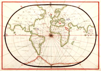
Portolan atlas of the Mediterranean Sea, western Europe, and the northwest coast of Africa: World map drawn on an oval projection (ca. 1590) by Joan Oliva.
Download
Edit image
Published by:
Creazilla
Author:
Library of Congress
Source:
rawpixel.com
Loading...
1 download
Print it
Copy image
Loading...
maps
sea
earth
globe
vintage
compass
world map
africa map
journey
watercolor
vintage maps
old map
MORE LIKE THIS