Log in
All resources
Create a design
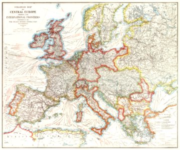
Strategic map of Central Europe showing the international frontiers / prepared in the War College Division (1915) by Arch. B. Williams and Geo. F. Bontz, Draftsmen.
Download
Edit image
Published by:
Creazilla
Author:
Beinecke Rare Book & Manuscript Library
Source:
rawpixel.com
Loading...
2 downloads
Print it
Copy image
Loading...
maps
globe
vintage
world map
antique
vintage maps
1900s
old map
public domain
maps antique
world maps public domain
maps public domain
MORE LIKE THIS