Log in
All resources
Create a design
258 Free Images of 1730 Maps
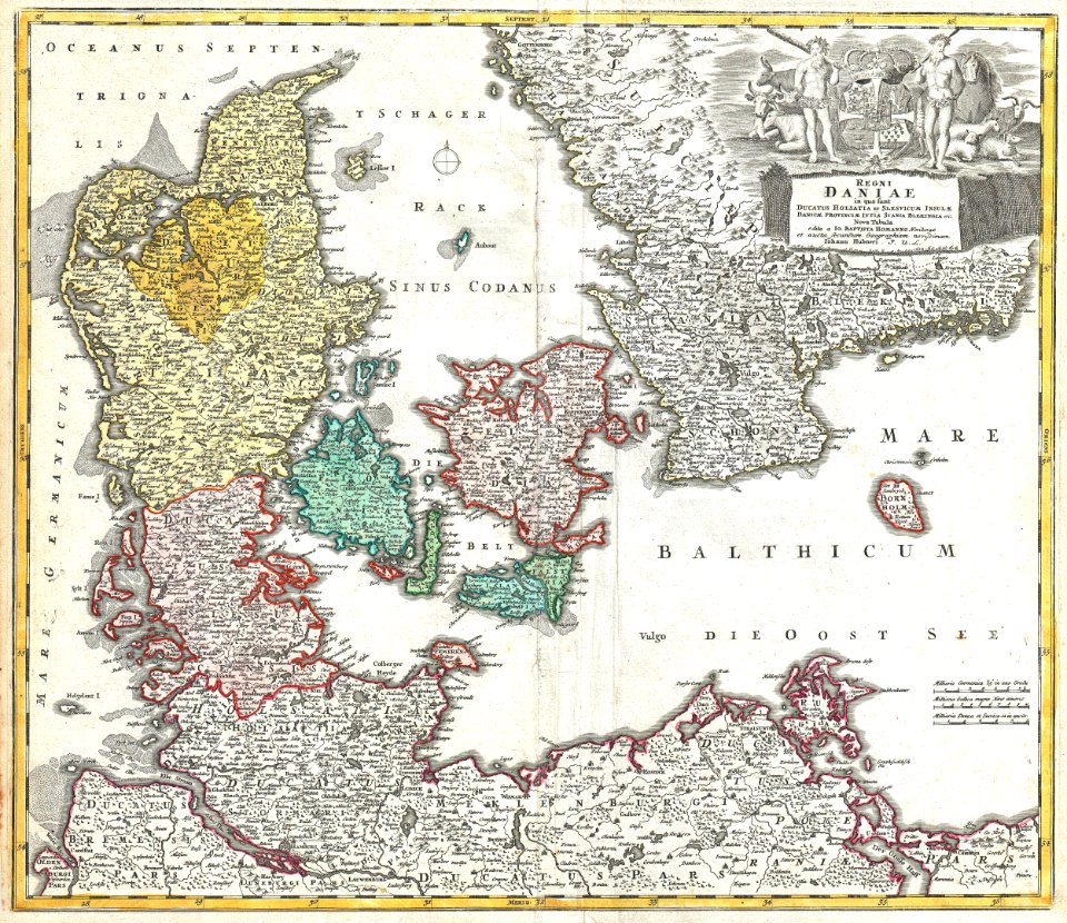
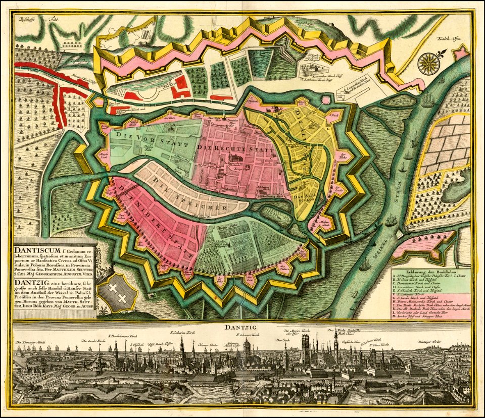
maps by matthäus seutter
1730s
cc-zero
bibliothèque nationale de france
pages with maps
latin-language maps
plan de roussel - derivative files
maps by homannsche erben
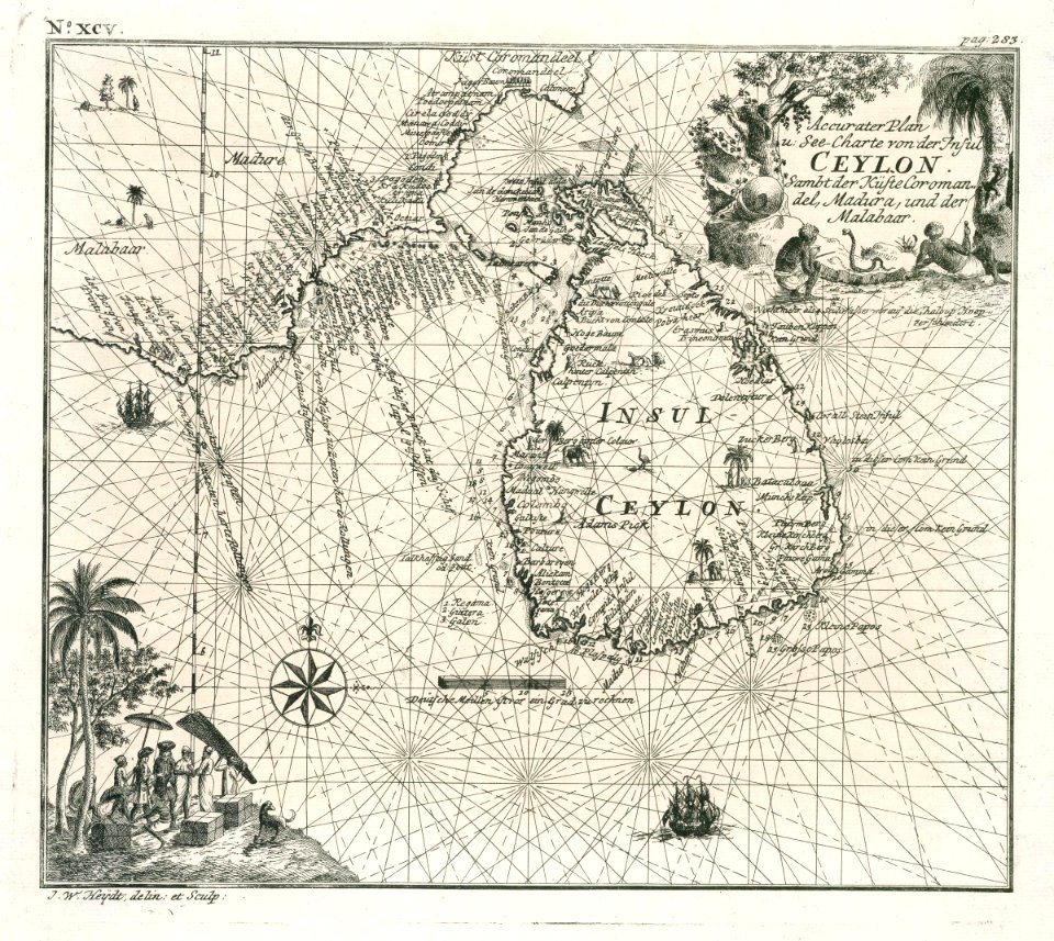
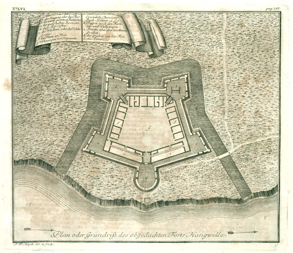
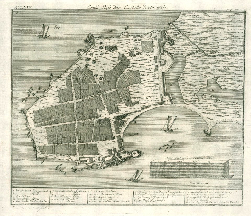
maps of the dutch east india company - sri lanka
johann baptist homann
self-published work
pages with maps
february 2016 denmark photographs
self-published work
february 2016 denmark photographs
trinitatis kirke
kaart van het baljuwschap kennemerland
maps in the rijksmuseum amsterdam
carta hydrographica y chorographica de las yslas filipinas
baroque painting
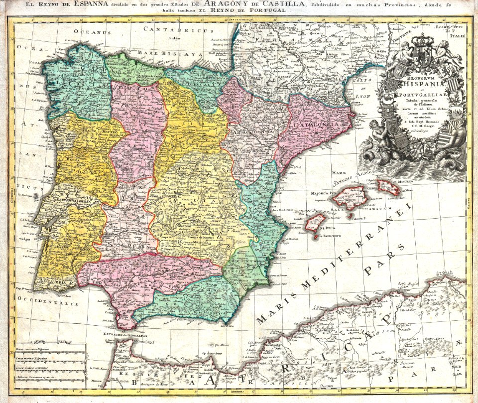
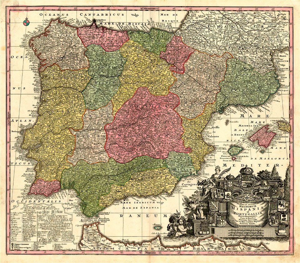
old maps of the iberian peninsula
johann baptist homann
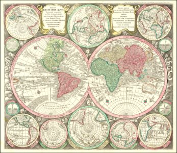
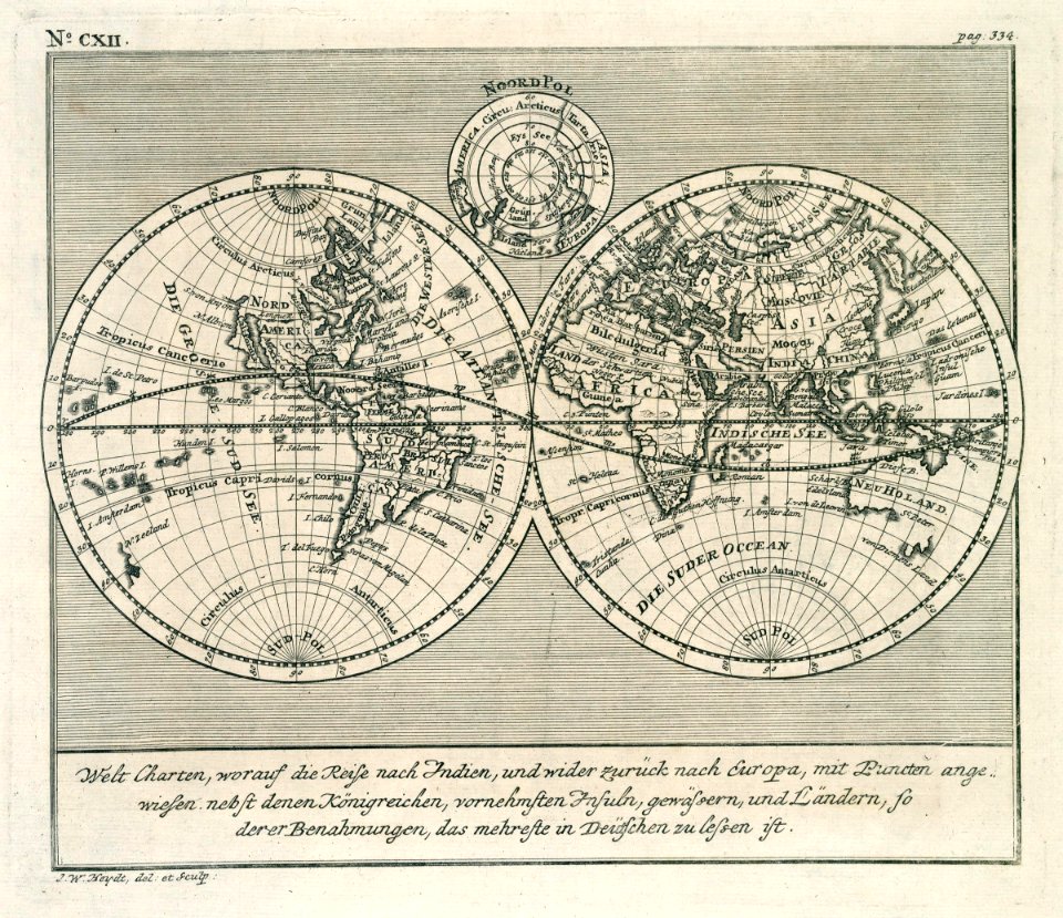
double hemisphere world maps
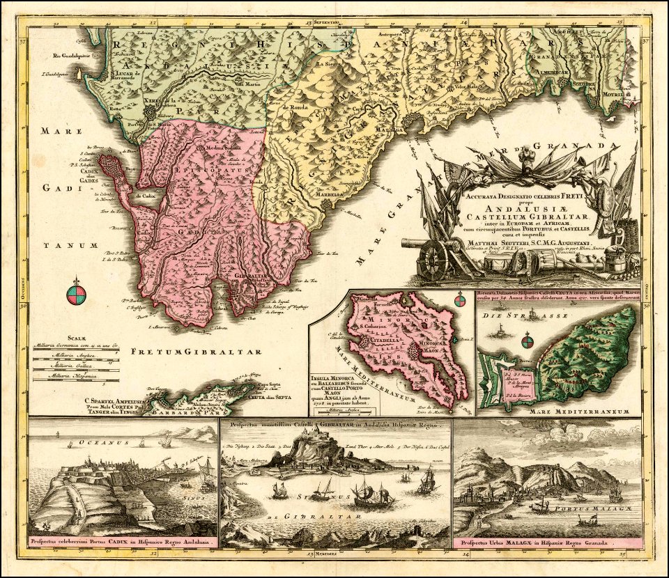
maps by matthäus seutter
maps by homannsche erben
latin-language maps
english-language maps
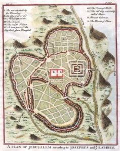
pool of siloam
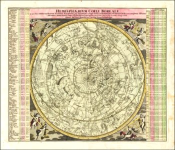
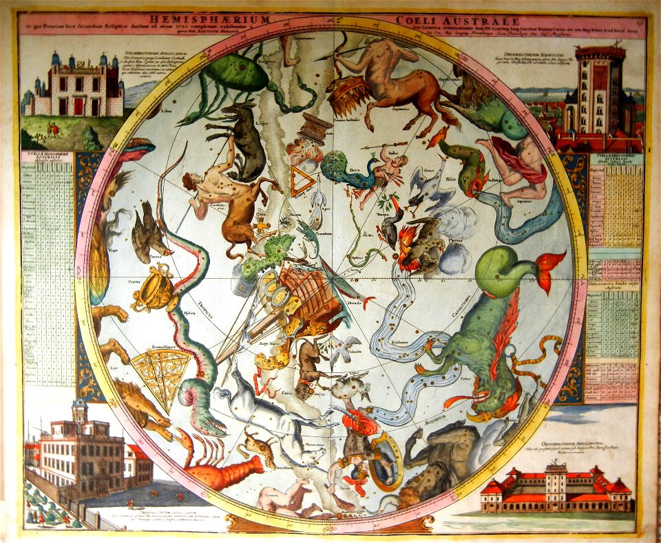
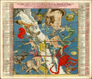
johann gabriel doppelmayr
star location maps
málaga
cádiz
maps by matthäus seutter
1730 maps
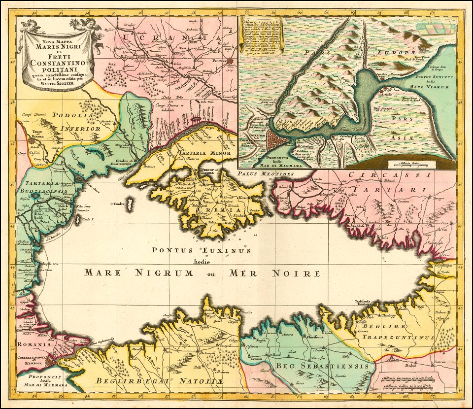
18th-century maps of the black sea
maps by matthäus seutter
johann baptist homann
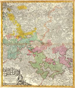
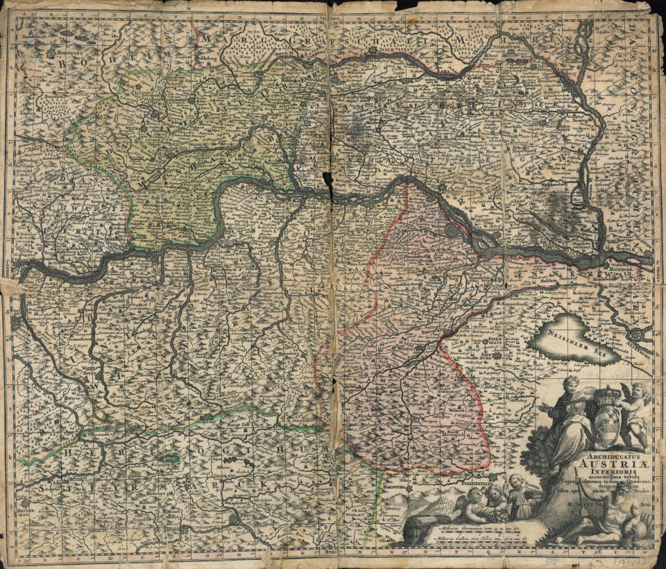
old maps of hesse
maps by homannsche erben
latin-language maps
maps of territories in the lower saxony circle
johann baptist homann
old celestial maps
maps with figures
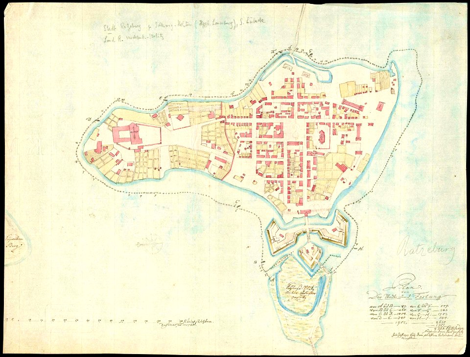
history of ratzeburg
1730 maps of germany
coats of arms of the crown of aragon
coats of arms on maps
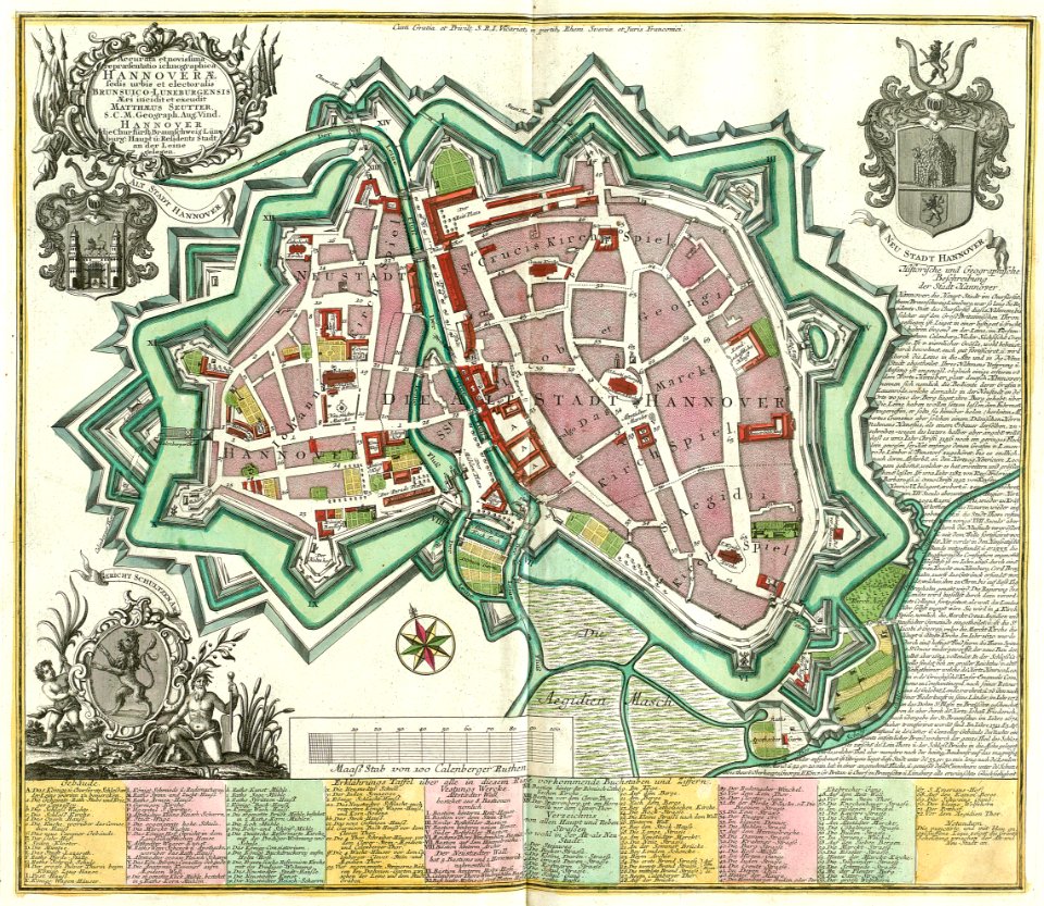
old maps of cities in germany
maps by matthäus seutter
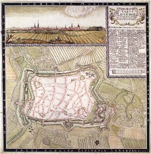
historical maps of lüneburg
lüneburg in the 1730s
maps by matthäus seutter
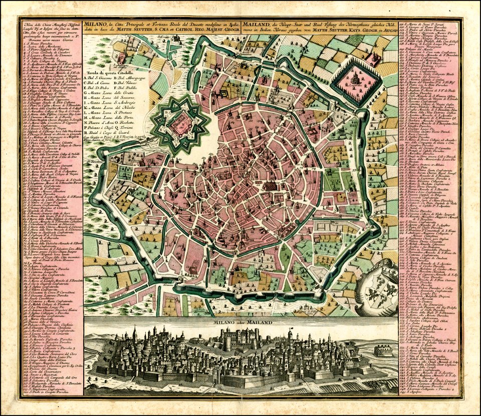
old maps of milan
maps by matthäus seutter
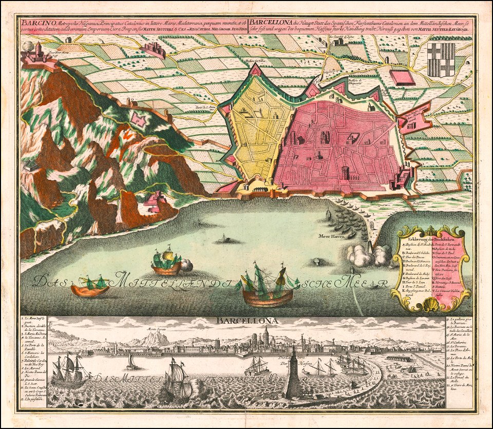
old maps of barcelona
maps by matthäus seutter
old maps of madrid
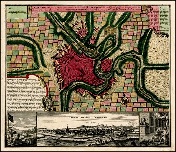
old maps of luxembourg city
maps by matthäus seutter
maps by matthäus seutter
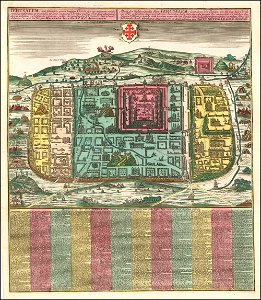
old maps of jerusalem
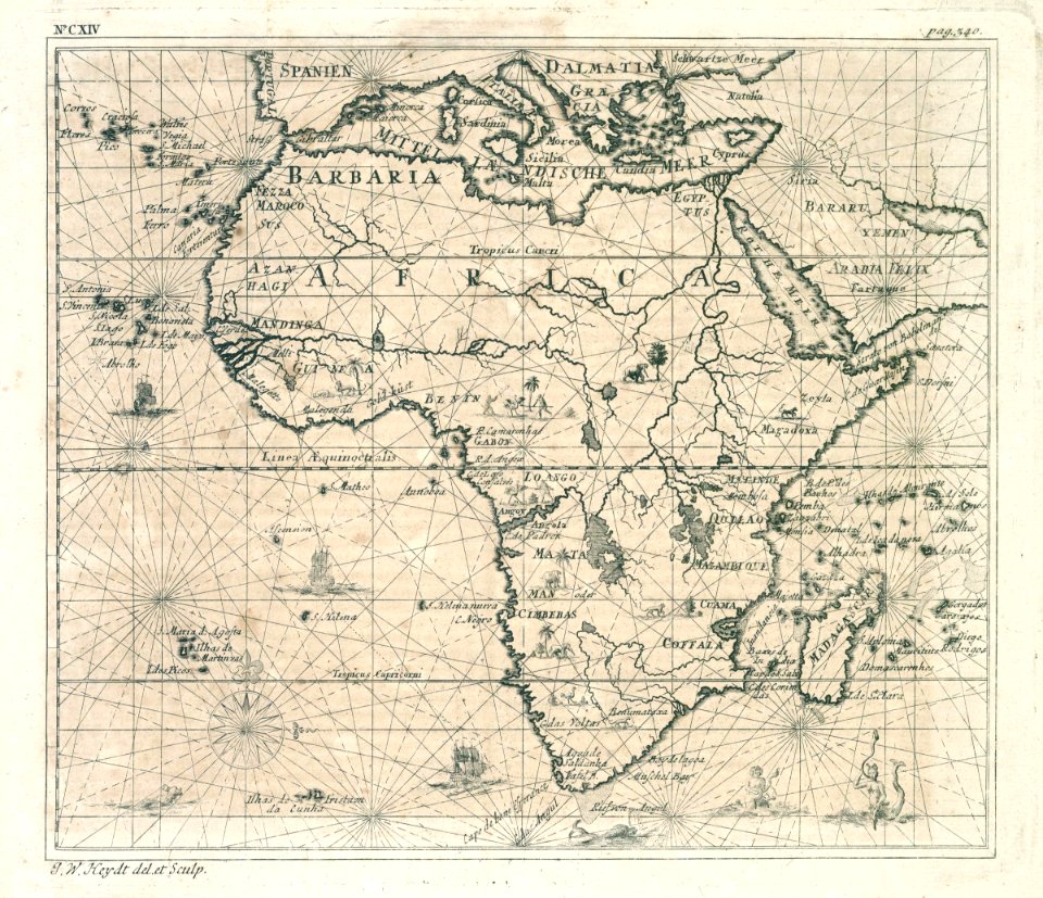
old maps of the dutch east india company
1730s
maps of the dutch east india company - sri lanka
1730s
maps of the dutch east india company - sri lanka
1730s
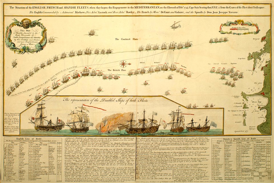
charts and maps of the royal museums greenwich
1730 maps
charts and maps of the royal museums greenwich
1730 maps
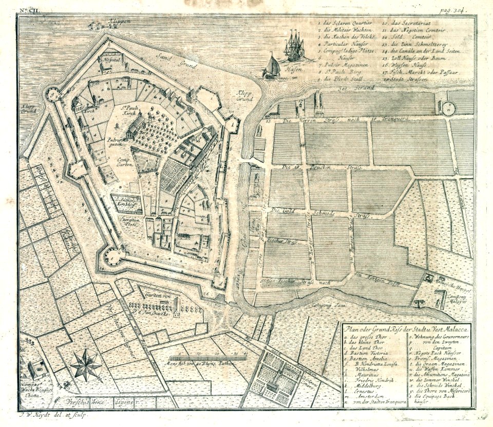
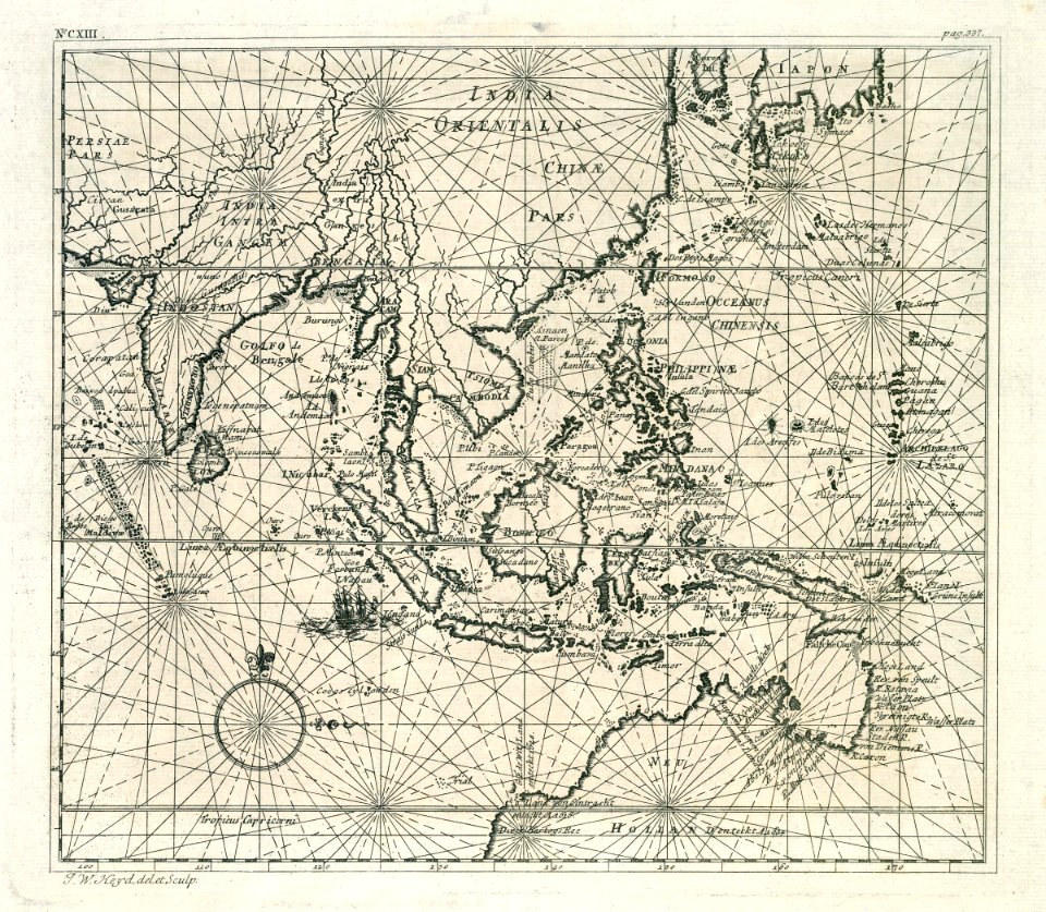
old maps of the dutch east india company - malaysia
1730s
maps by homannsche erben
latin-language maps
ports and harbours of the polish-lithuanian commonwealth
old maps of gdańsk
maps of the dutch east india company - sri lanka
1730s
old maps of the dutch east india company
1730s
old maps of the dutch east india company
1730s
maps of the dutch east india company - sri lanka
1730s
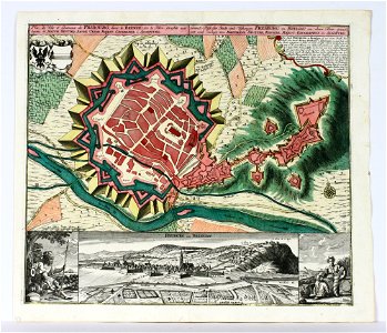
old maps of freiburg im breisgau
maps by matthäus seutter
self-published work
pages with maps
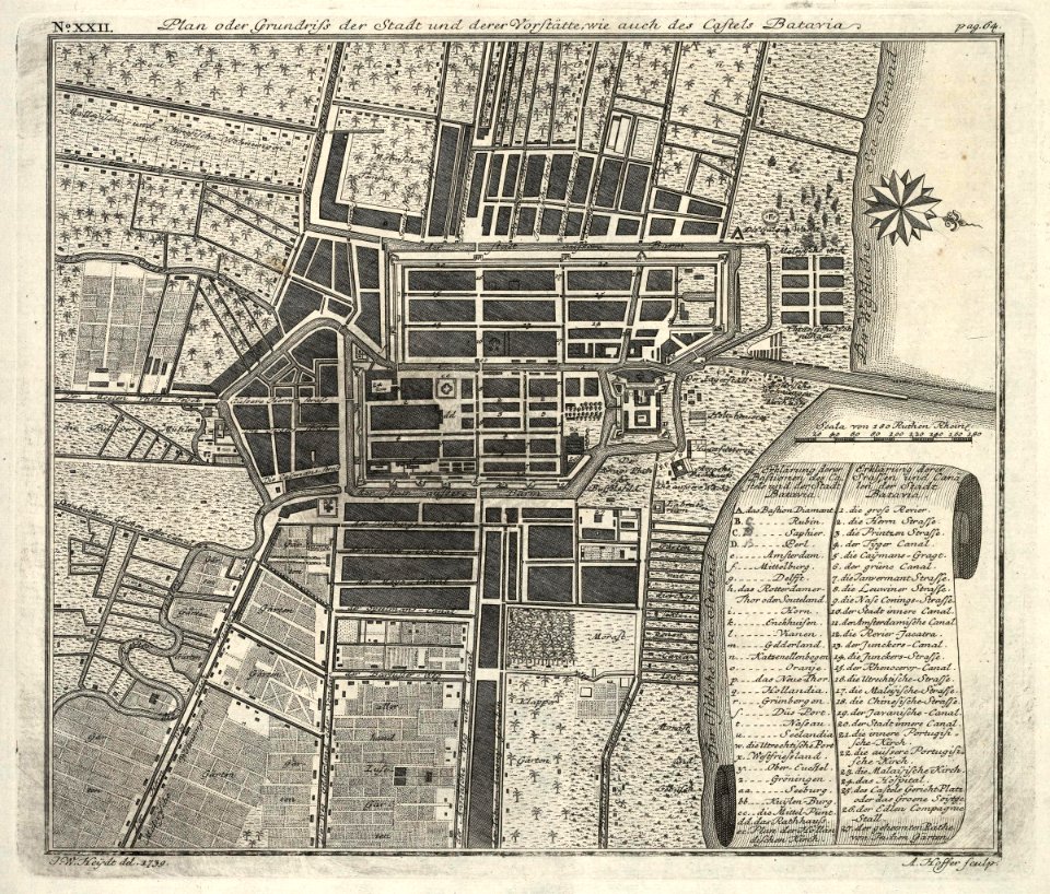
kota tua
batavia
old maps of the dutch east india company
1730s
maps of the dutch east india company - sri lanka
1730s
maps of the dutch east india company - sri lanka
1730s
maps of paris in the 1730s
plan de turgot
johannes kip
1732 maps
history of lorenzkirch
old maps of saxony
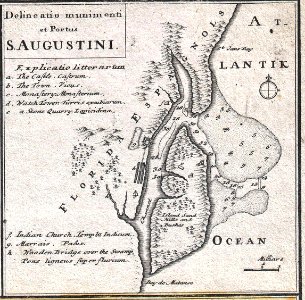
florida
1730s
maps of paris from the barry lawrence ruderman antique maps inc.
maps by homannsche erben
maps
sea
johann gabriel doppelmayr
old celestial maps
veracruz
florida
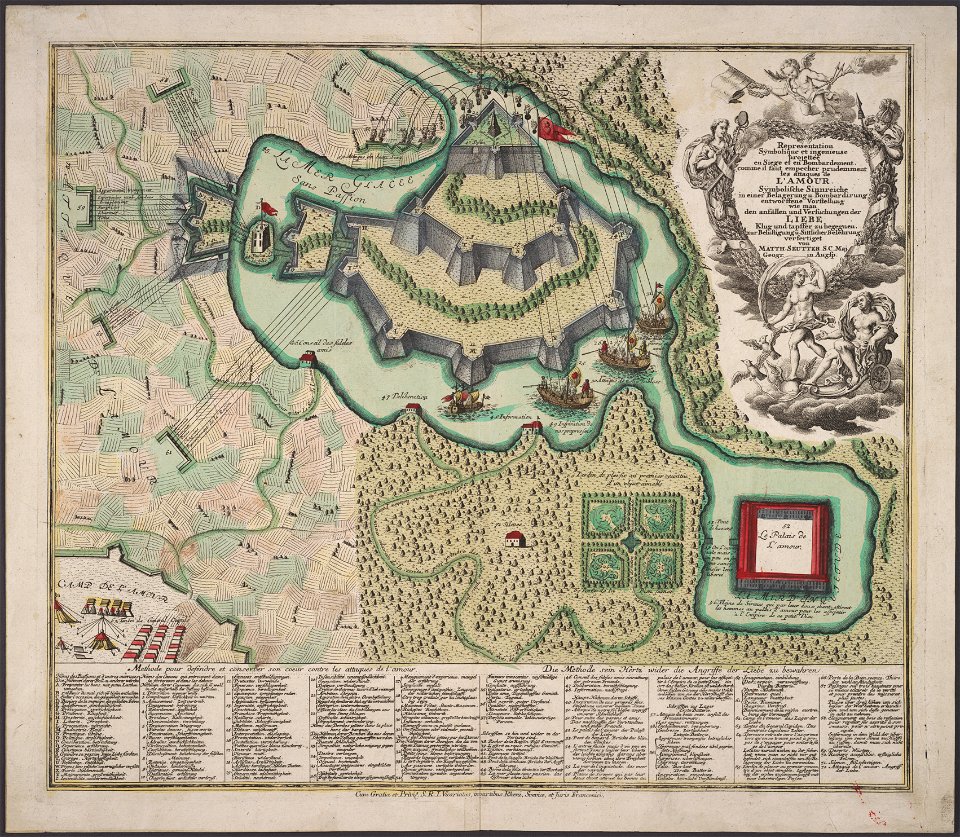
allegory
love
copper engraving
maps
maps made in the 18th century
maps in skokloster castle
old maps of france
1730
self-published work
pages with maps
self-published work
pages with maps
self-published work
pages with maps
self-published work
cc-pd-mark
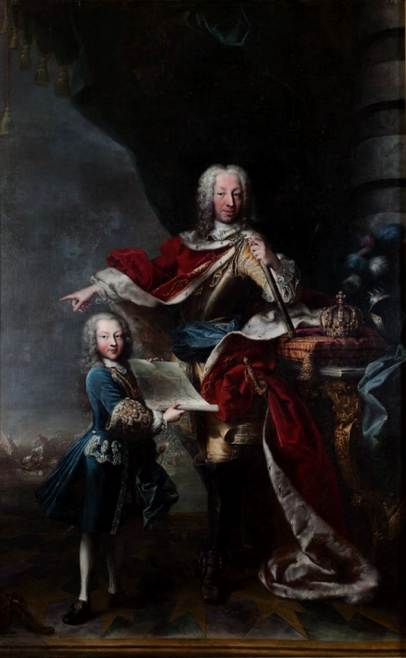
victor amadeus iii of sardinia
ermine (clothing) in art
1730s maps of south carolina
old maps of north america
old maps of banská štiavnica
danubius pannonico-mysicus
1730s maps of the netherlands
1730 maps
old maps of gorinchem
1730 maps
old submaps of paris 17e arrondissement
plan de roussel - derivative files
art works by johann christian leopold
friedrich bernhard werner
maps from university of amsterdam special collections
atlas der neederlanden
plan de roussel - derivative files
maps of meudon
beschryving van 'sgraven-hage
the hague in the 1570s
plan de roussel - derivative files
proletarian literature
beschryving van 'sgraven-hage
the hague in the 1570s
turgot map of paris, kyoto university library – derivative files
palais du louvre on old maps
maps of brussels city walls
old maps of brussels
a map of the british empire in america with the french and spanish settlements adjacent thereto
1730s maps of the caribbean
maps of the war of the spanish succession
apalachee
danubius pannonico-mysicus
1720s maps of transylvania
1730s maps of the americas
1730s maps
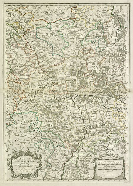
map of the circle of the rhineland by sanson
1730s maps of rhineland-palatinate
historical images of palais bourbon
plans of castles in france
maps of brussels city walls
old maps of brussels
maps in the library of congress
plaine de grenelle
map of the circle of the rhineland by sanson
1730s maps of rhineland-palatinate
maps from university of amsterdam special collections
atlas der neederlanden
maps of montreuil (seine-saint-denis)
plan de roussel - derivative files
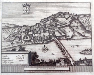
maps of coimbra by braun & hogenberg
maps by pieter van der aa
1730s maps of belgium
maps of houthulst
plans of the château de clagny
maps of baroque gardens
map of amsterdam by julius milheuser after daniël stalpaert, 1662
julius milheuser
maps of paris from bibliothèque nationale de france
plan de roussel
maps from university of amsterdam special collections
atlas der neederlanden
maps from university of amsterdam special collections
atlas der neederlanden
map of the circle of the rhineland by sanson
1730s maps of rhineland-palatinate
maps by alexis-hubert jaillot
1730s maps of france
place du maréchal-leclerc (meudon)
maps of meudon
a map of the british empire in america with the french and spanish settlements adjacent thereto
1730s maps of the caribbean
maps by nicolas sanson
1730s maps of france
map of the circle of the rhineland by sanson
1730s maps of rhineland-palatinate
maps of paris from bibliothèque nationale de france
plan de roussel
plan de roussel - derivative files
maps of issy-les-moulineaux
1 - 100 of 258
Next page
/ 3


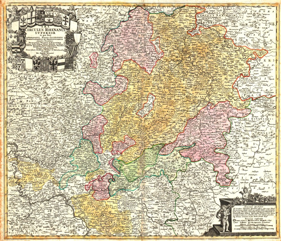


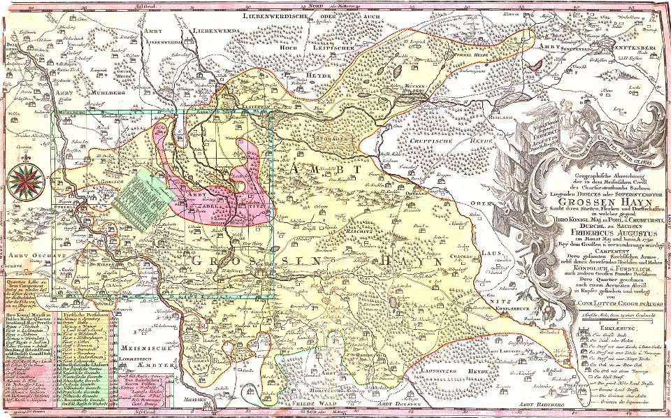


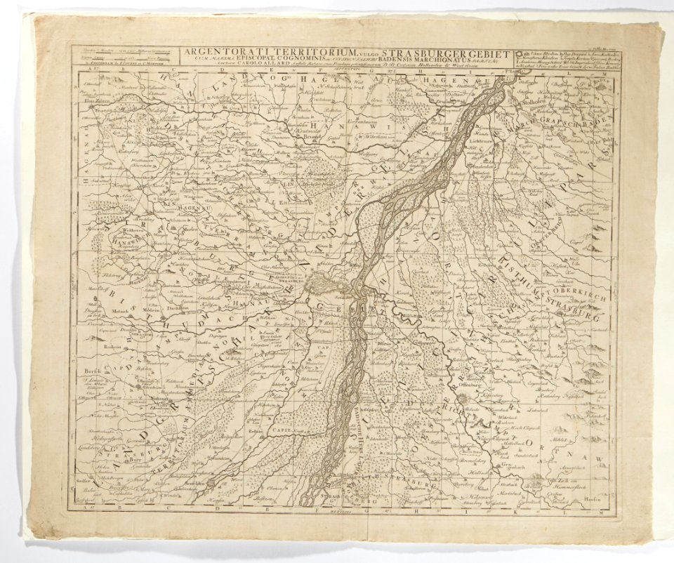


![The Electoral Circle of the Rhine subdivided into all the Estates which compose it... / by Sanson, ,... Geometric Miles or Miles of Italy [30 = 12] common leagues of France, 1734](https://cdn.creazilla.com/illustrations/10001532968/the-electoral-circle-of-the-rhine-subdivided-into-all-the-estates-which-compose-it-by-sanson-geometric-miles-or-miles-of-italy-30-12-common-leagues-of-france-1734-sm.jpg)


![Map or drawing of the river Merwede from Gorichem downwards etc. / [Nicolaes Cruquius], [1730]](https://cdn.creazilla.com/illustrations/10001419622/map-or-drawing-of-the-river-merwede-from-gorichem-downwards-etc-nicolaes-cruquius-1730-md.jpg)


![Map of Paris ([Reprod. in facsim.]) / by Roussel, engineer in 1700, 1730](https://cdn.creazilla.com/illustrations/10001522196/map-of-paris-reprod-in-facsim-by-roussel-engineer-in-1700-1730-md.jpg)
![Map or drawing of the river Merwede from Gorichem downwards etc. / [Nicolaes Cruquius], [1730]](https://cdn.creazilla.com/illustrations/10000781010/map-or-drawing-of-the-river-merwede-from-gorichem-downwards-etc-nicolaes-cruquius-1730-md.jpg)
![Map or drawing of the river Merwede from Gorichem downwards etc. / [Nicolaes Cruquius], [1730]](https://cdn.creazilla.com/illustrations/10001543119/map-or-drawing-of-the-river-merwede-from-gorichem-downwards-etc-nicolaes-cruquius-1730-sm.webp)