Log in
All resources
Create a design
59 Free Images of 1838 Maps
cc-zero
pages with maps
maps from the mechanical curator collection
bibliothèque nationale de france
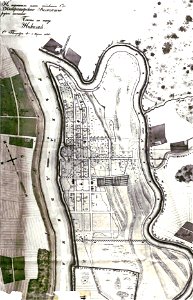
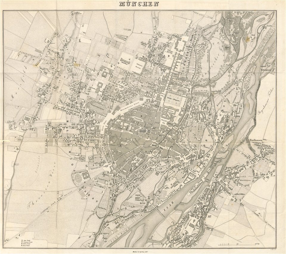
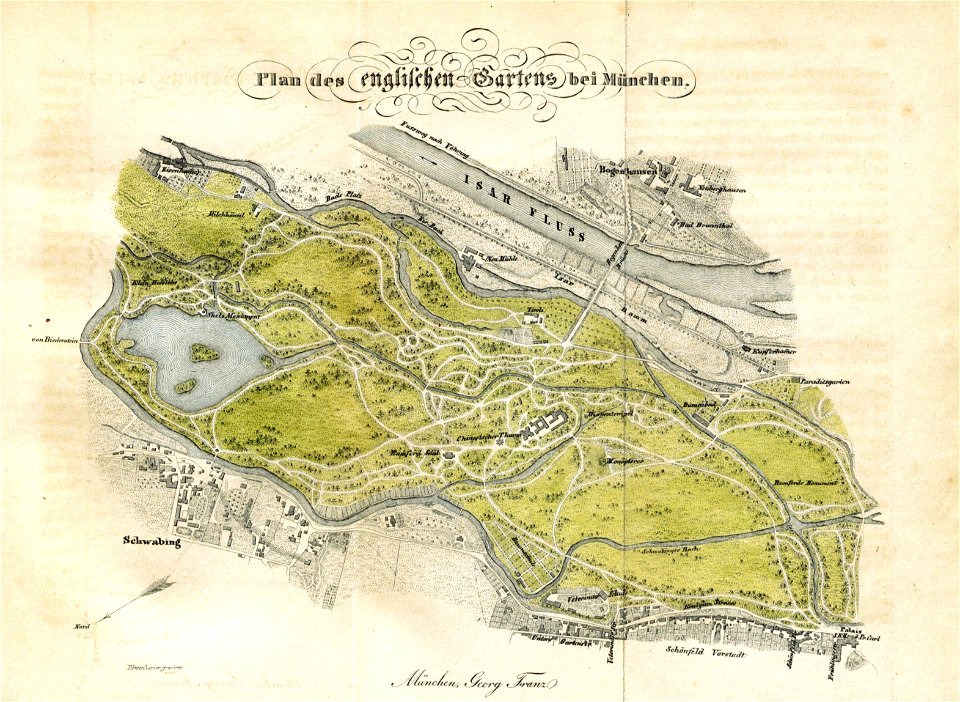
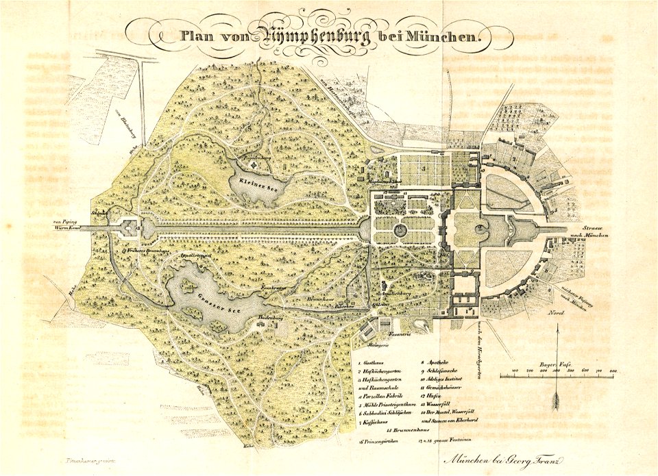
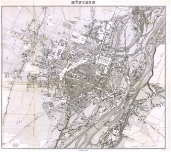
munich in the 19th century
topographisch
münchen mit seinen umgebungen historisch
statistisch dargestellt (1838) by johann von soeltl
engravings of munich
architecture
mollusca of nueva esparta state
self-published work
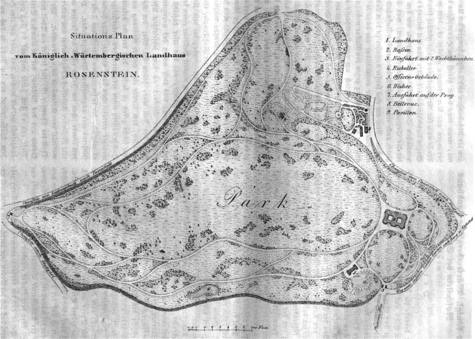
schloss rosenstein
rosensteinpark
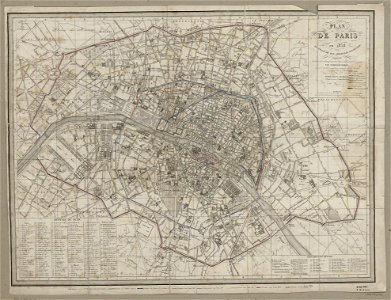
maps of paris from paris musées
1830s maps of paris
charts and maps of the royal museums greenwich
1838 maps
charts and maps of the royal museums greenwich
1838 maps
charts and maps of the royal museums greenwich
1838 maps
cornell university library
jr
old maps of belarus
daugava
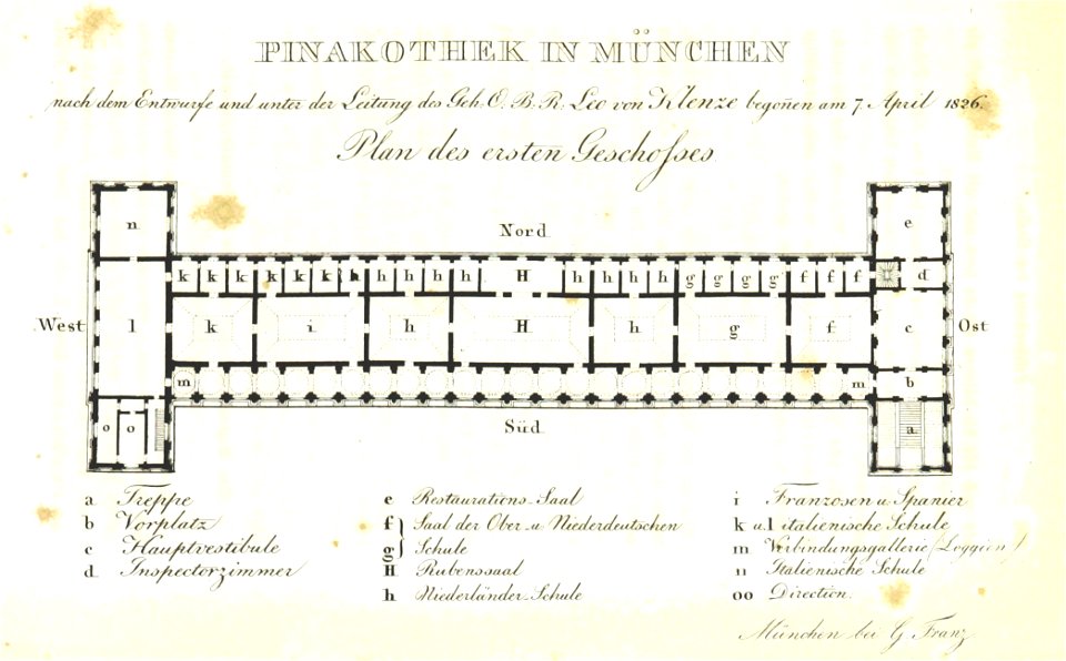
munich in the 19th century
alte pinakothek
munich in the 19th century
old city maps of munich
self-published work
light
maps from the mechanical curator collection
munich in the 19th century
maps from the mechanical curator collection
munich in the 19th century
munich in the 19th century
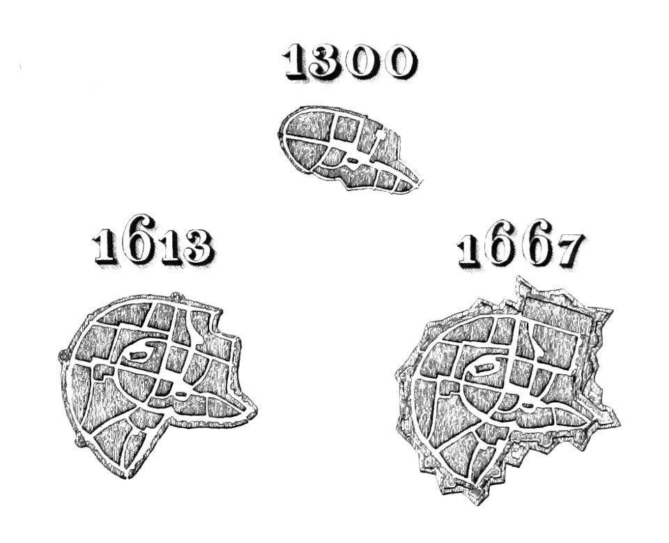
old city maps of munich
munich in the 19th century
old city maps of munich
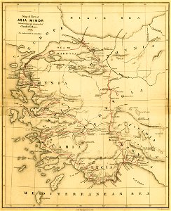
a journal written during an excursion in asia minor
london
self-published work
village
architecture
village
architecture
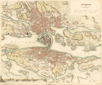
jakobstad
self-published work
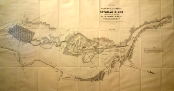
alexandria canal
self-published work
pages with maps
self-published work
pages with maps
self-published work
pages with maps
peter schwingen
peter de weerth
maps of paris from bibliothèque nationale de france
1830s maps of paris
maps from the mechanical curator collection available to georeference
maps from the mechanical curator collection
peter schwingen
peter de weerth
the gazetteer of scotland (1838)
william home lizars
paintings in the musée de la marine de toulon
émile vernet-lecomte
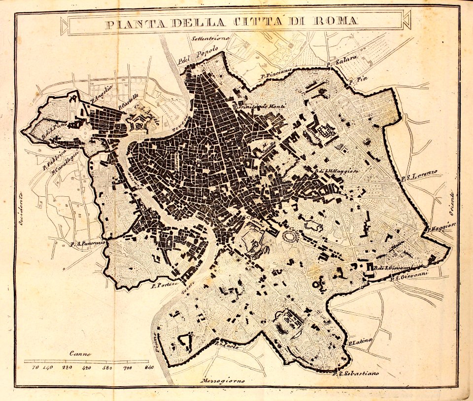
the hand-book for travellers in italy, from london to naples (1838)
old maps of tuscany
the gazetteer of scotland (1838)
edinburgh in art
maps in the library of congress
1838 maps
maps by george w. boynton
1838 maps of boston
great tenpō famine
watanabe kazan
pierre antoine tardieu
françois houiste
1830s maps of jerusalem
romanticism
historical
history
eran laor cartographic collection
romanticism
plan de paris d'ambroise tardieu - 1839
bibliothèque nationale de france
bowen's picture of boston, or the citizens and stranger's guide to the metropolis of massachusetts, and its environs. to which is affixed the annals of boston (1838)
1838 maps of boston
bowen's picture of boston, or the citizens and stranger's guide to the metropolis of massachusetts, and its environs. to which is affixed the annals of boston (1838)
1838 maps of boston
plan de paris d'ambroise tardieu - 1839
bibliothèque nationale de france
admiralty charts region b: england wales ireland english channel southern north sea
admiralty charts 1401-1600
1890s maps of the united kingdom
the birds of devon (1892)
indonesian paintings in the rijksmuseum amsterdam
romanticism
prints by utagawa hiroshige in the metropolitan museum of art
utagawa school,kasei culture,ukiyo-e
travel
book
travel
book
prints by utagawa hiroshige in the metropolitan museum of art
utagawa school,kasei culture,ukiyo-e
bibliothèque nationale de france
félix robaut
historical
history
imperial india; an artist's journals (1879)
pre-raphaelite brotherhood
imperial india; an artist's journals (1879)
pre-raphaelite brotherhood
imperial india; an artist's journals (1879)
pre-raphaelite brotherhood
bibliothèque nationale de france
félix robaut
abraham lincoln - a history (1914)
battle of hampton roads
bibliothèque nationale de france
félix robaut
voyage de l'asie mineure (1838)
old maps of the sinai peninsula
the voyages made by the sieur d. b. to the islands dauphine or madagascar and bourbon or mascarenne in the years 1669, 70, 71 and 72 (1897)
1667 map of madagascar by guillaume sanson
1 - 59 of 59
/ 1


![Map of the Pas-de-Calais department / Lith. by F[éli]x Robaut, Félix Robaut, 1838](https://cdn.creazilla.com/illustrations/10000352906/map-of-the-pas-de-calais-department-lith-by-flix-robaut-flix-robaut-1838-md.jpg)