Log in
All resources
Create a design
Tools
109 Free Images of Topographisch
topographischer atlas der schweiz
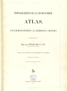
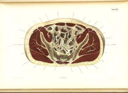
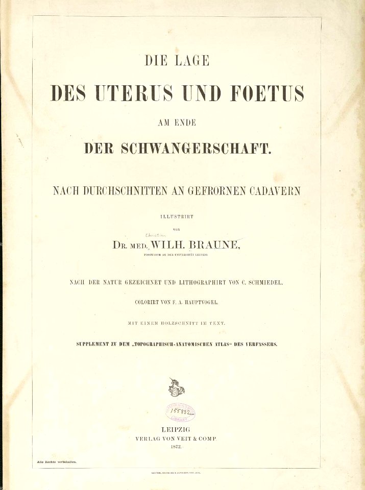
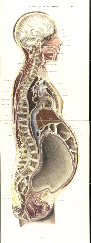
topographisch-anatomischer atlas
bibliothèque nationale de france
topographisch, oeconomisch und militaerische charte von mecklenburg, schwerin und ratzeburg
topographisch, oeconomisch und militaerische charte des herzogthums mecklenburg schwerin and des fürstenthums ratzeburg - schmettau
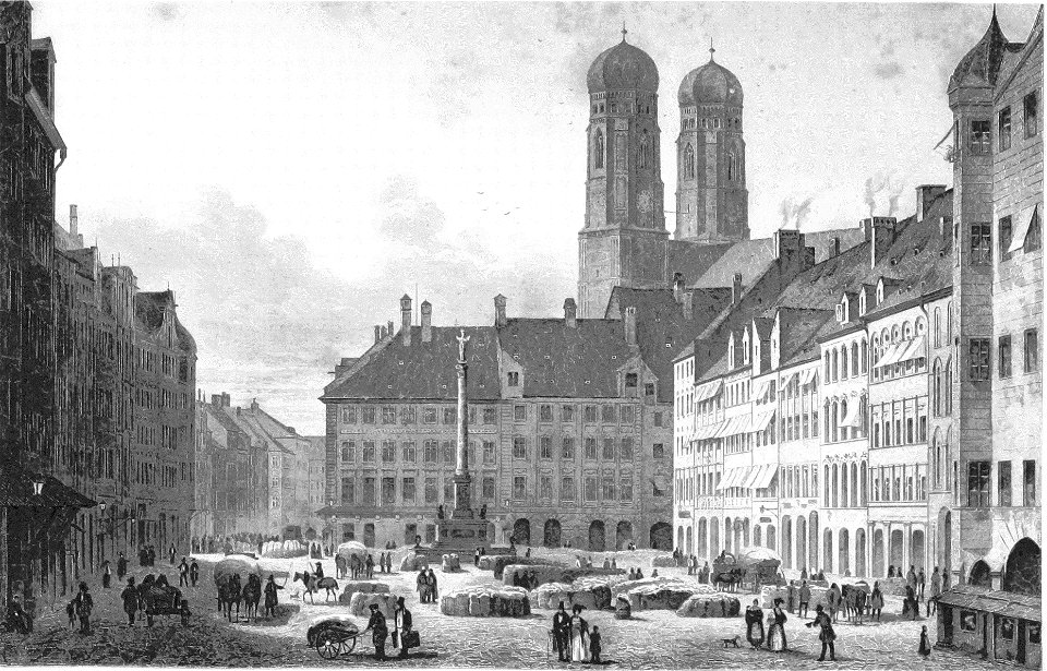
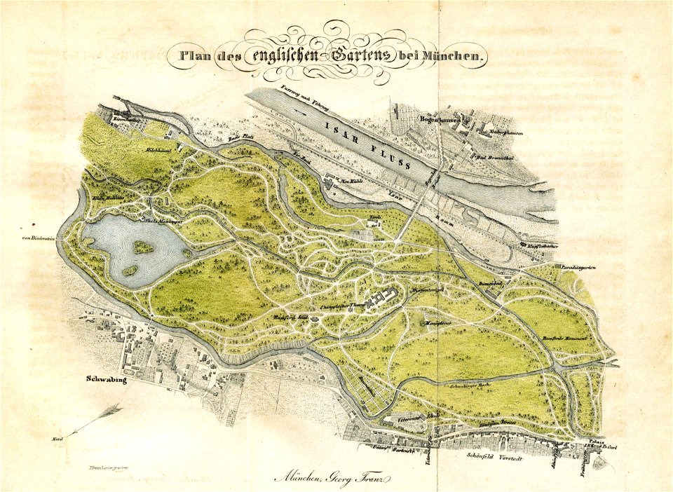
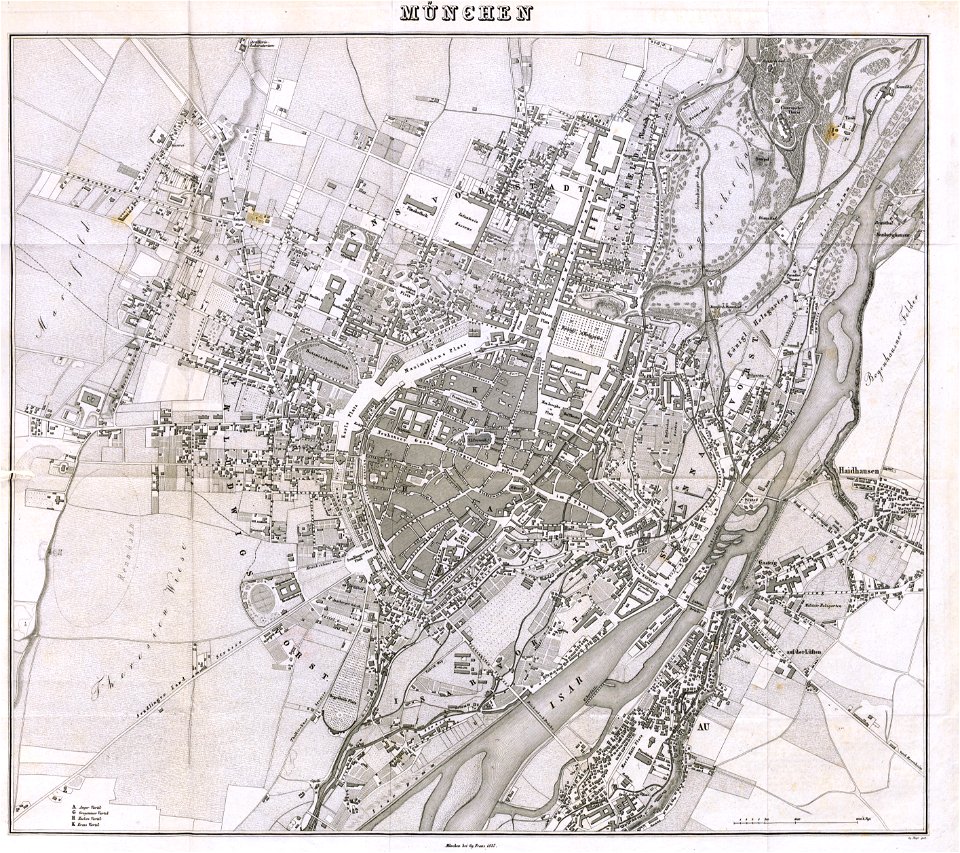
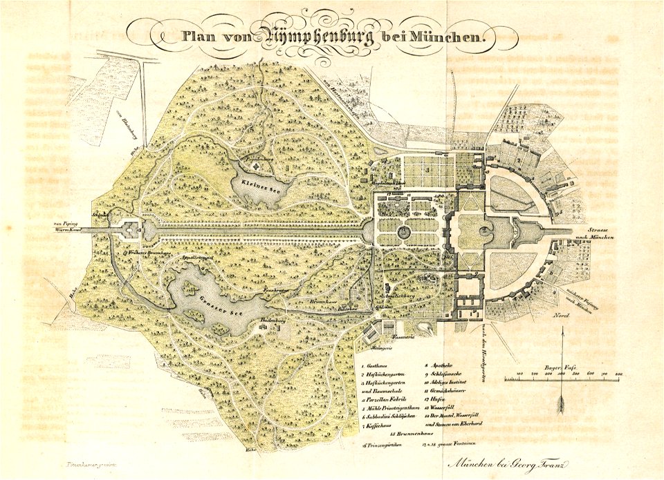
münchen mit seinen umgebungen historisch
statistisch dargestellt (1838) by johann von soeltl
munich in the 19th century
engravings of munich
maps from the mechanical curator collection
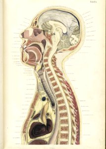
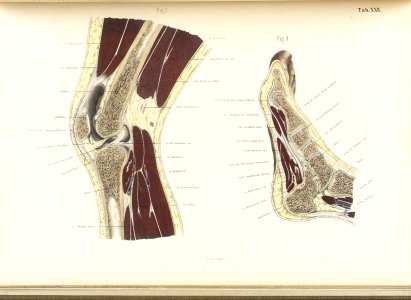
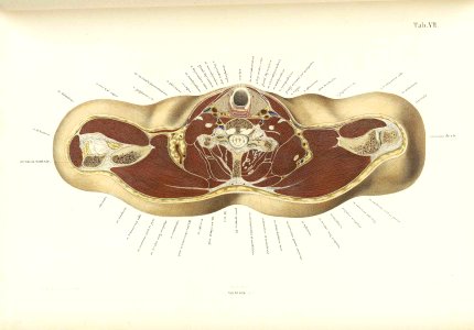
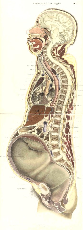
topographisch-anatomischer atlas
topographisch-anatomischer atlas
topographisch-anatomischer atlas
topographisch-anatomischer atlas
topographisch-anatomischer atlas
topographisch-anatomischer atlas
topographisch-anatomischer atlas
self-published work
bad wörishofen
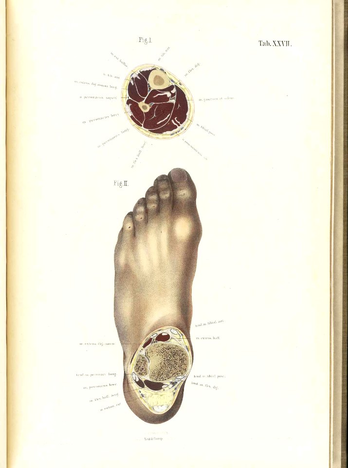
topographisch-anatomischer atlas
topographisch-anatomischer atlas
topographisch-anatomischer atlas
topographisch-anatomischer atlas
topographisch-anatomischer atlas
topographisch-anatomischer atlas
topographisch-anatomischer atlas
topographisch-anatomischer atlas
1877 in switzerland
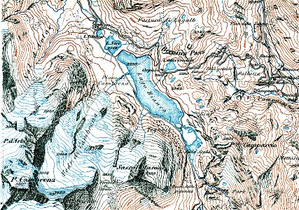
berninapass
topographisch-anatomischer atlas
christian wilhelm braune
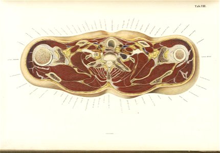
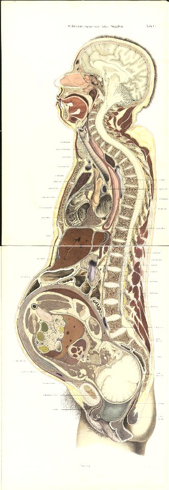
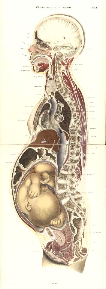
lateral cross-section of pregnant woman's torso
topographisch-anatomischer atlas
lateral cross-section of pregnant woman's torso
topographisch-anatomischer atlas
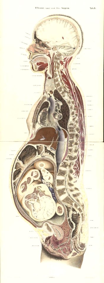
lateral cross-section of pregnant woman's torso
topographisch-anatomischer atlas
lateral cross-section of pregnant woman's torso
topographisch-anatomischer atlas
lateral cross-section of pregnant woman's torso
topographisch-anatomischer atlas
old maps of switzerland
piz varuna
lateral cross-section of pregnant woman's torso
topographisch-anatomischer atlas
topographisch
munich
section schwarzenberg (1843)
oberreit
munich in the 19th century
history of ludwigstraße
section schwarzenberg (1843)
oberreit
munich in the 19th century
history of marienplatz
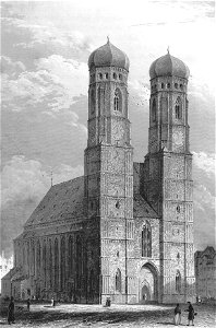
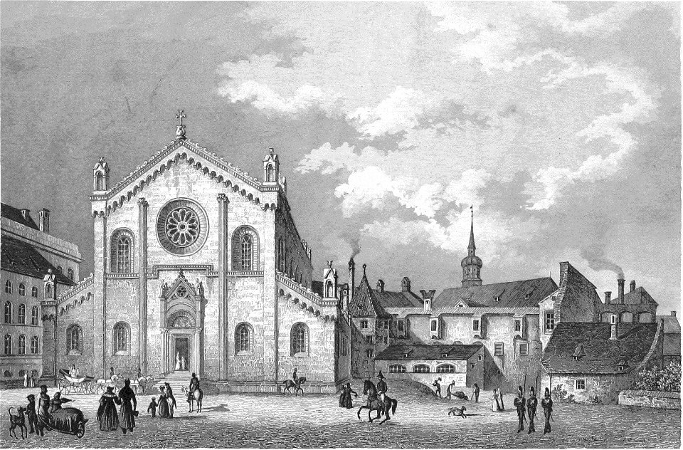
history of the munich frauenkirche
munich in the 19th century
munich in the 19th century
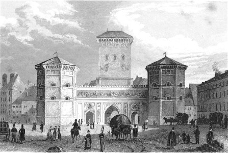
old views of isartor
engravings of munich
topographisch
munich in the 19th century
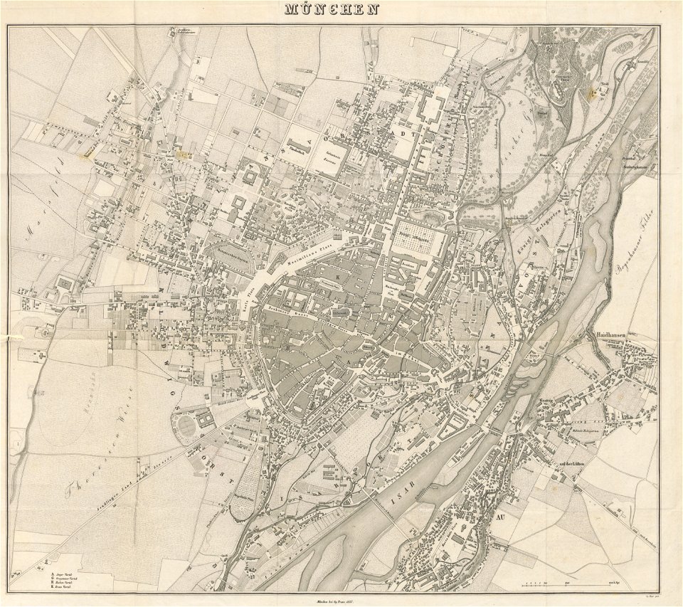
old city maps of munich
munich in the 19th century
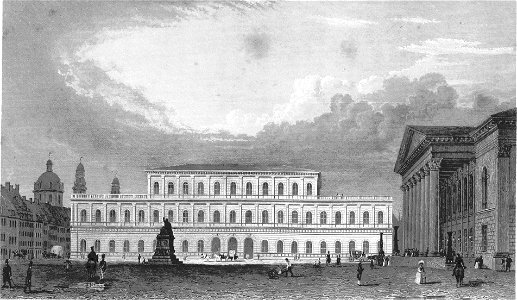
ludwig lange (architect)
views of munich
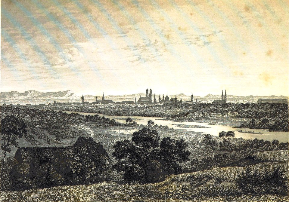
isar in art
munich in the 19th century
old city maps of munich
section schwarzenberg (1843)
oberreit
maps from the mechanical curator collection
munich in the 19th century
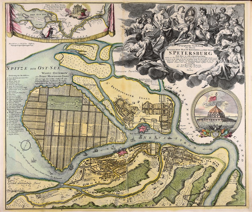
homann map st petersburg ab1720
johann baptist homann
munich in the 19th century
old city maps of munich
maps from the mechanical curator collection
munich in the 19th century
munich in the 19th century
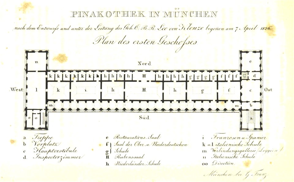
alte pinakothek
topographisch-historische ansicht der belagerung kopenhagens (1807)
1807 book covers
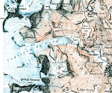
topographischer atlas der schweiz
historical images of brugg
topographischer atlas der schweiz
maps of aletschgletscher
1878 in switzerland
maps of bremgarten
topographischer atlas der schweiz
eiger
old maps of the canton of zürich
türlersee
topographischer atlas der schweiz
maps of lake lugano
topographischer atlas der schweiz
historical images of zofingen
topographischer atlas der schweiz
weiach
hamburg: historisch-topographische und baugeschichtliche mittheilungen
villa kaltehofe
topographischer atlas der schweiz
old maps of zollikon
topographischer atlas der schweiz
old maps of zollikerberg
historical images of rapperswil-jona
topographischer atlas der schweiz
wüstung äppelhausen
schlattingen
topographischer atlas der schweiz
thurauen
hamburgische elbkarte von melchior lorichs
wilhelm hauers
topographischer atlas der schweiz
maps of the canton of valais
topographischer atlas der schweiz
weberei säge schindellegi
topographischer atlas der schweiz
maps of winterthur quarters
topographischer atlas der schweiz
kraftwerk wildegg
baumwollspinnerei im sood
fabrikkanal sihltal
hamburg: historisch-topographische und baugeschichtliche mittheilungen
marmorkapelle (schröderstift)
topographisch, oeconomisch und militaerische charte des herzogthums mecklenburg schwerin and des fürstenthums ratzeburg - schmettau
topographisch, oeconomisch und militaerische charte von mecklenburg, schwerin und ratzeburg
topographisch, oeconomisch und militaerische charte des herzogthums mecklenburg schwerin and des fürstenthums ratzeburg - schmettau
topographisch, oeconomisch und militaerische charte von mecklenburg, schwerin und ratzeburg
topographisch, oeconomisch und militaerische charte des herzogthums mecklenburg schwerin and des fürstenthums ratzeburg - schmettau
topographisch, oeconomisch und militaerische charte von mecklenburg, schwerin und ratzeburg
topographischer atlas der schweiz
history of baden ag
topographischer atlas der schweiz
old maps of zürich
allaman
armary
topographischer atlas der schweiz
palügletscher
montherod
armary
topographisch, oeconomisch und militaerische charte des herzogthums mecklenburg schwerin and des fürstenthums ratzeburg - schmettau
topographisch, oeconomisch und militaerische charte von mecklenburg, schwerin und ratzeburg
topographisch, oeconomisch und militaerische charte des herzogthums mecklenburg schwerin and des fürstenthums ratzeburg - schmettau
topographisch, oeconomisch und militaerische charte von mecklenburg, schwerin und ratzeburg
topographisch, oeconomisch und militaerische charte des herzogthums mecklenburg schwerin and des fürstenthums ratzeburg - schmettau
topographisch, oeconomisch und militaerische charte von mecklenburg, schwerin und ratzeburg
topographisch, oeconomisch und militaerische charte des herzogthums mecklenburg schwerin and des fürstenthums ratzeburg - schmettau
topographisch, oeconomisch und militaerische charte von mecklenburg, schwerin und ratzeburg
topographisch, oeconomisch und militaerische charte des herzogthums mecklenburg schwerin and des fürstenthums ratzeburg - schmettau
topographisch, oeconomisch und militaerische charte von mecklenburg, schwerin und ratzeburg
topographisch, oeconomisch und militaerische charte des herzogthums mecklenburg schwerin and des fürstenthums ratzeburg - schmettau
topographisch, oeconomisch und militaerische charte von mecklenburg, schwerin und ratzeburg
topographisch, oeconomisch und militaerische charte des herzogthums mecklenburg schwerin and des fürstenthums ratzeburg - schmettau
topographisch, oeconomisch und militaerische charte von mecklenburg, schwerin und ratzeburg
topographisch, oeconomisch und militaerische charte des herzogthums mecklenburg schwerin and des fürstenthums ratzeburg - schmettau
topographisch, oeconomisch und militaerische charte von mecklenburg, schwerin und ratzeburg
topographisch, oeconomisch und militaerische charte des herzogthums mecklenburg schwerin and des fürstenthums ratzeburg - schmettau
topographisch, oeconomisch und militaerische charte von mecklenburg, schwerin und ratzeburg
topographische karte der gegenden wiens... - m. ragginger, del... - btv1b530275792
tranquillo mollo
topographisch, oeconomisch und militaerische charte des herzogthums mecklenburg schwerin and des fürstenthums ratzeburg - schmettau
topographisch, oeconomisch und militaerische charte von mecklenburg, schwerin und ratzeburg
topographisch, oeconomisch und militaerische charte des herzogthums mecklenburg schwerin and des fürstenthums ratzeburg - schmettau
topographisch, oeconomisch und militaerische charte von mecklenburg, schwerin und ratzeburg
topographisch, oeconomisch und militaerische charte des herzogthums mecklenburg schwerin and des fürstenthums ratzeburg - schmettau
topographisch, oeconomisch und militaerische charte von mecklenburg, schwerin und ratzeburg
topographisch, oeconomisch und militaerische charte des herzogthums mecklenburg schwerin and des fürstenthums ratzeburg - schmettau
topographisch, oeconomisch und militaerische charte von mecklenburg, schwerin und ratzeburg
tschiervagletscher
roseggletscher
topographischer atlas der schweiz
pfahlbausiedlungen wauwilermoos
topographischer atlas der schweiz
maps wohlen, aargau
topographischer atlas der schweiz
piz medel
topographisch-historische ansicht der belagerung kopenhagens (1807)
maps from the mechanical curator collection
topographischer atlas der schweiz
old maps of fribourg
topographischer atlas der schweiz
rorschach–heiden railway line
old maps of cities in switzerland
maps of biel/bienne
topographischer atlas der schweiz
maps of glaciers of switzerland
topographisch-historische ansicht der belagerung kopenhagens (1807)
maps from the mechanical curator collection
topographischer atlas der schweiz
herisau railway station
topographischer atlas der schweiz
maps of glaciers of switzerland
topographischer atlas der schweiz
maps of morteratsch glacier
1 - 100 of 109
Next page
/ 2