Log in
All resources
Create a design
18 Free Images of 18th Century Maps Of The Caribbean
history
historical
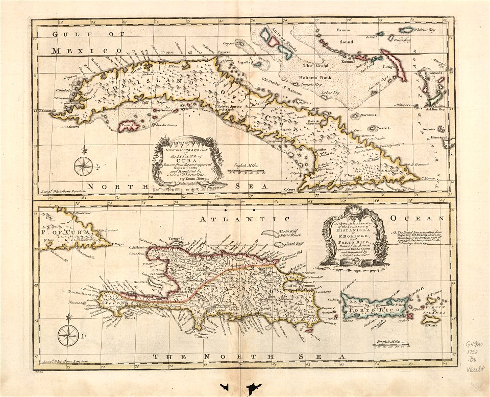
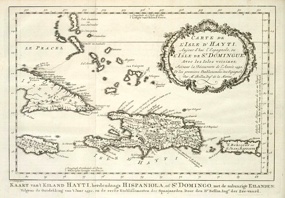
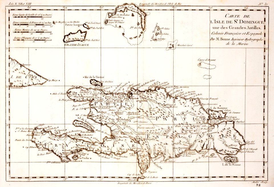
18th-century maps of hispaniola
prints from bonne atlas de toutes les parties at the peace palace library
18th-century maps of puerto rico
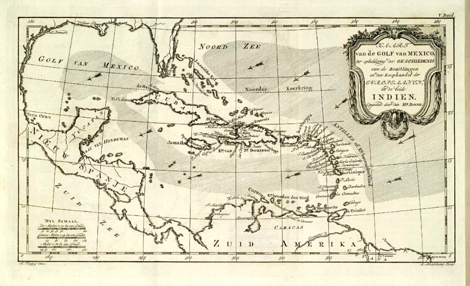
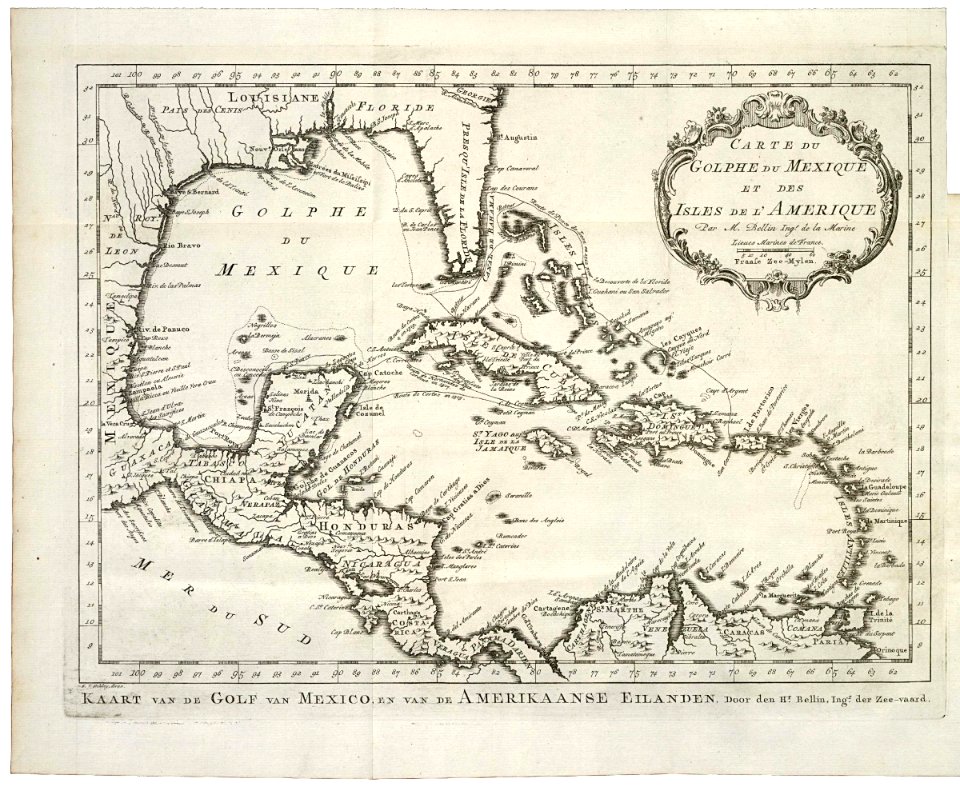
maps of the west-indische compagnie
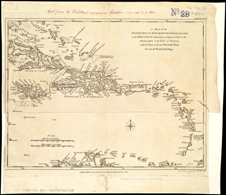
1780s maps of the caribbean
maps in the library of congress
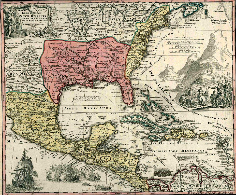
old maps of mexico
1780 in central america
18th-century maps of puerto rico
18th-century maps of cuba
maps of the west-indische compagnie
1777
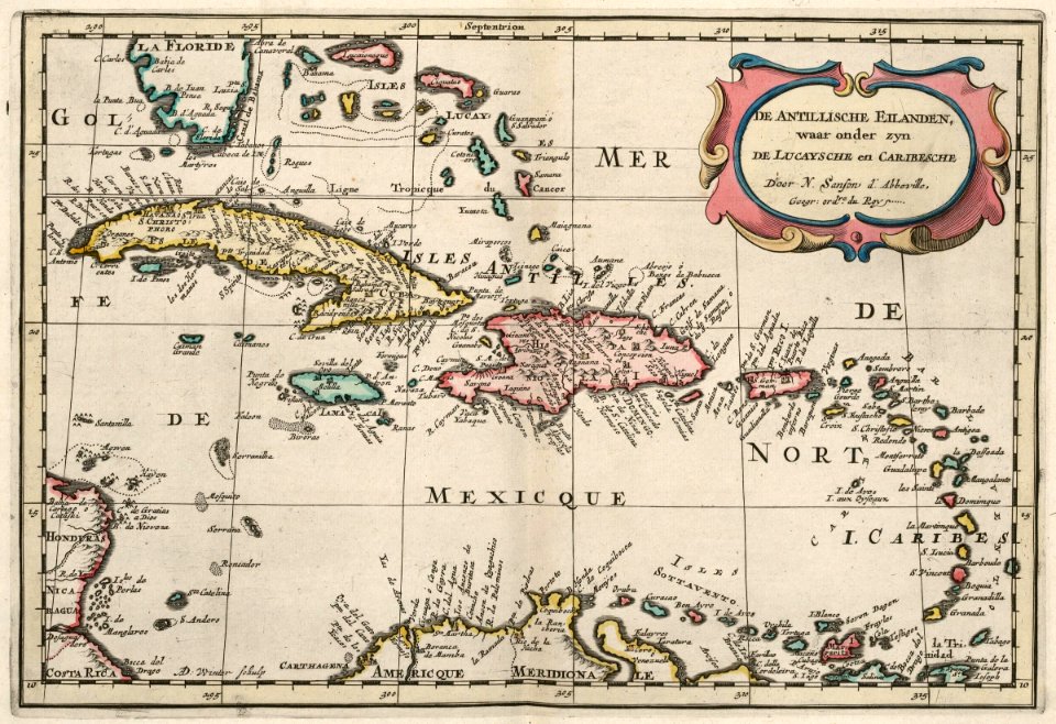
maps by nicolas sanson
1705
18th-century maps of hispaniola
1780s maps of the caribbean
18th-century maps of hispaniola
18th-century maps of cuba
maps by jacques-nicolas bellin
1768
maps by jacques-nicolas bellin
1768
veracruz
florida
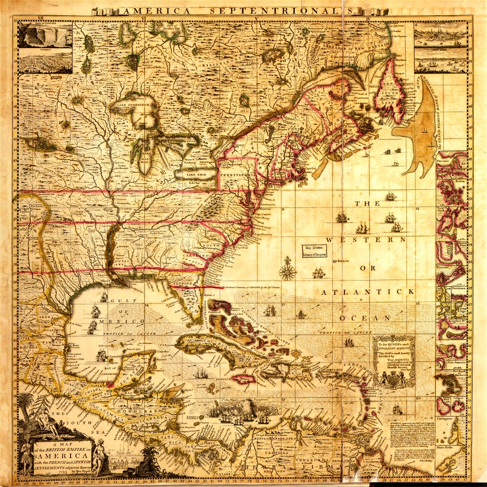
a map of the british empire in america with the french and spanish settlements adjacent thereto
maps in the library of congress
a map of the british empire in america with the french and spanish settlements adjacent thereto
maps in the library of congress
18th-century maps of nicaragua
1780 in central america
18th-century maps of hispaniola
1780 in the caribbean
historical
history
historical
history
historical
history
historical
history
historical
history
historical
history
1 - 18 of 18
/ 1