Log in
All resources
Create a design
Tools
3,563 Free Images of Chart
frederick william beechey
maps by frederick william beechey
william chimmo
richard brydges beechey
18th-century french nautical charts
joseph roux
eran laor cartographic collection
german-language maps
technology
history
admiralty charts region u: north america east coast
admiralty charts 201-400
admiralty charts region c: scotland
admiralty charts 4001-
admiralty charts region c: scotland
admiralty charts 2001-2200
maps by willem and johannes blaeu
dutch-language maps
kantharos harbour (piraeus)
maps of piraeus
18th-century french nautical charts
red and yellow
collections of the bibliothèque de l'école nationale des chartes
prints of bacchus
18th-century french nautical charts
old maps of thessaloniki
admiralty charts region c: scotland
admiralty charts 2801-3000
admiralty charts 2601-2800
tralee
admiralty charts region u: north america east coast
admiralty charts 201-400
postcard production
color charts
uss kearsarge (ship, 1861)
alabama (ship, 1862)
eran laor cartographic collection
tranquillo mollo
technology
business
admiralty charts region b: england wales ireland english channel southern north sea
admiralty charts 1401-1600
postcard production
color charts
woodcuts by albrecht dürer in the national gallery of art
german renaissance
eran laor cartographic collection
tranquillo mollo
admiralty charts 2601-2800
achill head
admiralty charts region b: england wales ireland english channel southern north sea
admiralty charts 1001-1200
technology
business
charts and maps of the royal museums greenwich
1777 maps
admiralty charts region r: usa and mexico west coasts
admiralty charts 1801-2000
postcard production
color charts
admiralty charts region r: usa and mexico west coasts
admiralty charts 401-600
eran laor cartographic collection
tranquillo mollo
admiralty charts region d: eastern north sea baltic norway iceland faroes svalbard
admiralty charts 3001-3400
admiralty charts 2001-2200
westport, county mayo
rhyme? and reason?
valentine's day
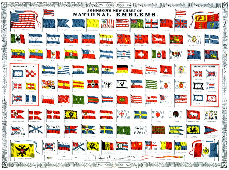
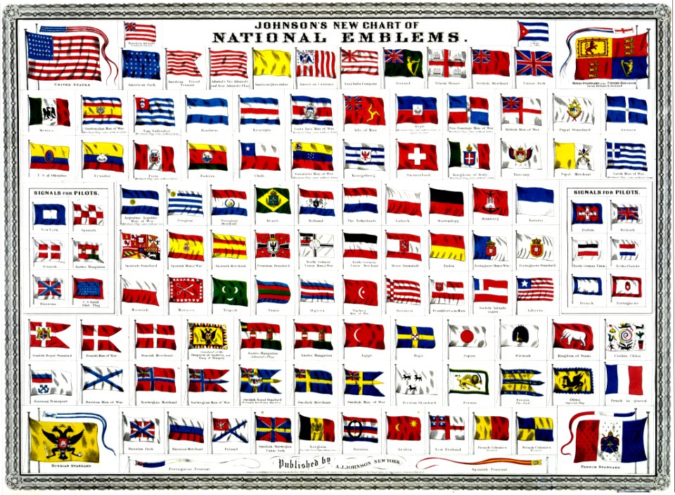
symbol
charts and maps of the royal museums greenwich
1590 maps
18th-century french nautical charts
old maps of lesbos
charts and maps of the royal museums greenwich
1778 maps of new york (state)
rejang alphabet
alphabet charts
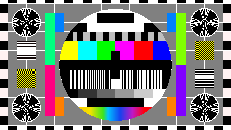
test pattern
color bars
a & c black general atlas of the world
1850s maps of the world
old maps of the tuamotus
old maps of polynesia
icons
symbol
indianapolis
checkflickr
historical
history
admiralty charts 2601-2800
blacksod bay
chicago and the midwest, newberry library
dill pickle club
chicago and the midwest, newberry library
dill pickle club
business
symbol
cartouches by willem and johannes blaeu
dutch-language maps
admiralty charts region t: west indies and central america
admiralty charts 401-600
philip island, norfolk island
views from admiralty charts
views from admiralty charts
richard brydges beechey
mountain height comparison diagrams
andriveau-goujon
admiralty charts 1001-1200
avacha bay
checkflickr
yellow
the northern hemisphere of the celestial globe by albrecht dürer
german renaissance
cetus (constellation) in art
uranometria
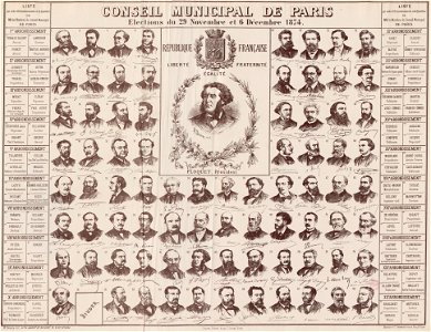
georges clemenceau
1875,
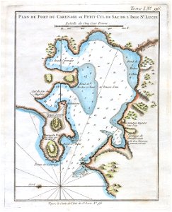
maps by jacques-nicolas bellin
old maps of saint lucia
charts and maps of the royal museums greenwich
1777 maps of new york (state)
woodcuts by albrecht dürer in the national gallery of art
german renaissance
eran laor cartographic collection
willem albert bachiene
historical
history
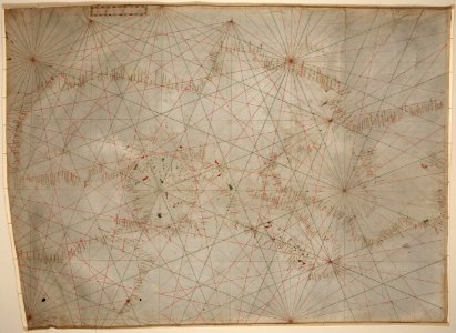
maps of cresques family
abraham cresques
gilbert-gabriel andriveau-goujon
sigismond himely
admiralty charts 1-200
skerries, dublin
views from admiralty charts
richard brydges beechey
eran laor cartographic collection
willem albert bachiene
media contributed by the frick collection
naïve art
admiralty charts 2401-2600
achill head
mapping
human
views from admiralty charts
san francisco bay
decorative arts in the louvre - room 564
academic art,rococo revival
admiralty charts 1801-2000
preston, lancashire
historical
history
16th-century maps of guyana
old maps of french guiana
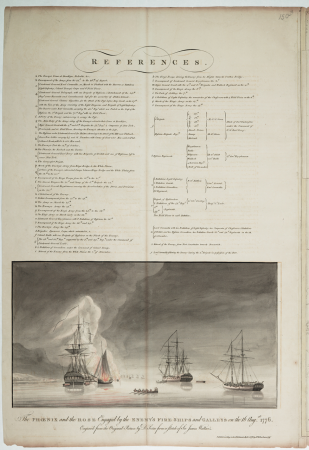
voyages and travels to india, ceylon, the red sea, abyssinia, and egypt, vol. 2
henry cooper (engraver)
admiralty charts 1801-2000
maps of tawi-tawi
18th-century french nautical charts
old maps of lemnos
sturm und drang,weimar classicism,age of enlightenment
johann wolfgang von goethe
maps of cresques family
abraham cresques
architecture
perspective
history
chart
nature
chart
saskatchewan
canada
a voyage to abyssinia, and travels into the interior of that country, executed under the orders of the british government in the years 1809 & 1810
john outhett
maps of the turks and caicos islands
1782 maps of the caribbean
mapping
human
meyer's ornament
cross symbols
meyer's ornament
cross symbols
lawrence h. slaughter collection of english maps, charts, globes, books and atlases
maps of nieuw nederland
bodleian maps collection
1610s maps of the world
maps by william home lizars
1810s maps of the world
maps of the gambier islands
admiralty charts 1001-1200
historical
history
graphics
chart
french presidential election (1974)
romanticism,orientalism
chicago and the midwest, newberry library
dill pickle club
avatar (2009 film)
avengers: endgame
1701 - 1800 of 3,563
Next page
/ 36


![[Edward Wright, Chart of the World ], Edward Wright, 1610](https://cdn.creazilla.com/illustrations/10000975501/edward-wright-chart-of-the-world-edward-wright-1610-md.jpg)