Log in
All resources
Create a design
Tools
3,563 Free Images of Chart
bibliothèque nationale de france
topographisch, oeconomisch und militaerische charte von mecklenburg, schwerin und ratzeburg
topographisch, oeconomisch und militaerische charte des herzogthums mecklenburg schwerin and des fürstenthums ratzeburg - schmettau
history
historical
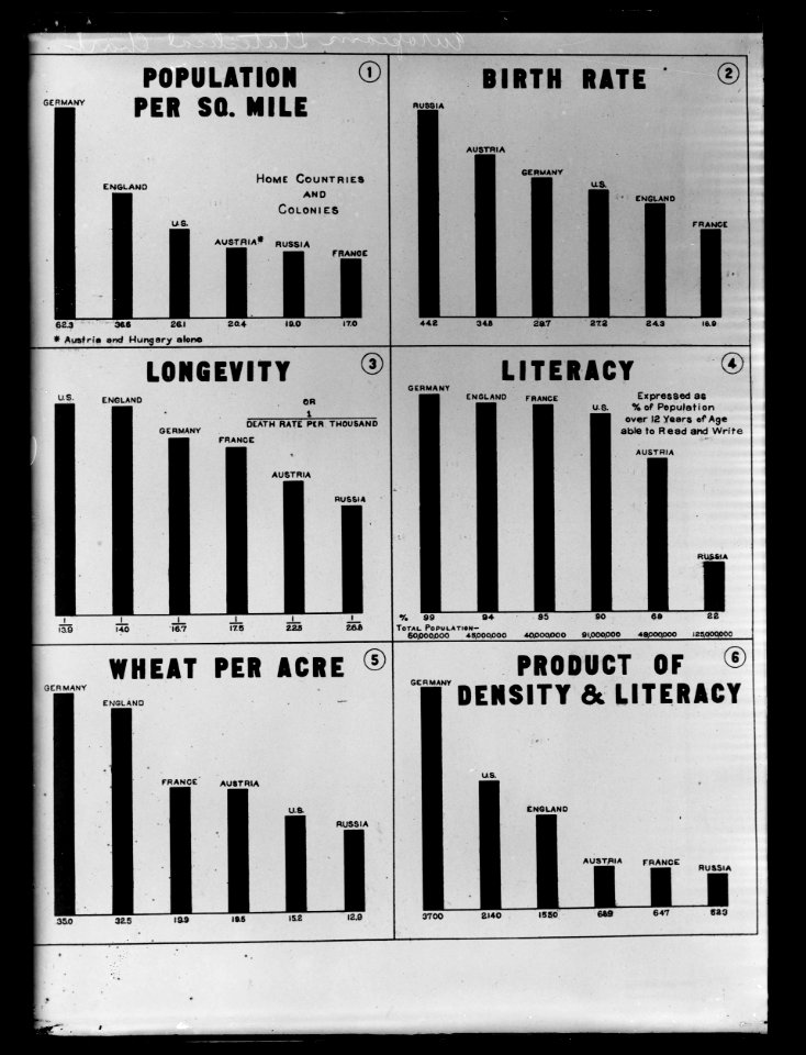
statistics
science
office
graph
business
catalan atlas
catalan atlas
voyages and travels to india, ceylon, the red sea, abyssinia, and egypt, vol. 2
henry cooper (engraver)
illuminated manuscripts in the museo correr
pietro vesconte
latin alphabet charts
german renaissance
historical
history
historical
history
1816 maps
1684 maps
drawings by johan frederik clemens in the statens museum for kunst
brush and gray wash
maps in the library of congress
1758 maps of cuba
maps in the library of congress
1875 maps of california
drawings by johan frederik clemens in the statens museum for kunst
pencil
walter heubach
otto schmeil
catalan atlas
😃 emoji
office
historical
history
gershwin prize 2024
clothing in 2024
maps of the west-indische compagnie
1665
sütterlin latin alphabet charts
handwriting
the fables of æsop (jacobs, heighway)
pedigree charts
catalan atlas, 1959 reproduction
coats of arms on maps
maps in the british museum
1780s maps of france
maps in the british museum
maps of the irish sea
drawings by jens adolf jerichau (painter) in the statens museum for kunst
pencil
science
mammals
topographisch, oeconomisch und militaerische charte des herzogthums mecklenburg schwerin and des fürstenthums ratzeburg - schmettau
topographisch, oeconomisch und militaerische charte von mecklenburg, schwerin und ratzeburg
topographisch, oeconomisch und militaerische charte des herzogthums mecklenburg schwerin and des fürstenthums ratzeburg - schmettau
topographisch, oeconomisch und militaerische charte von mecklenburg, schwerin und ratzeburg
topographisch, oeconomisch und militaerische charte des herzogthums mecklenburg schwerin and des fürstenthums ratzeburg - schmettau
topographisch, oeconomisch und militaerische charte von mecklenburg, schwerin und ratzeburg
topographisch, oeconomisch und militaerische charte des herzogthums mecklenburg schwerin and des fürstenthums ratzeburg - schmettau
topographisch, oeconomisch und militaerische charte von mecklenburg, schwerin und ratzeburg
topographisch, oeconomisch und militaerische charte des herzogthums mecklenburg schwerin and des fürstenthums ratzeburg - schmettau
topographisch, oeconomisch und militaerische charte von mecklenburg, schwerin und ratzeburg
topographisch, oeconomisch und militaerische charte des herzogthums mecklenburg schwerin and des fürstenthums ratzeburg - schmettau
topographisch, oeconomisch und militaerische charte von mecklenburg, schwerin und ratzeburg
de wikisource book leaflet
de nordseeküste (karten)
business
display
antelope
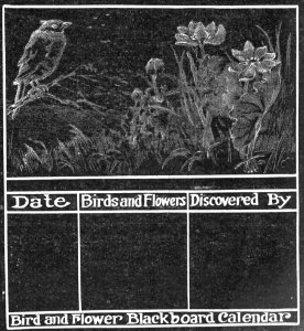
chart
chalkboard style graphics
checkflicr2
science
mammals
science
mammals
drawings by jens adolf jerichau (painter) in the statens museum for kunst
pencil
historical
history
painting
history
historical
history
historical
history
topographisch, oeconomisch und militaerische charte des herzogthums mecklenburg schwerin and des fürstenthums ratzeburg - schmettau
topographisch, oeconomisch und militaerische charte von mecklenburg, schwerin und ratzeburg
topographisch, oeconomisch und militaerische charte des herzogthums mecklenburg schwerin and des fürstenthums ratzeburg - schmettau
topographisch, oeconomisch und militaerische charte von mecklenburg, schwerin und ratzeburg
topographisch, oeconomisch und militaerische charte des herzogthums mecklenburg schwerin and des fürstenthums ratzeburg - schmettau
topographisch, oeconomisch und militaerische charte von mecklenburg, schwerin und ratzeburg
topographisch, oeconomisch und militaerische charte des herzogthums mecklenburg schwerin and des fürstenthums ratzeburg - schmettau
topographisch, oeconomisch und militaerische charte von mecklenburg, schwerin und ratzeburg
topographisch, oeconomisch und militaerische charte des herzogthums mecklenburg schwerin and des fürstenthums ratzeburg - schmettau
topographisch, oeconomisch und militaerische charte von mecklenburg, schwerin und ratzeburg
topographisch, oeconomisch und militaerische charte des herzogthums mecklenburg schwerin and des fürstenthums ratzeburg - schmettau
topographisch, oeconomisch und militaerische charte von mecklenburg, schwerin und ratzeburg
topographisch, oeconomisch und militaerische charte des herzogthums mecklenburg schwerin and des fürstenthums ratzeburg - schmettau
topographisch, oeconomisch und militaerische charte von mecklenburg, schwerin und ratzeburg
topographisch, oeconomisch und militaerische charte des herzogthums mecklenburg schwerin and des fürstenthums ratzeburg - schmettau
topographisch, oeconomisch und militaerische charte von mecklenburg, schwerin und ratzeburg
topographisch, oeconomisch und militaerische charte des herzogthums mecklenburg schwerin and des fürstenthums ratzeburg - schmettau
topographisch, oeconomisch und militaerische charte von mecklenburg, schwerin und ratzeburg
topographisch, oeconomisch und militaerische charte des herzogthums mecklenburg schwerin and des fürstenthums ratzeburg - schmettau
topographisch, oeconomisch und militaerische charte von mecklenburg, schwerin und ratzeburg
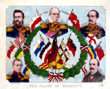
flag charts of romania
flags of moldavia
business
present
woodcuts by albrecht dürer, 1489-1500
german renaissance
science
symbol
science
symbol
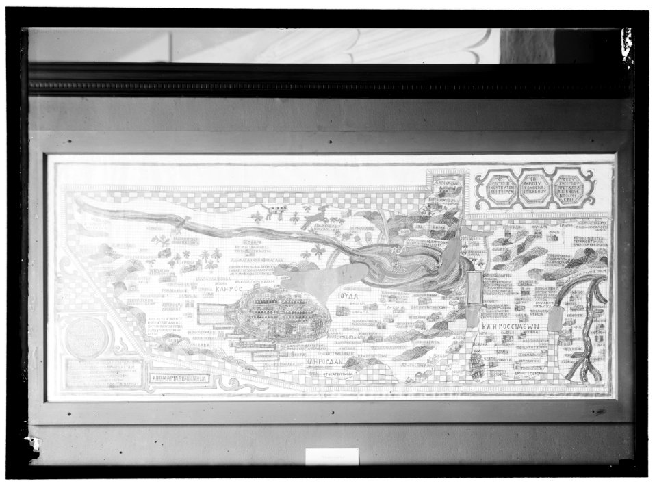
cape verde in the 17th century
cidade velha
historical
history
maps in the library of congress
1770s maps showing history
science
mammals
library of congress - misc
checkflicr2
old maps of zeeland
old maps of holland
naval flags of the batavian republic
flag charts of the netherlands
medical
hawaii
lawrence h. slaughter collection of english maps, charts, globes, books and atlases
1640s maps of the americas
cartouches by willem and johannes blaeu
maps of the republic of venice
17th-century maps of istria
icons
symbol
cresques abraham
catalan atlas
😃 emoji
money
portolan charts by willem and johannes blaeu
old maps of holland
library of congress - misc
checkflicr2
cartouches by willem and johannes blaeu
pieter goos
lawrence h. slaughter collection of english maps, charts, globes, books and atlases
pre-raphaelite brotherhood
indiana jones and the temple of the forbidden eye
dinosaur (disney's animal kingdom)
lawrence h. slaughter collection of english maps, charts, globes, books and atlases
de nieuwe en onbekende weereld
chromolithographs at boston public library of flags and arms
louis prang & company
17th-century maps of the mediterranean sea
1610 maps of europe
historical
history
library of congress - misc
checkflicr2
😃 emoji
office
library of congress - misc
checkflicr2
desktop
screen
board
chart
united states
beer
lucas janszoon waghenaer
1610s maps of norway
astronomicum caesareum
lunar eclipse charts
maps of circumnavigations of the world
1740s maps of the world
1740s maps of the united kingdom
maps in the british museum
historical
history
historical
history
historical
history
historical
history
historical
history
lawrence h. slaughter collection of english maps, charts, globes, books and atlases
nypl lionel pincus and princess firyal map division
people
flag
drawings in the cooper–hewitt, smithsonian design museum
rococo
a map of the provinces of new york and new jersey, with a part of pennsylvania and the province of quebec
lawrence h. slaughter collection of english maps, charts, globes, books and atlases
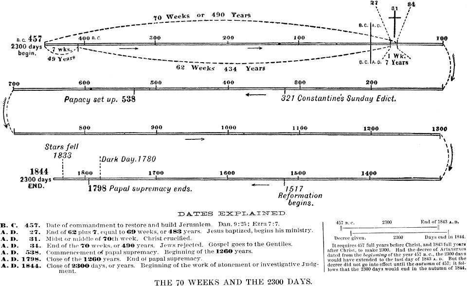
great controversy 1888
checkflicr2
1901 - 2000 of 3,563
Next page
/ 36