Log in
All resources
Create a design
Tools
16,724 Free Images of Language
bibliothèque nationale de france
marco boschini
maps of the islands of greece by marco boschini (1658)
context files from gallica
english language
alphabet
history
historical
hands
hand sign
ribbon
blue
ribbon
blue
ornament
wine
symbol
finger
ornament
heart
ornament
heart
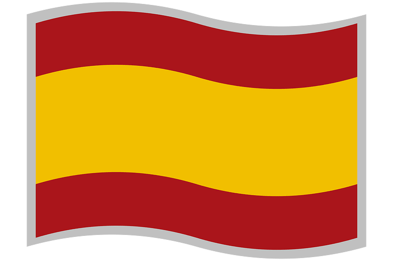
spain
flag
john williams (missionary)
1837 books
illustrations by warwick goble
indian myth and legend (1913)
elephant riding in art of india
illustrations by warwick goble
teaching illustrations for language learning
black and white icons
the history and antiquities of london, westminster, southwark and parts adjacent
english-language books about london
a rapid french course for students in evening classes, private students, and others (1917)
a rapid french course for students in evening classes, private students, and others (1917)
a rapid french course for students in evening classes, private students, and others (1917)
spanish-language maps
1785 maps
a rapid french course for students in evening classes, private students, and others (1917)
henry william bunbury
the gout (gillray)
1840s maps showing history
maps by thomas starling
high renaissance
pirro ligorio
17th-century maps of scotland
maps of islay
maps of neuss by braun & hogenberg
maps of bonn by braun & hogenberg
maps by willem and johannes blaeu
1640s maps of ukraine
cartouche (cartography)
nicholas tindal
maps of mombasa by braun & hogenberg
maps of cefala by braun & hogenberg
magni ducatus lithuaniae
maps facing west
victor levasseur - maps of france
old maps of meurthe (department)
1800 maps of the atlantic ocean
1800s maps of the americas
maps of ancient italy by philipp clüver
maps of ancient sicily
17th-century maps of the british isles
maps by abraham ortelius
1770 illustrations
1770 books
electronics
technology
finger
devil
skeleton
symbol
symbol
finger
typography
music
victory
hands
ornament
heart
hands
peace
ornament
wine
old maps of asturias
1777 maps of spain
maps by nicolas sanson
red ruthenia
maps from gallica
guides joanne
map of the upper rhenian circle by sanson
1700s maps of north rhine-westphalia
old maps of asturias
1777 maps of spain
1780s maps of tunisia
1780s maps of libya
maps of los palacios by braun & hogenberg
maps of las cabezas by braun & hogenberg
maps of spain by tomas lopez
1769 maps of spain
😃 emoji
face
drawings (print room), leiden university library
jan gerard smits
(lettre autographe signée d'andré saglio, dit drésa, à jacques rouché, 21 mars 1919) (manuscrit autographe) - btv1b53150676w
andré saglio
maps of the islands of greece by marco boschini (1658)
old maps of the peloponnese
context files from gallica
history of icaria
old maps of norway
guillaume sanson
17th-century maps of the strait of magellan
1668 maps of south america
map of the upper rhenian circle by sanson
1670s maps of hesse
francesco nicolini
old maps of ikaria
maps of spain by tomas lopez
1768 maps of spain
1698 map of evesché de meaux
robert cordier (engraver)
maps by guillaume sanson
old maps of friesland
old maps of the balearic islands
maps of spain by tomas lopez
portraits of men
academic art
eran laor cartographic collection
willem albert bachiene
drawings (print room), leiden university library
ars aemula naturae, leiden university library
antoine-françois tardieu
pierre antoine tardieu
18th-century maps of the sea of marmara
18th-century maps of the dardanelles
old maps of antiparos
old maps of paros
maps by willem and johannes blaeu
1663 maps of africa
maps of the islands of greece by marco boschini (1658)
history of anafi
old maps of seville
baroque
maps of meldorf by braun & hogenberg
maps of heide by braun & hogenberg
maps of the islands of greece by marco boschini (1658)
history of milos
chorographia britanniae (1741-1742)
18th-century maps of wiltshire
maps of the islands of greece by marco boschini (1658)
history of nisyros
magni ducatus lithuaniae
radziwiłł (surname)
maps of the islands of greece by marco boschini (1658)
history of paros
context files from gallica
history of rügen
maps of the islands of greece by marco boschini (1658)
history of tilos
limousin (province) in the 17th century
context files from gallica
maps of the islands of greece by marco boschini (1658)
history of naxos
maps indicating exploration
royal geographical society
historical
history
historical
history
historical
history
historical
history
historical
history
historical
history
historical
history
maps by alexis-hubert jaillot
old maps of the tyrol
baroque,dutch golden age painting
1907 books
partie méridionale des estats de savoye ou sont le duché de savoye - par le sr sanson d'abbeville - btv1b530430656
guillaume sanson
le comté de zélande dressé sur les memoires les pl. nouveaux - par le sr sanson... - btv1b53213970d
guillaume sanson
carte de la moldavie pour servir à l'histoire militaire de la guerre entre les russes et les turcs - levés par l'etat-major sous la direction de f.g. de bawz... echelle de 10 heures de moldavie, 50... - btv1b53100577d
leonard schenk jansz.
sanson maps of the circles of germany
bibliothèque nationale de france
carte de l'alsace by sanson (1703)
bibliothèque nationale de france
alsace-lorraine. carte départementale. moselle, meurthe, bas-rhin, haut-rhin - btv1b85935488
bibliothèque nationale de france
sanson map of the german empire (17th century)
sanson maps of the circles of germany
carte de la moldavie pour servir à l'histoire militaire de la guerre entre les russes et les turcs - levés par l'etat-major sous la direction de f.g. de bawz... echelle de 10 heures de moldavie, 50... - btv1b53100577d
leonard schenk jansz.
maps of ports and fortresses of the mediterranean by marco boschini (1651)
bibliothèque nationale de france
13501 - 13600 of 16,724
Next page
/ 168


![Novesium vulgo Neus [...]; Verona, nunc Bonna [...]; Brula, vulgari idiomate Broell ante bellum; Sontina, Zunss Oppidum ad Rheni ripas [...], 1635](https://cdn.creazilla.com/illustrations/10000945882/novesium-vulgo-neus-verona-nunc-bonna-brula-vulgari-idiomate-broell-ante-bellum-sontina-zunss-oppidum-ad-rheni-ripas-1635-md.jpg)


![Siciliae antiquae descriptio. 15; Corsicae antiquae descriptio. 16; Sardiniae antiquae descriptio / auctore Phil[ippo] Cluverio; Henry le Roy fecit, 1624](https://cdn.creazilla.com/illustrations/10001349357/siciliae-antiquae-descriptio-15-corsicae-antiquae-descriptio-16-sardiniae-antiquae-descriptio-auctore-phil-ippo-cluverio-henry-le-roy-fecit-1624-sm.jpg)


![Aethiopia inferior, vel exterior, partes magis septentrionales, quae hic desiderantur, vide in tabula Aethiopiae superioris / [Joan Blaeu], 1663](https://cdn.creazilla.com/illustrations/10000599277/aethiopia-inferior-vel-exterior-partes-magis-septentrionales-quae-hic-desiderantur-vide-in-tabula-aethiopiae-superioris-joan-blaeu-1663-sm.jpg)