Log in
All resources
Create a design
Tools
357,549 Free Images of Map
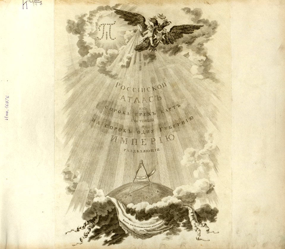
atlas of the russian empire (1800)
volume 9 of le tour du monde
volume 7 of le tour du monde
geographical illustrations by coronelli
old maps of governorates of the russian empire
lepsius-projekt - maps
volume 2 of le tour du monde
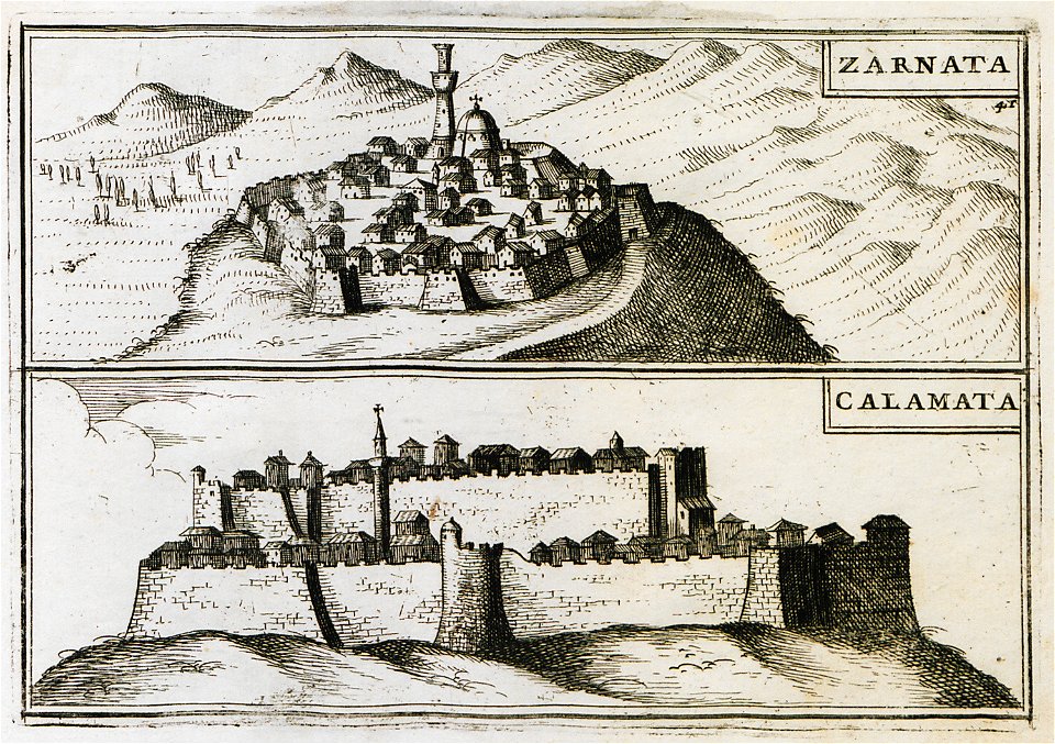
old maps of the peloponnese
braun & hogenberg
1787
science
maps
svg logos of wikiprojects
path text svg
clouds
maps
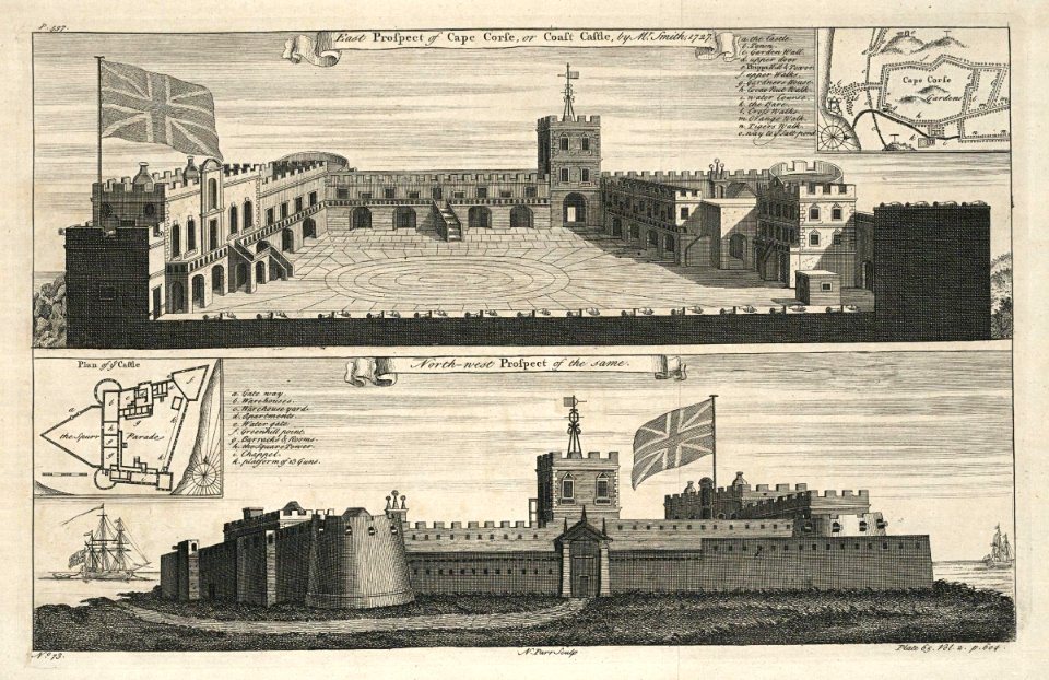
collection of the yorkshire museum
william smith (geologist)
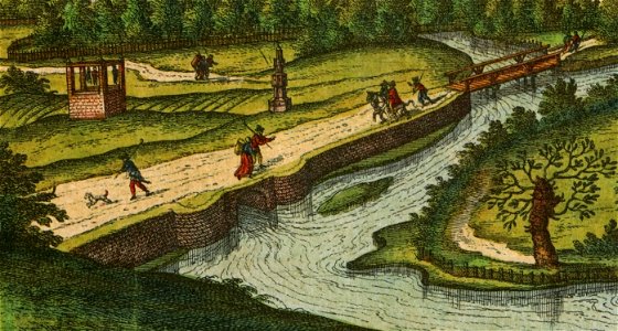
river transport in the polish-lithuanian commonwealth
engravings by matthäus merian
volume 9 of le tour du monde
1860s maps of africa
description de l'universe
maps of nineveh
description de l'universe
maps of nineveh
port of jijel
maps of jijel
maps and topographical views by joris hoefnagel
historical images of brno
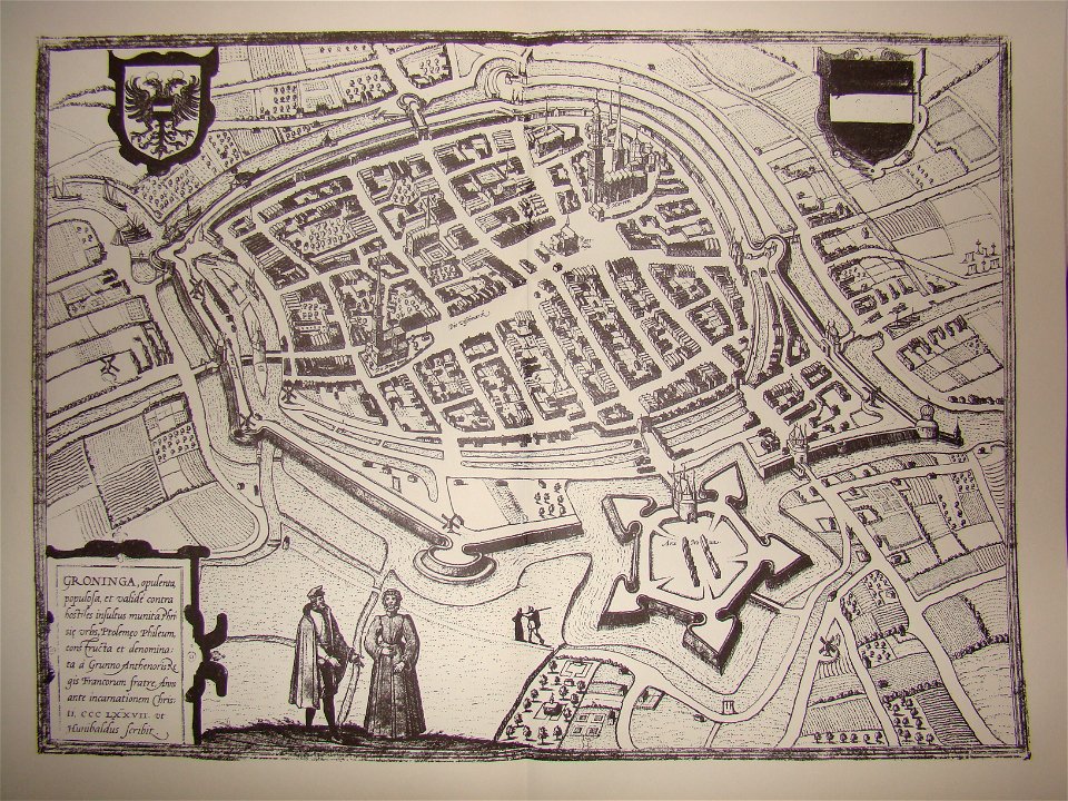
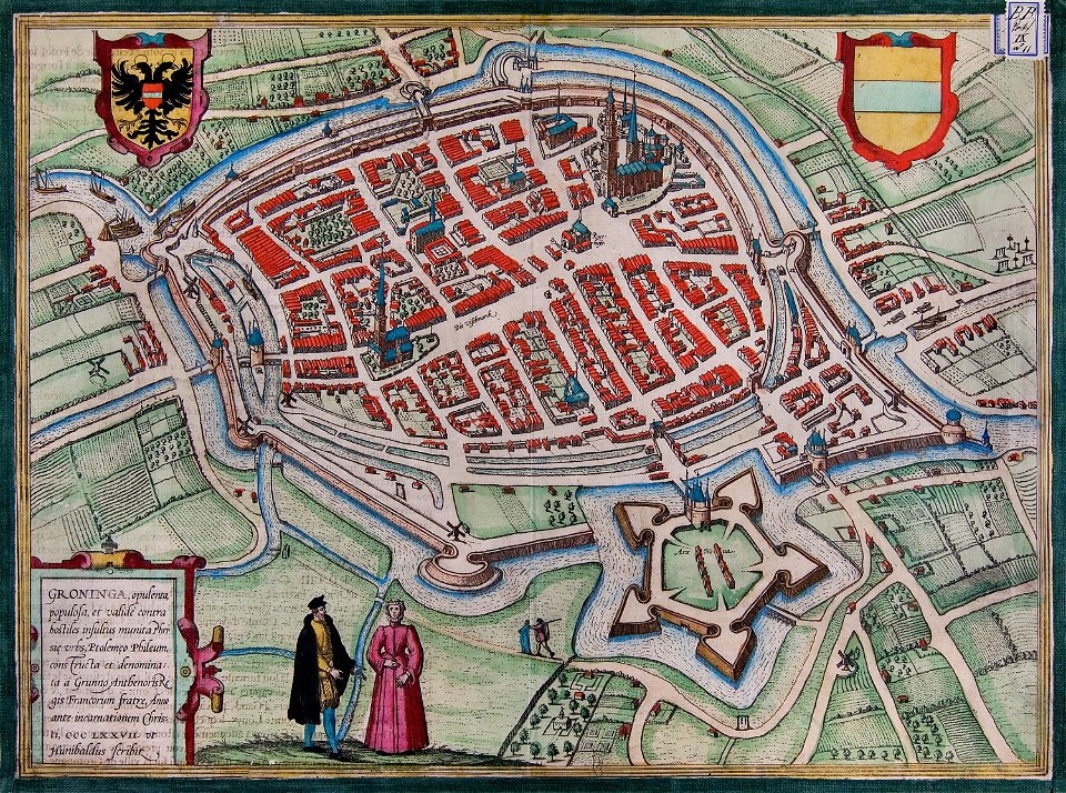
coats of arms of groningen (city)
braun & hogenberg
17th-century woodcuts
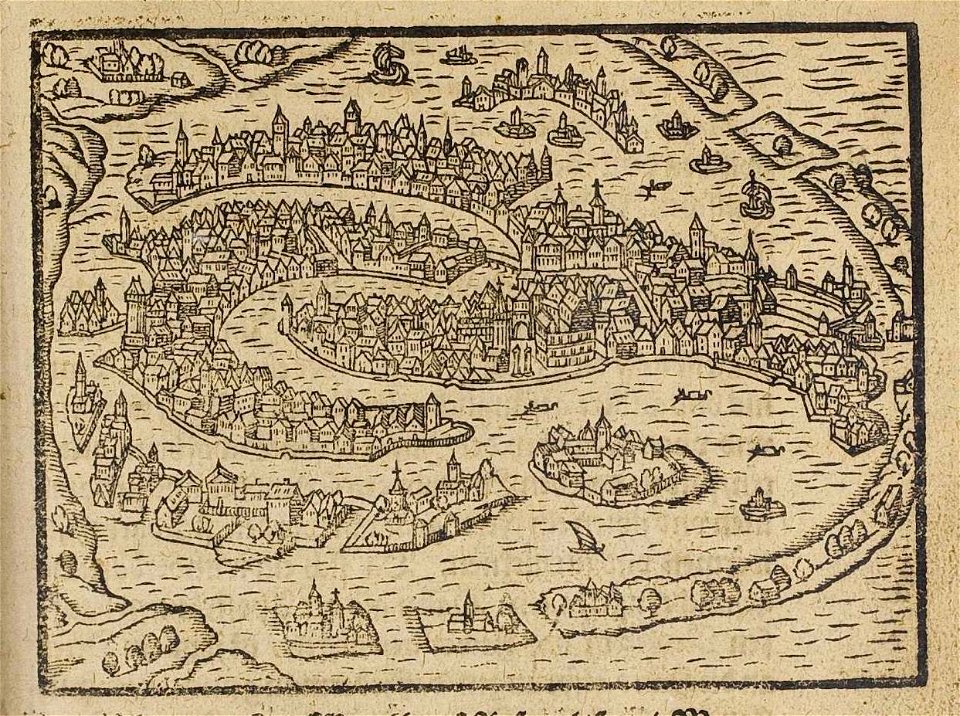
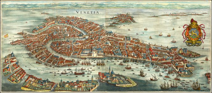
old maps of venice
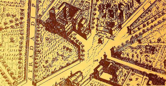
map of rome by giovanni battista falda (1676)
villa palombara (rome)
printing
1869
volume 7 of le tour du monde
old maps of mauritius
travels in sicily greece and albania
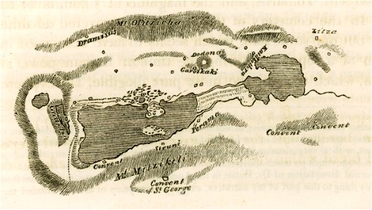
lake pamvotis
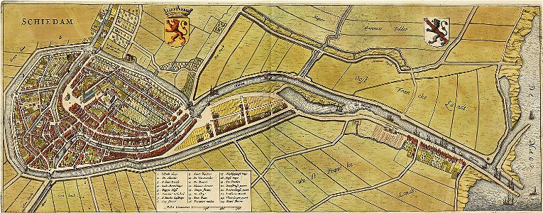
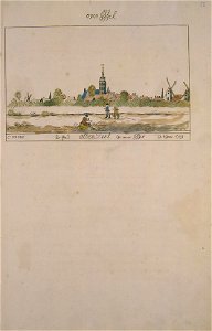
old maps of schiedam
atlas de wit 1698
engravings of topographia saxoniae inferioris
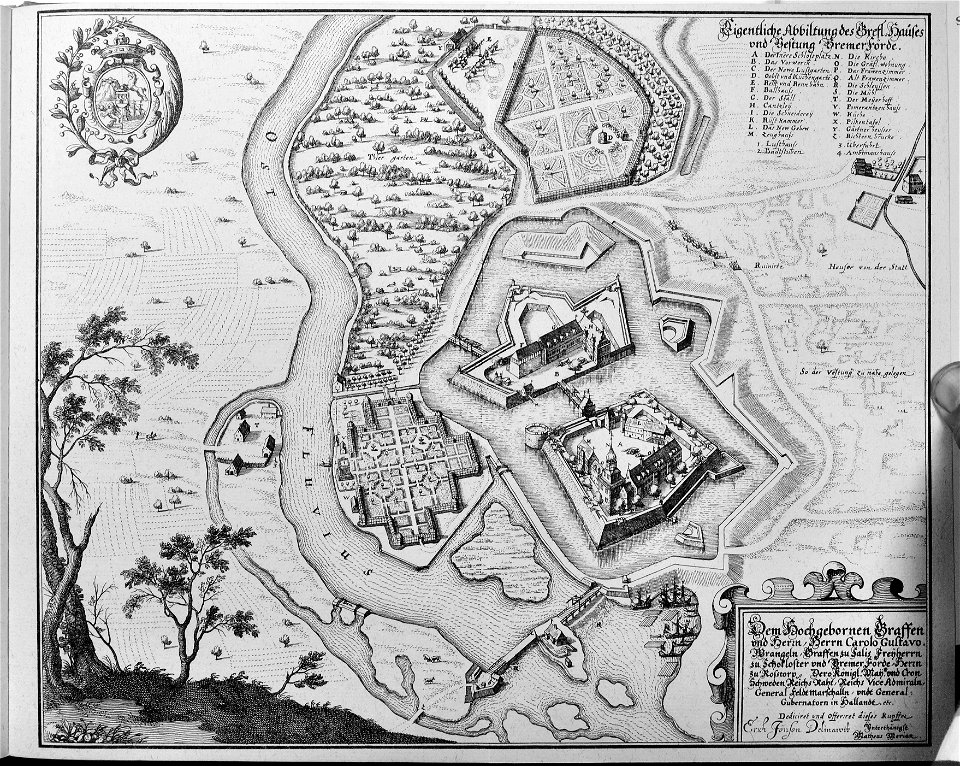
maps of bremervörde
paintings in the museum het prinsenhof
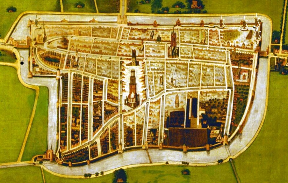
old maps of delft
maps of groningen (city) by braun & hogenberg
great frisian war
popular science monthly illustrations/volume 32
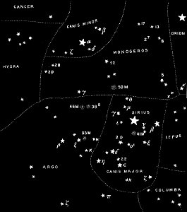
astronomical maps
popular science monthly illustrations/volume 16
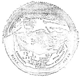
ancient greek maps of the world
drawings in the museu antônio parreiras
illustrations from 'robinson crusoe' by walter paget
people with maps in art
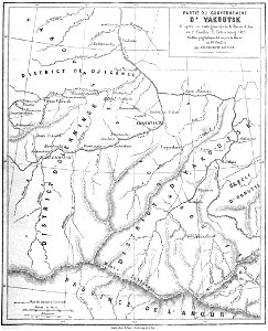
atlas of the russian empire (1800)
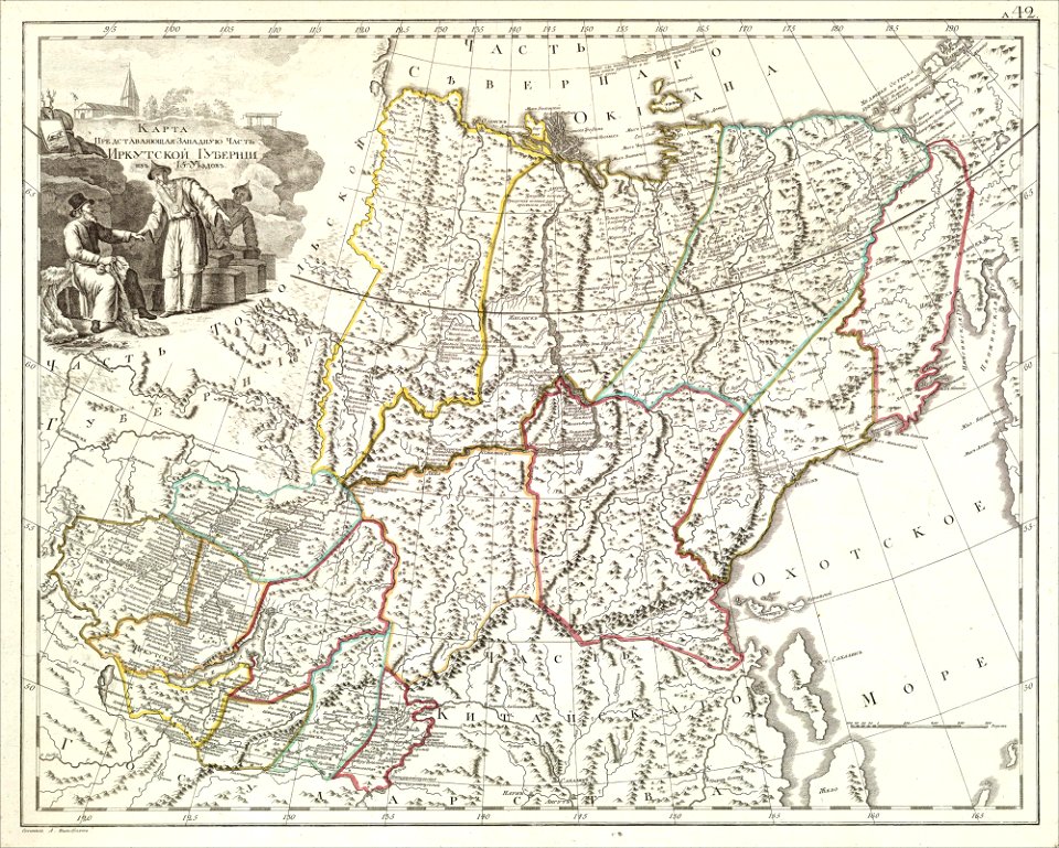
old maps of irkutsk governorate
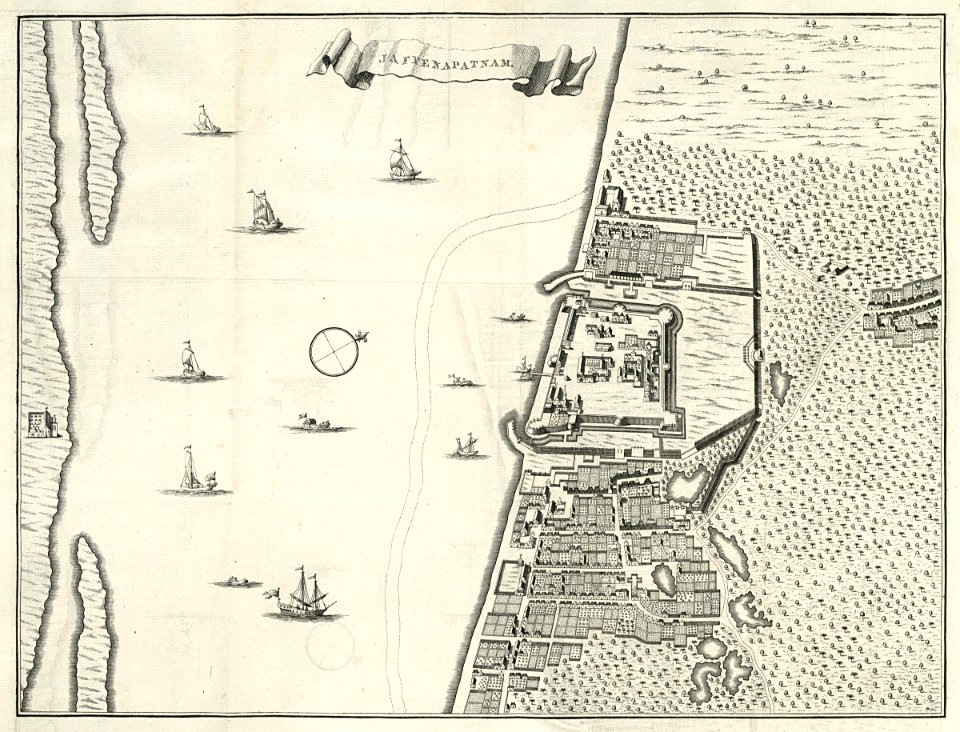
maps of the dutch east india company - sri lanka
1787
old maps of venice
matthäus merian
maps of the dutch east india company - sri lanka
1787
old maps of islands of the aegean sea
bartolommeo dalli sonetti
old maps of islands of the aegean sea
bartolommeo dalli sonetti
old maps of islands of the aegean sea
bartolommeo dalli sonetti
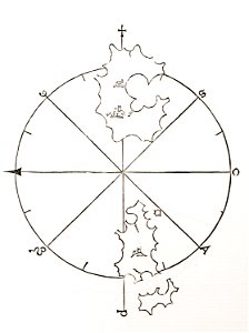
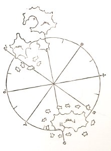
atlas schoemaker-overijssel
atlas schoemaker
old maps of governorates of the russian empire
atlas of the russian empire (1800)
old maps of governorates of the russian empire
atlas of the russian empire (1800)
atlas schoemaker-overijssel
atlas schoemaker
maps and topographical views by joris hoefnagel
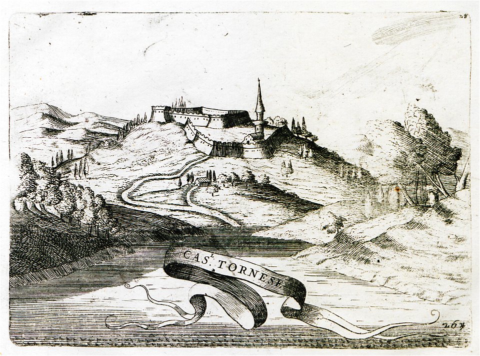
historical images of castle of eger
geographical atlas for the 5-6 grades of secondary school (1941)
old maps of the nazi germany
rhaetiae et valesiae
merian helvetiae
map of ferrara by andrea bolzoni
viale cavour (ferrara)
pennsylvania
duquesne
collections of hauptstaatsarchiv stuttgart
1584 maps
description des principales villes (1690)
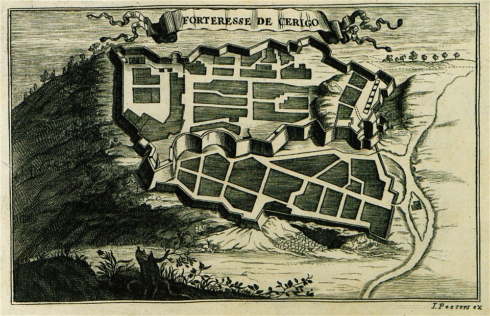
engravings of kythira
lepsius-projekt - temples
lepsius-projekt - maps
il devotissimo viaggio di gerusalemme fatto
giovanni camocio
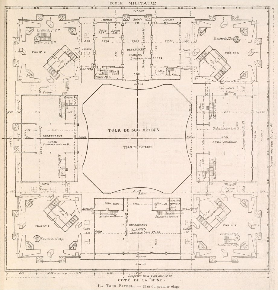
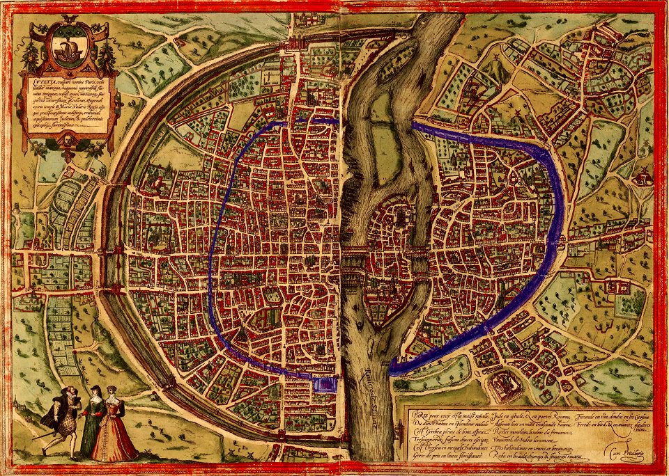
floor plans of paris
engravings of paris
volume 1 of le tour du monde
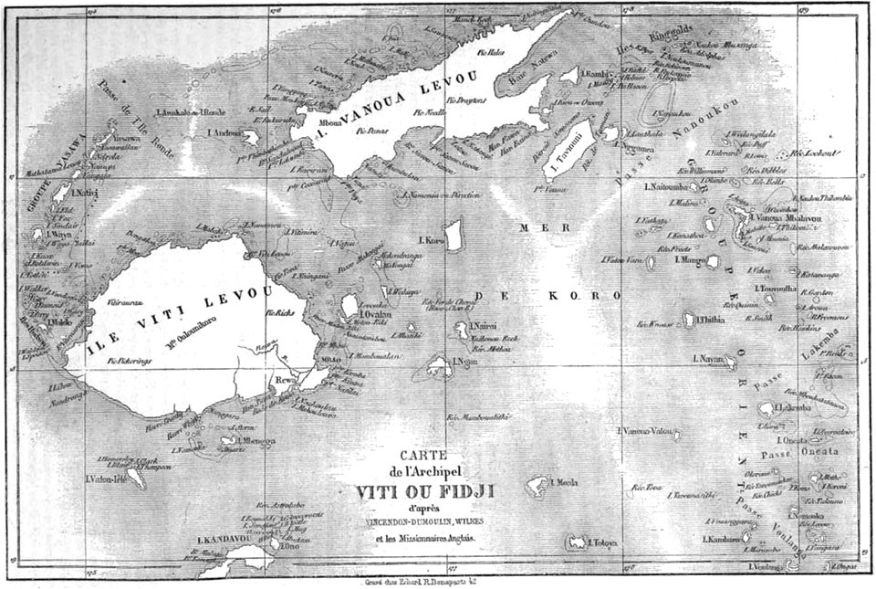
old maps of fiji
volume 4 of le tour du monde
old maps of vietnam
volume 2 of le tour du monde
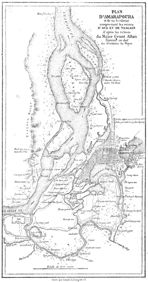
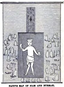
old maps of myanmar
volume 2 of le tour du monde
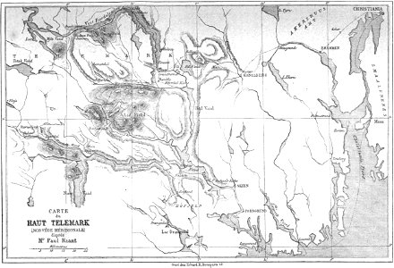
old maps of telemark
volume 5 of le tour du monde
old maps of indonesia
volume 7 of le tour du monde
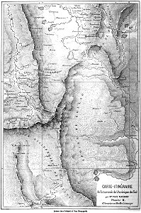
1863 maps of egypt
volume 7 of le tour du monde
old maps of dahomey
volume 7 of le tour du monde
old maps of newfoundland
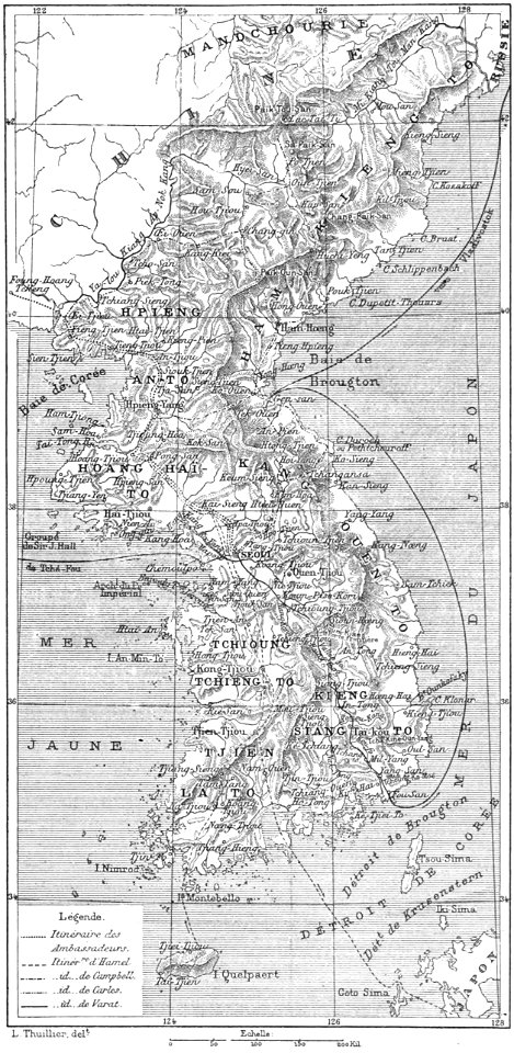
volume 63 of le tour du monde
old maps of korea
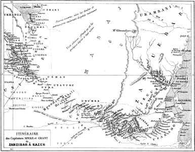
volume 9 of le tour du monde
1860s maps of africa
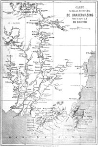
volume 9 of le tour du monde
old maps of beijing
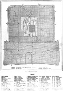
volume 9 of le tour du monde
1862 maps of turkey
bibliothèque municipale de reims
rès. g 153
geographical illustrations by coronelli
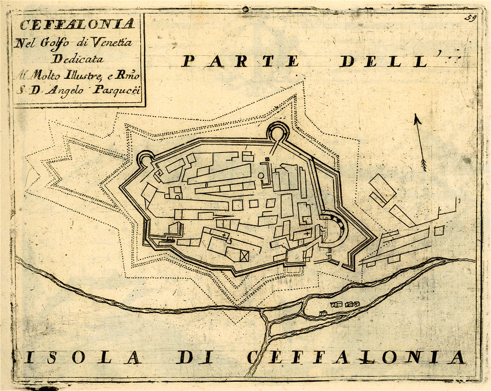
historical maps of kefalonia
pennsylvania
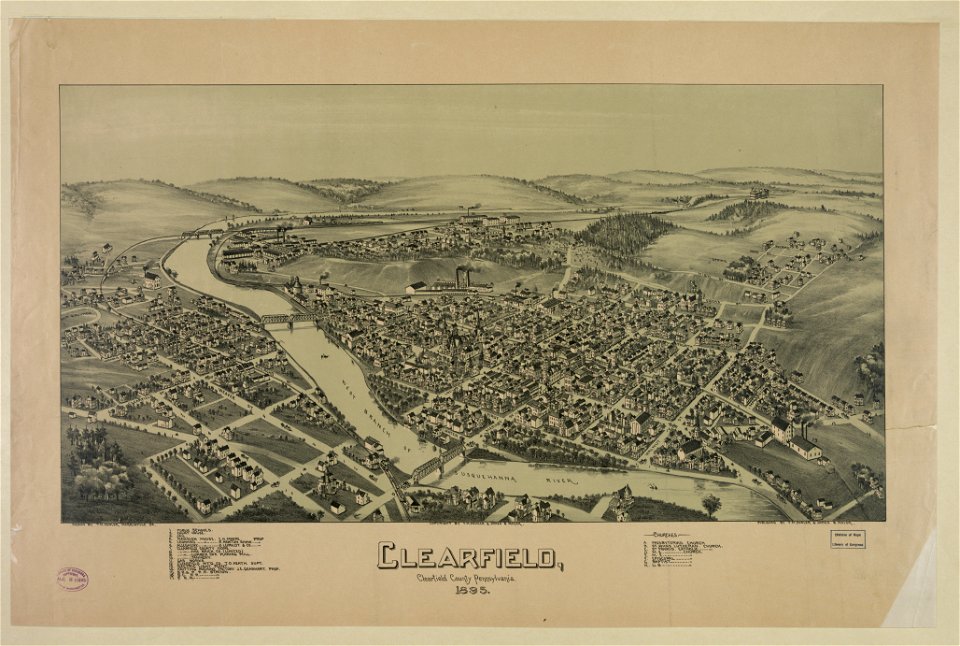
clearfield
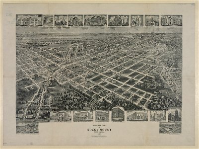
bird's eye view maps of north carolina
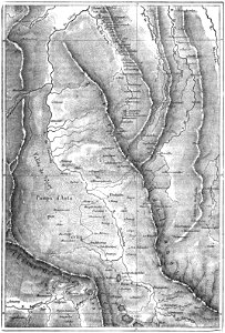
myanmar in art
wesleyan
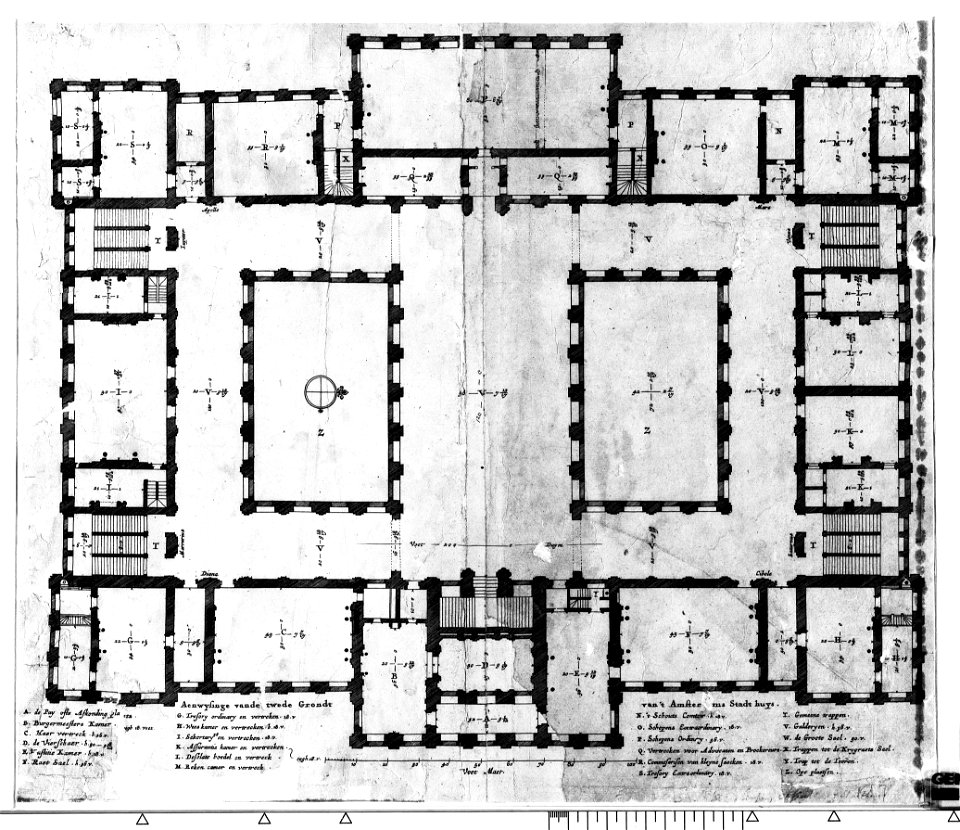
construction drawings in the stadsarchief amsterdam
the conspiracy of claudius civilis
construction
bridge
compass
travel
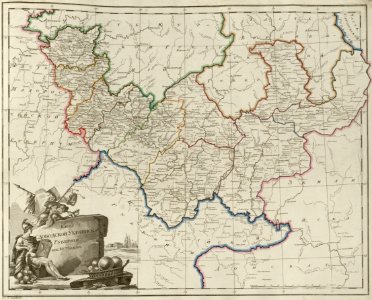
old maps of governorates of the russian empire
atlas of the russian empire (1800)
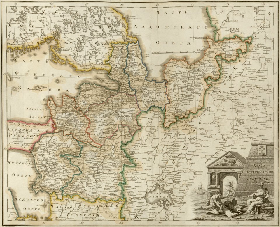
maps of saint petersburg governorate
atlas of the russian empire (1800)
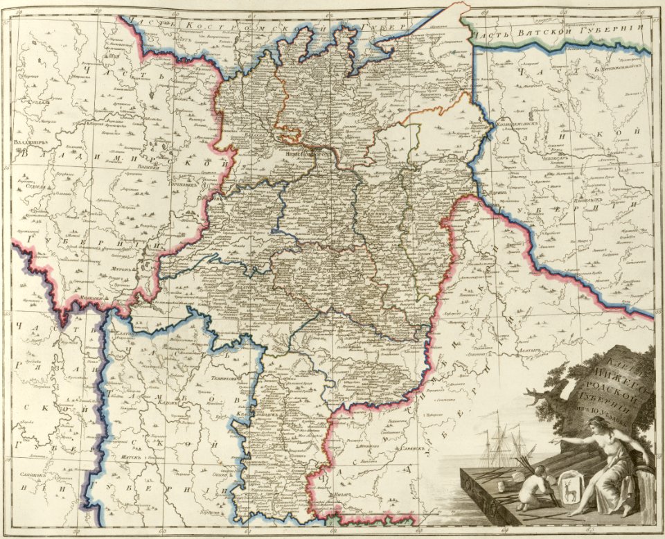
maps of nizhny novgorod governorate
atlas of the russian empire (1800)
old maps of governorates of the russian empire
atlas of the russian empire (1800)
old maps of deventer
atlas schoemaker
maps of the west-indische compagnie
1745
geographical illustrations by coronelli
old maps of the peloponnese
files from the bodleian libraries
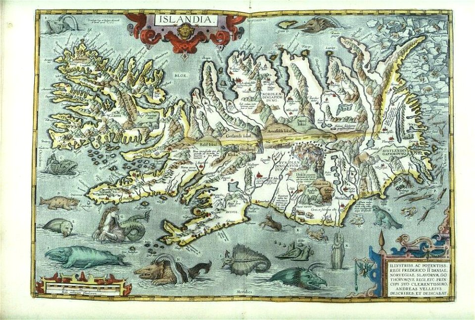
old maps of iceland
collection de la bibliothèque municipale de reims
old maps of aube
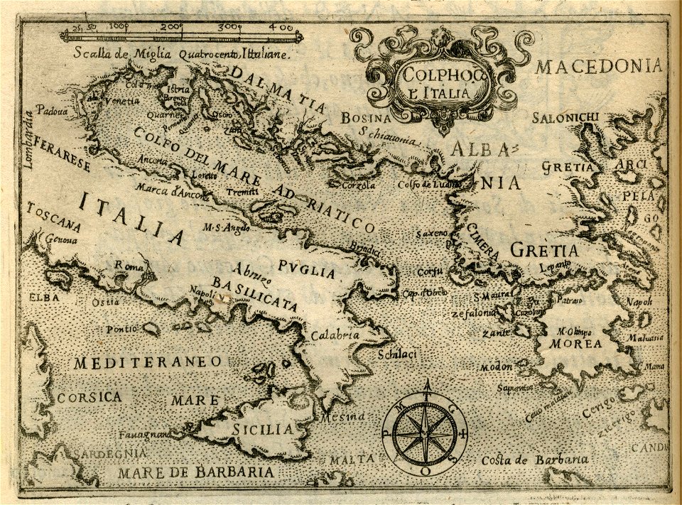
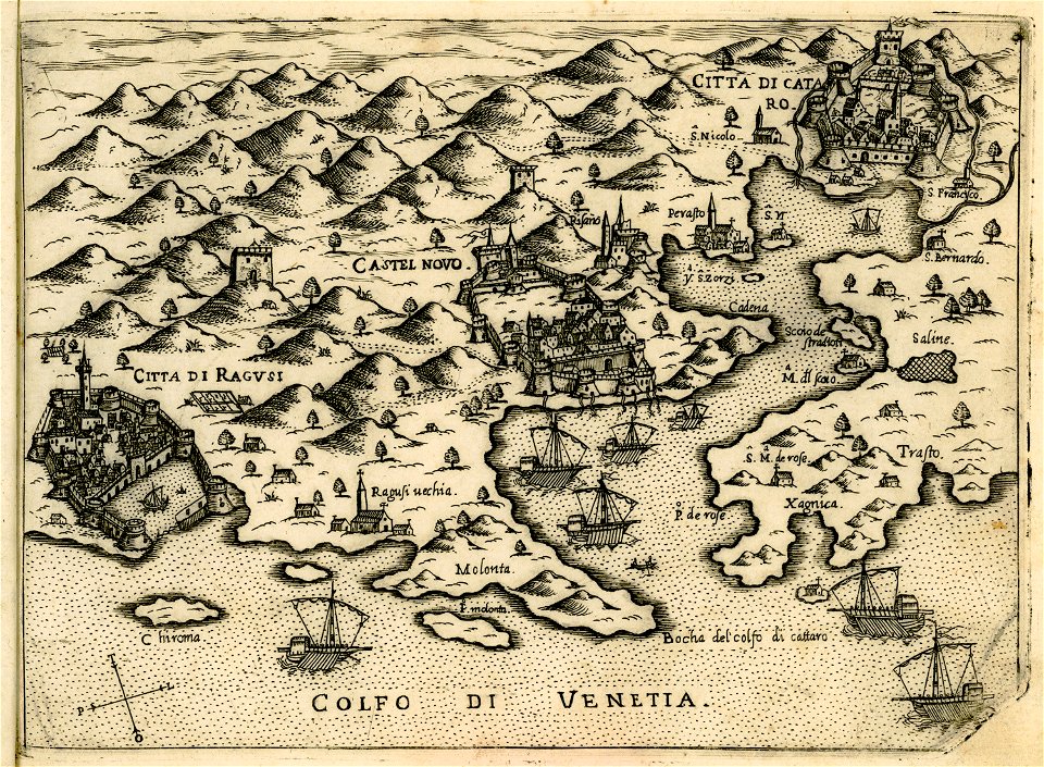
maps of dalmatia
1552
geographical illustrations by coronelli
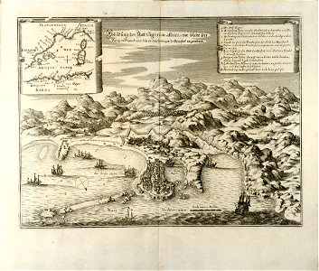
old maps of the peloponnese
coats of arms of markgröningen
old maps of markgröningen
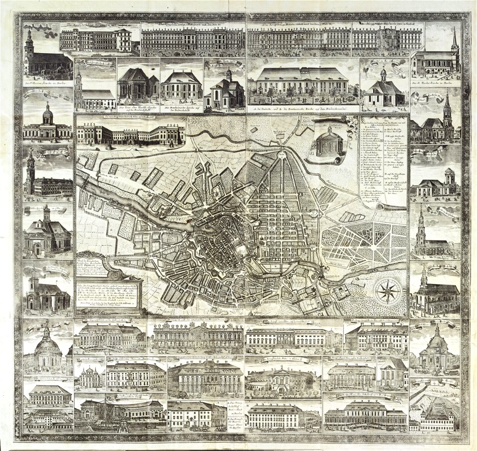
18th-century maps of berlin
johann david schleuen
old maps of constantinople
braun & hogenberg
geographical illustrations by coronelli
old maps of the peloponnese
charts and maps of the royal museums greenwich
old maps of istanbul
nicolas de fer
geographical illustrations by coronelli
old maps of the peloponnese
volume 9 of le tour du monde
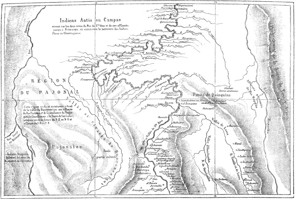
old maps of peru
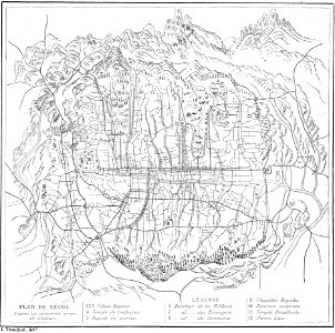
volume 63 of le tour du monde
old maps of seoul
volume 2 of le tour du monde
old maps of russia
volume 2 of le tour du monde
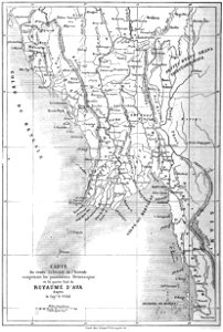
old maps of myanmar
volume 7 of le tour du monde
old maps of peru
volume 6 of le tour du monde
old maps of peru
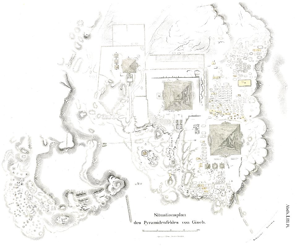
lepsius-projekt - pyramids
plans of giza necropolis
lepsius-projekt - temples
lepsius-projekt - maps
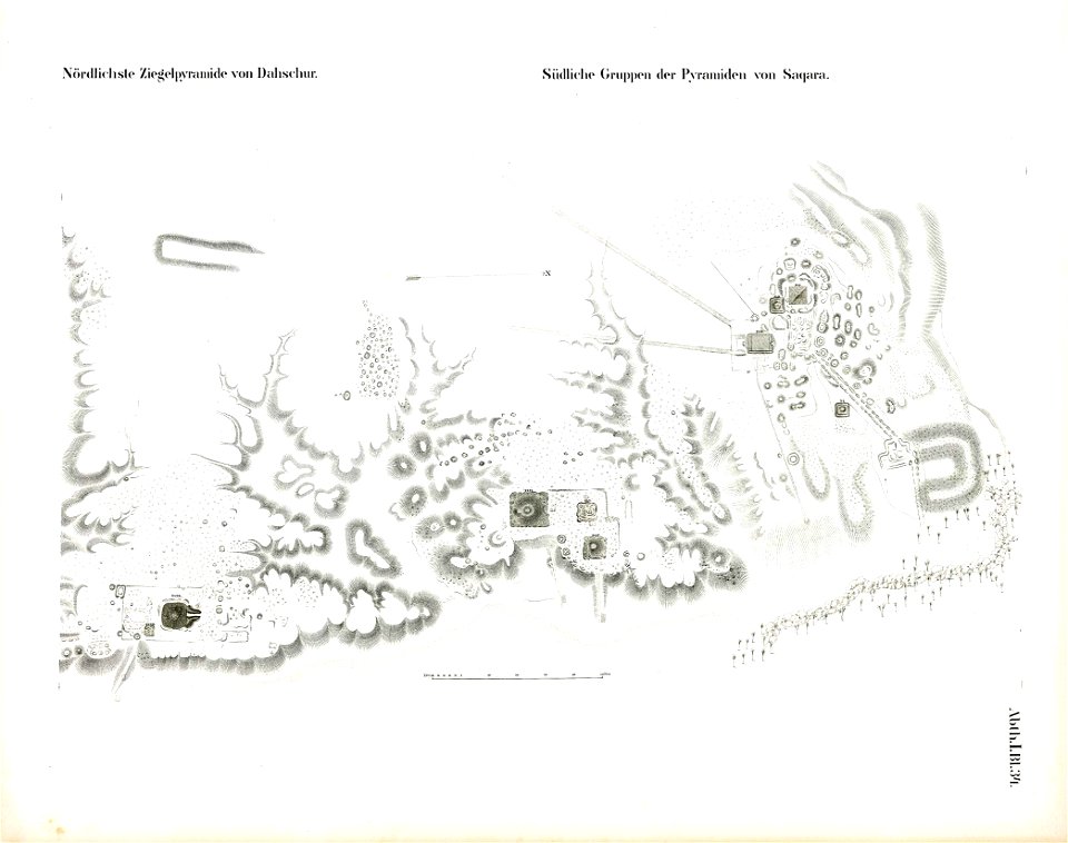
saqqara pyramids
dahshur
maps of paris by braun & hogenberg
paris in the 16th century
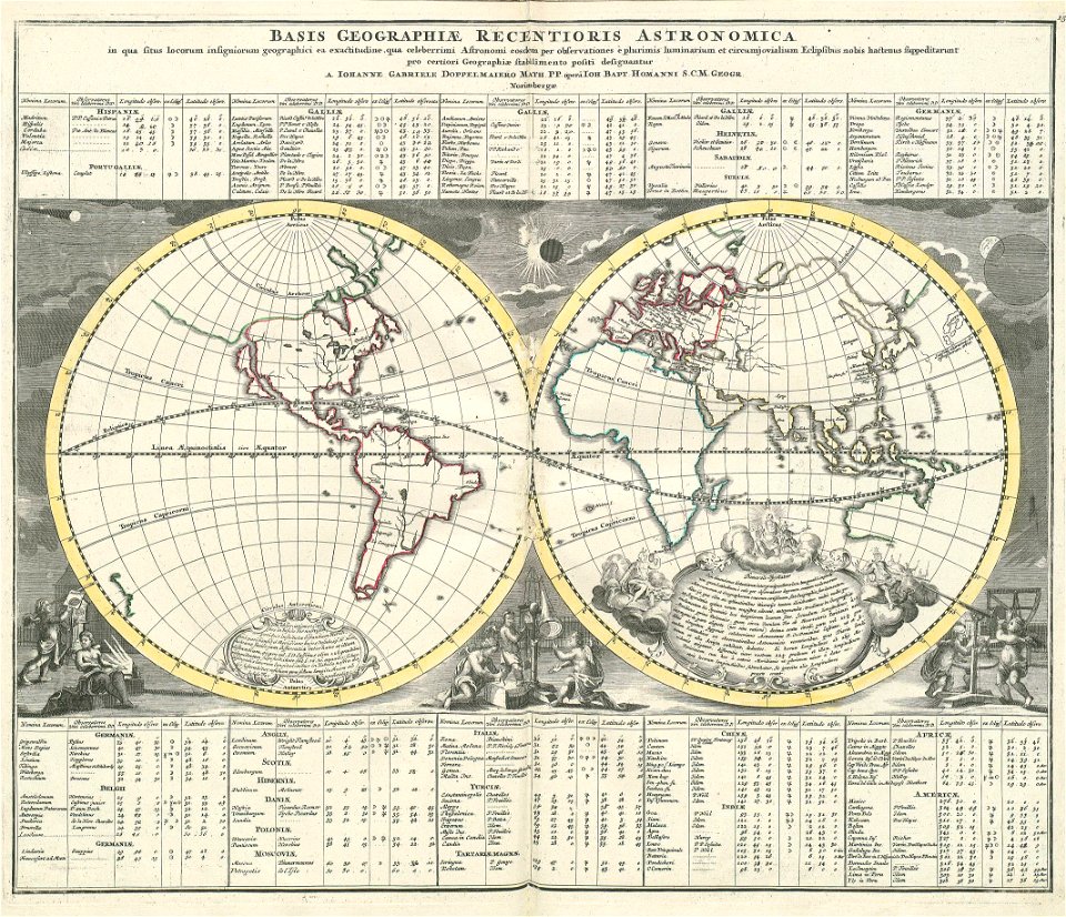
„atlas coelestis in quo mundus spectabilis“ by j.b. doppelmayr
double hemisphere world maps
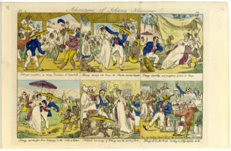
william elmes
printing
atlante veneto (raremaps.com) volume 2
18th-century maps of lombardy
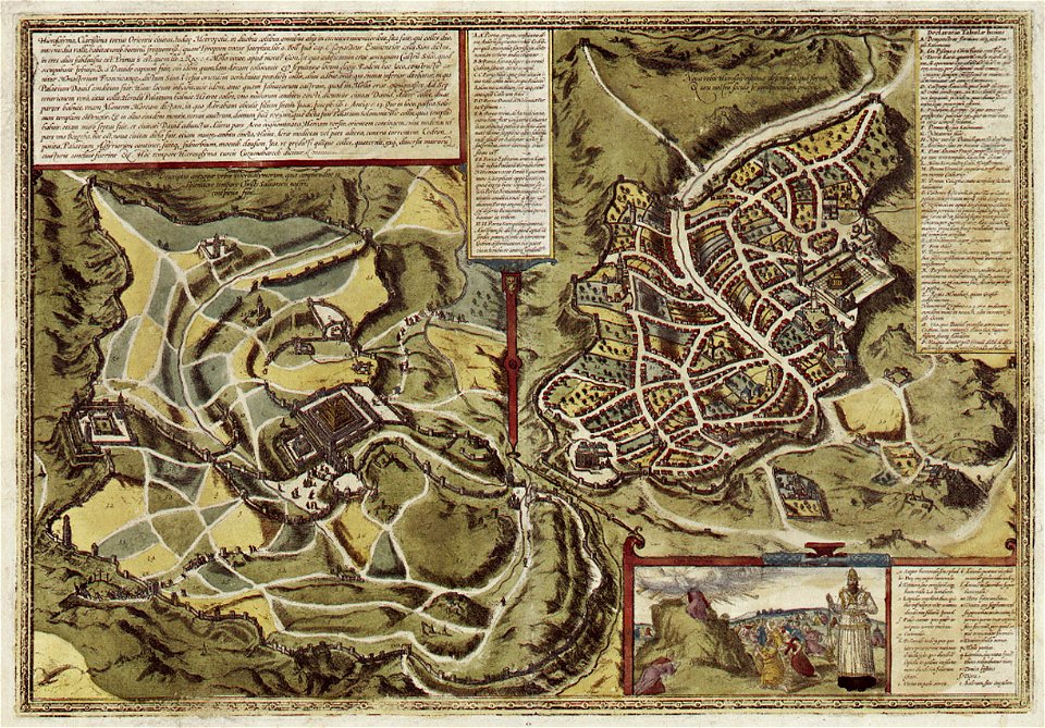
historical images of jerusalem
braun & hogenberg
old celestial maps
andreas cellarius
maps of the dutch east india company - sri lanka
1787
12401 - 12500 of 357,549
Next page
/ 3576