Log in
All resources
Create a design
Tools
357,549 Free Images of Map
geographical illustrations by coronelli
1552
geographiae claudii ptolemaei alexandrini (münster
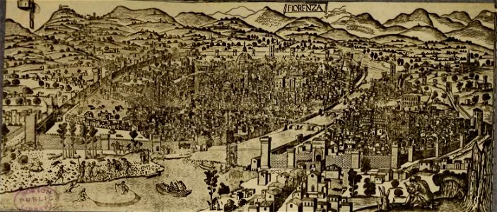
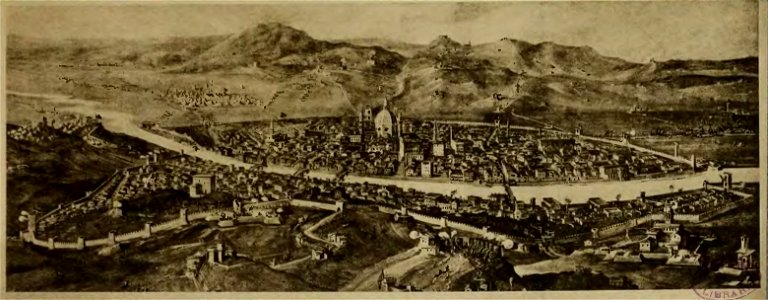
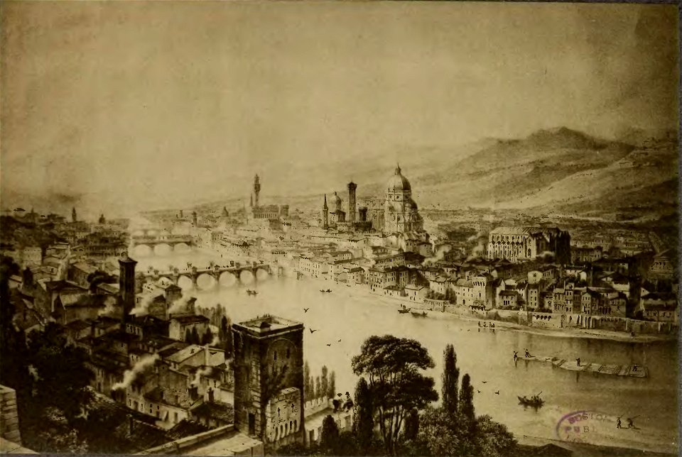
old maps of florence
cento vedute di firenze antica
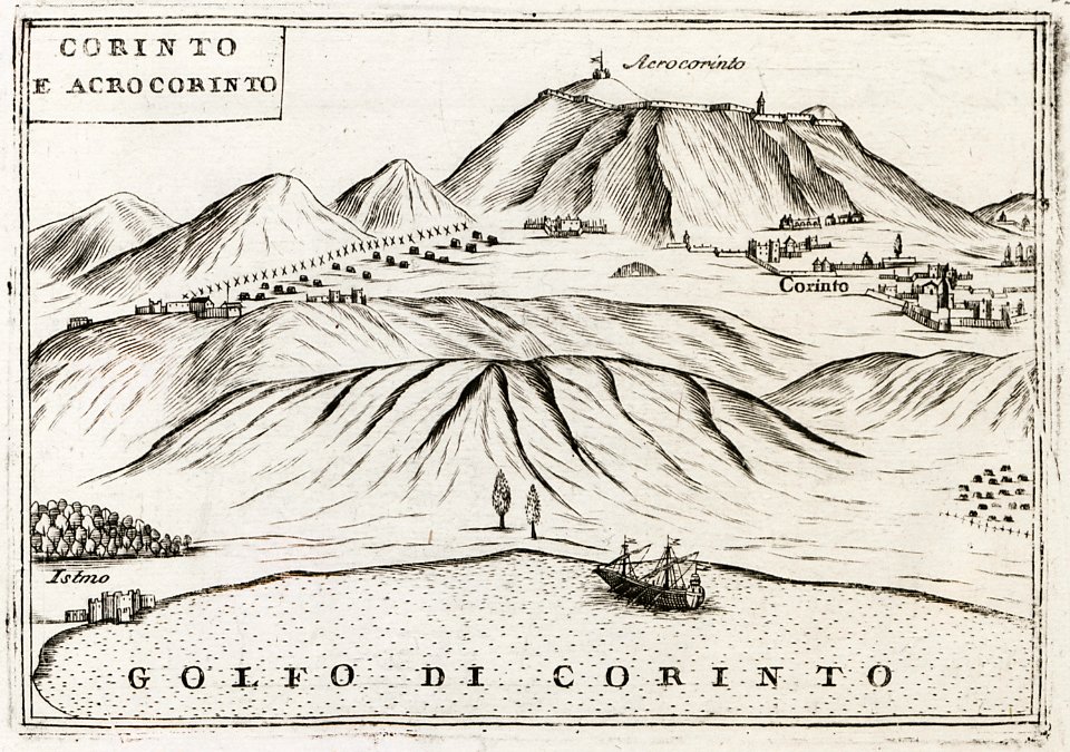
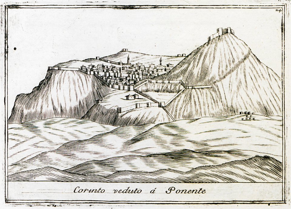
old maps of the peloponnese
maps in the stadsarchief amsterdam
maps by gerardus mercator
mercator celestial globe
maps
maps by frederick de wit
copper engraving
maps by gerardus mercator
mercator celestial globe
cento vedute di firenze antica
old maps of florence
geographical illustrations by coronelli
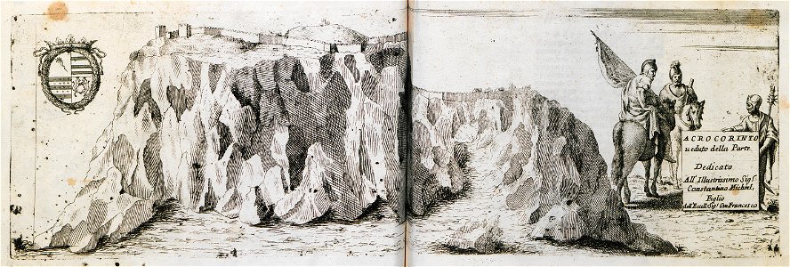
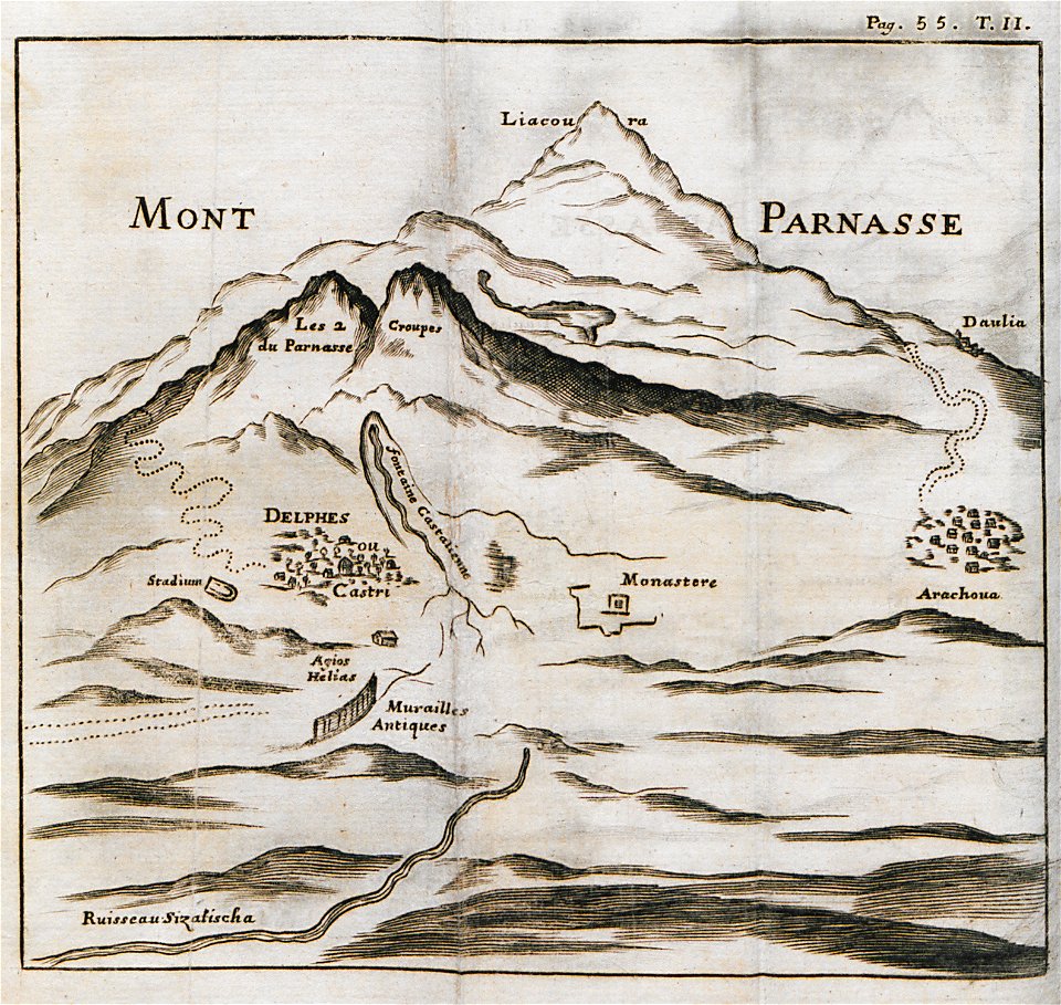
remote views of acrocorinth
geographical illustrations by coronelli
remote views of acrocorinth
maps in the stadsarchief amsterdam
claes jansz. visscher (ii)
ukiyo-e by unknown artists
nagasaki-e
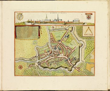
old maps of armentières
atlas de wit 1698
grote of lebuïnuskerk
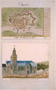
old maps of deventer
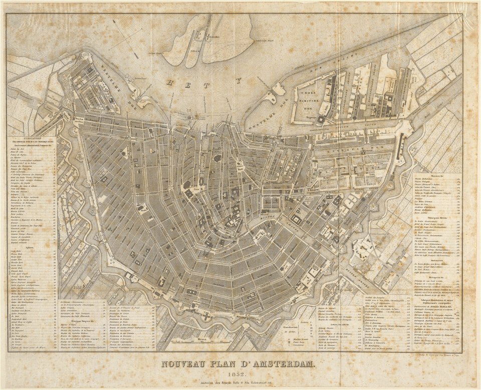
published by frans buffa & zonen
maps in the stadsarchief amsterdam
cento vedute di firenze antica
old maps of florence
theatrum orbis terrarum (london 1606)
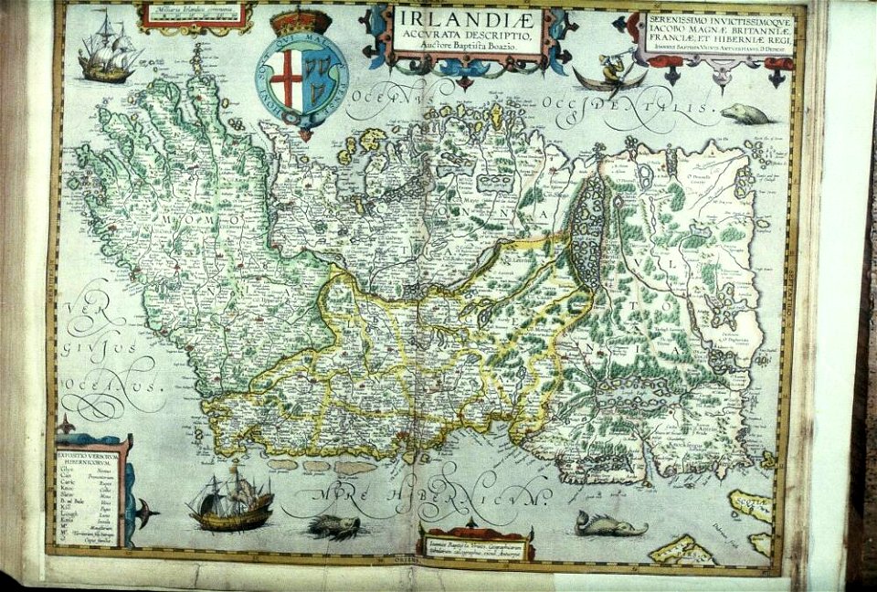
files from the bodleian libraries
files from the bodleian libraries
old maps of ireland
cento vedute di firenze antica
old maps of florence
cento vedute di firenze antica
old maps of florence
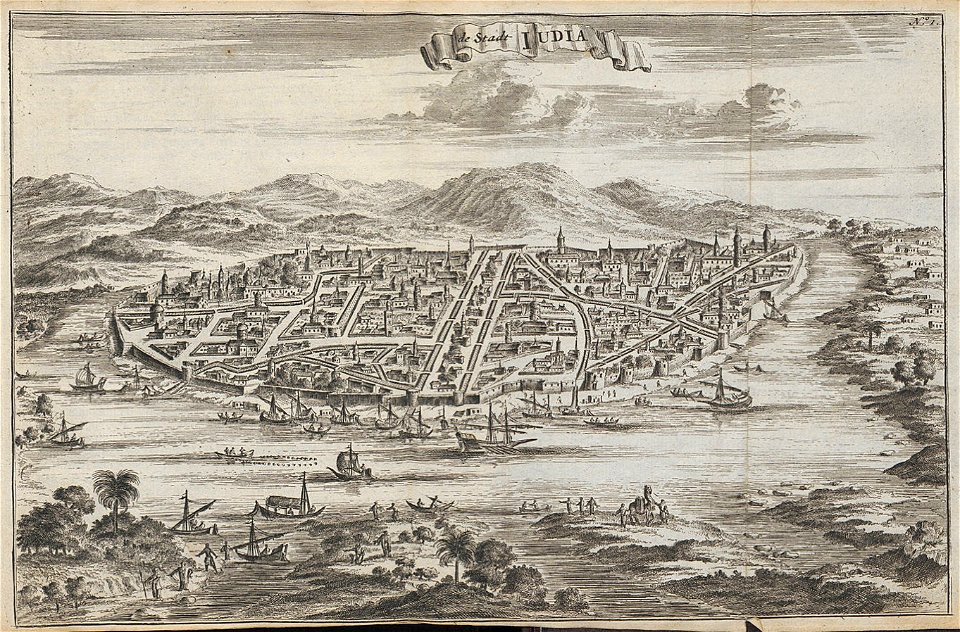
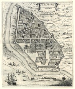
india
diu
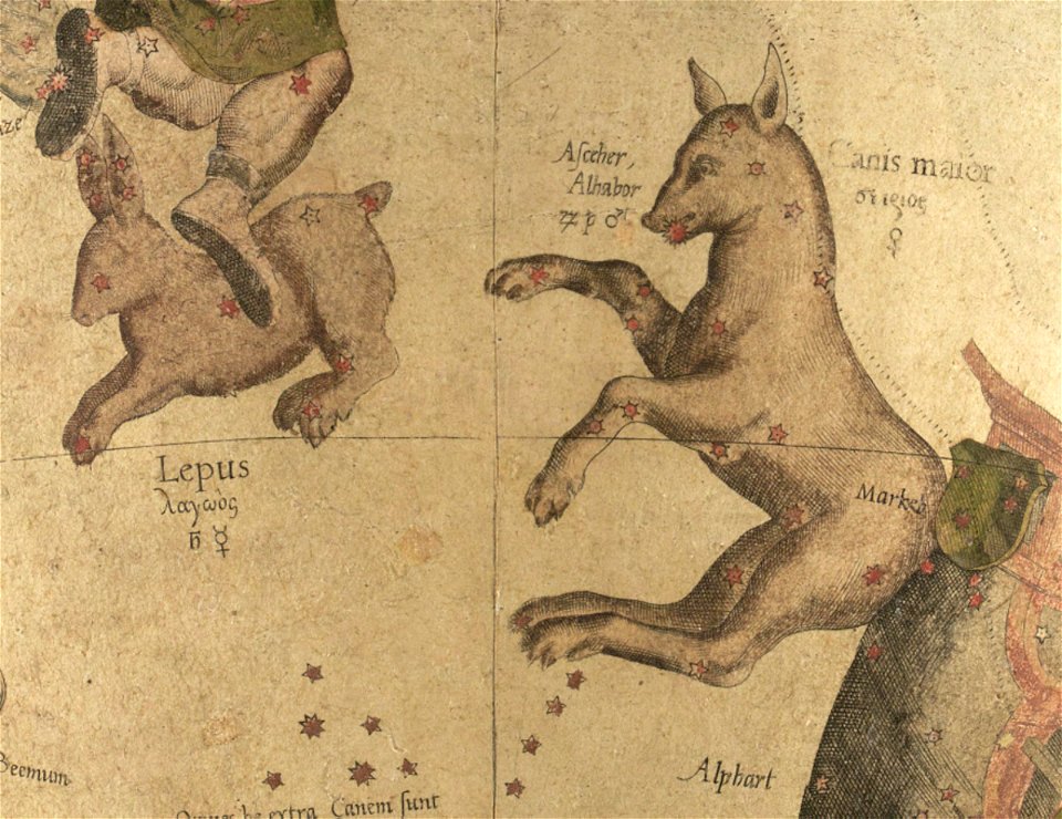
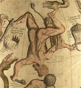
draco (constellation) in art
ursa minor in art
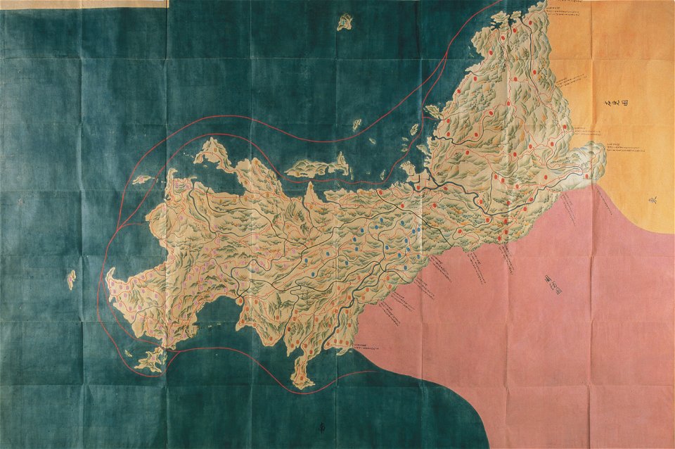
nagato province
genroku kuniezu
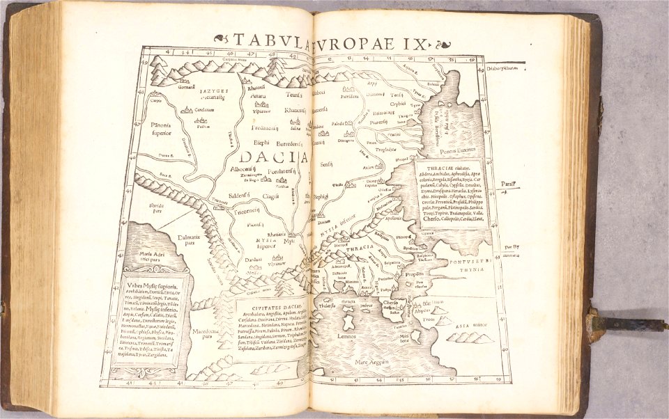
ptolemy's 9th european map
1552
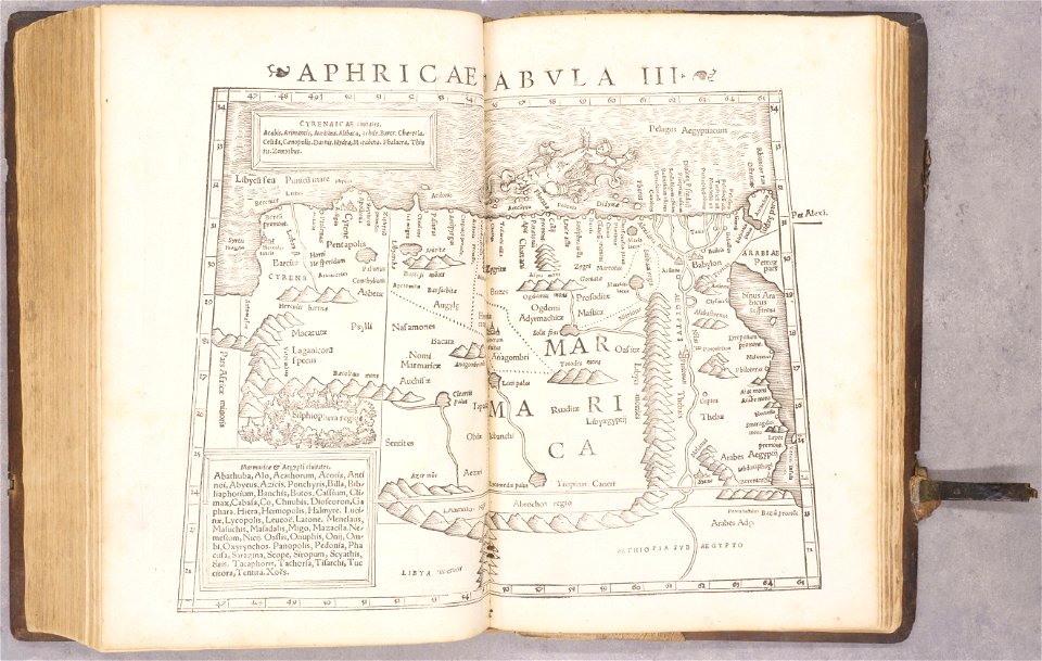
ptolemy's 3rd african map
1552
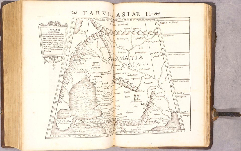
ptolemy's 3rd asian map
1552
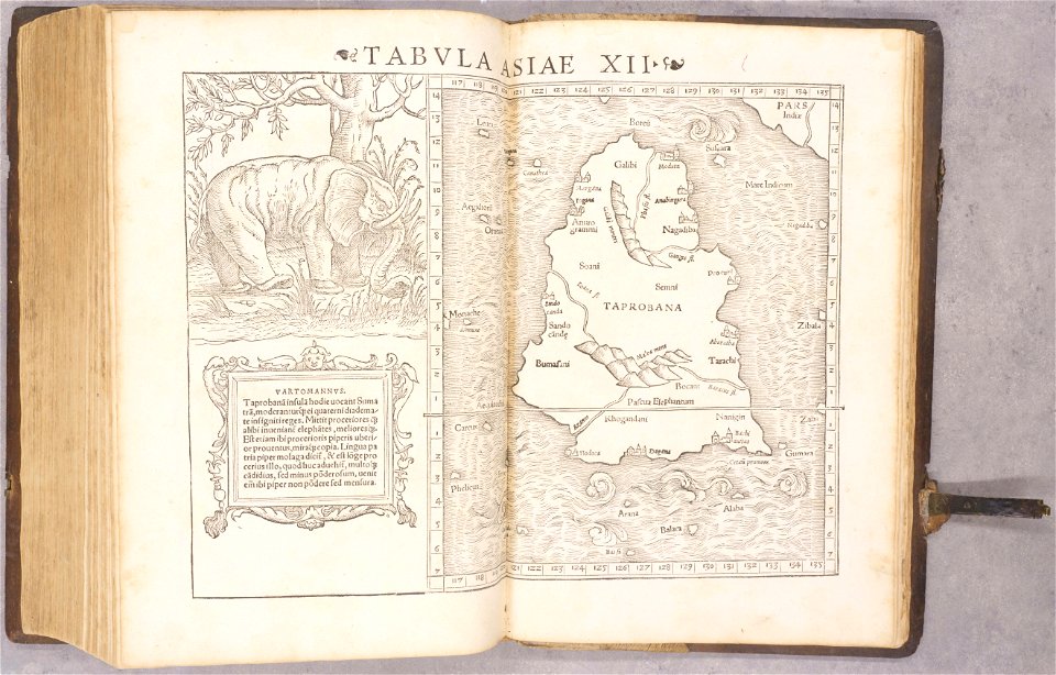
ptolemy's 11th asian map
1552
geographiae claudii ptolemaei alexandrini (münster
1552
geographiae claudii ptolemaei alexandrini (münster
1552
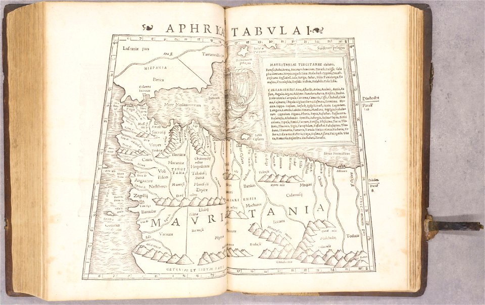
ptolemy's 1st african map
1552
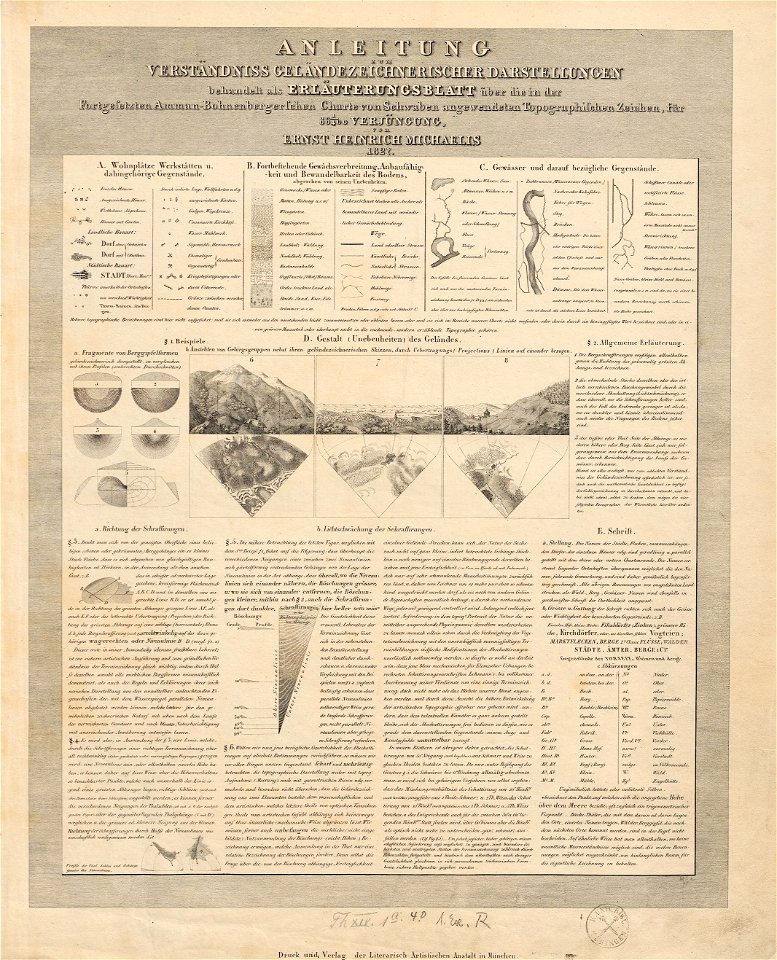
charte von schwaben (bohnenberger)
1827 engravings
drie aanmerkelyke reizen
old maps of ayutthaya
engravings of topographia saxoniae inferioris
old maps of bremen (state)
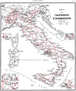
history of rail transport in italy
enzyklopädie des eisenbahnwesens
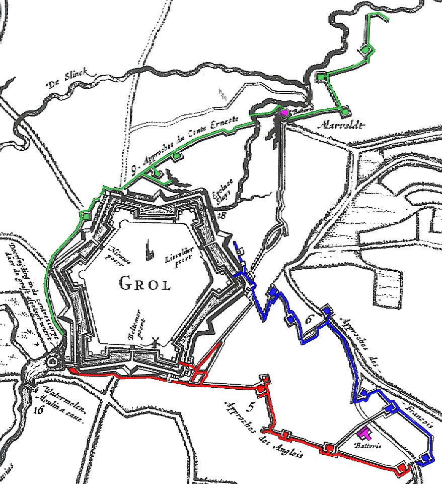
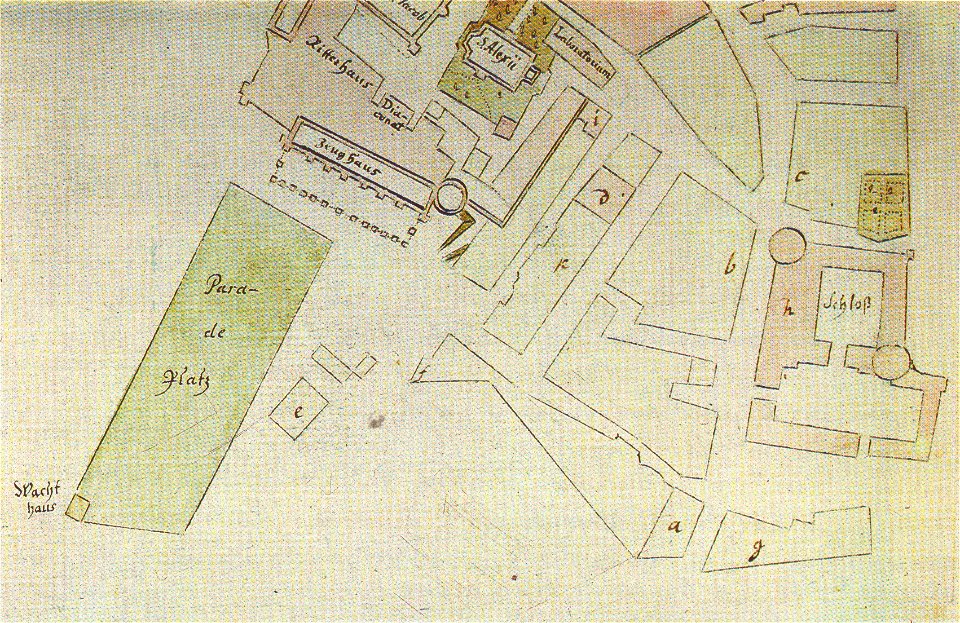
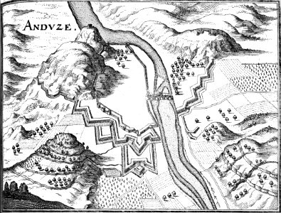
17th-century fortress plans
military trenches
maps of yamaguchi prefecture
nagato province
engravings by jan luyken
1696
soldiers in art
ink drawing
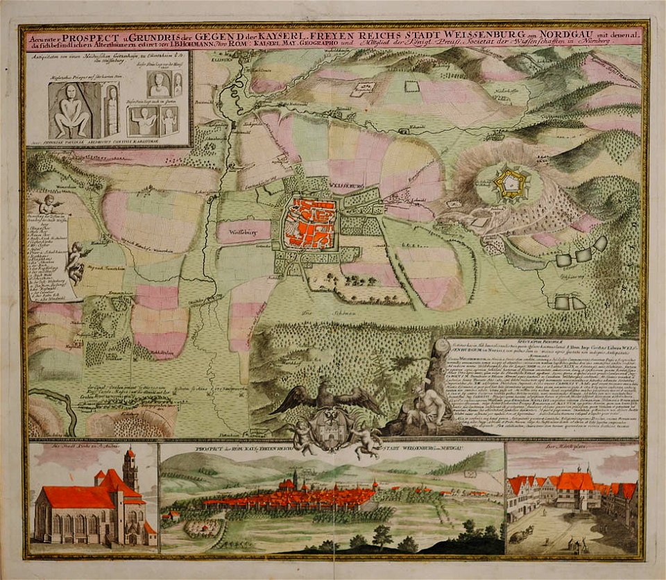
weißenburg in bayern in art
maps by homannsche erben
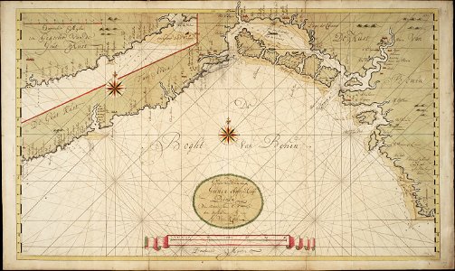
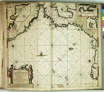
charts and maps of the royal museums greenwich
lucas janszoon waghenaer
charts and maps of the royal museums greenwich
lucas janszoon waghenaer
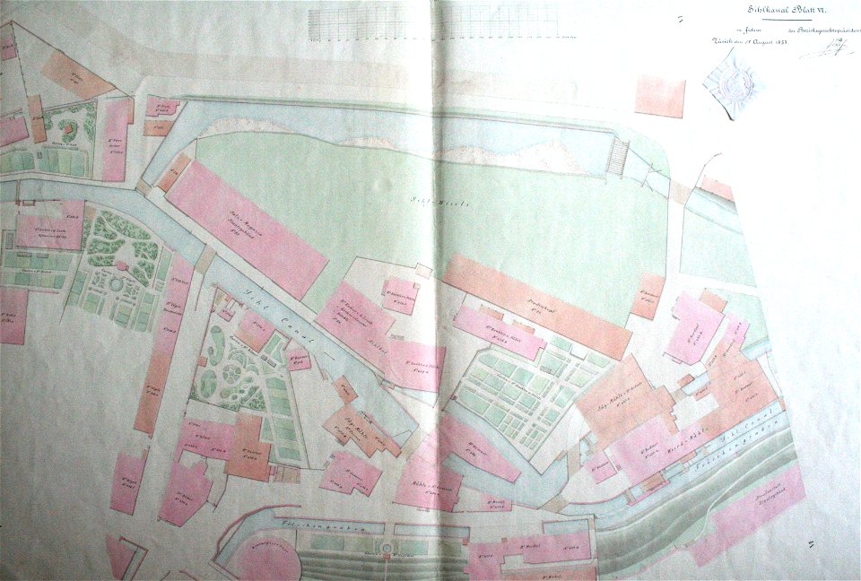
werdmühle (zürich)
zürich
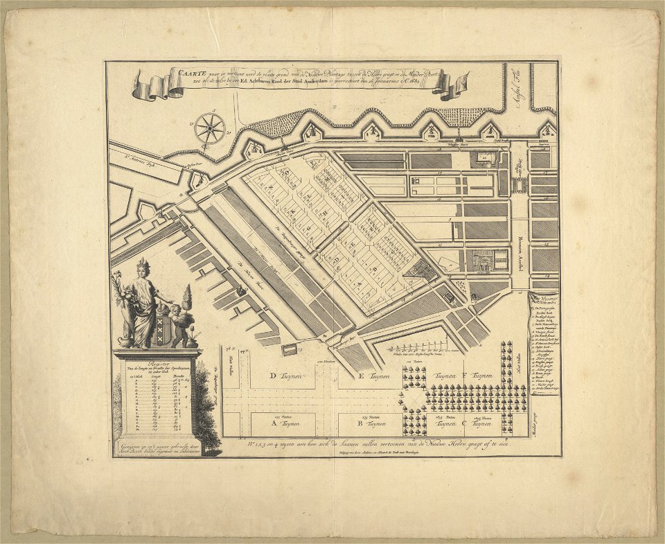
maps in the stadsarchief amsterdam
hendrik de leth
maps in the stadsarchief amsterdam
hendrik de leth
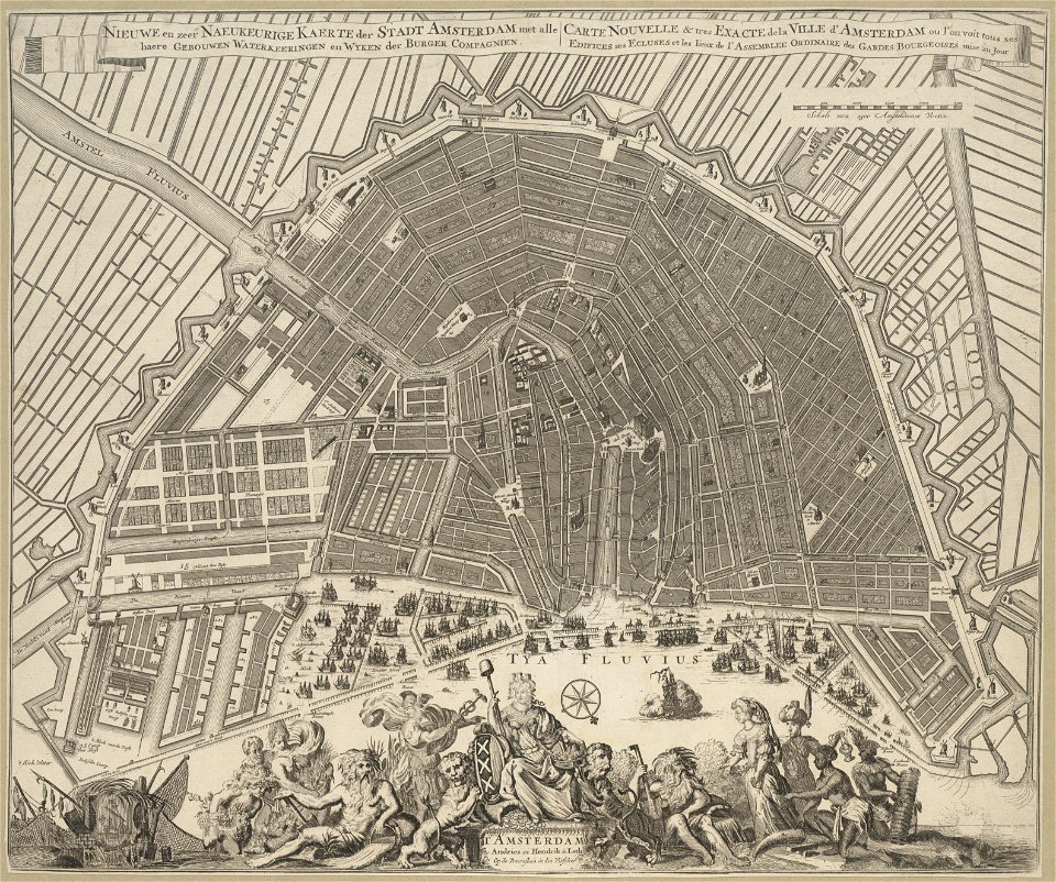
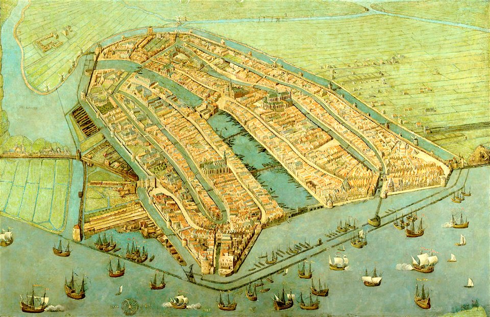
paintings of amsterdam
amsterdam
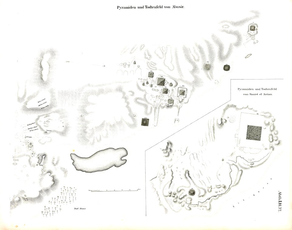
abusir pyramids
abusir
geographical illustrations by coronelli
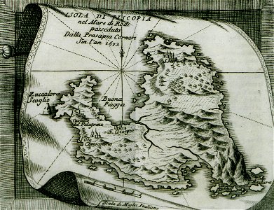
history of the dodecanese
manuscripts in the houghton library
harvard university
illustrations de l'histoire de la nouvelle france d'eugène guénin
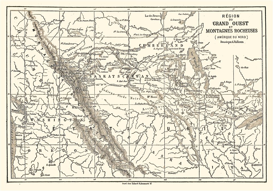
maps of the rocky mountains
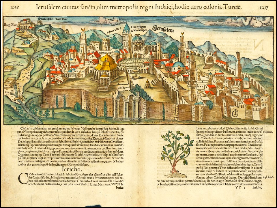
jerusalem in the 16th century
maps by sebastian münster
volume 1 of le tour du monde
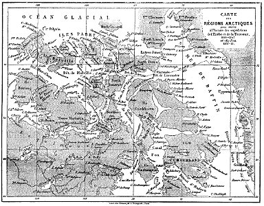
john franklin
volume 4 of le tour du monde
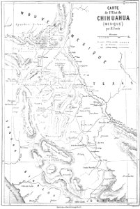
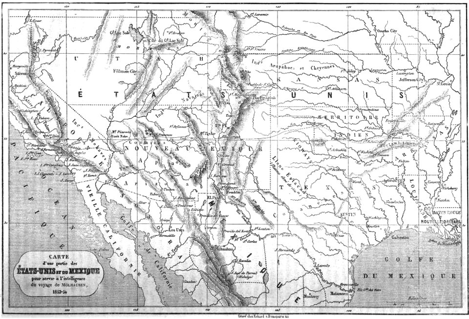
old maps of mexico
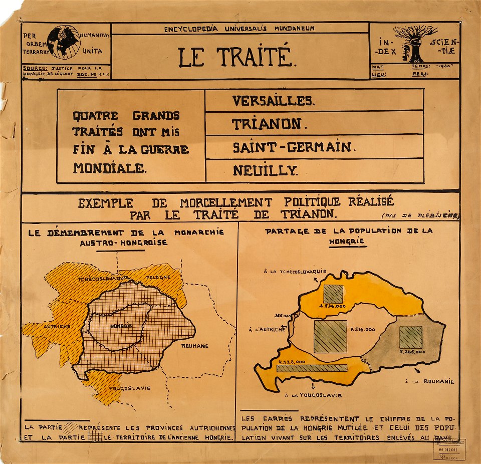
encyclopaedia universalis mundaneum
maps of the treaty of trianon
maps by gerardus mercator
mercator celestial globe
19th-century maps of the united states
volume 1 of le tour du monde
ukiyo-e by unknown artists
nagasaki-e
drawings (documentary) collection in the library of congress
drawings by alfred waud
geographical illustrations by coronelli
acrocorinth in art
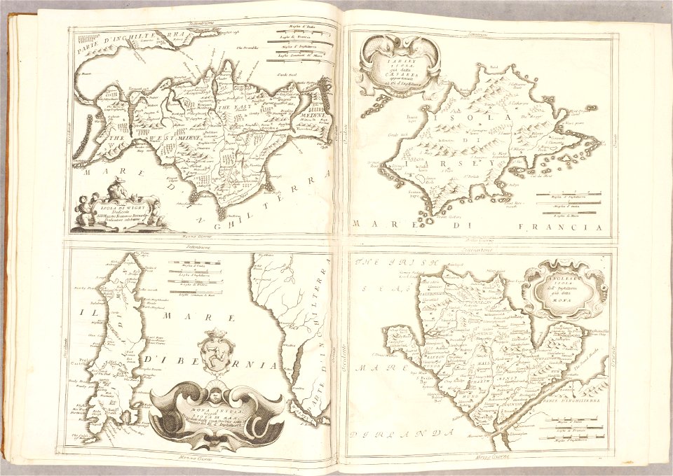
isle of wight
anglesey
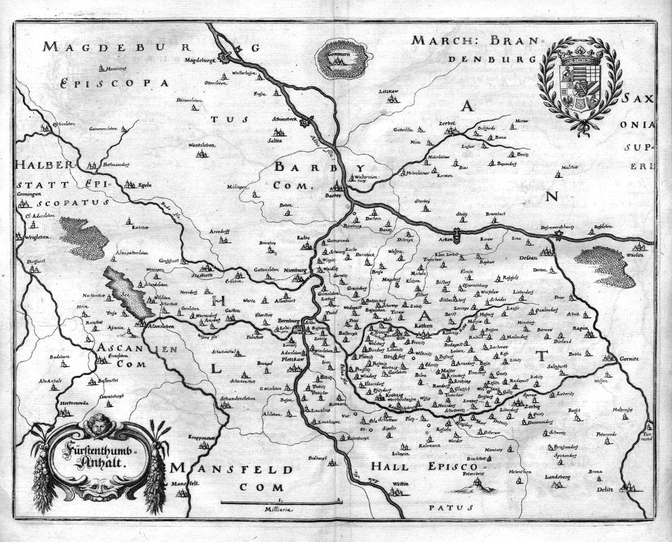
engravings of topographia superioris saxoniae
thüringiae
johann christoph brotze
old maps of riga
maps in the stadsarchief amsterdam
claes jansz. visscher (ii)
maps in the stadsarchief amsterdam
claes jansz. visscher (ii)
geographical illustrations by coronelli
antirrio
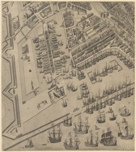
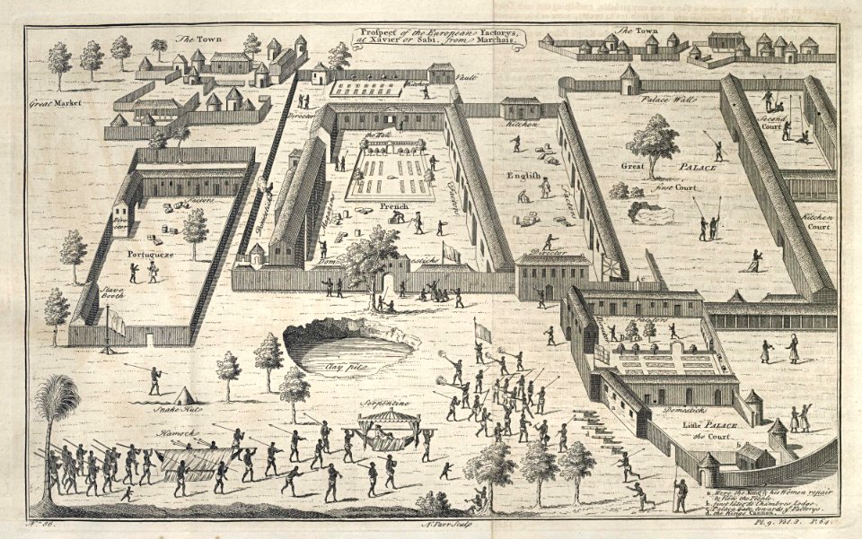
maps of the dutch east india company - india
1672
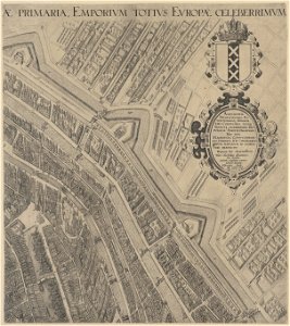
maps of the dutch east india company - india
1709
maps of the west-indische compagnie
1745
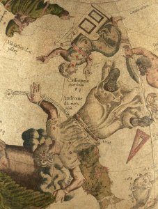
triangulum (constellation)
andromeda (constellation)
bibliothèque municipale de reims
rès. g 153
west-indische compagnie
gerard van keulen
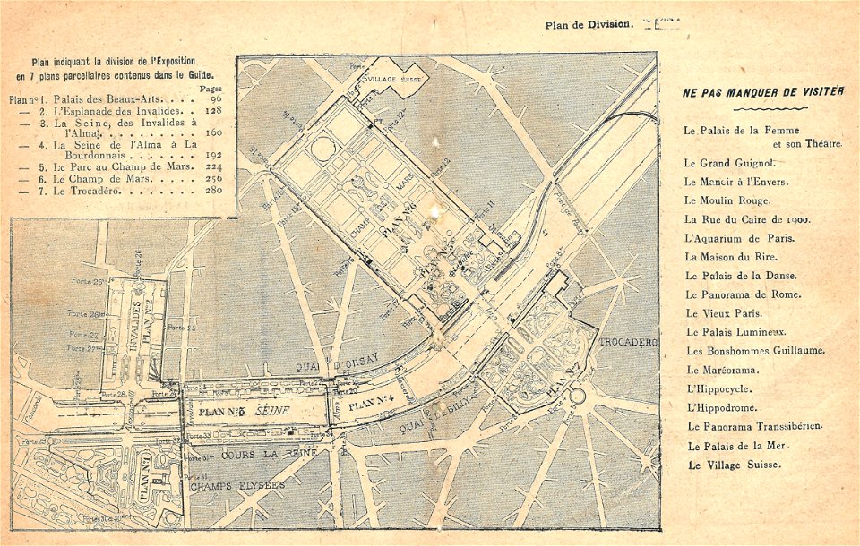
illustrations du catalogue remboursable de l'expo 1900
maps of the exposition universelle (1900)
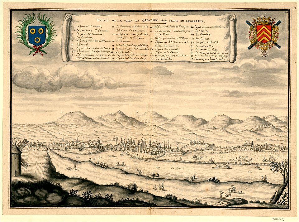
description des principales villes (1690)
history of aegina
atlantis magni tomus primus (biblioteca comunale di trento)
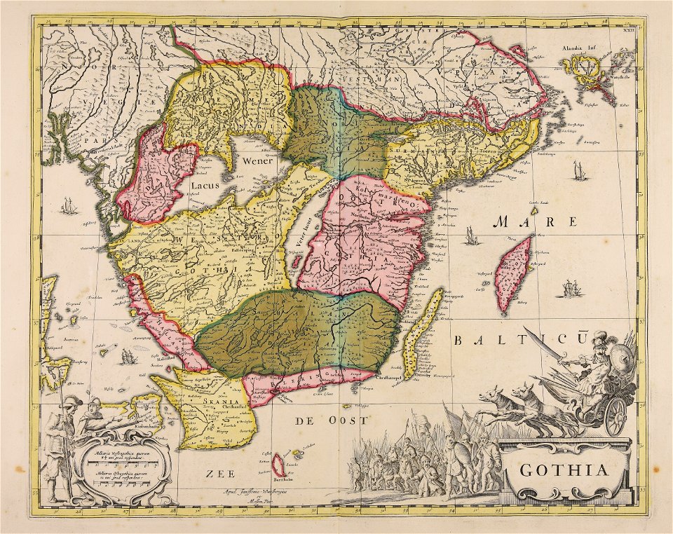
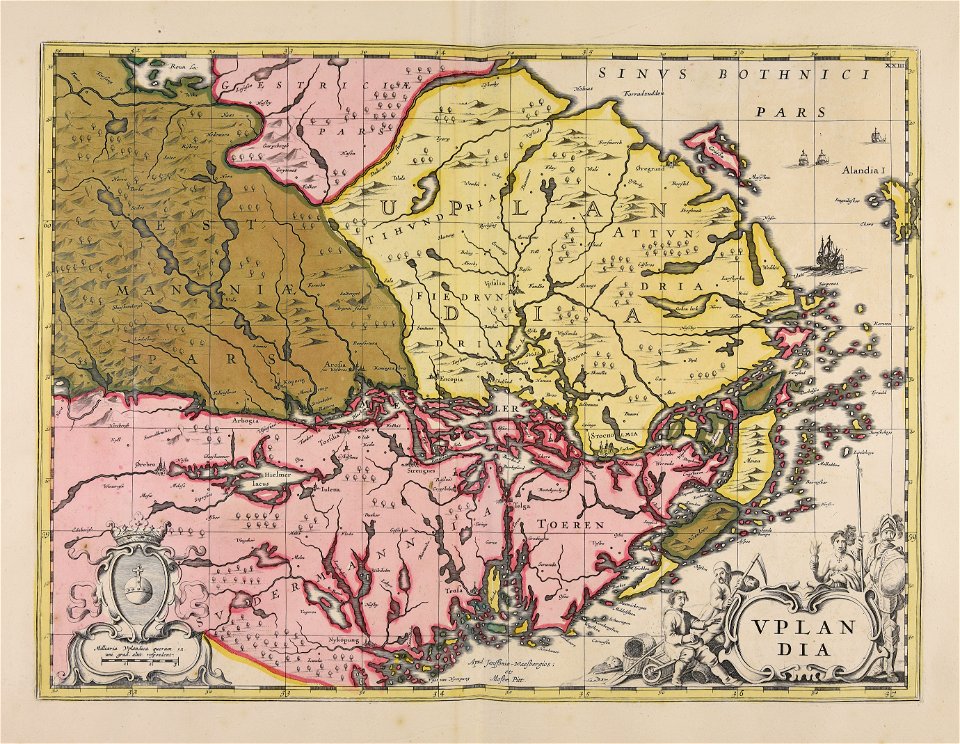
17th-century maps of sweden
roger de gaignières
louis boudan
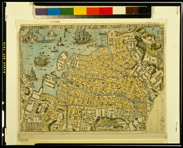
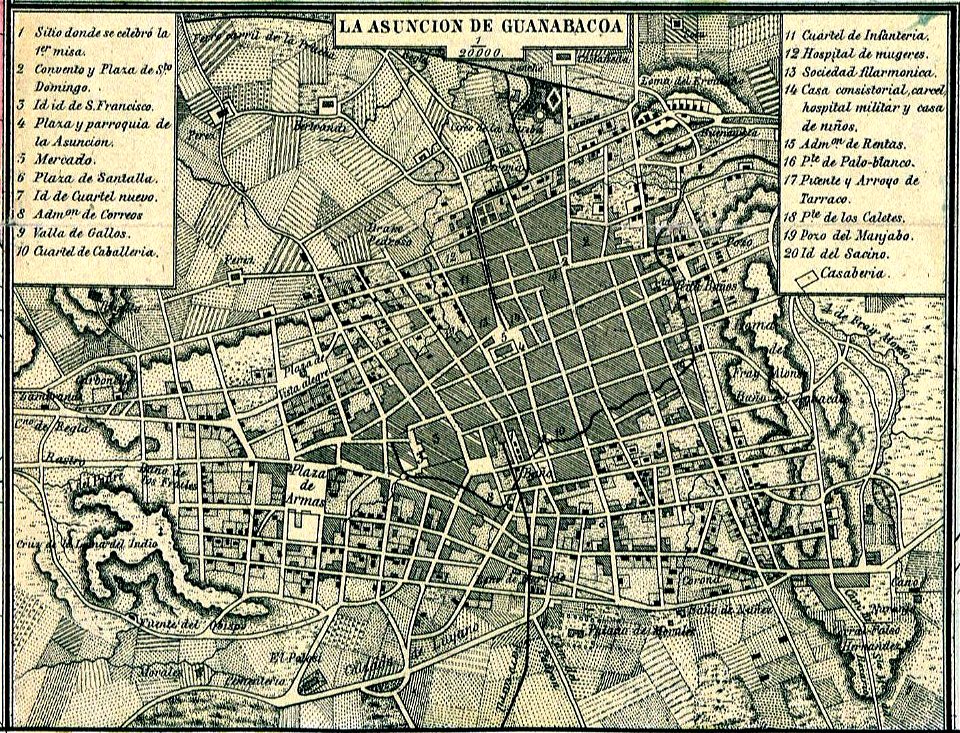
old maps of havana
1866
vehicle
maps
illustration
maps
business
maps
background
maps
icons
symbol
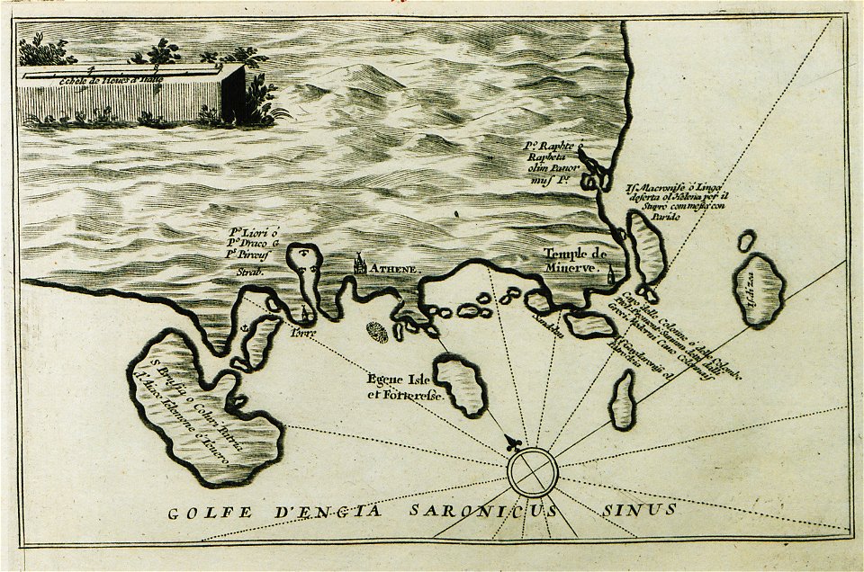
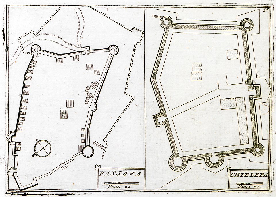
geographical illustrations by coronelli
old maps of the peloponnese
charts and maps of the royal museums greenwich
atlantis magni tomus primus (biblioteca comunale di trento)
17th-century maps of sweden
old maps of gibraltar
history of gibraltar
„atlas coelestis in quo mundus spectabilis“ by j.b. doppelmayr
double hemisphere world maps
old maps of haarlem
atlas de wit 1698
illustrations from césar cascabel by george roux
19th-century maps of the americas
braun & hogenberg
maps of tours
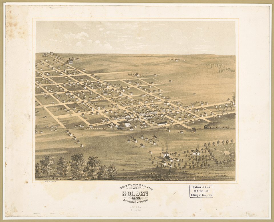
bird's eye view maps of missouri
albert ruger
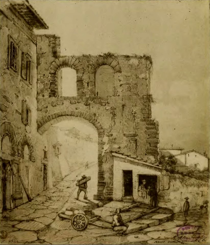
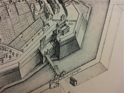
map of ferrara by andrea bolzoni
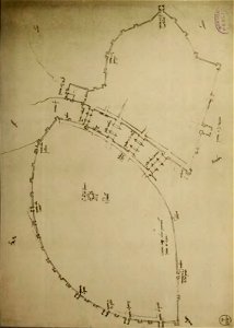
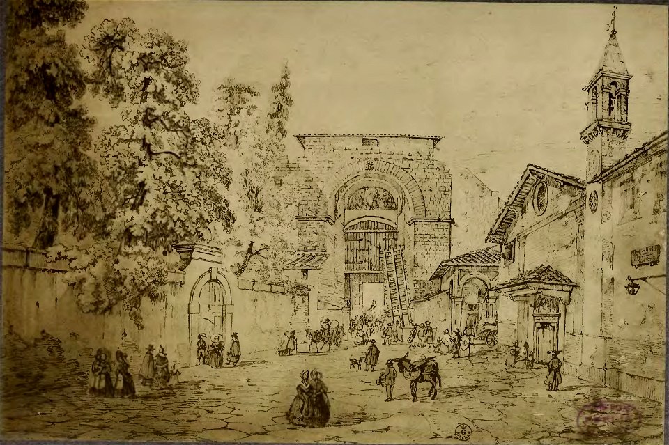
porta romana detta di s. giorgio
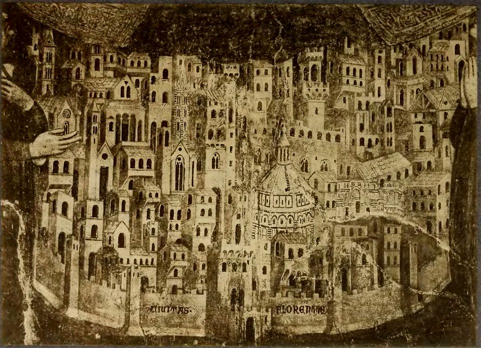
cento vedute di firenze antica
old maps of florence
cento vedute di firenze antica
old maps of florence
cento vedute di firenze antica
old maps of florence
files from the bodleian libraries
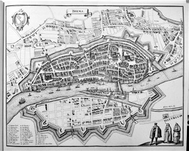
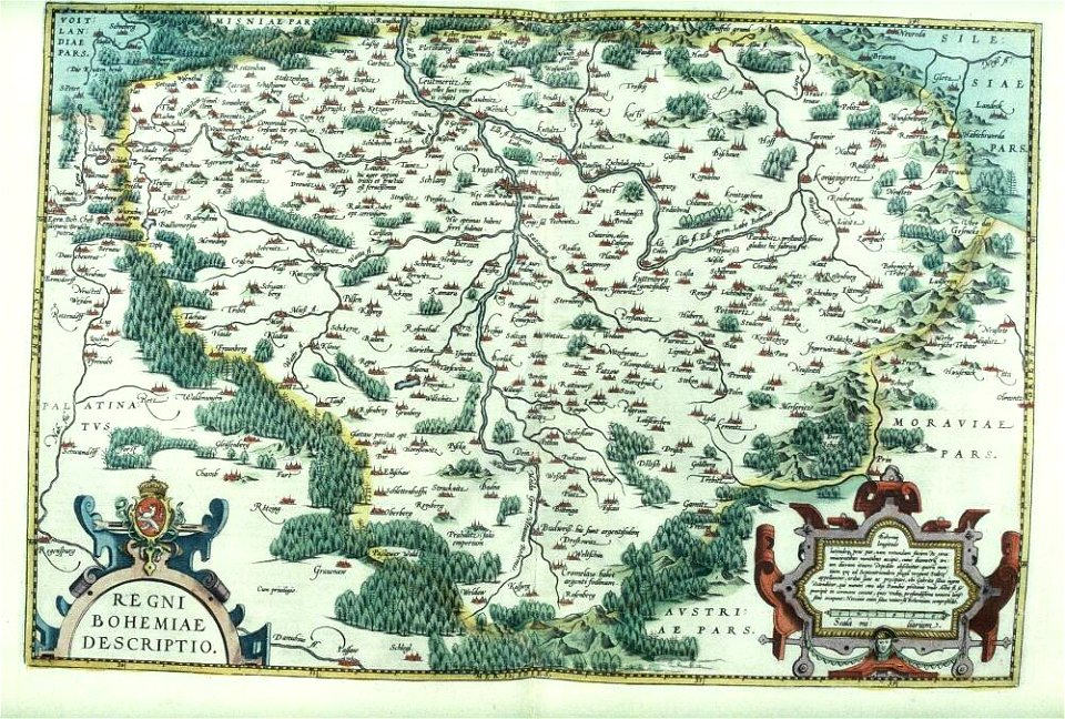
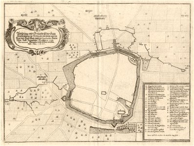
old maps of bohemia
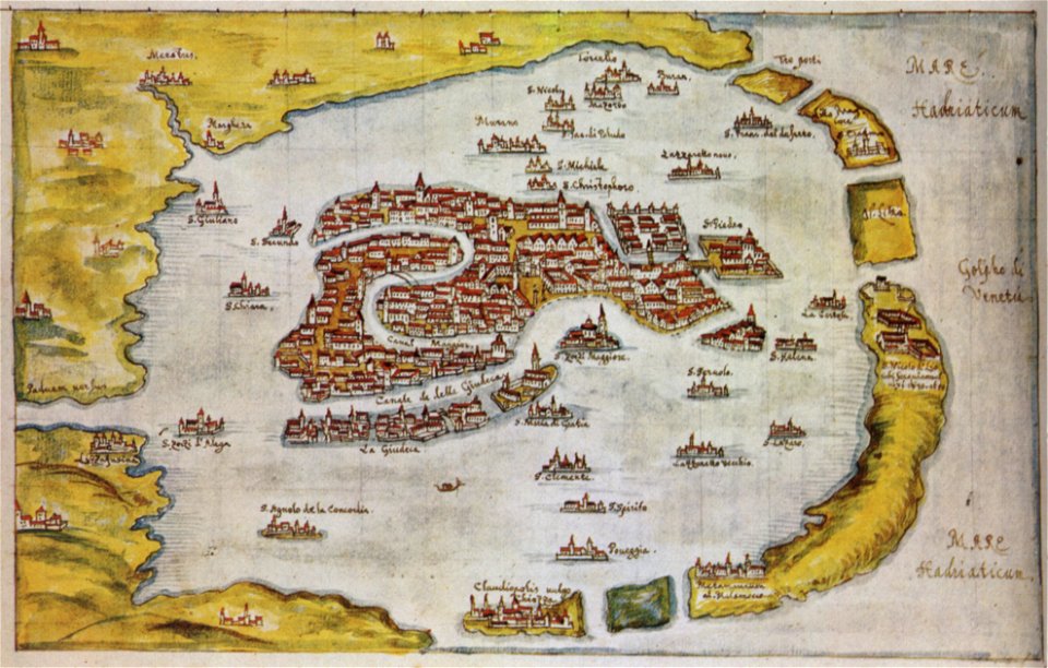
old maps of venice
gabriel bucelin
maps by gerardus mercator
mercator celestial globe
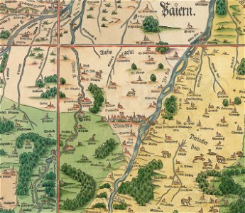
snippets of philipp apian's bairische landtafeln
old maps of boroughs in munich
voyagie door italien
dalmatien
geographical illustrations by coronelli
old maps of the peloponnese
old maps of switzerland
piz varuna
collections de la bibliothèque nationale et universitaire de strasbourg
old maps of alsace
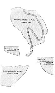
zoos in art
1896 maps
maps of landkreis weißenburg-gunzenhausen
engravings of theatrum europaeum
geographical illustrations by coronelli
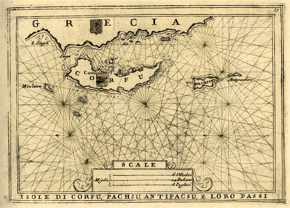
old maps of corfu
geographiae claudii ptolemaei alexandrini (münster
1552
13001 - 13100 of 357,549
Next page
/ 3576