Log in
All resources
Create a design
Tools
357,549 Free Images of Maps
maps in the library of congress
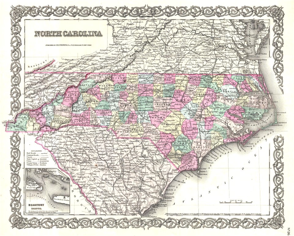
maps by joseph hutchins colton
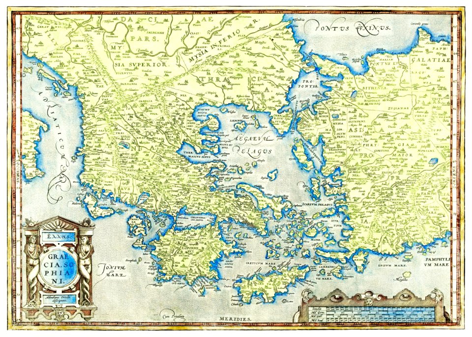
latin-language maps
maps from the mechanical curator collection
david rumsey historical map collection
vintage maps
ohio
bird's eye view maps of ohio
maps by john thomson
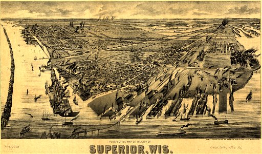
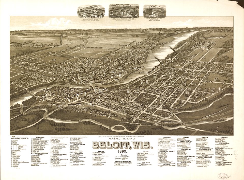
old maps of wisconsin
maps from the mechanical curator collection
1857 books
maps in the library of congress
1889 maps
maps in the library of congress
1893 maps
maps in the library of congress
1890 maps
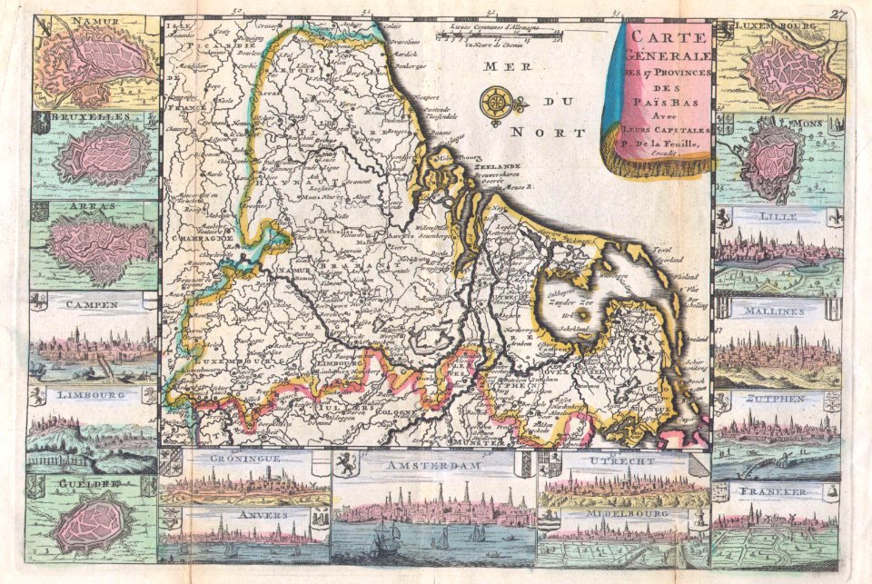
pieter van der keere
sindi people
old maps of south africa
maps by william faden
german-language maps
1770 maps
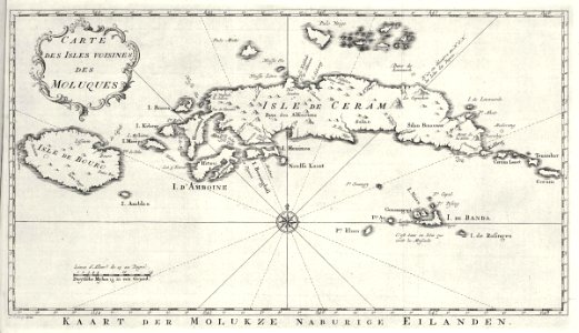
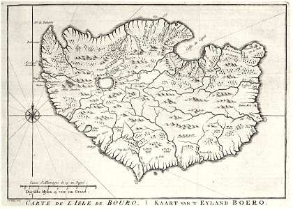
maps of the dutch east india company - indonesia
banda islands
maps from allgemeiner historischer handatlas
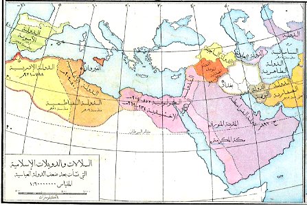
arabic-language maps
david rumsey historical map collection
j. and p. knapton
french-language maps
1710 maps
world
maps
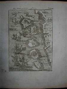
mexico
maps
continent
maps
1870s maps of australia
1879 maps
images from the new york public library
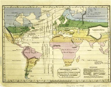
old weather and climate maps
border
maps
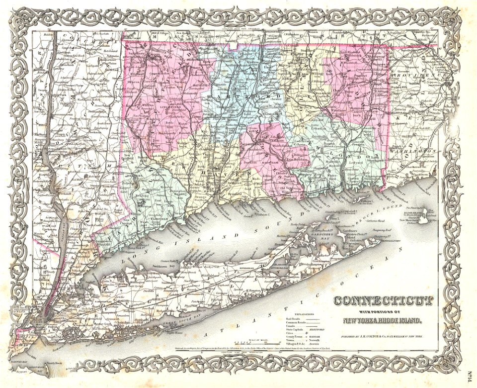
long island sound
block island
continent
world map
maps in the library of congress
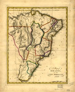
19th-century maps of brazil
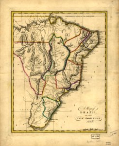
maps in the library of congress
19th-century maps of brazil
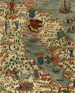
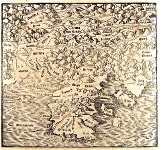
maps of the republic of novgorod
1539 maps of russia
maps by sebastian münster
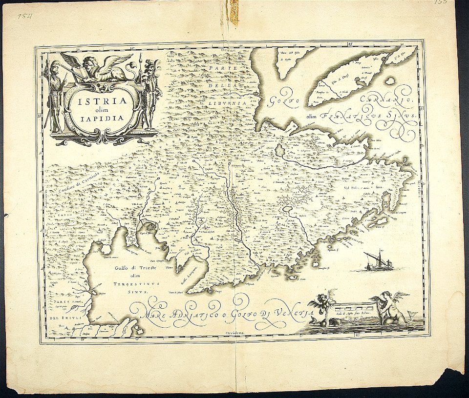
old maps of croatia
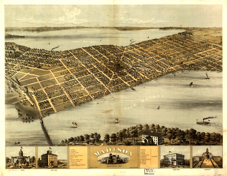
maps in the library of congress
wisconsin
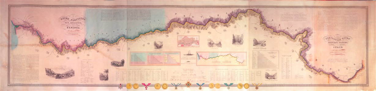
joseph james forrester
port wine
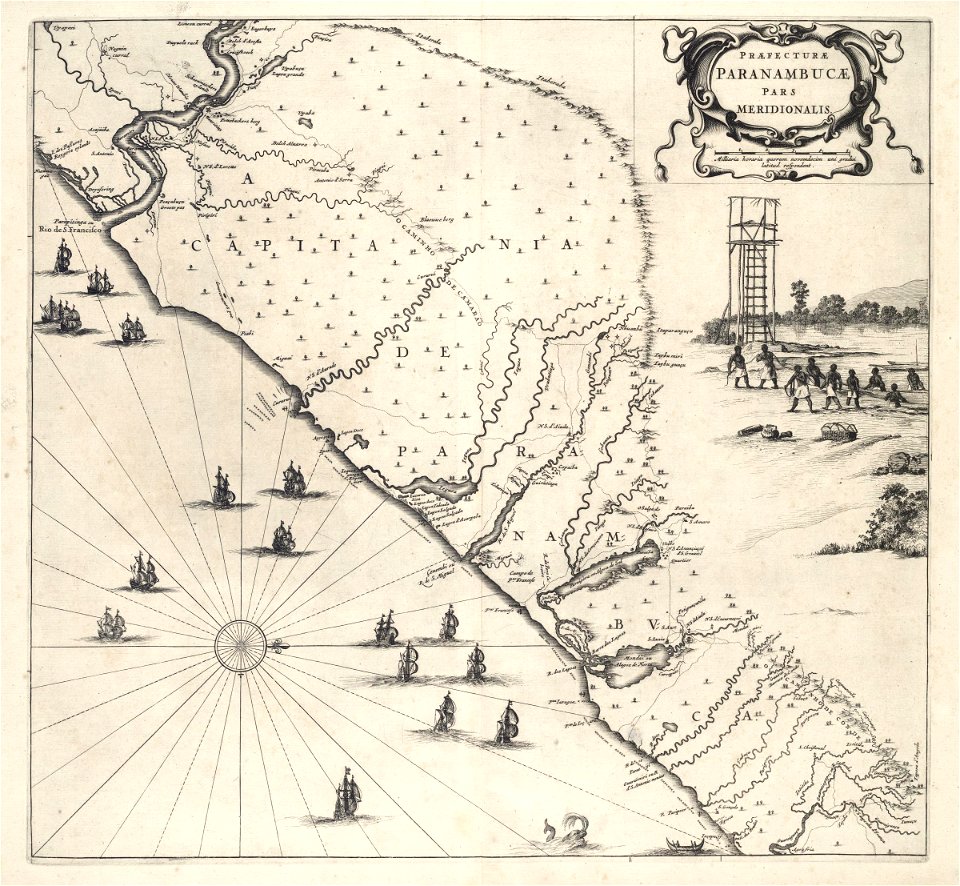
old maps of pernambuco
1665
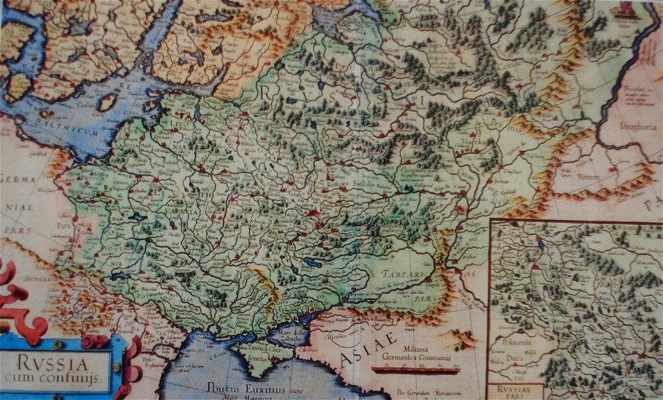
old maps of the tsardom of russia
red ruthenia
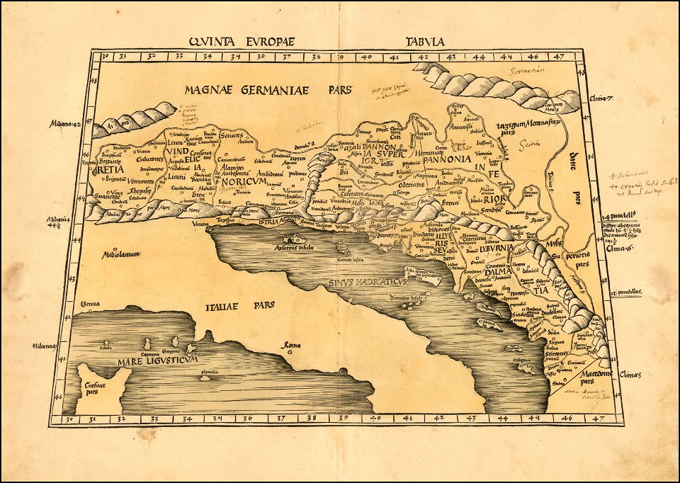
1490s maps of the world
ptolemaic world maps
maps by martin waldseemüller
1513 maps
maps in the library of congress
old maps of maine
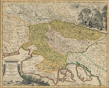
maps by johann weikhard von valvasor
18th-century maps of slovenia
maps in the stadsarchief amsterdam
maps by nicolaes visscher i
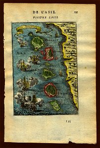
17th-century maps of indonesia
description de l'universe
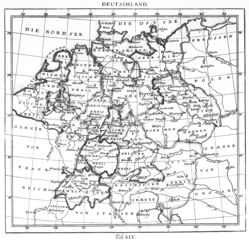
elementarwerk
1774 maps
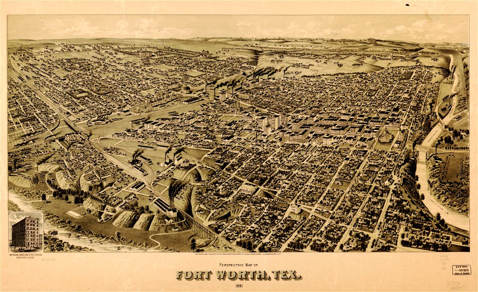
old maps of texas
1891 map
old maps of texas
1891 map
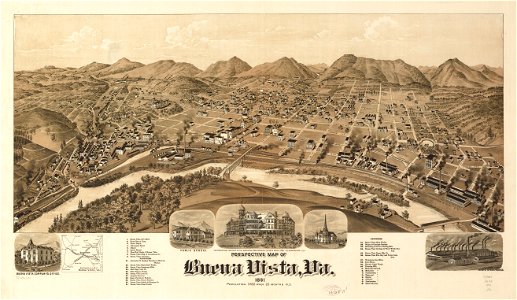
old maps of virginia
1891 map
maps of polders in north holland
old maps of north holland
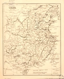
maps in the library of congress
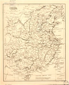
old maps of china
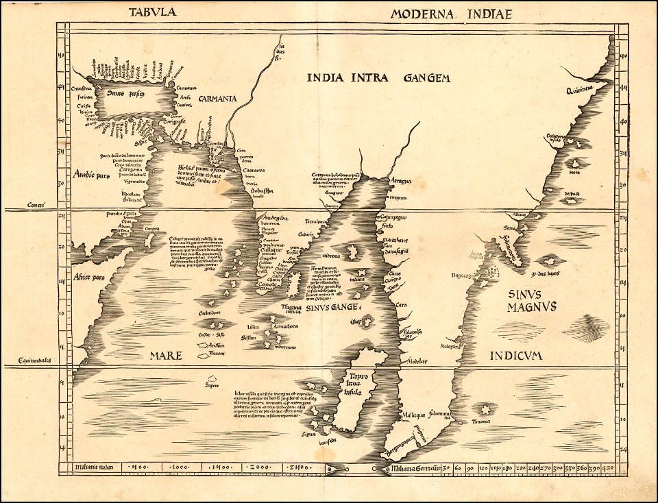
maps by martin waldseemüller
1513 maps
maps from the mechanical curator collection
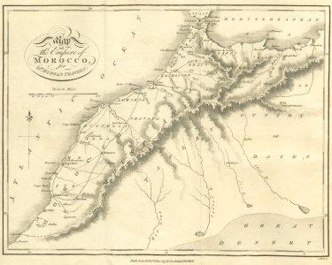
old maps of morocco
self-published work
israel
illustration
maps
maps in the library of congress
ohio
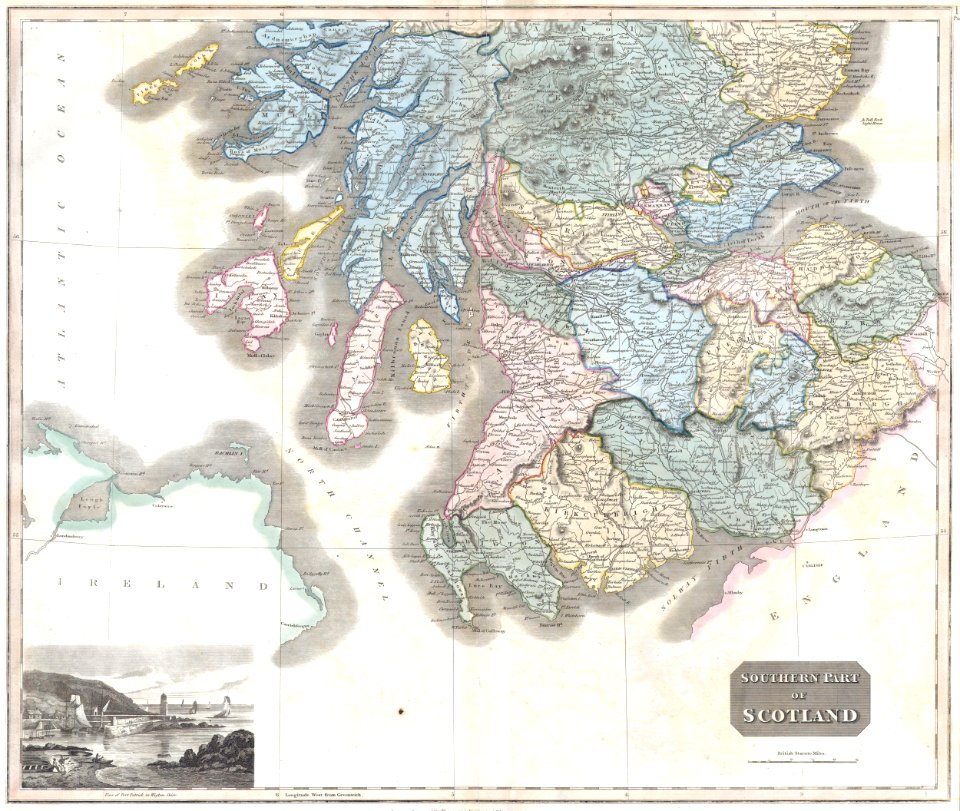
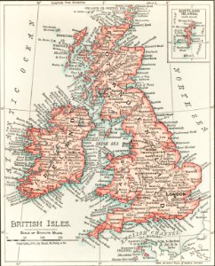
old maps of scotland
maps by john thomson
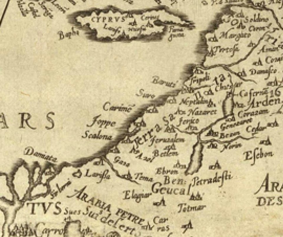
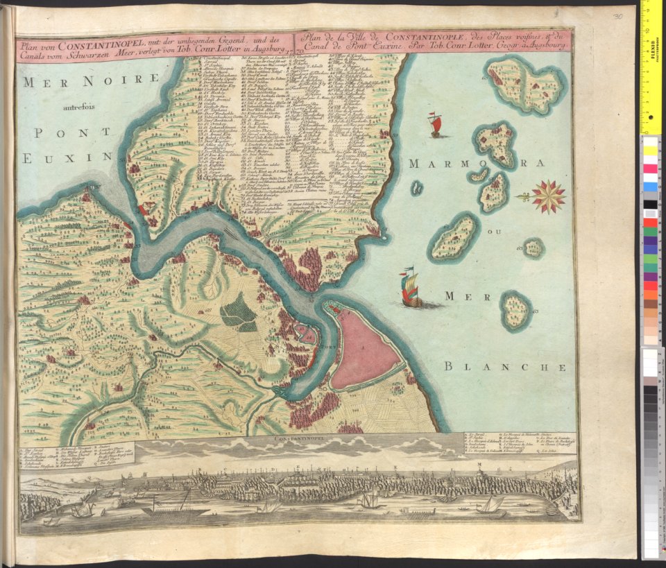
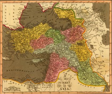
1590 maps of armenia
1590 maps of turkey
old maps of the persian gulf
1616 maps
maps in the library of congress
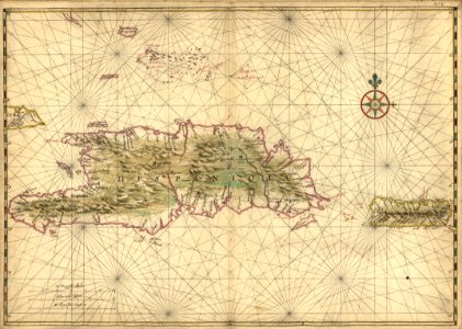
17th-century maps of hispaniola
old maps of new hampshire
old maps of vermont
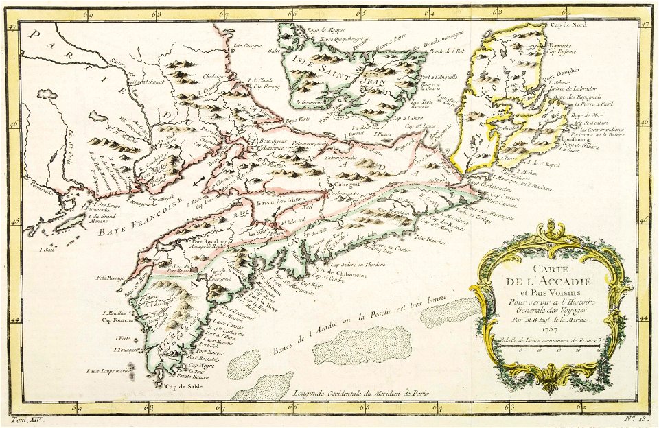
maps by jacques-nicolas bellin
old maps of canada
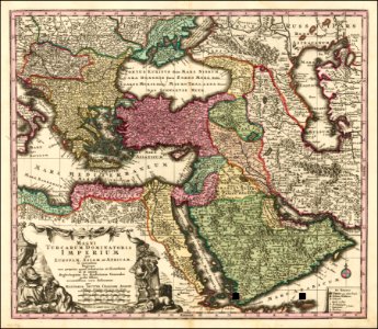
old maps of the ottoman empire
old maps of poland
johann baptist homann
german-language maps
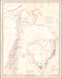
society for the diffusion of useful knowledge (great britain)
old maps of lebanon
maps by joseph hutchins colton
1855 maps
old maps of sicily
old maps of malta
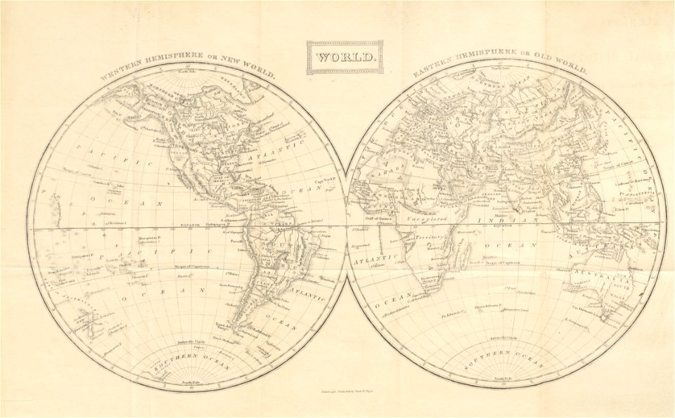
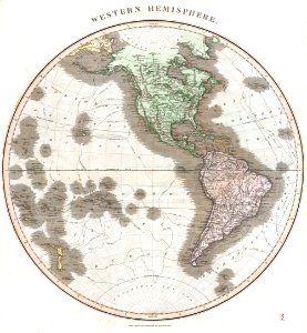
old maps of earth's hemispheres
maps of voyages
vintage
maps
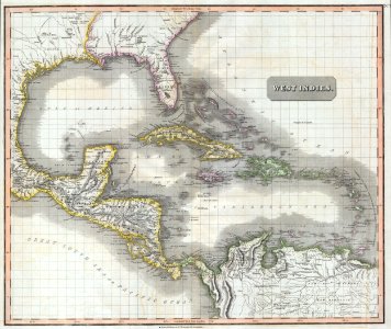
english-language maps
1814 maps
maps
sea
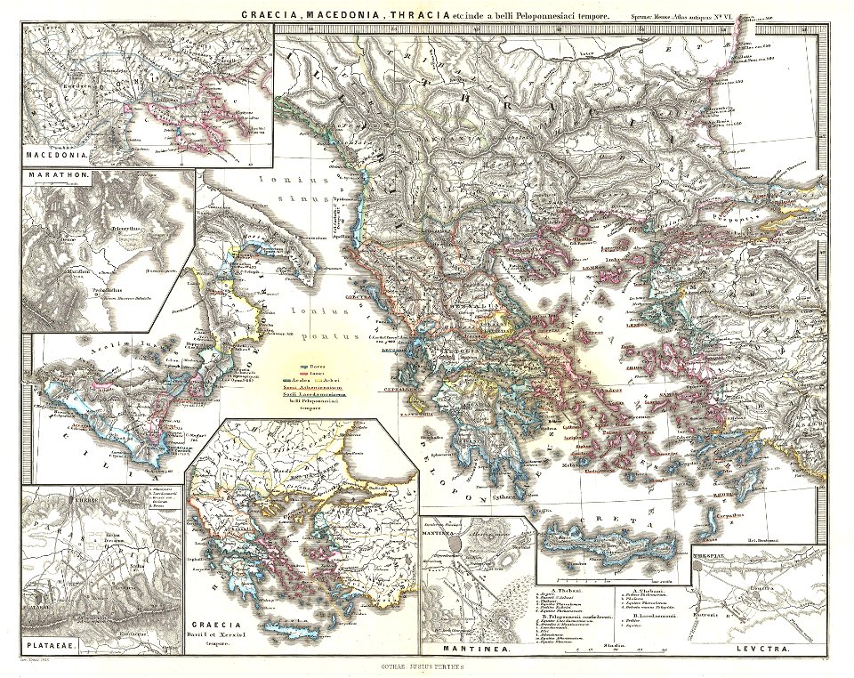
old maps of ancient greece
karl spruner von merz
old maps of the middle east
jr
maps from the mechanical curator collection
old maps of nepal
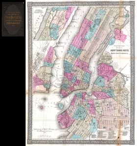
new york city
1867 maps
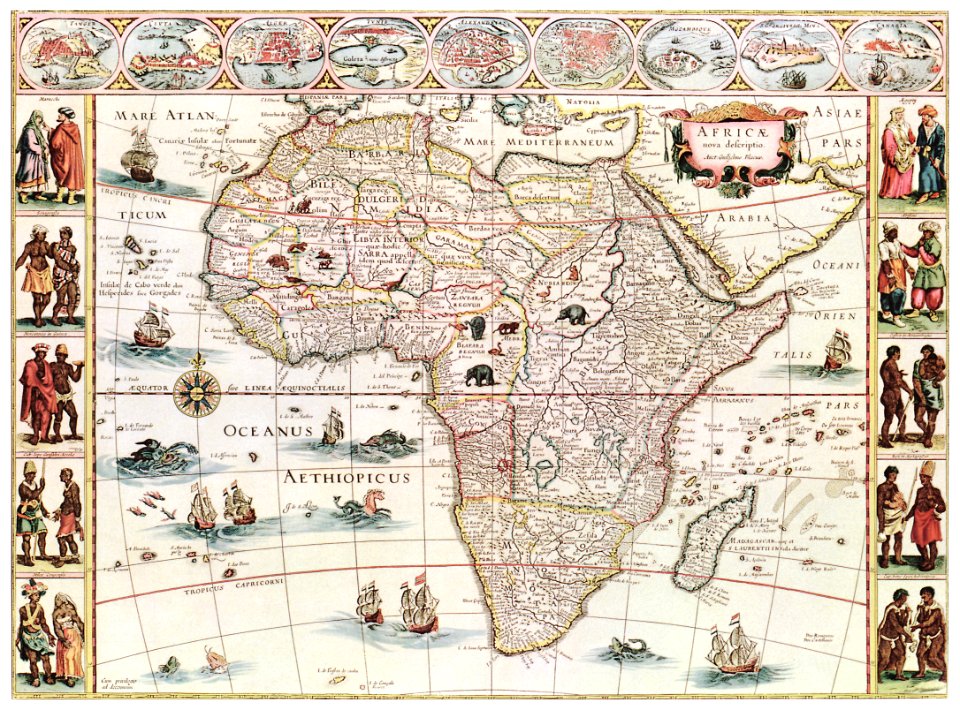
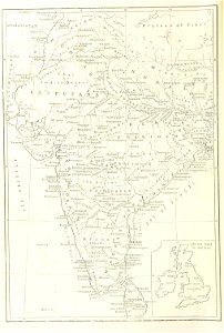
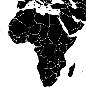
africa
maps
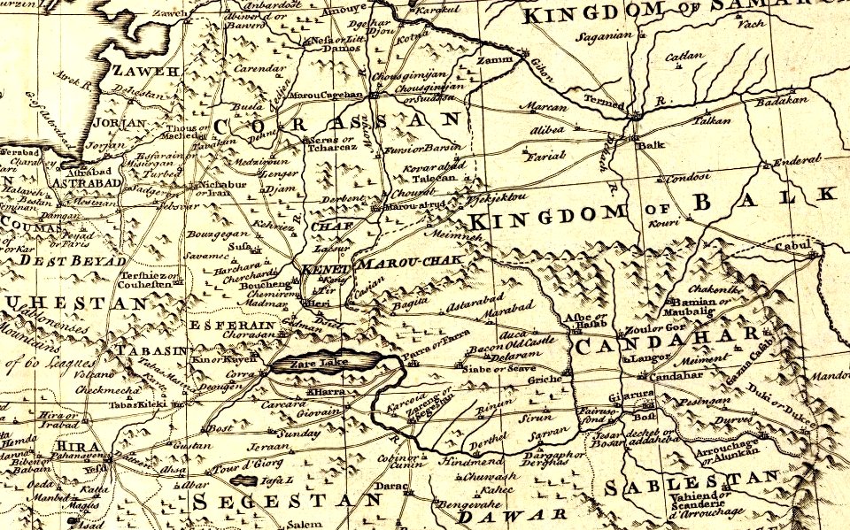
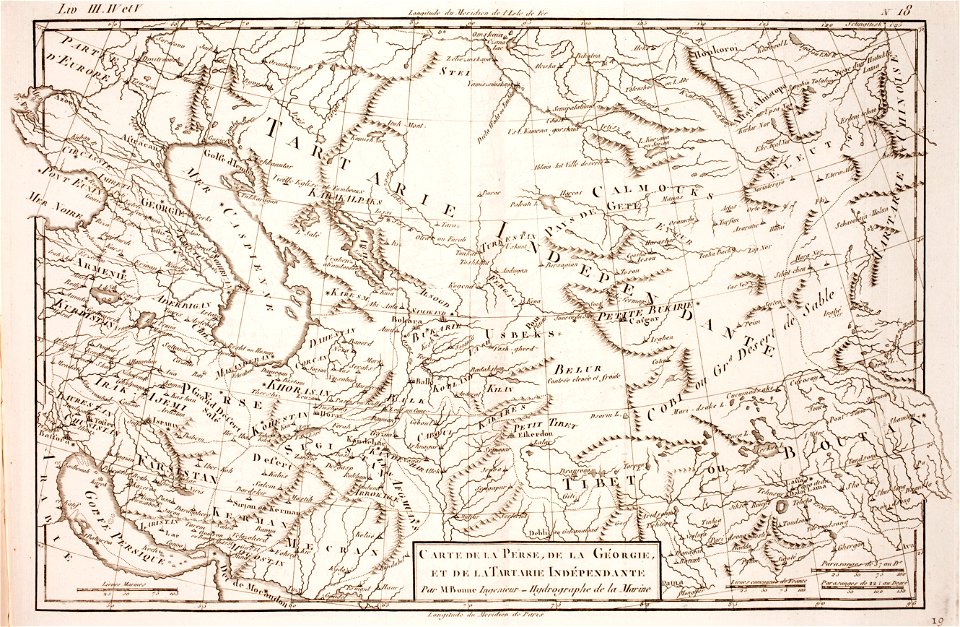
1780 maps of afghanistan
ganges river
1780 maps of afghanistan
tajikistan
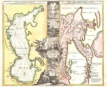
maps by matthäus seutter
latin-language maps
maps in the library of congress
old maps of maine
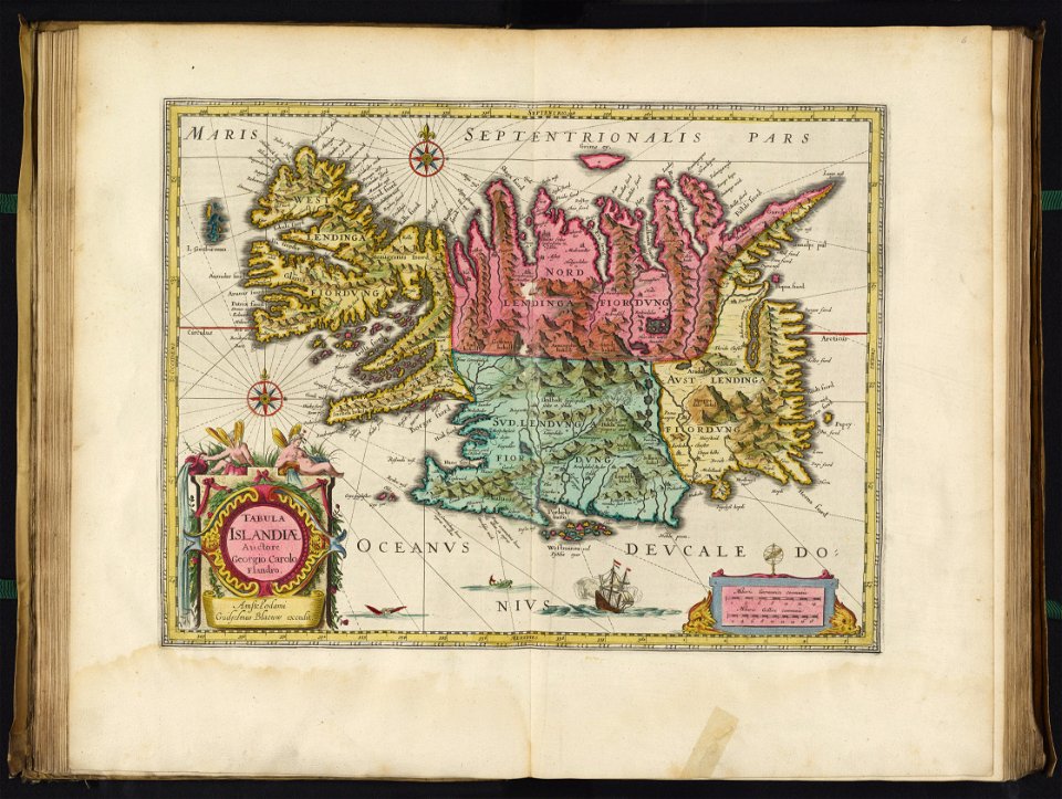
maps with cartouches
joan blaeu
maps in the library of congress
1888 maps
18th-century maps of indonesia
description de l'universe
maps in the library of congress
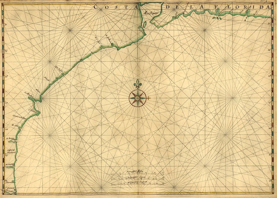
old maps of florida
maps in the library of congress
old maps of florida
maps of the dutch east india company - indonesia
1753 maps
maps in the library of congress
old maps of china
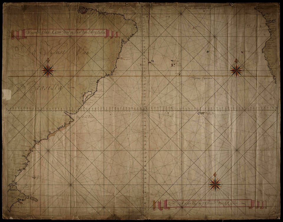
maps of the west-indische compagnie
old maps of dutch brazil
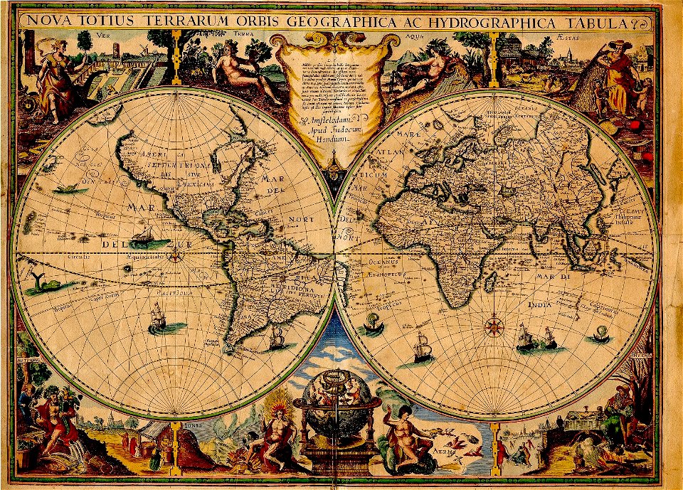
double hemisphere world maps
copper engraving
maps by willem and johannes blaeu
joan blaeu
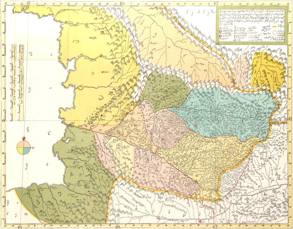
description of kingdom of georgia
its habits and canons
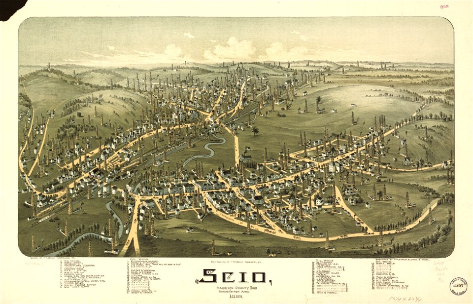
maps in the library of congress
ohio
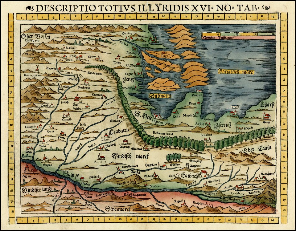
16th-century woodcuts
old maps of croatia
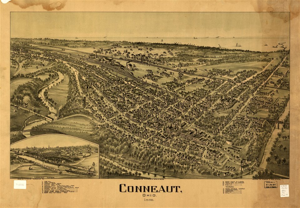
conneaut
ohio
conneaut
ohio
prints from dankaerts historis at the peace palace library
maps by johannes janssonius
17th-century maps of brazil
old maps of pernambuco
latin-language book pages
ptolemaic world maps
vintage
maps
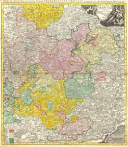
johann baptist homann
maps of franconia
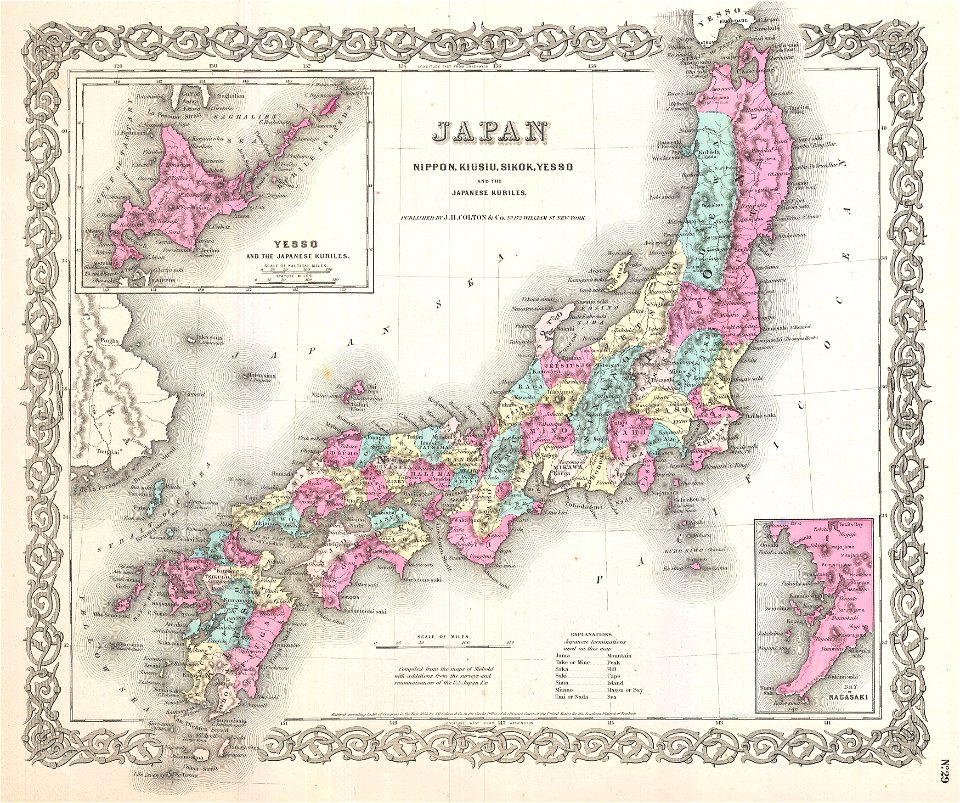
old maps of the sea of japan
1855 maps
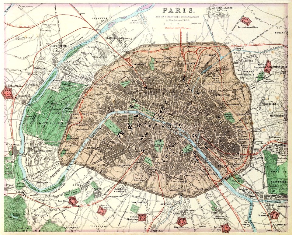
maps of paris from the david rumsey historical map collection
1872 maps
kandahar province
j. and p. knapton
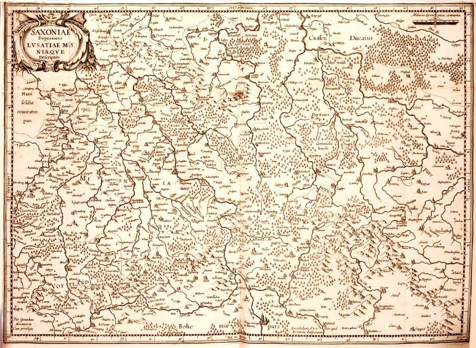
maps of territories in the lower saxony circle
old maps of neuwerk
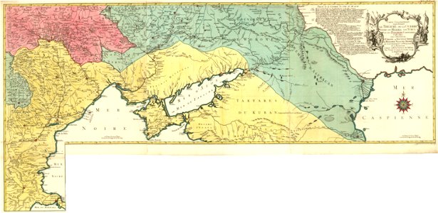
pictorial history of the russian war 1854-5-6 by george dodd
19th-century maps of the caucasus
maps from the mechanical curator collection
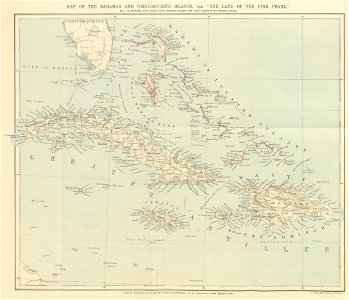
the land of the pink pearl
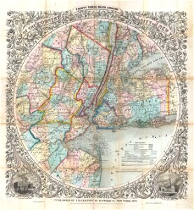
cartography of new york city
english-language maps
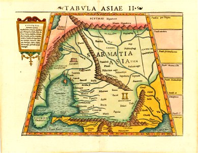
heinrich petri (printer)
maps with cartouches
united states geological survey maps
old maps of new york (state)
united states geological survey maps
old maps of new york (state)
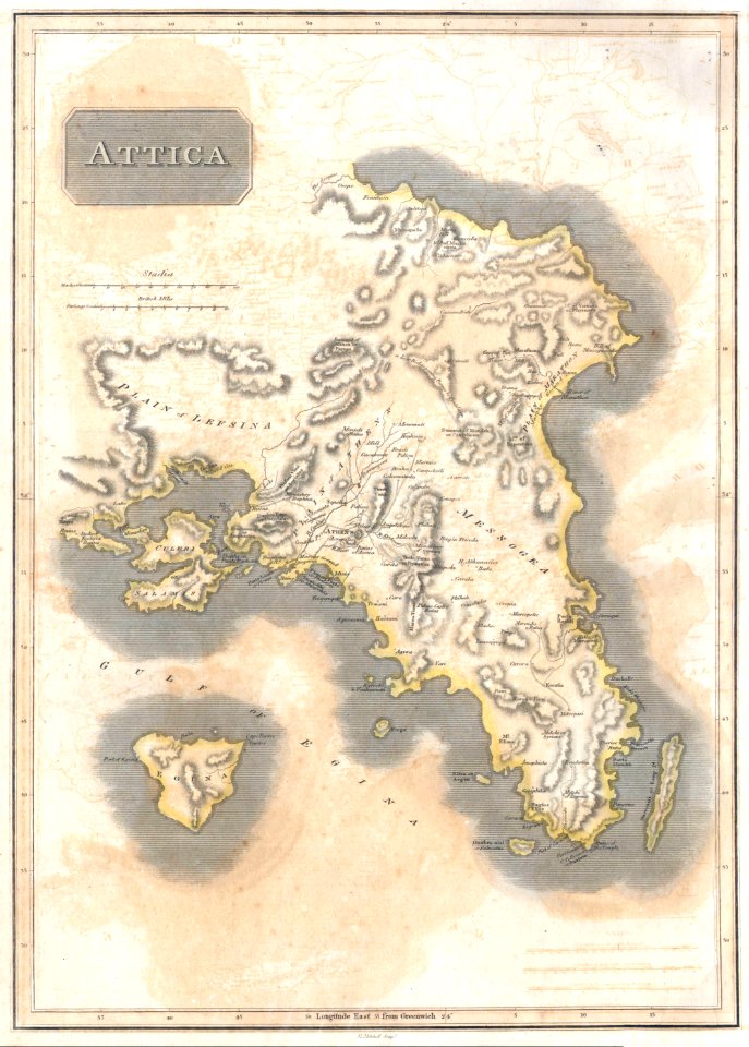
english-language maps
athens
16th century maps of the middle east
1590 maps of israel
3201 - 3300 of 357,549
Next page
/ 3576


![Map of France, Spain, and Portugal; Switzerland in cantons [inset]; Island of Corsica (1863) by Samuel Augustus Mitchell.](https://cdn.creazilla.com/illustrations/1953186/map-of-france-spain-and-portugal-switzerland-in-cantons-inset-island-of-corsica--sm.jpeg)