Log in
All resources
Create a design
Tools
357,630 Free Images of Maps
maps of the west-indische compagnie
charts and maps of the royal museums greenwich
maps in the library of congress
1682 maps
maps made in the 17th century
maps by pieter schenk (i)
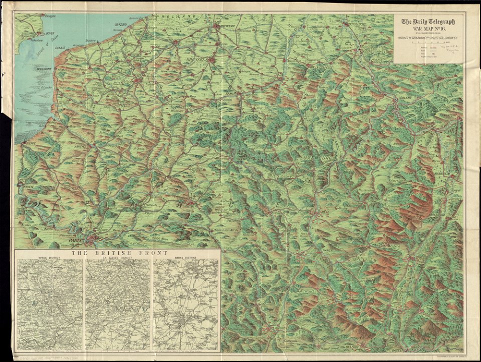
maps of world war i by the daily telegraph
koninklijk nederlands aardrijkskundig genootschap
map collection frederik muller & co
maps from university of amsterdam special collections
atlantis magni tomus primus (biblioteca comunale di trento)
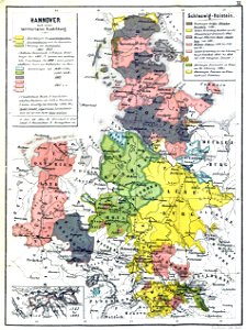
17th-century maps of schleswig-holstein
prints from dankaerts historis at the peace palace library
cornelis danckerts (i)
trịnh lords
1718)
maps made in the 17th century
gerard valck
maps with cartouches
finland
maps with cartouches
copper engraving
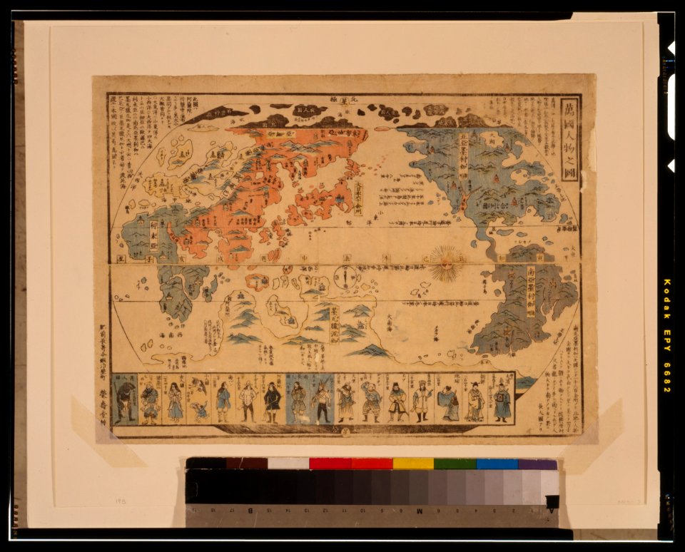
ukiyo-e by unknown artists
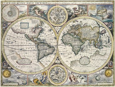
1800s maps of the world
johann baptist homann
latin-language maps
koninklijk nederlands aardrijkskundig genootschap
map collection frederik muller & co
koninklijk nederlands aardrijkskundig genootschap
map collection frederik muller & co
maps in the library of congress
1855 maps
maps in the biblioteca federiciana
old maps of marche
maps made in the 17th century
maps by nicolaes visscher i
hand-drawn maps and views of world war i battlefields by h.m.
old maps of the english channel
french-language maps
pictorial maps
lower manhattan
new york city
old maps of france
old maps of brest
maps
usa
charts and maps of the royal museums greenwich
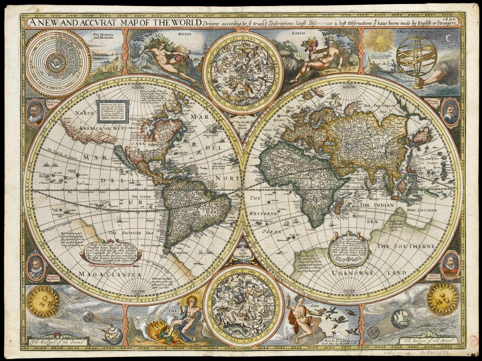
1626 maps
charts and maps of the royal museums greenwich
1626 maps
maps from the mechanical curator collection
1869 maps
maps made in the 18th century
old maps of europe
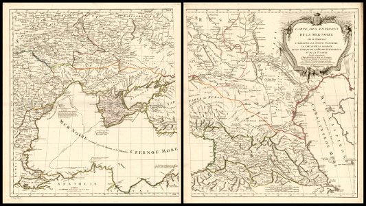
18th-century maps of the black sea
charles françois delamarche
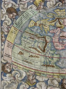
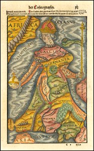
cosmographia (1600) by sebastian münster
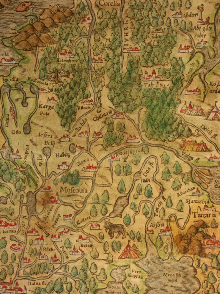
old maps of moscow
illustrations of cosmographia (münster)
old map
description de l'universe
1683 maps of africa
old maps of hérault
alexis donnet
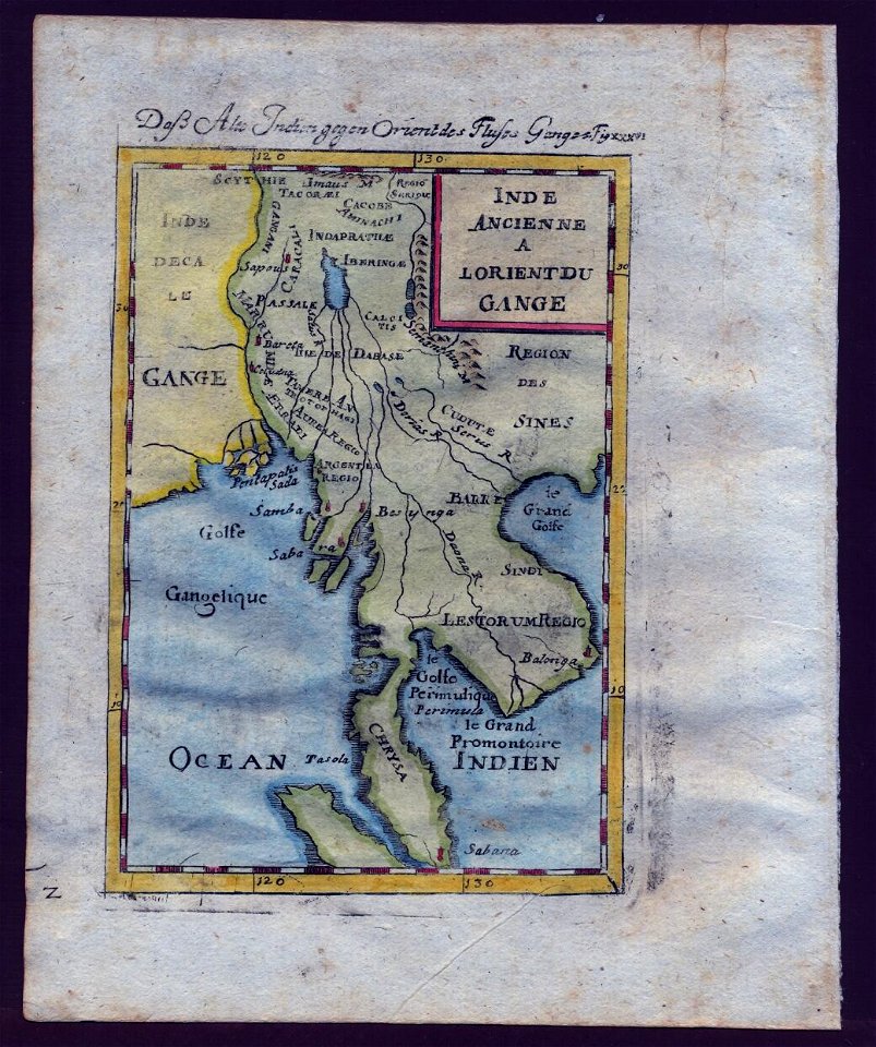
old maps of southeast asia
description de l'universe
illustrations of cosmographia (münster)
old map
cosmographia (1600) by sebastian münster
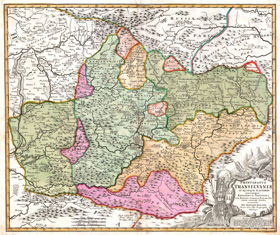
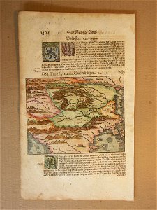
1600 maps of transylvania
maps in london labour and the london poor (1851)
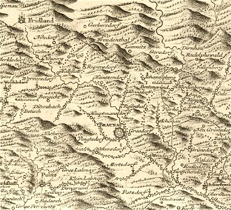
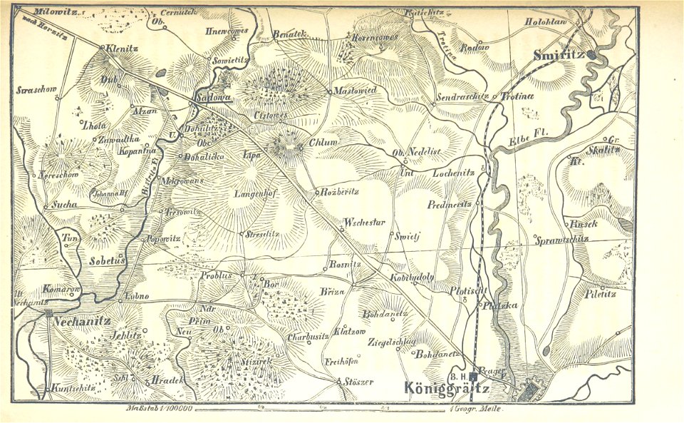
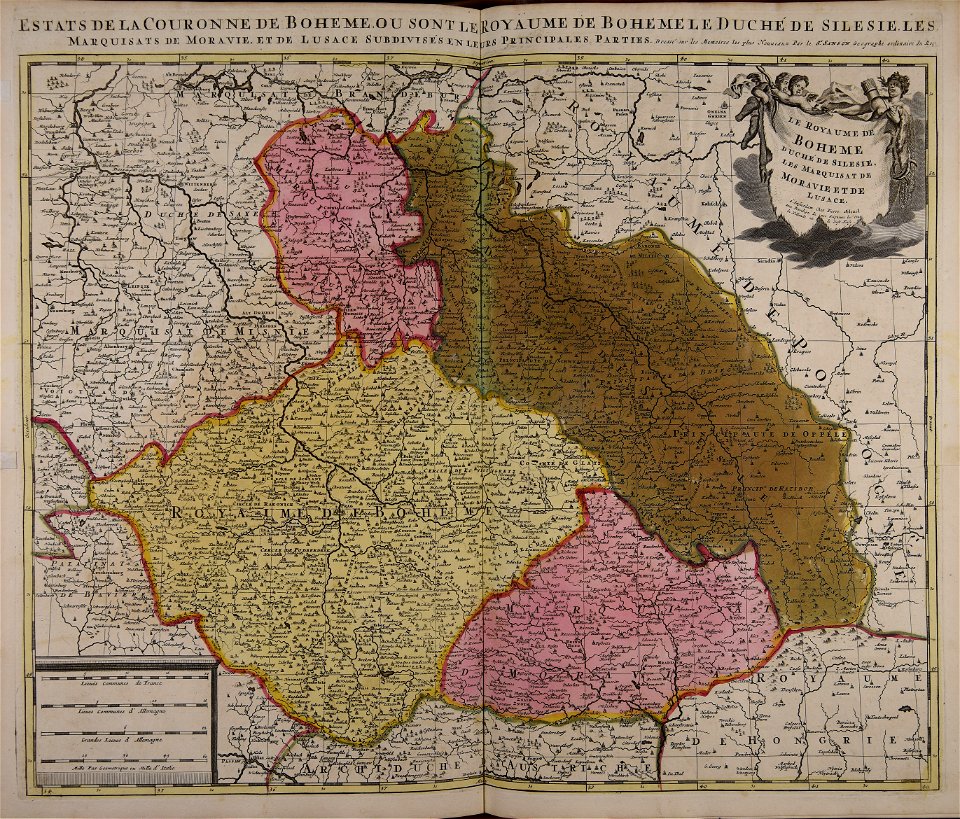
müller's map of bohemia
history of broumov
charts and maps of the royal museums greenwich
1682 maps
map „das herzogthum nassau“ by j.b. fischer
1828
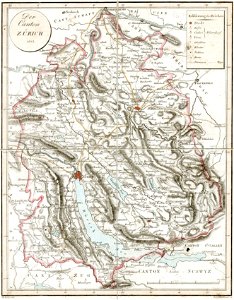
old maps of the canton of zürich
heinrich keller
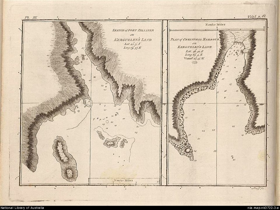
old maps of the kerguelen islands
port-christmas
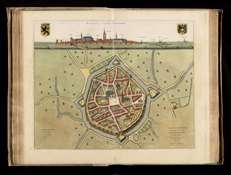
flandria illustrata
veurne
maps in the library of congress
1884 maps of new york (state)
württembergische flurkarte 1:2.500
1858 maps
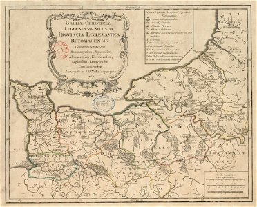
old maps published in the gallia christiana
maps of catholic dioceses of france
cosmographia (1600) by sebastian münster
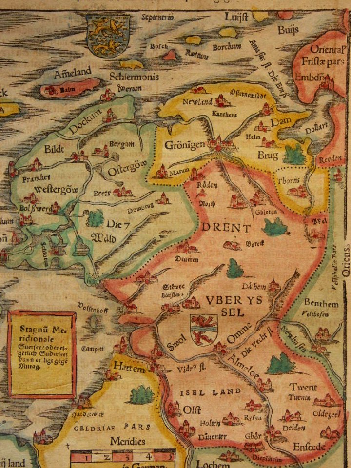
old maps of friesland
map of ghent by jacob van deventer
maps of oudenaarde by jacob van deventer
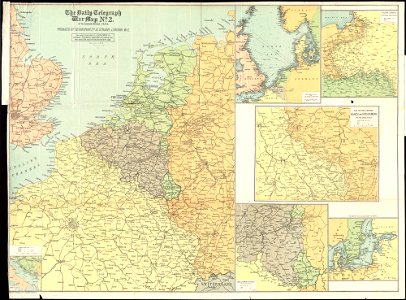
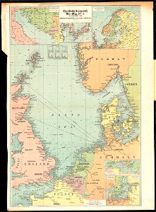
maps of world war i by the daily telegraph
maps of world war i by the daily telegraph
maps of world war i by the daily telegraph
maps of world war i by the daily telegraph
old maps of southeast asia
description de l'universe
maps in the library of congress
1882 maps of ontario
flandria illustrata
old maps of menen
lepsius-projekt - maps
old maps of the nile
old maps of the peloponnese
maps by coronelli
charts and maps of the royal museums greenwich
1682 maps
maps in the library of congress
1890 maps of new york (state)
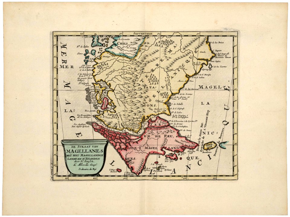
maps of the west-indische compagnie
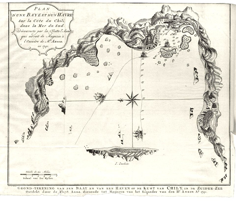
1750
charts and maps of the royal museums greenwich
1682 maps
maps of the west-indische compagnie
1705
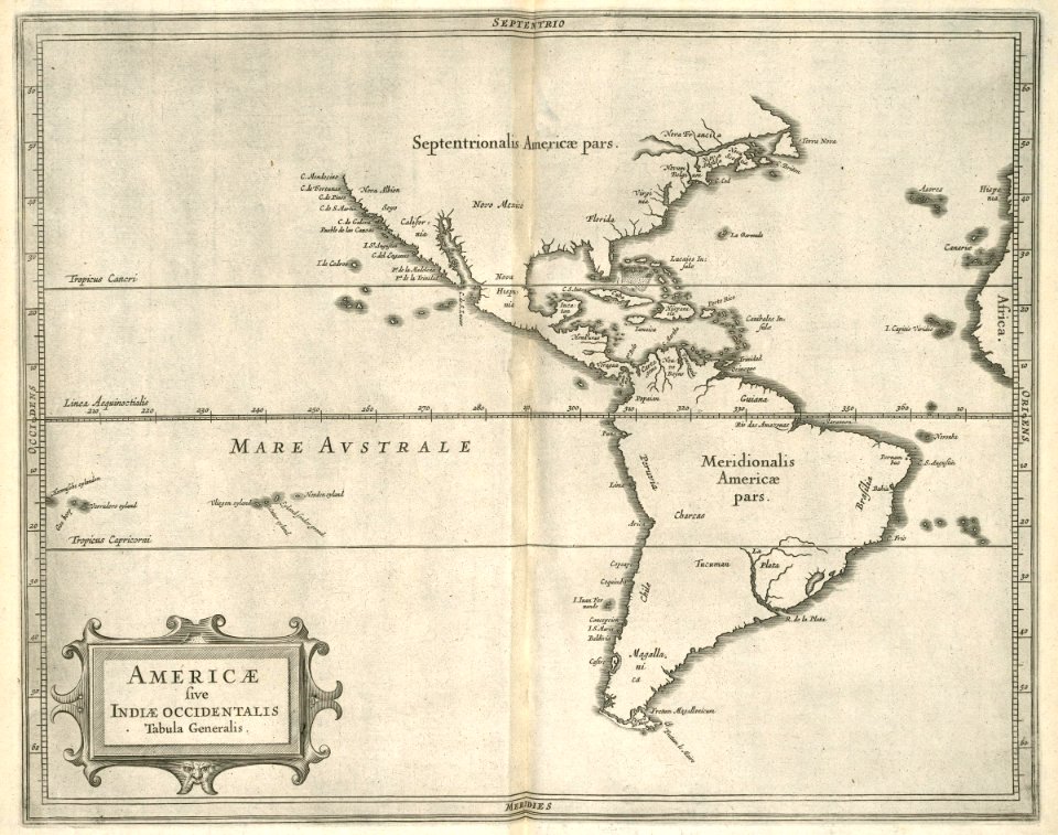
maps of the west-indische compagnie
1630
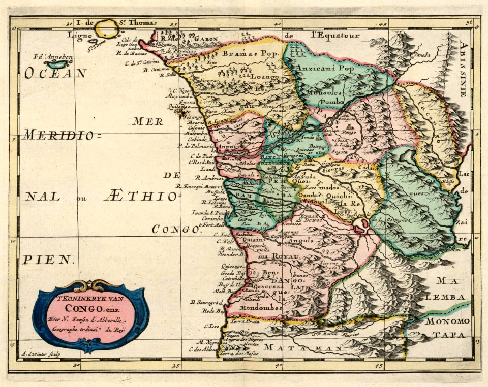
maps of the west-indische compagnie
1705
maps of the west-indische compagnie
1668
maps of the west-indische compagnie
1665
old maps of the dutch east india company
1730s
maps of the west-indische compagnie
1647
maps of the west-indische compagnie
1647
maps of the west-indische compagnie
1716
maps of the west-indische compagnie
1646
maps of the west-indische compagnie
maps of the west-indische compagnie
1747)
maps of the west-indische compagnie
1662
maps of the west-indische compagnie
1647
maps of the west-indische compagnie
1747)
maps of the west-indische compagnie
1681
maps of the west-indische compagnie
1773
old maps of the dutch east india company
1622
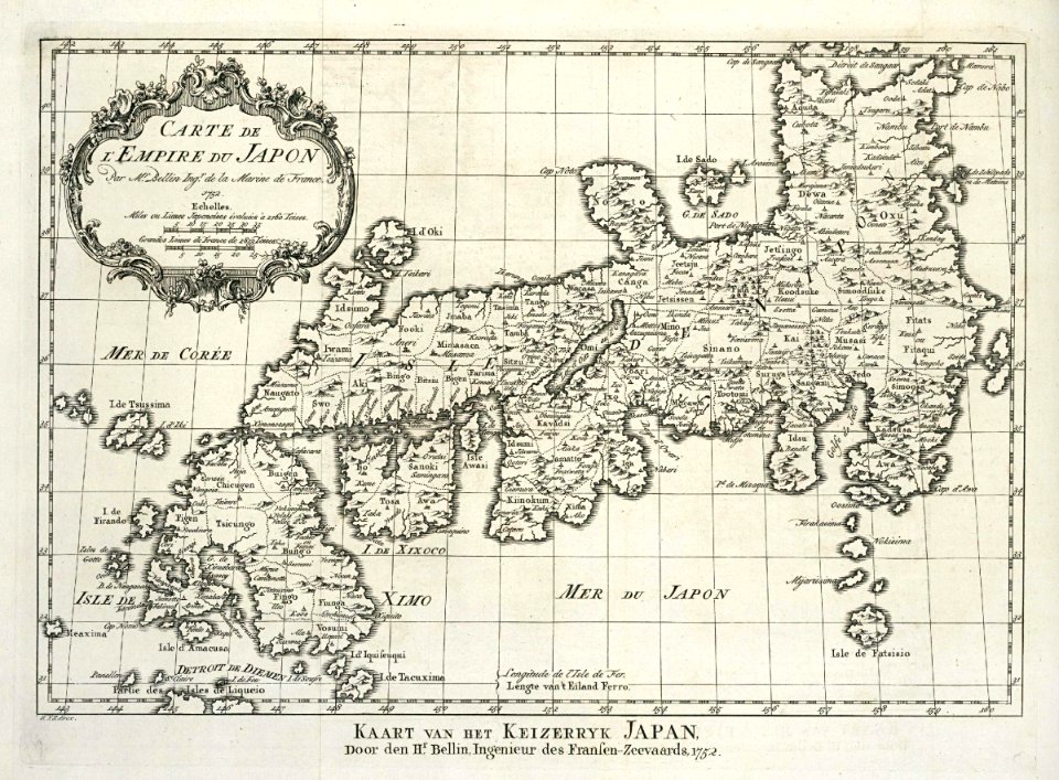
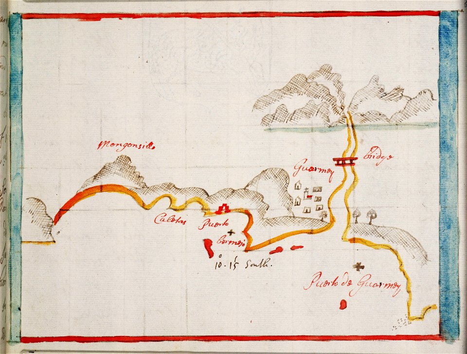
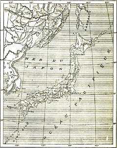
maps of the dutch east india company - japan
1756
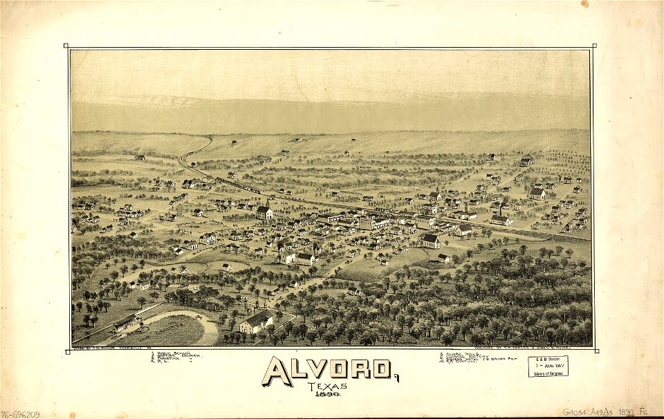
alvord
texas
old maps of the dutch east india company
1662
maps of the dutch east india company - madagascar
1662
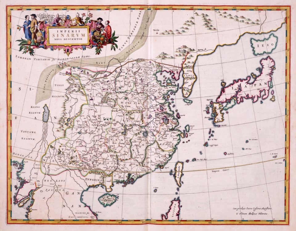
maps of the dutch east india company - china
1655)
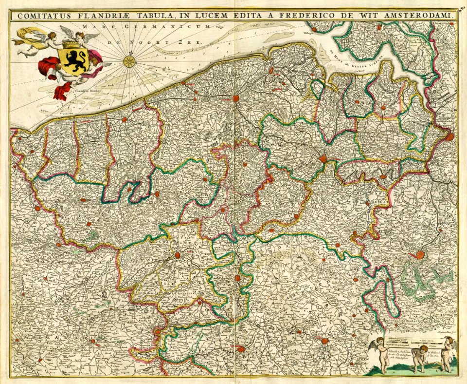
maps by frederick de wit
1680s maps of belgium
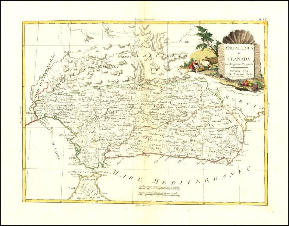
maps by antonio zatta
old maps of andalusia
maps in the library of congress
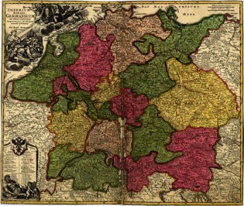
18th-century maps of germany
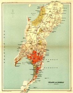
presidencies and provinces of british india
old maps of mumbai
charts and maps of the royal museums greenwich
1682 maps
provided by landsbókasafn íslands
maps made in the 16th century
maps by willem and johannes blaeu
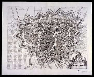
old maps of groningen (city)
cicero and the fall of the roman republic
maps of battles
charts and maps of the royal museums greenwich
1682 maps
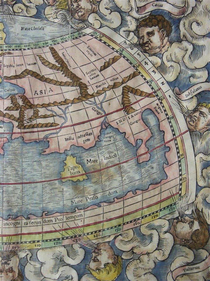
maps by sebastian münster
1570s maps of europe
french-language maps
old maps of japan
charts and maps of the royal museums greenwich
1626 maps
maps
sign
maps from the mechanical curator collection
000
decorative map
german bible
maps made in the 17th century
maps by nicolas sanson
maps made in the 17th century
gerard valck
maps
man
temperance movement
jr
koninklijk nederlands aardrijkskundig genootschap
map collection frederik muller & co
old maps of scandinavia
johannes ratelband
6901 - 7000 of 357,630
Next page
/ 3577