Log in
All resources
Create a design
Tools
357,638 Free Images of Maps
maps in the library of congress
fonds ancely - bibliothèque municipale de toulouse - maps
victor levasseur - maps of france
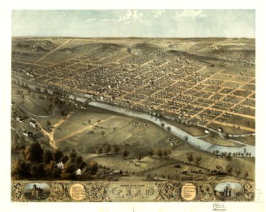
albert ruger
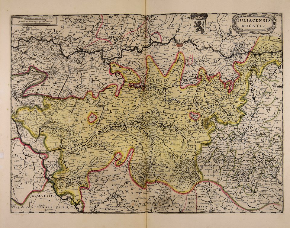
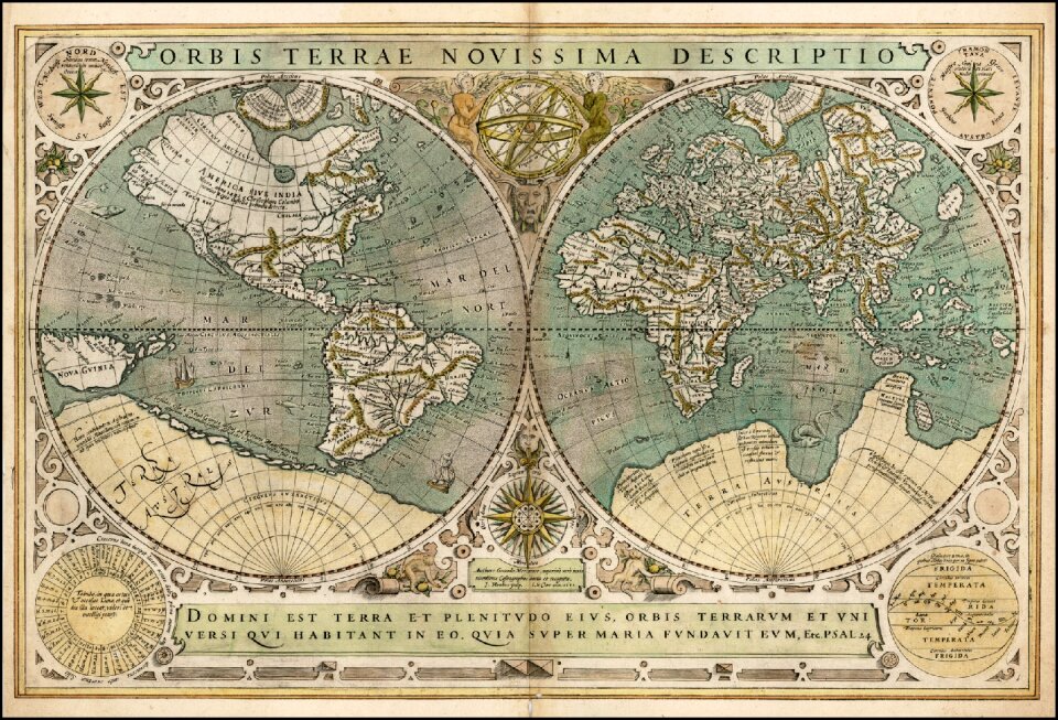
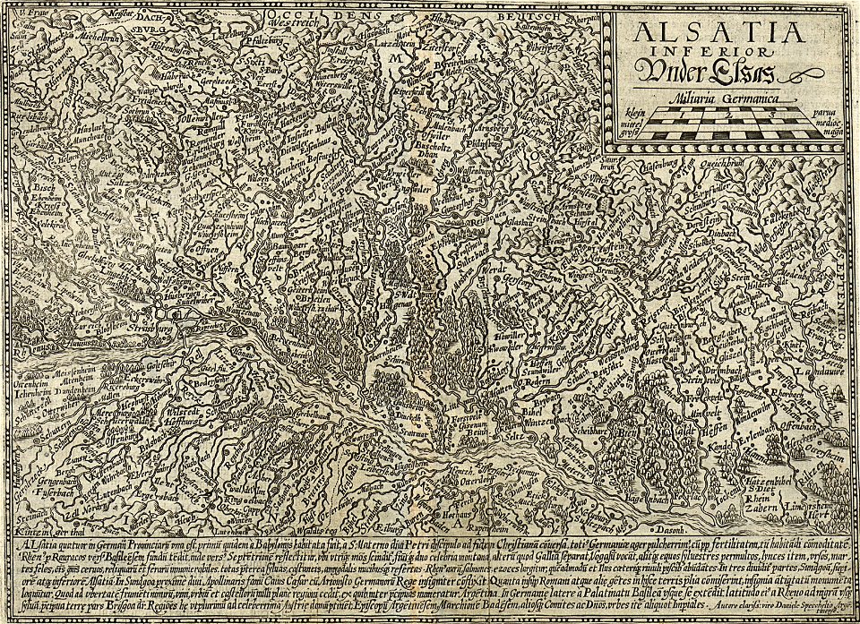
maps made in the 17th century
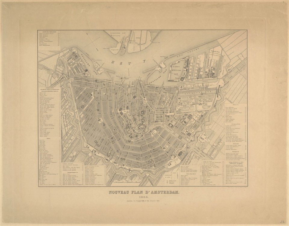
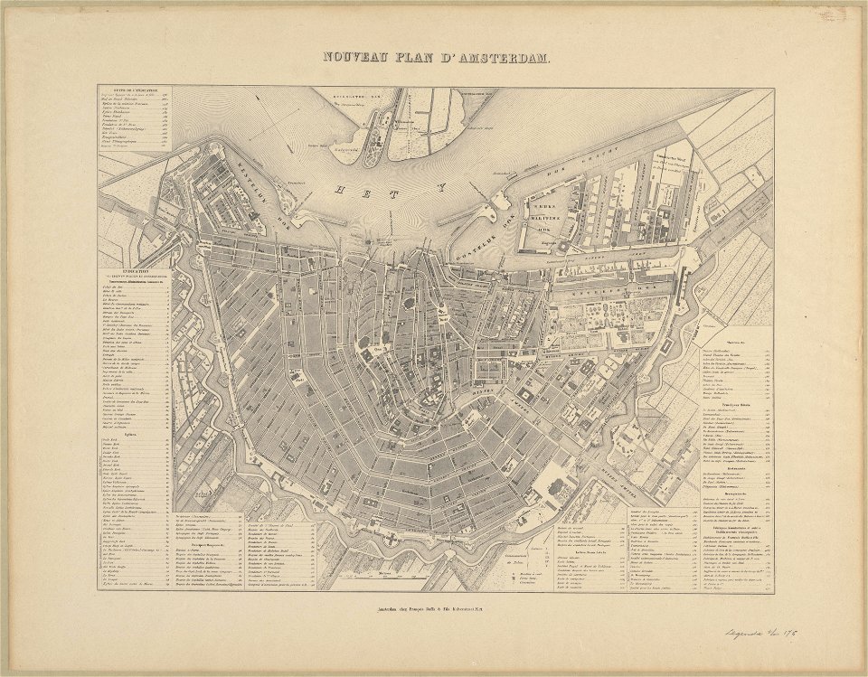
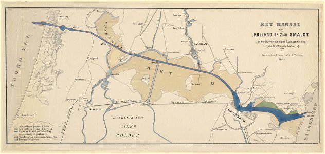
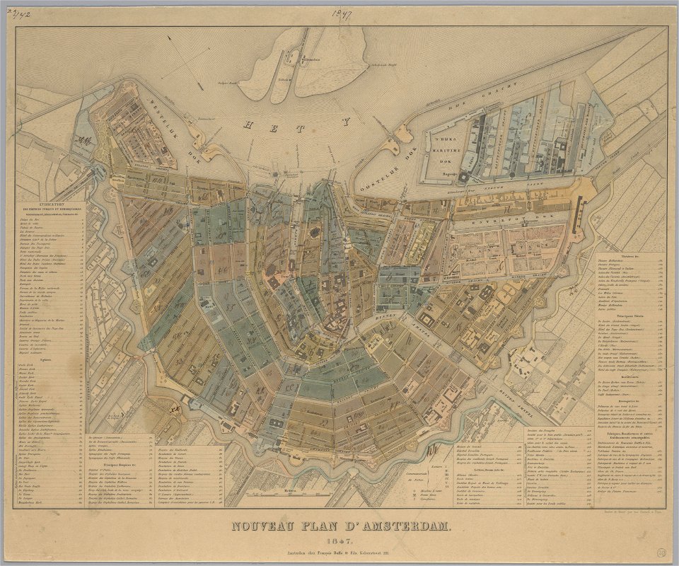
maps in the stadsarchief amsterdam
old maps of amsterdam
published by frans buffa & zonen
frédéric-auguste laguillermie
atlantis magni tomus tertius (biblioteca comunale di trento)
harvard university
map of manhattan
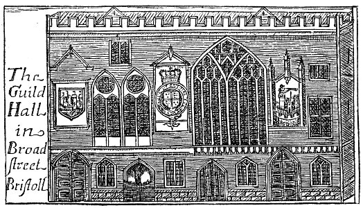
images from bristol past and present (1882)
bristol old city
atlantis magni tomus tertius (biblioteca comunale di trento)
maps made in the 17th century
kyoto university library – derivative files
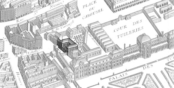
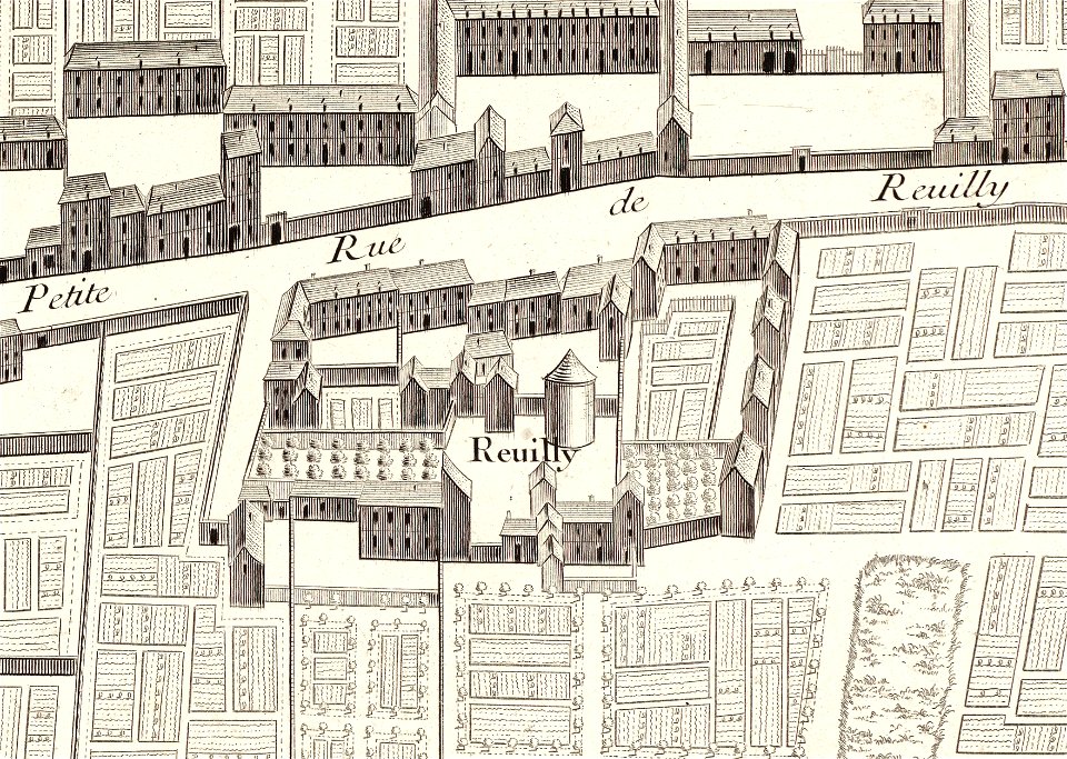
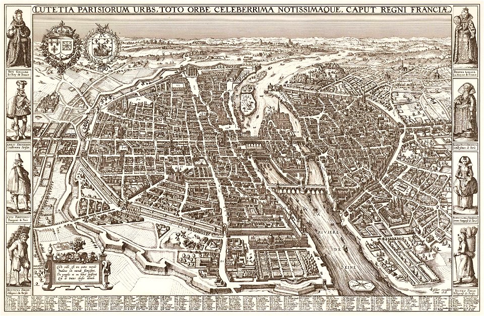
turgot map of paris
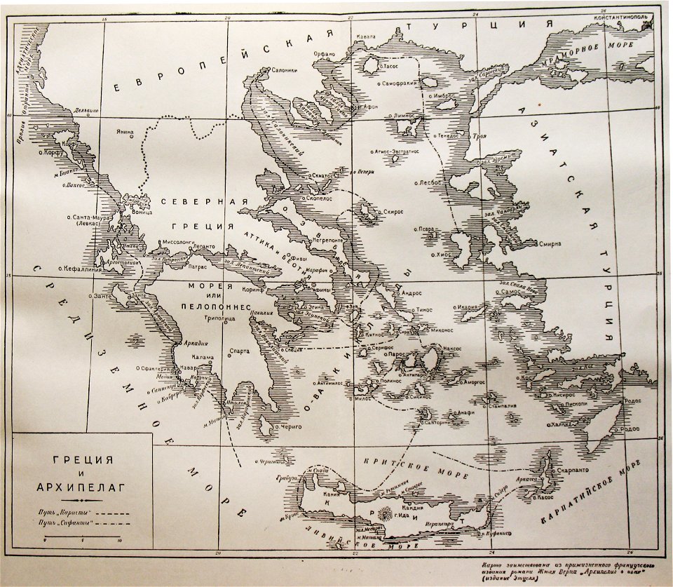
old maps of greece
giovanni camocio
indiana
peru
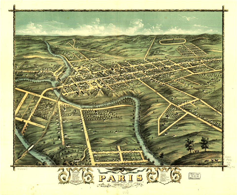
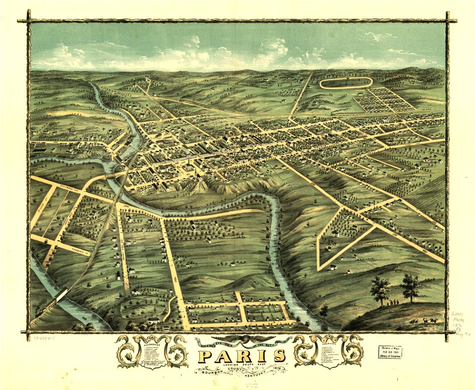
kentucky
paris
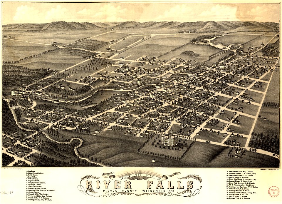
river falls
wisconsin
maps in the library of congress
albert ruger
charts and maps of the royal museums greenwich
1766 maps
maps
blue
background
maps
maps
girl
brown
maps
background
maps
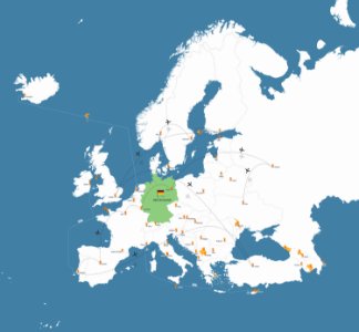
germany
maps
background
maps
christmas
maps
collections de la bibliothèque nationale et universitaire de strasbourg
matthias quad
bibliothèque municipale de reims
rès. g 152
maps in the stadsarchief amsterdam
old maps of amsterdam
maps in the stadsarchief amsterdam
old maps of amsterdam
old maps of japan
old maps of korea
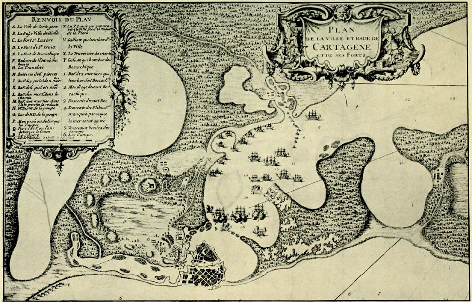
old maps of cartagena
colombia
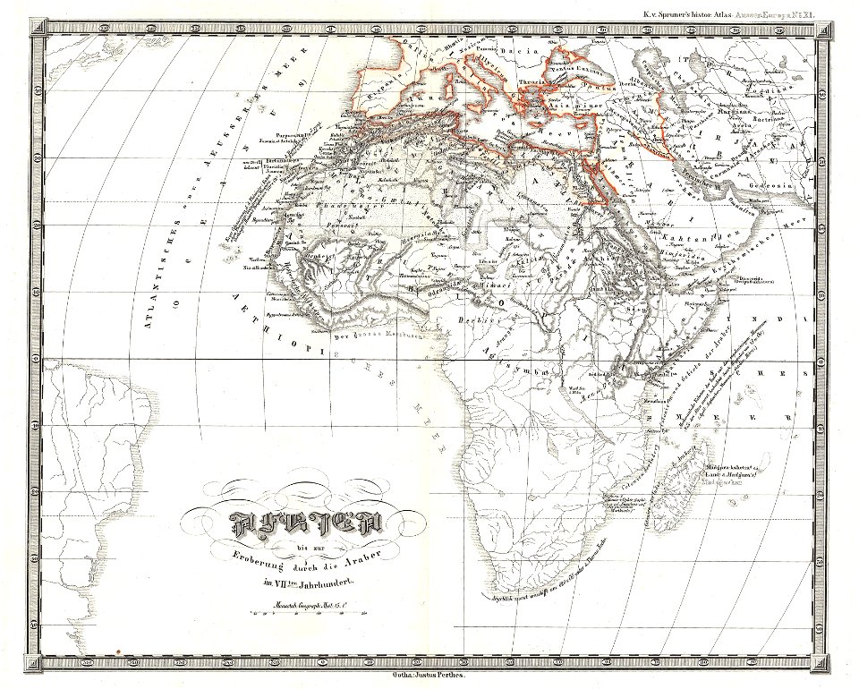
karl spruner von merz
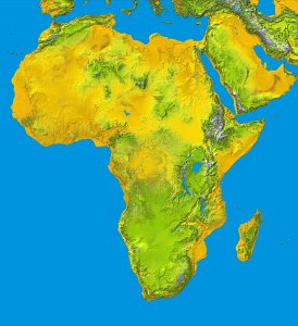
1855 maps of africa
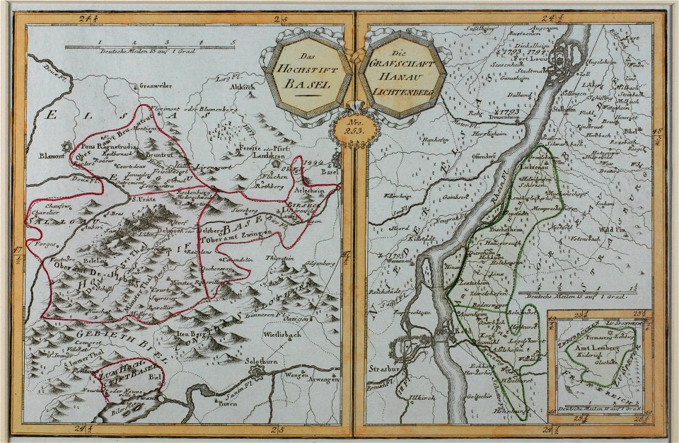
old maps of baden-württemberg
1552
charte von schwaben (bohnenberger)
maps of landkreis sigmaringen
charte von schwaben (bohnenberger)
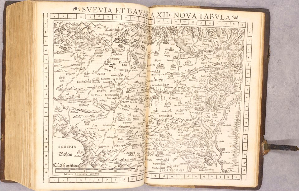
19th-century maps of bavaria
old maps of venice
johannes ratelband
david rumsey historical map collection – derivative files
turgot map of paris
historical images of solothurn
old maps of switzerland
description de l'universe
alain manesson-mallet
description de l'universe
alain manesson-mallet
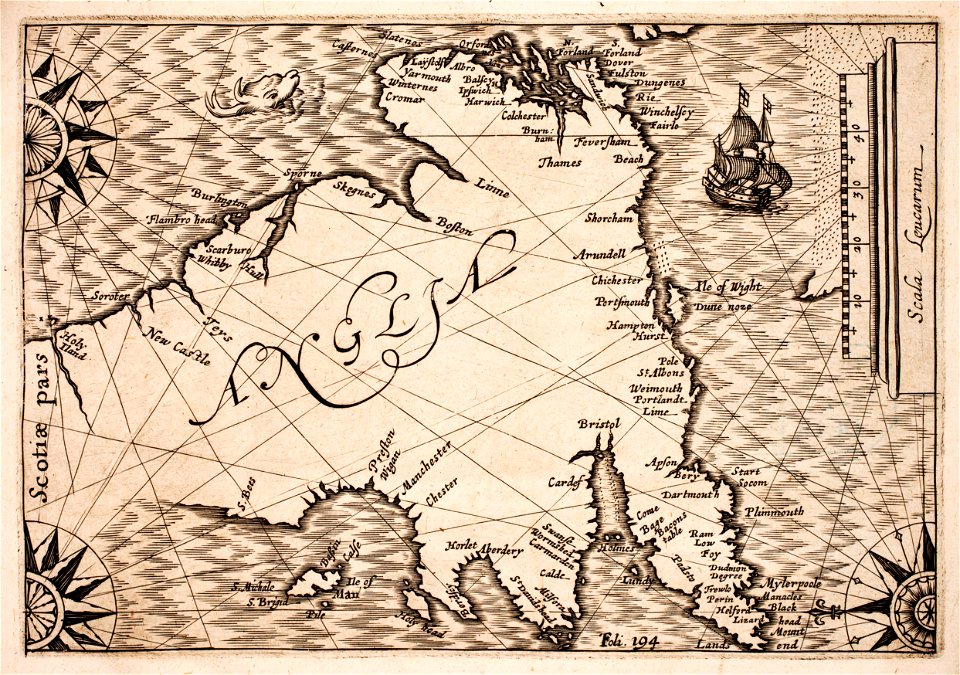
prints from selden mare clausum at the peace palace library
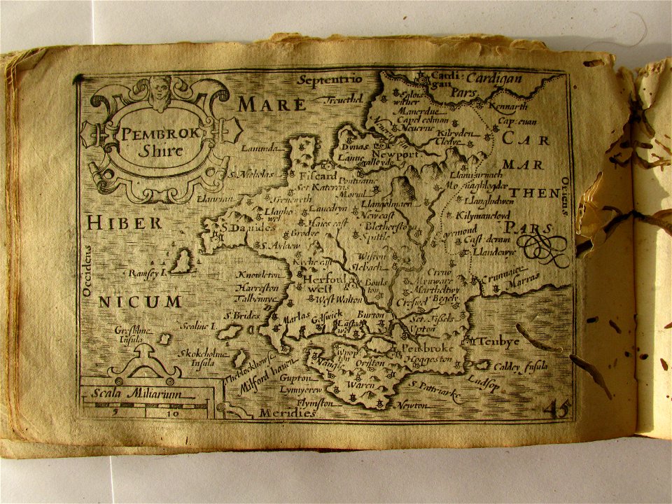
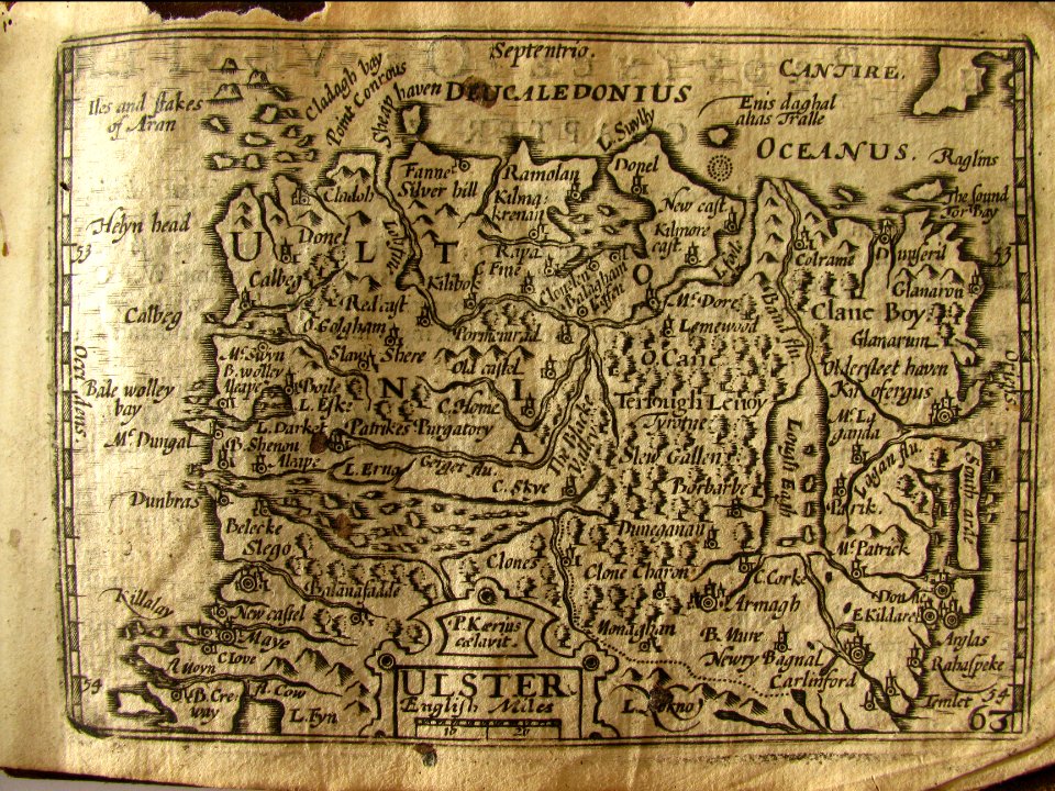
1636 maps of england
maps made in the 17th century
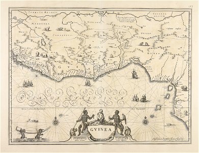
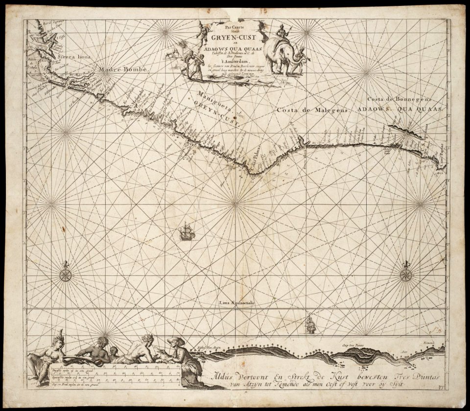
old maps of guinea
media in the houghton library
harvard university
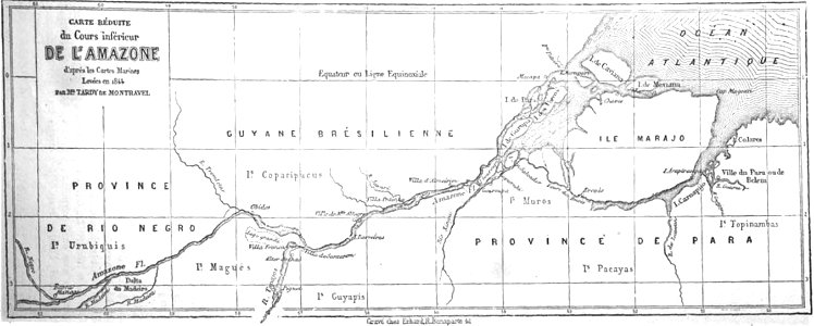
19th-century maps of brazil
map of brazil
map of paris by claes jansz. visscher
bird's eye view maps of paris
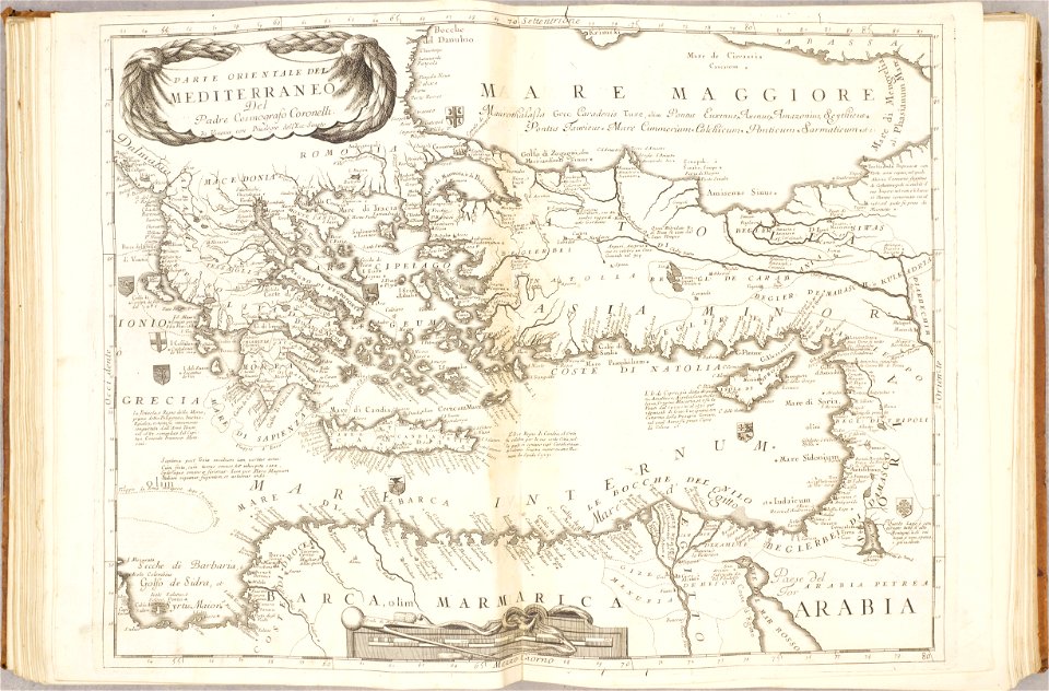
old maps of mediterranean sea
levantine sea
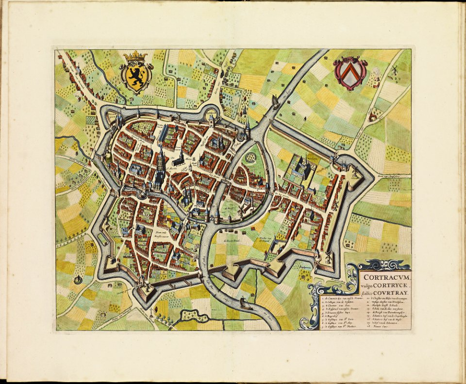
old maps of kortrijk
atlas de wit 1698
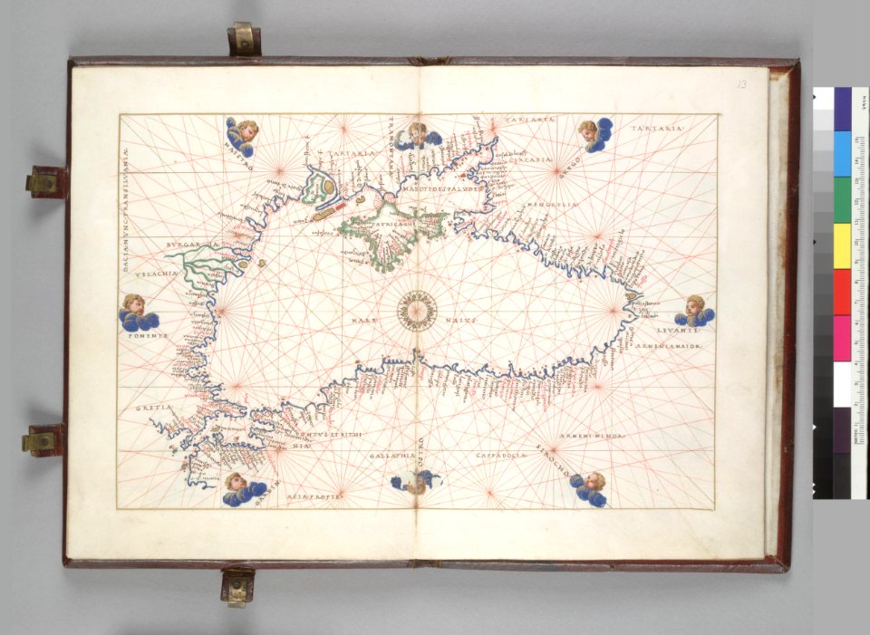
16th-century maps of the black sea
battista agnese
miniature speed atlas (1627) pieter van den keere
pieter van der keere
miniature speed atlas (1627) pieter van den keere
pieter van der keere
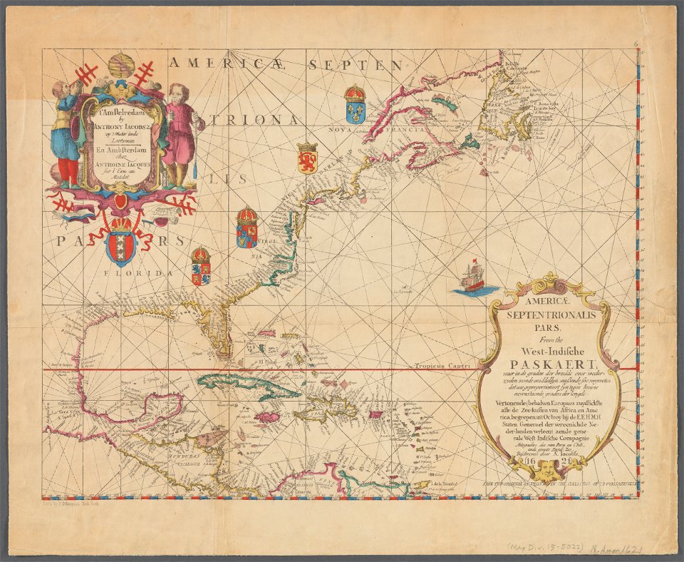
maps of the west-indische compagnie
1732
kentucky
paris
river falls
wisconsin
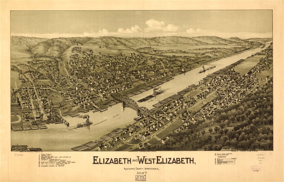
pennsylvania
elizabeth
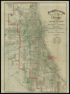
chicago and the midwest
newberry library
maps by pieter pourbus
1570s maps
ms. ludwig xv 4 (getty museum) - bird book of hugo fouilloy
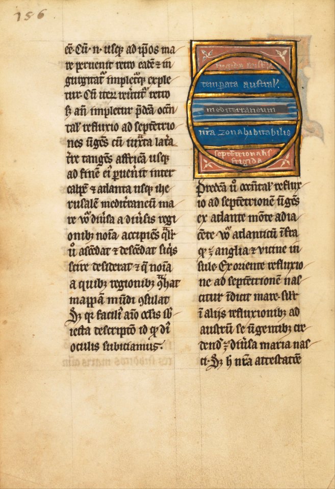
13th-century maps of the world
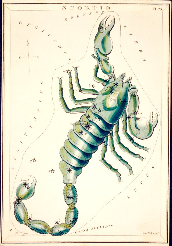
astronomy
maps
flag maps of prefectures of japan
self-published work
flag maps of prefectures of japan
self-published work
maps
usa
nature
maps
islands
maps
maps from the mechanical curator collection available to georeference
maps from the mechanical curator collection
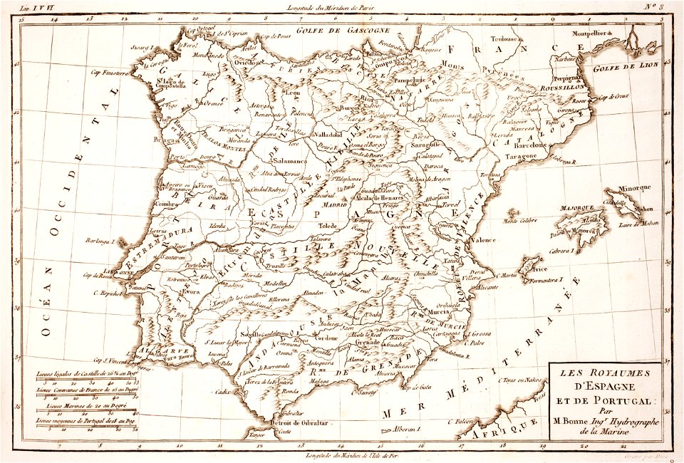
1780s maps of portugal
1780s maps of spain
maps by willem and johannes blaeu
maps made in the 17th century
fonds ancely - bibliothèque municipale de toulouse - maps
frédéric-auguste laguillermie
coats of arms of rhône
louis gabriel suchet
fonds ancely - bibliothèque municipale de toulouse - maps
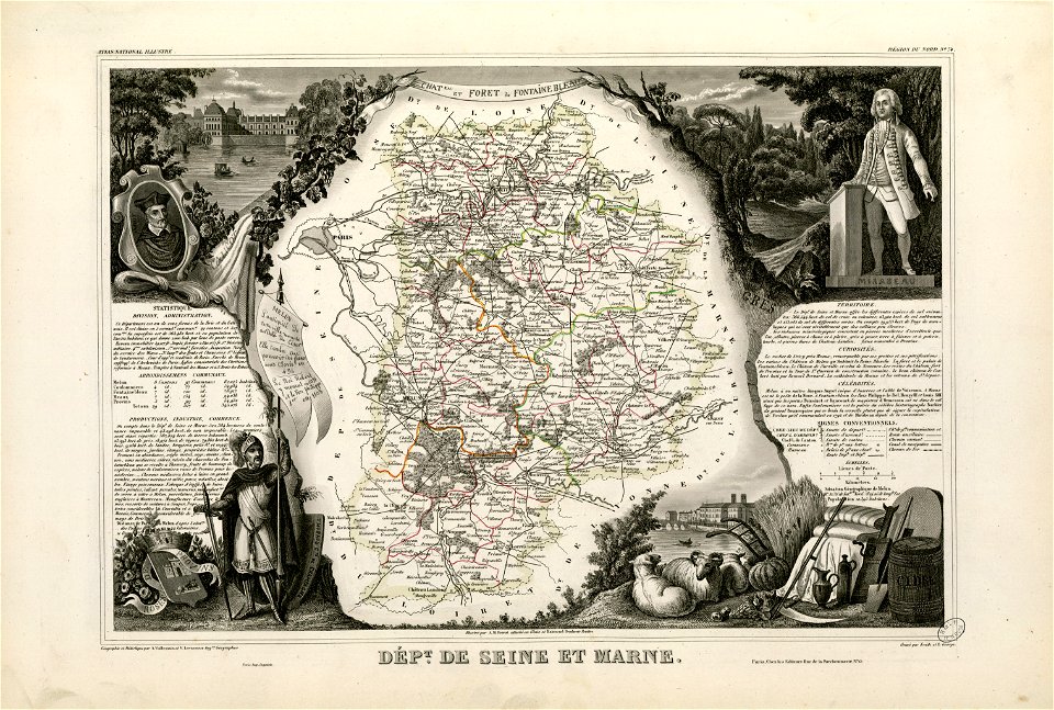
victor levasseur - maps of france
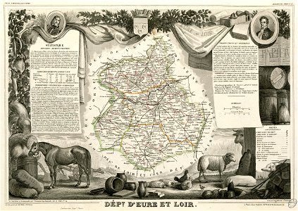
old maps of seine-et-marne
honoré mirabeau
old maps of north america from the norman b. leventhal map center
1755 maps of the united states
portraits of jean racine
history of soissons
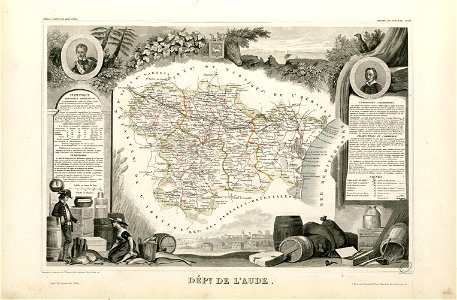
coats of arms of cities in aude
coats of arms of aude
françois-antoine de boissy d'anglas
frédéric-auguste laguillermie
coats of arms of cities in hautes-pyrénées
bertrand barère de vieuzac
18th-century maps of brazil
1780 in south america
maps from the mechanical curator collection
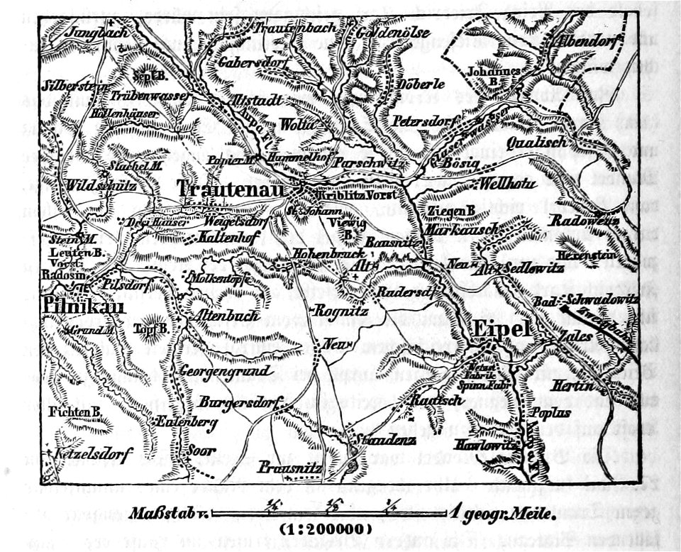
battle of trautenau
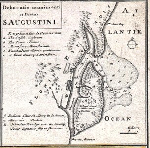
florida
1730s
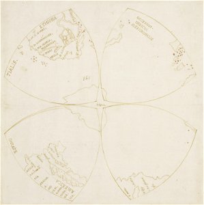
map of the northern hemisphere in four segments (rcin 991393)
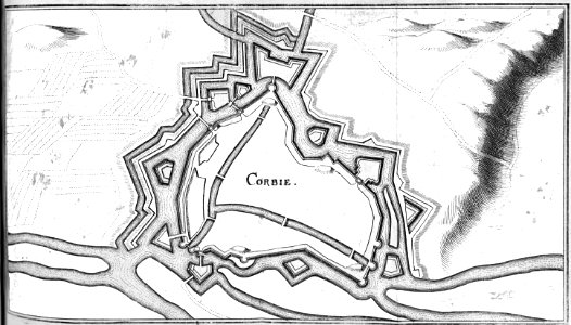
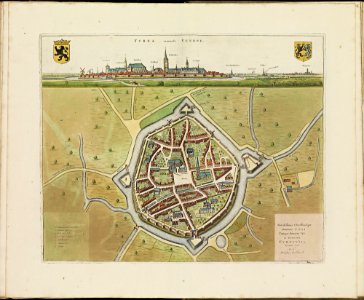
maps of veurne city walls
atlas de wit 1698
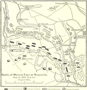
battle of mars-la-tour
1895 drawings
rennes in the 1880s
1889 maps
maps of the west-indische compagnie
johannes van keulen
maps in the stadsarchief amsterdam
old maps of amsterdam
maps in the stadsarchief amsterdam
old maps of amsterdam
maps in the stadsarchief amsterdam
old maps of amsterdam
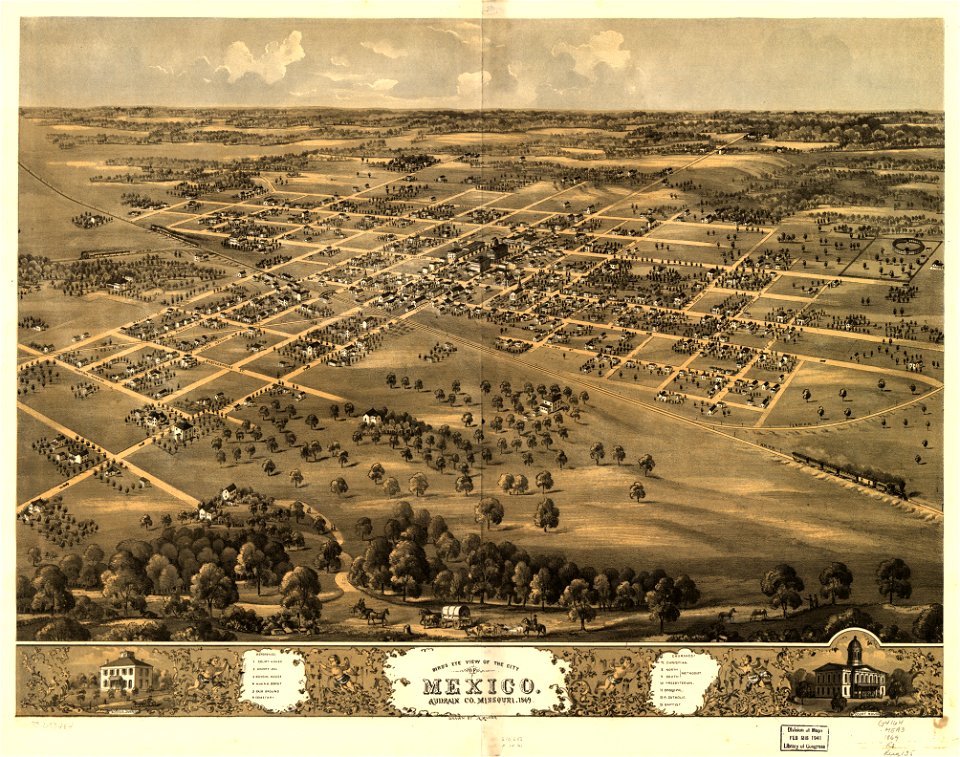
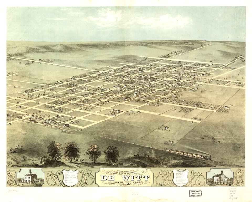
missouri
mexico
indiana
peru
maps in the library of congress
albert ruger
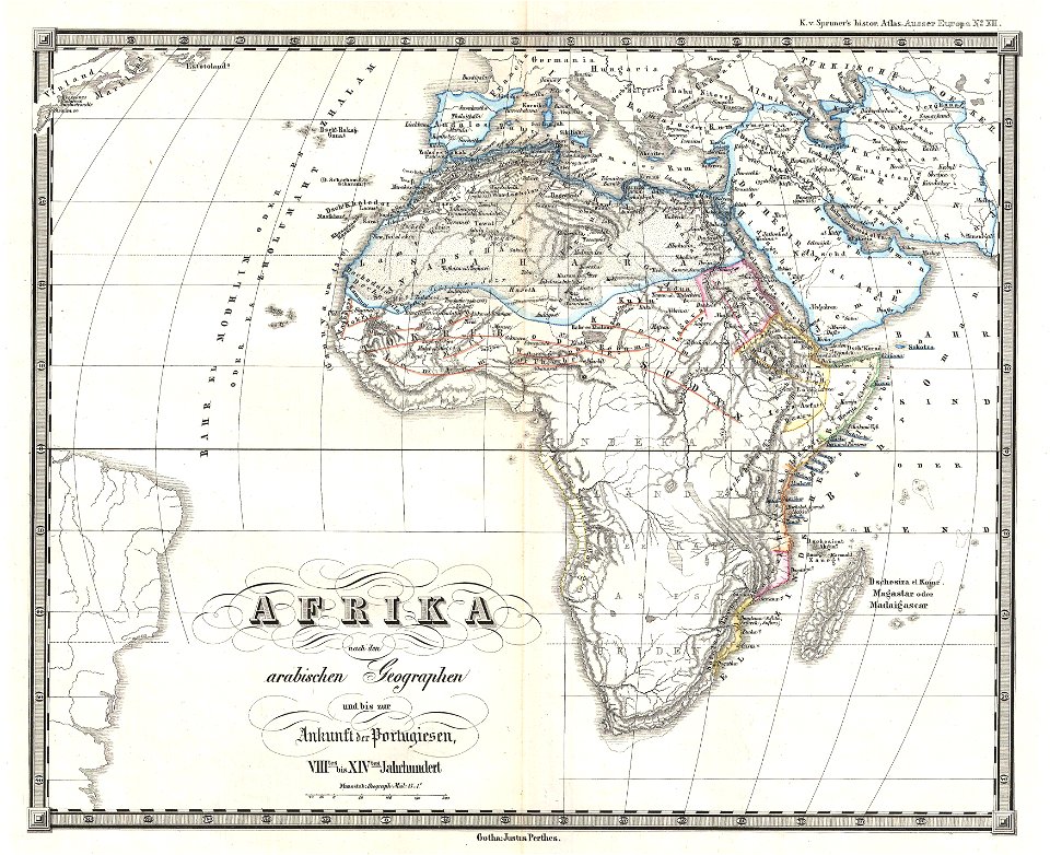
karl spruner von merz
1855 maps of africa
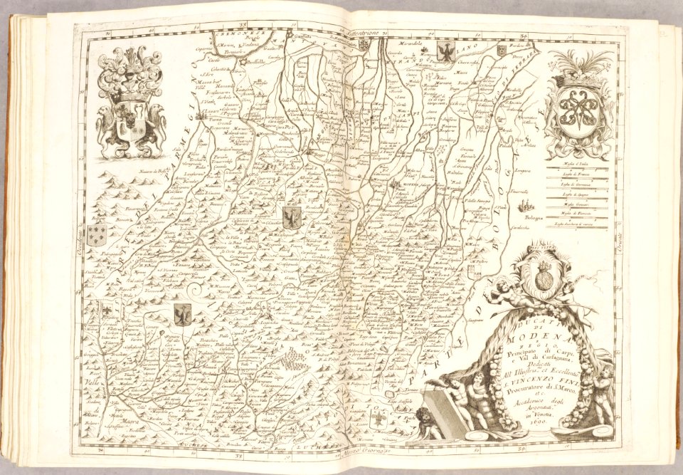
maps of duchy of modena and reggio
modena
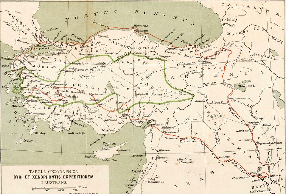
ten thousand campaign
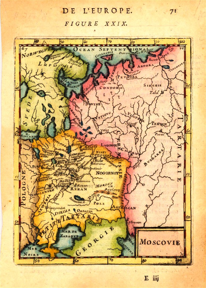
old maps of turkey
russian-language maps
old maps of greece
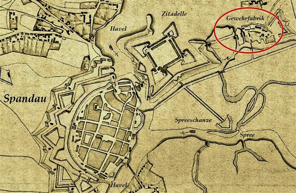
historical documents of the spandau citadel
festung spandau
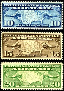
aircraft on stamps of the united states
airmail stamps of the united states
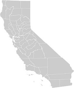
bancroft library collections
california
engravings in the rijksmuseum amsterdam
old maps of venice
atlantis magni tomus tertius (biblioteca comunale di trento)
maps made in the 17th century
maps in london labour and the london poor (1851)
atlantis magni tomus tertius (biblioteca comunale di trento)
maps made in the 17th century
old maps of papua new guinea
maps by alexandre vuillemin
images from the new york public library
francis d'avignon
georg marggraf
elmina
travel
maps
coats of arms of switzerland
coats of arms of italy
europe
world
africa
maps
9001 - 9100 of 357,638
Next page
/ 3577