Log in
All resources
Create a design
38 Free Artworks of Huron
curt teich postcard archives, detroit publishing company
the last of the mohicans
oil on canvas
paul kane
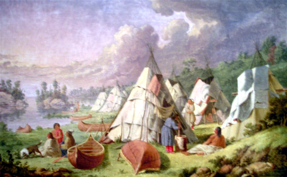
ojibwa dwellings
postcards of ann arbor, michigan
history of ann arbor, michigan
michigan in the 1900s
robert wallis (engraver)
maps by john tallis
portrait paintings by élisabeth vigée-lebrun (french commoners)
male portraits by élisabeth vigée-lebrun
paintings in canada
paul kane
maps in the library of congress
1867 maps
bruce county
ontario
maps in the library of congress
1867 maps
lake huron in art
academic art
canadian paintings in the national gallery of canada
frederick arthur verner
iron range and huron bay railroad
baraga county, michigan
postcards of ann arbor, michigan
dams in michigan
curt teich postcard archives, v. o. hammon publishing company
huronic (ship, 1902)
wendake
huron
robert wallis (engraver)
henry warren
georgian bay in art
academic art
william berczy
huron
chicago and the midwest, newberry library
1703 maps of north america
postcards of cleveland, ohio
playhouse square district
leatherstocking tales
romanticism
presentation at lorette by henri daniel thielcke
curt teich postcard archives, curt teich & company
1936 in chicago
leatherstocking tales
romanticism
curt teich postcard archives, curt teich & company
postcards of chicago
curt teich postcard archives, detroit publishing company
postcards of ann arbor, michigan
postcards of ann arbor, michigan
dams in michigan
curt teich postcard archives, detroit publishing company
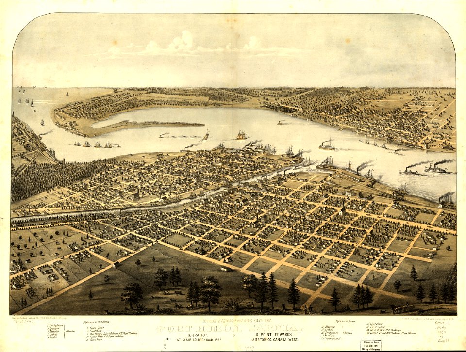
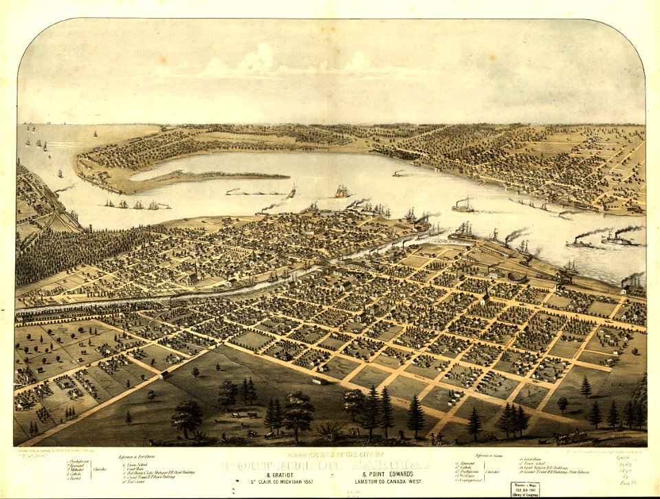
postcards of port huron, michigan
walk in the water (ship, 1818)
detroit in art
curt teich postcard archives, detroit publishing company
views of grand hotel (michigan) from lake huron
1850s maps of ontario
maps by john tallis
chicago and the midwest, newberry library
st. james episcopal cathedral, chicago
self-portrait by zacharie vincent (c 1850)
zacharie vincent
presentation at lorette by henri daniel thielcke
henry daniel thielcke
photographs by louis-prudent vallée
zacharie vincent
antoine plamondon
zacharie vincent
engravings by jules huyot
the last of the mohicans
the last of the mohicans
romanticism
robert wallis (engraver)
henry warren
1821 maps of the united states
maps by john cary
1806 maps of the united states
maps by john cary
files from 115892967@n03 flickr stream
ashtabula harbor
1 - 38 of 38
/ 1