Log in
All resources
Create a design
54 Free Artworks of Old Maps Of Spain
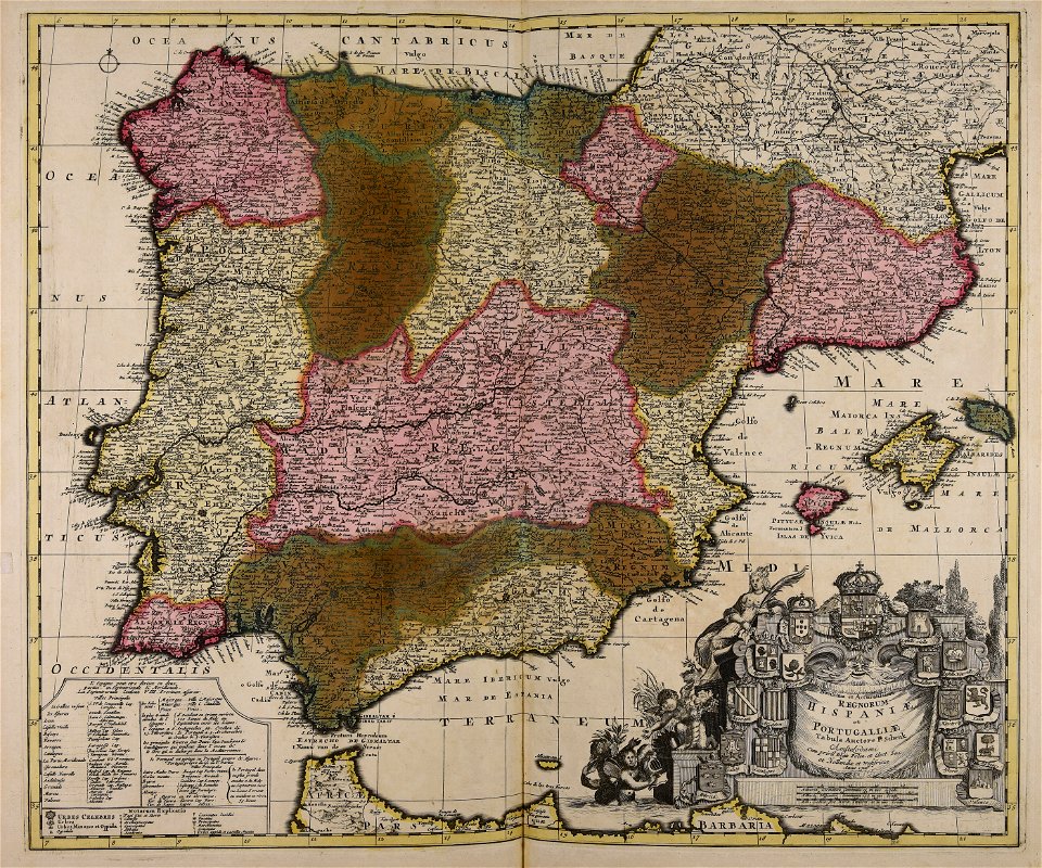
old maps of the iberian peninsula
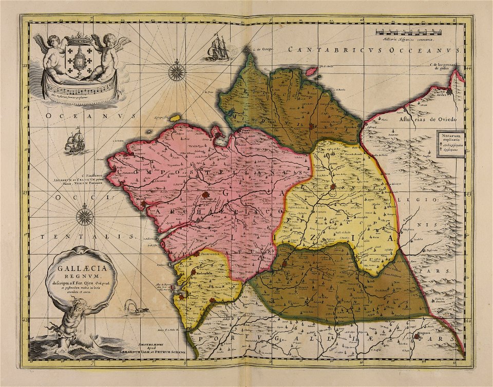
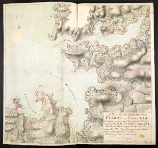
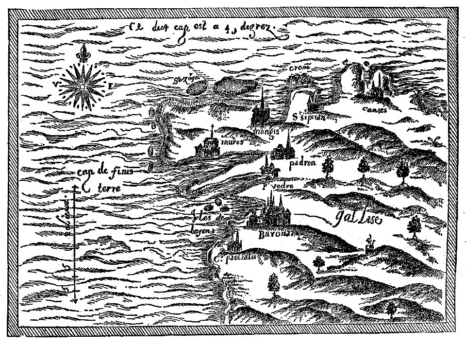
old maps of galicia (spain)
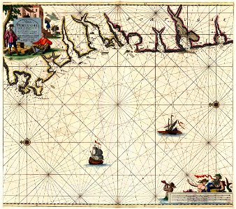
old maps of portugal
pictorial maps
old manuscript maps
spanish-language maps
1632 maps
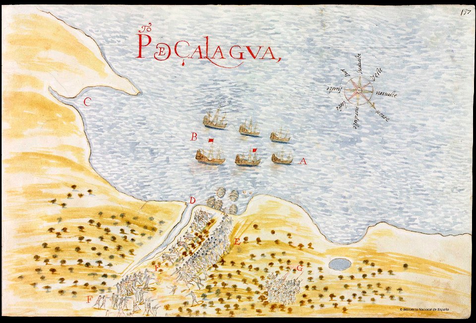
en especial del descubrimiento del reino de la california
descripciones geográphicas e hydrográphicas de muchas tierras y mares del norte y sur en las indias
maps by nicolás de cardona
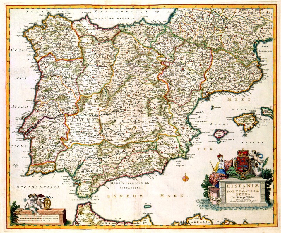
maps by nicolaes visscher i
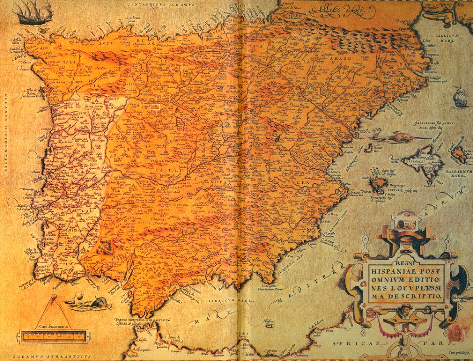
old maps of spain
ships on maps
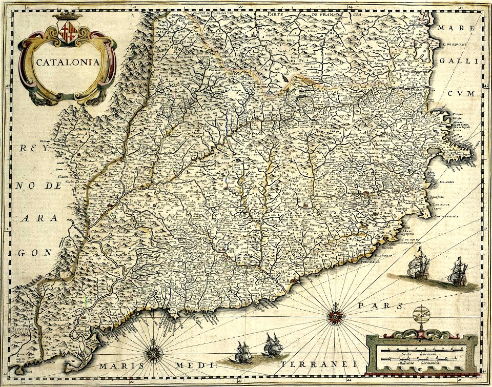
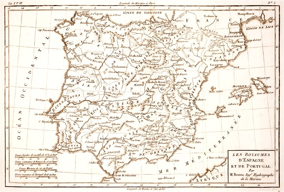
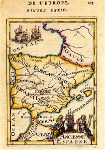
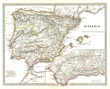
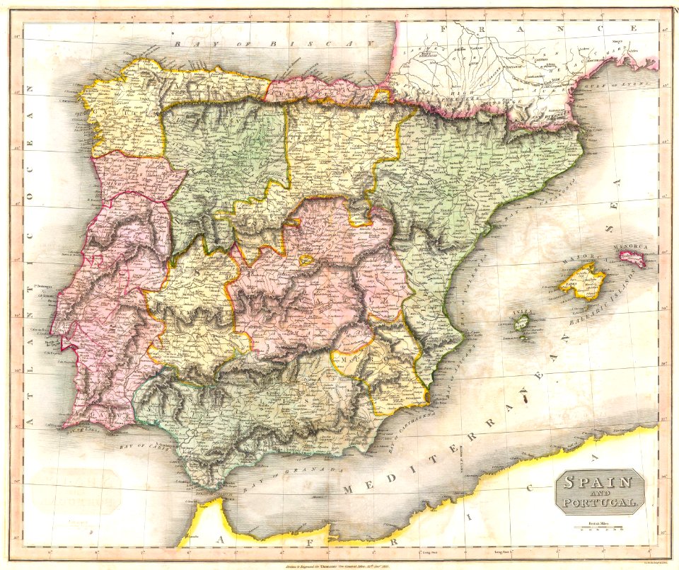
spain
description de l'universe
1680s maps of spain
old maps of the iberian peninsula
1865 maps
old maps of the iberian peninsula
ships on maps
old maps of the iberian peninsula
maps by john thomson
cosmographia claudii ptolomaei alexandrini
old maps of galicia (spain)
old maps of the iberian peninsula
maps by nicolaes visscher i
old maps of the iberian peninsula
1850s maps of portugal
1902 maps
spain
old maps of the iberian peninsula
johannes ratelband
coats of arms of the crown of aragon
coats of arms on maps
old maps of the iberian peninsula
johann baptist homann
old maps of the british isles
coats of arms on maps
cosmographia claudii ptolomaei alexandrini
latin-language maps
johannes ratelband
1747 maps
historical maps of western sahara
dien (printer)
old maps of spain
1552
old maps of the iberian peninsula
1780s maps of spain
vintage
maps
old maps of the iberian peninsula
1870 in spain
atlante veneto (raremaps.com) volume 2
old maps of portugal
french-language maps
johannes ratelband
maps in the library of congress
sailing ships of spain
coats of arms of galicia (spain)
holy roman empire
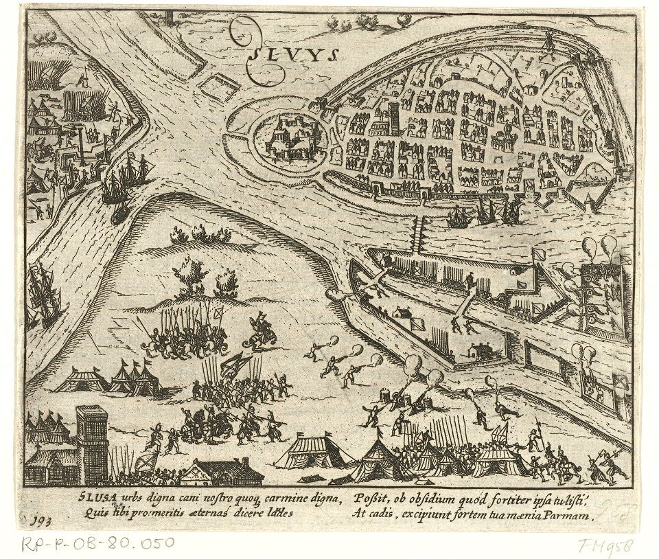
maps made in the 17th century
gerard valck
old maps of the iberian peninsula
1700s maps of portugal
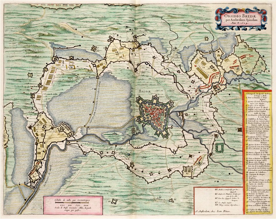
maps by willem and johannes blaeu
spain in the 17th century
maps by willem and johannes blaeu
1649
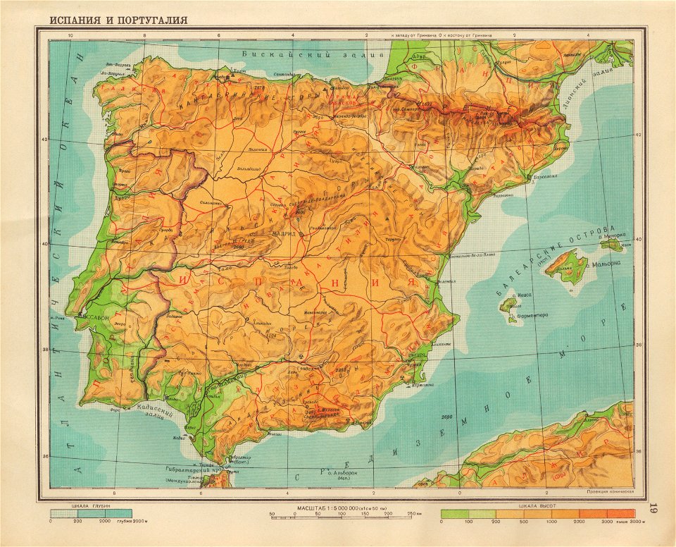
geographical atlas for the 5-6 grades of secondary school (1941)
old maps of the iberian peninsula
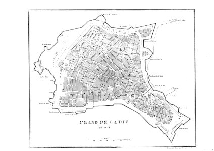
cádiz in the 19th century
scanned spanish texts
images from the john carter brown library
maps by samuel de champlain
18th-century maps of puerto rico
18th-century maps of cuba
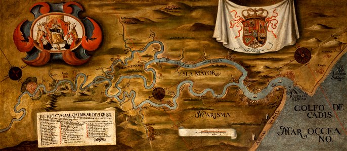
guadalquivir
1760 maps
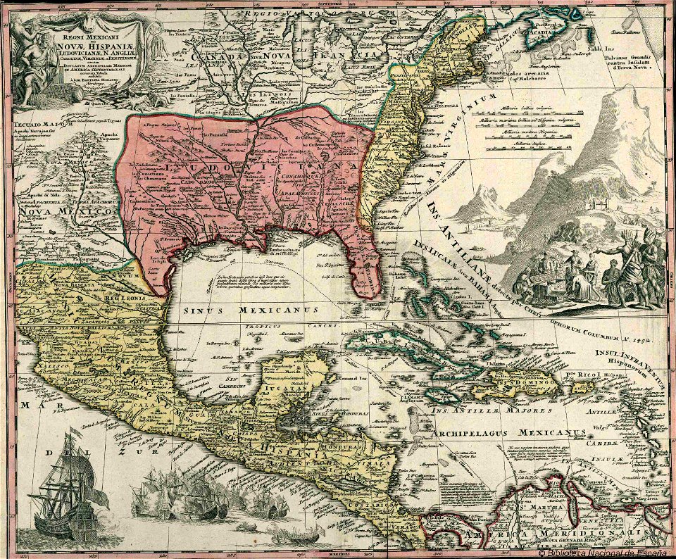
old maps of mexico
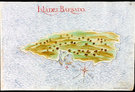
pictorial maps
maps made in the 17th century
gerard valck
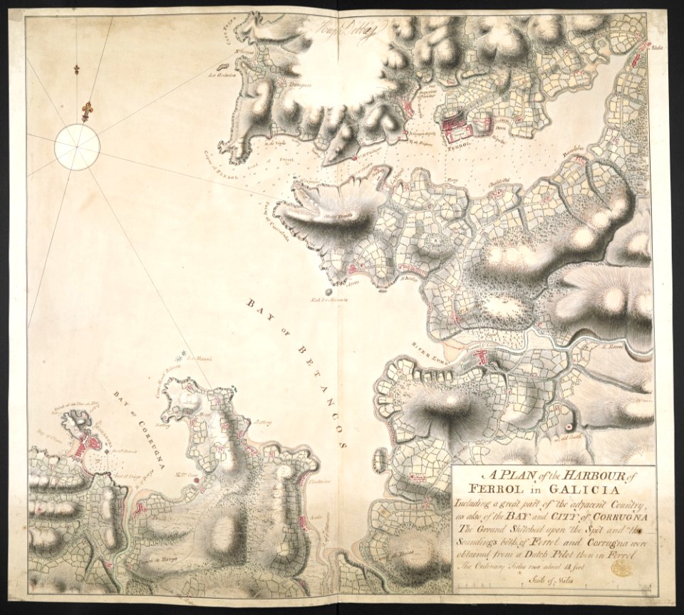
old maps of the province of a coruña
litografía de julio donón
spain in the 1720s
nicolas de fer
maps with cartouches
atlas van der hagen
maps by samuel de champlain
old maps of galicia (spain)
old maps of the province of a coruña
1767 in galicia (spain)
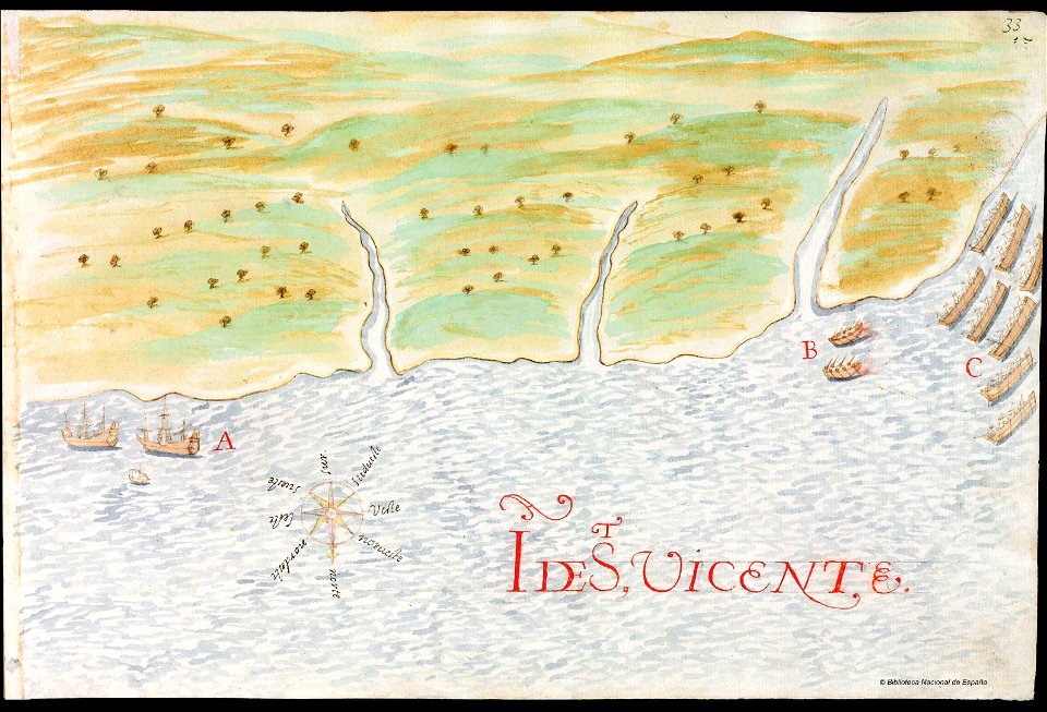
history of saint vincent and the grenadines
pictorial maps
old maps of the iberian peninsula
nicolaes visscher ii
old maps of mexico
pictorial maps
old maps of the province of a coruña
1767 in galicia (spain)
old maps of galicia (spain)
johannes van keulen
old manuscript maps
pictorial maps
1780s maps of portugal
1780s maps of spain
drawings by samuel de champlain
old maps of galicia (spain)
flemish 17th-century prints in the rijksmuseum amsterdam
frans hogenberg
maps by willem and johannes blaeu
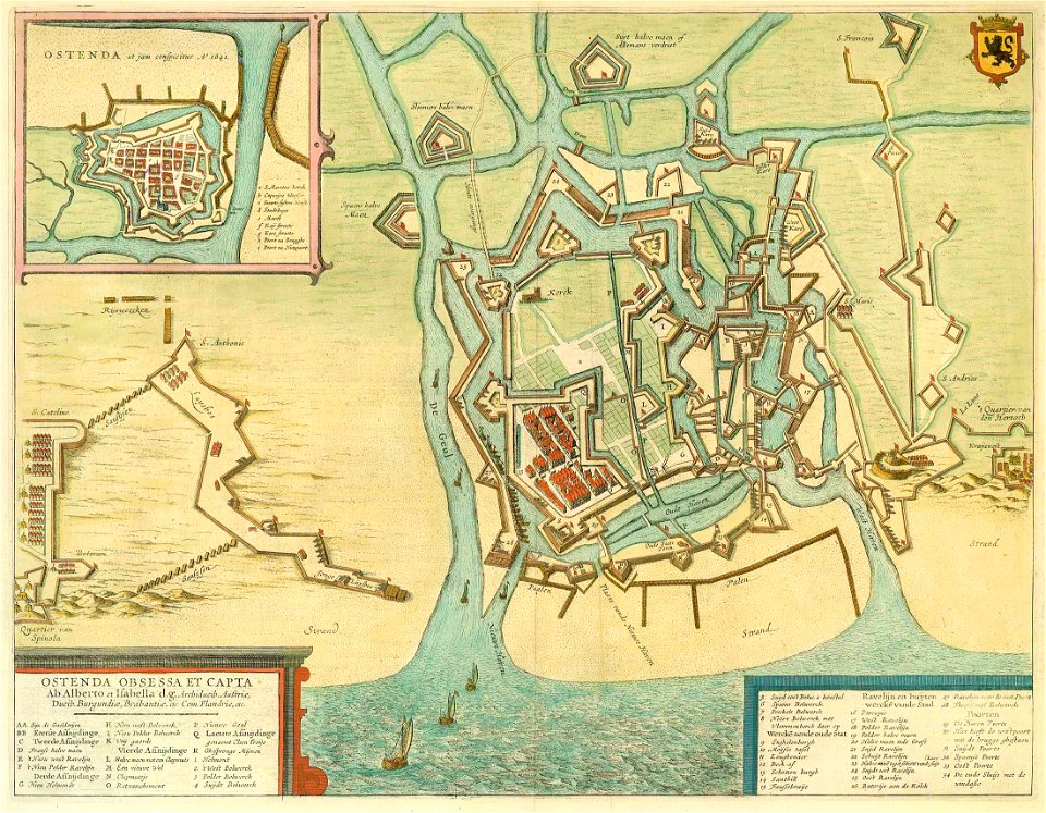
circumvallation
pictorial maps
barbados
artworks without wikidata item
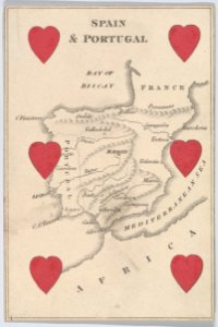
6 of hearts
illustration
maps
1 - 54 of 54
/ 1


![Map of France, Spain, and Portugal; Switzerland in cantons [inset]; Island of Corsica (1863) by Samuel Augustus Mitchell.](https://cdn.creazilla.com/illustrations/1953186/map-of-france-spain-and-portugal-switzerland-in-cantons-inset-island-of-corsica--md.jpeg)