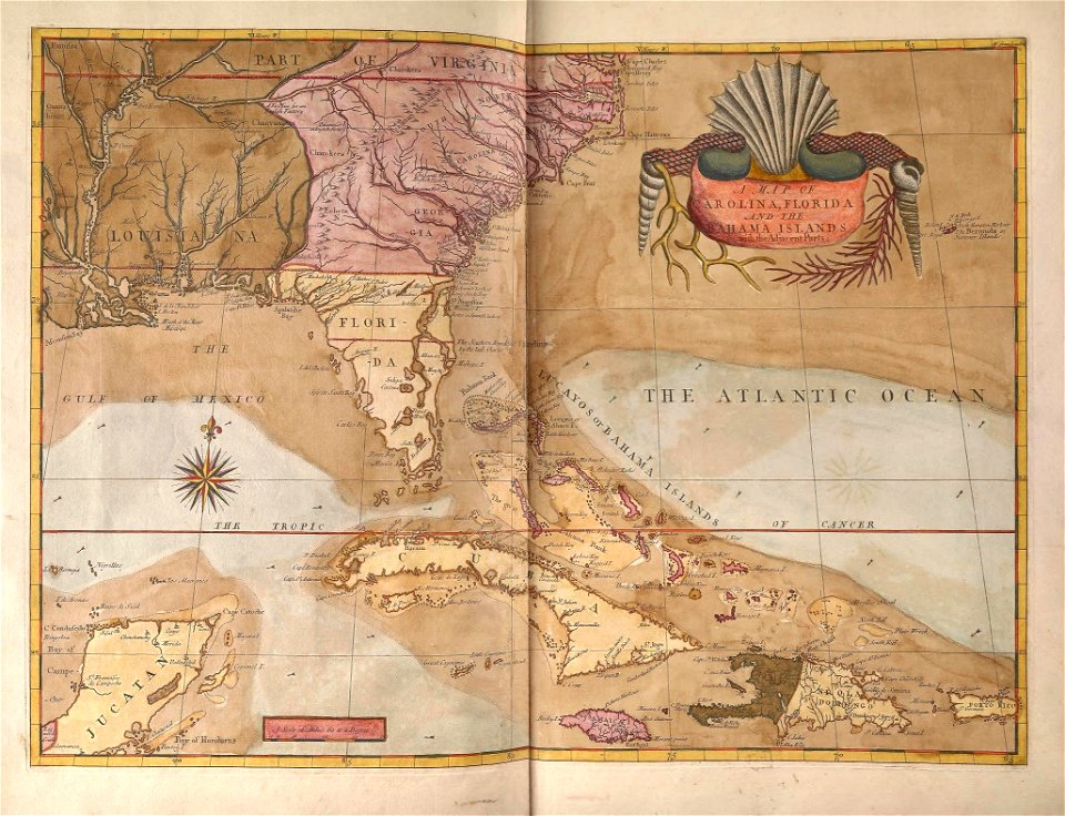
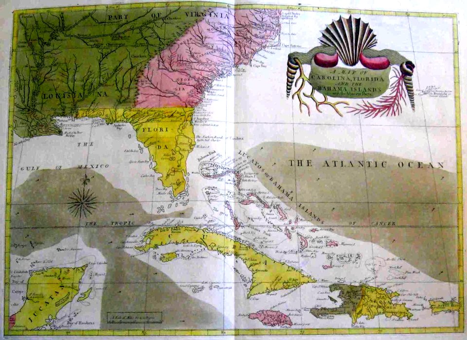
49 Свободни изкуства за Florida Map

Map of the Peninsula of Florida. LOC 2003629547
Map of the Gulf Coast from Florida to Mexico. LOC 2003623404
Birds eye view of Florida and part of Georgia and Alabama LOC 99447266
Green Cove Springs, county seat of Clay County, Florida. 1885. LOC 75693179
View of the city of Tallahassee. State capital of Florida, county seat of Leon county 1885. LOC 75693186
Païs cedés, sheet IId, containing the Peninsula and Gulf of Florida, with the Bahama Islands (18160898518)
Map of Atlantic Coast of North America from the Chesapeake Bay to Florida. LOC 2003623403
Pensacola, Fla. county seat of Escambia County 1885. LOC 75693185
Birds eye view of Louisiana, Mississippi, Alabama and part of Florida LOC 99447004
Atlas Van der Hagen-KW1049B13 076-VIRGINIAE partis australis, et FLORIDAE partes orientalis, interjacentiumq- regionum NOVA DESCRIPTIO
Birds eye view of Louisiana, Mississippi, Alabama and part of Florida LOC 99447004
Panoramic-view of Lake City, Fla. county seat of Columbia Cty. 1885. LOC 75693183
Virginia and Florida by W. Blaeu (MAM, Madrid, 413) 01
Païs cedés, sheet Ist, containing the coast of Louisiana and Florida (18162564399)
1747 Ruyter Map of Florida, Mexico and the West Indies - Geographicus - PortoBello-ratelband-1747
A chart of the coast of America - from New York and Philadelphia to the Strait or Gulf of Florida, and from thence to the Mississippi - a new edition corrected and improved by J.W. Norie, NYPL434117
Mapa del Caribe y América Central (Siglo XVI)
Mapa Caribe 1720
Jetportimpact 1 1
A chart of the coast of America - from New York and Philadelphia to the Strait or Gulf of Florida, and from thence to the Mississippi - a new edition corrected and improved by J.W. Norie, NYPL434117
DeBry Map of Caribbean & Florida1594
Rigobert-Bonne-Atlas-de-toutes-les-parties-connues-du-globe-terrestre MG 0028
Virginiae partis australis et Floridae partis orientalis, interjacentiumque regionum nova descriptio - CBT 6621022
Bodleian Libraries, La Florida Gvastecan
Julius Rubens Ames, Moral Map of U.S. 1847 Cornell CUL PJM 2051 01
Regni Mexicani seu Novae Hispaniae, Floridae, Novae Angliae, Carolinae, Virginiae et... - CBT 6625637
Pas kaart vande noord oost kust van Cuba en d'oost kust van Florida vervaartende van Canal van Bahama met de Bahaamse Eylanden RMG F8151
Julius Rubens Ames My Country Is The World 1847 Cornell CUL PJM 2051 02
1 - 49 z celkového počtu 49
/ 1