Accedi
Tutte le risorse
Creare un design
Tools
20.175 Immagini gratuite per Speciale
veicolo
bicicletta
luna
canada
ritratto
marittimo
mare
veicolo
luna
animali
ala
veicolo
luna
veicolo
luna
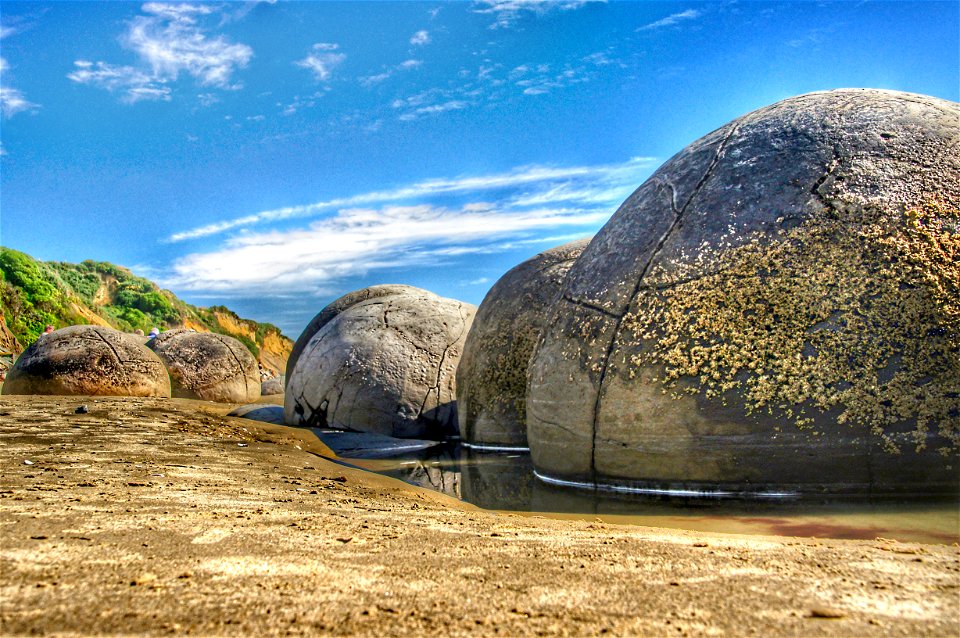
spiaggia
scienza
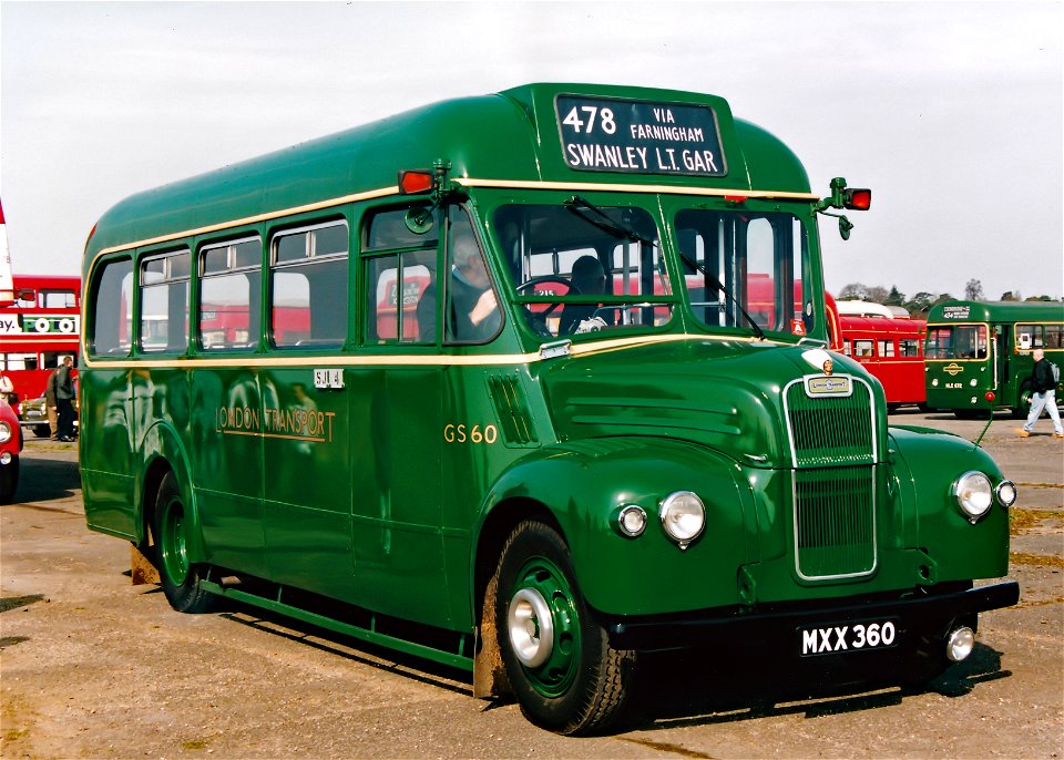
trasporto
londra
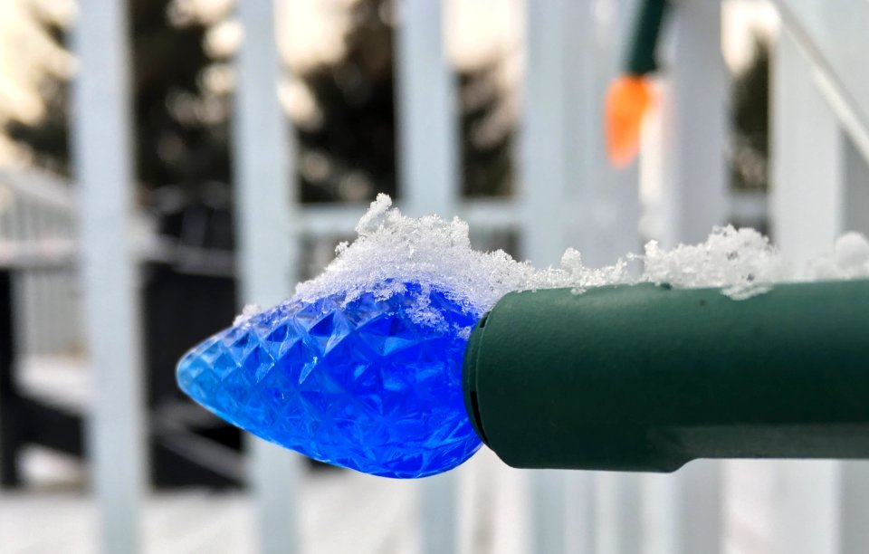
luce
canada
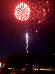
fuochi d'artificio
villaggio
cina
nuova zelanda
veicolo
uomo e donna
bicicletta
shopping
canada
paesaggio
natura
6801 - 6900 di 20.175
Pagina successiva
/ 202

![Kennemerland Water Board Map - Rijnland Water Board, Hendrik de Leth, [1729]](https://cdn.creazilla.com/illustrations/10001117580/kennemerland-water-board-map-rijnland-water-board-hendrik-de-leth-1729-md.jpg)
![Kennemerland Water Board Map - Rijnland Water Board, Hendrik de Leth, [1729]](https://cdn.creazilla.com/illustrations/10001181332/kennemerland-water-board-map-rijnland-water-board-hendrik-de-leth-1729-md.jpg)
![Kennemerland Water Board Map - Rijnland Water Board, Hendrik de Leth, [1729]](https://cdn.creazilla.com/illustrations/10001040533/kennemerland-water-board-map-rijnland-water-board-hendrik-de-leth-1729-md.jpg)
![Kennemerland Water Board Map - Rijnland Water Board, Hendrik de Leth, [1729]](https://cdn.creazilla.com/illustrations/10000578202/kennemerland-water-board-map-rijnland-water-board-hendrik-de-leth-1729-md.jpg)
![Map and images of the glory of Abbenbroek 1701 / I. Stemmers sculpsit; A. Steyaart invenit, Romeyn de Hooghe, [1701]](https://cdn.creazilla.com/illustrations/10000431246/map-and-images-of-the-glory-of-abbenbroek-1701-i-stemmers-sculpsit-a-steyaart-invenit-romeyn-de-hooghe-1701-md.jpg)
![Kennemerland Water Board Map - Rijnland Water Board, Hendrik de Leth, [1729]](https://cdn.creazilla.com/illustrations/10001510543/kennemerland-water-board-map-rijnland-water-board-hendrik-de-leth-1729-md.jpg)
![Kennemerland Water Board Map - Rijnland Water Board, Hendrik de Leth, [1729]](https://cdn.creazilla.com/illustrations/10000534022/kennemerland-water-board-map-rijnland-water-board-hendrik-de-leth-1729-md.jpg)
![Kennemerland Water Board Map - Rijnland Water Board, Hendrik de Leth, [1729]](https://cdn.creazilla.com/illustrations/10000761895/kennemerland-water-board-map-rijnland-water-board-hendrik-de-leth-1729-md.jpg)
![Kennemerland Water Board Map - Rijnland Water Board, Hendrik de Leth, [1729]](https://cdn.creazilla.com/illustrations/10001059183/kennemerland-water-board-map-rijnland-water-board-hendrik-de-leth-1729-md.jpg)
![Kennemerland Water Board Map - Rijnland Water Board, Hendrik de Leth, [1729]](https://cdn.creazilla.com/illustrations/10001090722/kennemerland-water-board-map-rijnland-water-board-hendrik-de-leth-1729-md.jpg)
![Kennemerland Water Board Map - Rijnland Water Board, Hendrik de Leth, [1729]](https://cdn.creazilla.com/illustrations/10001321586/kennemerland-water-board-map-rijnland-water-board-hendrik-de-leth-1729-md.jpg)


![Map of the Nieukoopsche Plas – Land Reclamation (1788), [1791]](https://cdn.creazilla.com/illustrations/10000814135/map-of-the-nieukoopsche-plas-land-reclamation-1788-1791-md.jpg)


![Holland, Zeeland, Brabant Map - Bergen op Zoom, Johannes Condet, [1748]](https://cdn.creazilla.com/illustrations/10001181342/holland-zeeland-brabant-map-bergen-op-zoom-johannes-condet-1748-md.jpg)

![Caarte vande polder van Rugge A° 1696 / Heyman van Dyck fecit; A. Steyaart invenit; I. Stemmers sculpsit; I. Luiken fecit cum aqua forti, Romeyn de Hooghe, [1701]](https://cdn.creazilla.com/illustrations/10001404604/caarte-vande-polder-van-rugge-a-1696-heyman-van-dyck-fecit-a-steyaart-invenit-i-stemmers-sculpsit-i-luiken-fecit-cum-aqua-forti-romeyn-de-hooghe-1701-sm.jpg)

![Map and images of the city and free glory of Heenvliet / I. Luiken fecit cum aqua forti; I. Stemmer's sculpsit; A. Steyaart invenit, Romeyn de Hooghe, [1701]](https://cdn.creazilla.com/illustrations/10001201061/map-and-images-of-the-city-and-free-glory-of-heenvliet-i-luiken-fecit-cum-aqua-forti-i-stemmers-sculpsit-a-steyaart-invenit-romeyn-de-hooghe-1701-md.jpg)


![Alphabetical table of the names of towns, villages, etc. which are on the map of Dutch Guelders, etc., by Mr. Sanson., [after 1696]](https://cdn.creazilla.com/illustrations/10000812947/alphabetical-table-of-the-names-of-towns-villages-etc-which-are-on-the-map-of-dutch-guelders-etc-by-mr-sanson-after-1696-md.jpg)
![Map or drawing of the river Merwede from Gorichem downwards etc. / [Nicolaes Cruquius], [1730]](https://cdn.creazilla.com/illustrations/10001419622/map-or-drawing-of-the-river-merwede-from-gorichem-downwards-etc-nicolaes-cruquius-1730-md.jpg)


![Map of the Newly Remodeled Sea Dyke - Dutch Coastal Defenses, Hendrik de Leth, [1737]](https://cdn.creazilla.com/illustrations/10000604534/map-of-the-newly-remodeled-sea-dyke-dutch-coastal-defenses-hendrik-de-leth-1737-sm.webp)


![T Hoogh-Heemraetschap vande Uytwaterende Sluysen in Kennemerlant and West Frieslant / [Johannes Douw], Isaak Tirion, [1756]](https://cdn.creazilla.com/illustrations/10000841147/t-hoogh-heemraetschap-vande-uytwaterende-sluysen-in-kennemerlant-and-west-frieslant-johannes-douw-isaak-tirion-1756-md.jpg)
![Map of the polder of Nieuw-Helle-Voet / I. Luiken fecit cum aqua forti; A. Steyaart invented; I. Stemmer's sculpsit, Romeyn de Hooghe, [1701]](https://cdn.creazilla.com/illustrations/10001032148/map-of-the-polder-of-nieuw-helle-voet-i-luiken-fecit-cum-aqua-forti-a-steyaart-invented-i-stemmer-s-sculpsit-romeyn-de-hooghe-1701-md.jpg)
![Map of the craftsmanship of the Old and New Streuyt / A. Steyaart invenit; I. Stemmer's sculpsit; I. Shutters fecit cum aqua forti, Romeyn de Hooghe, [1701]](https://cdn.creazilla.com/illustrations/10000536041/map-of-the-craftsmanship-of-the-old-and-new-streuyt-a-steyaart-invenit-i-stemmers-sculpsit-i-shutters-fecit-cum-aqua-forti-romeyn-de-hooghe-1701-md.jpg)


![T Hoogh-Heemraetschap vande Uytwaterende Sluysen in Kennemerlant and West Frieslant / [Johannes Douw], Isaak Tirion, [1756]](https://cdn.creazilla.com/illustrations/10000560278/t-hoogh-heemraetschap-vande-uytwaterende-sluysen-in-kennemerlant-and-west-frieslant-johannes-douw-isaak-tirion-1756-md.jpg)
![T Hoogh-Heemraetschap vande Uytwaterende Sluysen in Kennemerlant and West Frieslant / [Johannes Douw], Isaak Tirion, [1756]](https://cdn.creazilla.com/illustrations/10000976652/t-hoogh-heemraetschap-vande-uytwaterende-sluysen-in-kennemerlant-and-west-frieslant-johannes-douw-isaak-tirion-1756-md.jpg)
![T Hoogh-Heemraetschap vande Uytwaterende Sluysen in Kennemerlant and West Frieslant / [Johannes Douw], Isaak Tirion, [1756]](https://cdn.creazilla.com/illustrations/10001440533/t-hoogh-heemraetschap-vande-uytwaterende-sluysen-in-kennemerlant-and-west-frieslant-johannes-douw-isaak-tirion-1756-md.jpg)


![Map of Holland and Surrounding Provinces - Nicolaus Visscher, Gilliam van der Gouwen, [after 1705]](https://cdn.creazilla.com/illustrations/10000302103/map-of-holland-and-surrounding-provinces-nicolaus-visscher-gilliam-van-der-gouwen-after-1705-sm.webp)
![Gulf of Mexico Map - *J. v. Schley & Bellin Marine Engraving*, Jakob van der Schley, [1773]](https://cdn.creazilla.com/illustrations/10000578116/gulf-of-mexico-map-j-v-schley-bellin-marine-engraving-jakob-van-der-schley-1773-sm.webp)


![Persian and Indian Ocean Coastline Map (1740), Jakob van der Schley, [1773]](https://cdn.creazilla.com/illustrations/10001190018/persian-and-indian-ocean-coastline-map-1740-jakob-van-der-schley-1773-md.jpg)
![New map of the dike county of Dregterlandt MDCCXXIII / [Govert Oostwoudt], Hendrik de Leth, 1723](https://cdn.creazilla.com/illustrations/10001193208/new-map-of-the-dike-county-of-dregterlandt-mdccxxiii-govert-oostwoudt-hendrik-de-leth-1723-sm.jpg)

![Kennemerland Water Board Map - Rijnland Water Board, Hendrik de Leth, [1729]](https://cdn.creazilla.com/illustrations/10001035907/kennemerland-water-board-map-rijnland-water-board-hendrik-de-leth-1729-sm.webp)