Log in
All resources
Create a design
Tools
357,549 Free Images of Map
maps in the library of congress
fonds ancely - bibliothèque municipale de toulouse - maps
maps made in the 17th century
maps with cartouches
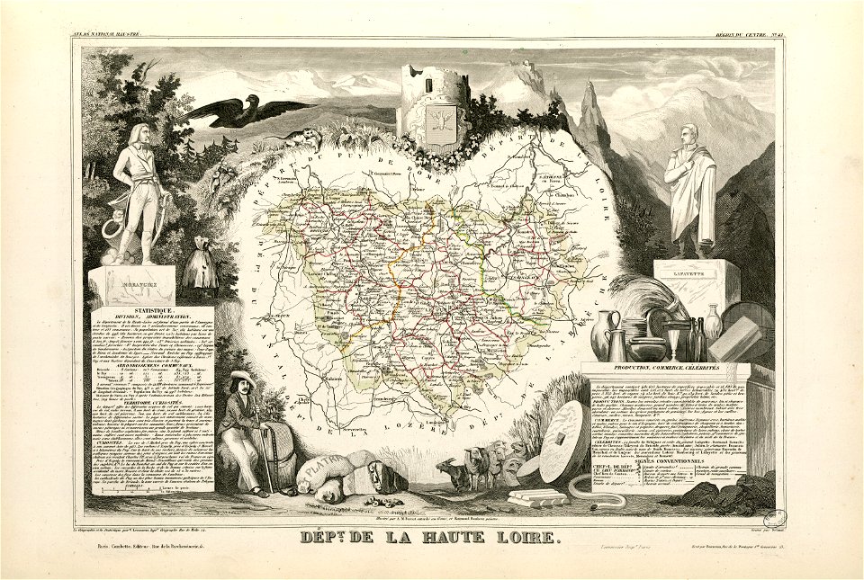
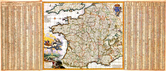
victor levasseur - maps of france
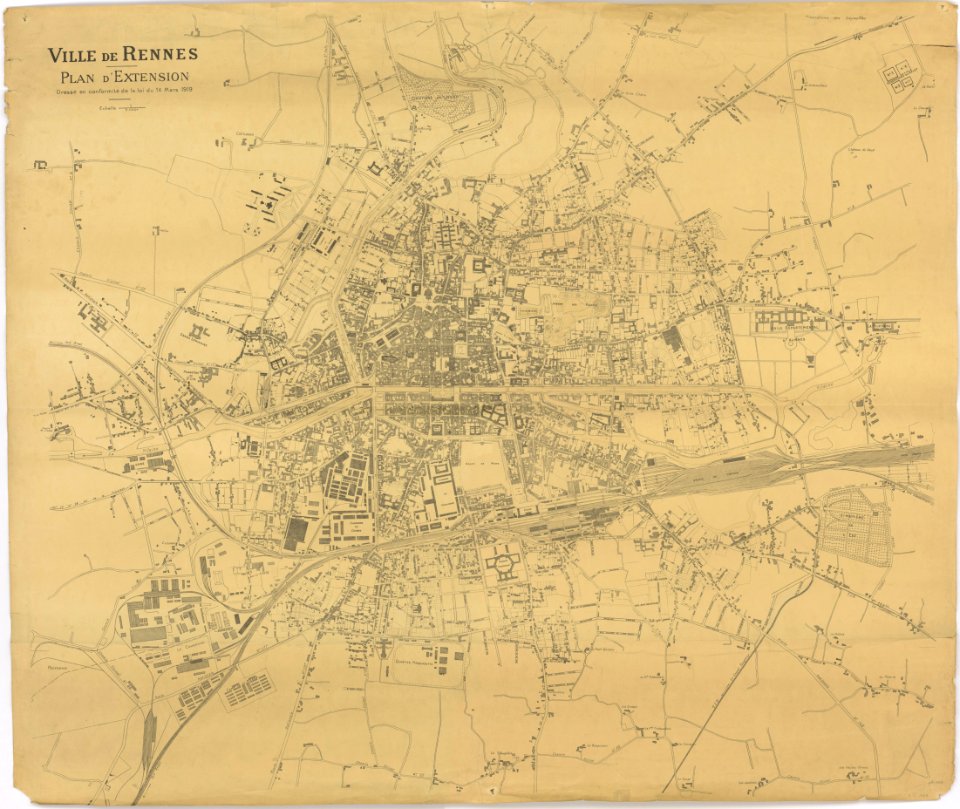
old maps of rennes
atlas van der hagen
bodleian library
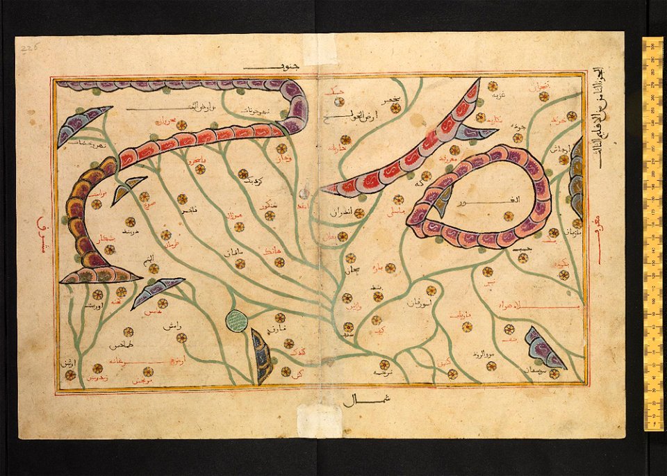
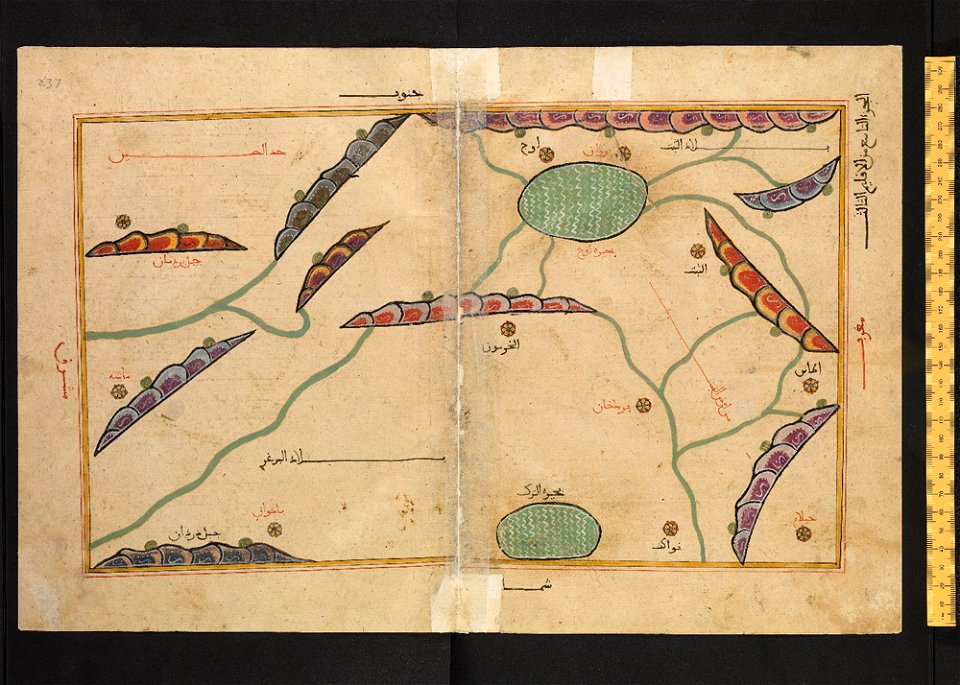
arabic-language manuscripts
files from the bodleian libraries
coats of arms of cities in haute-loire
marquis de la fayette
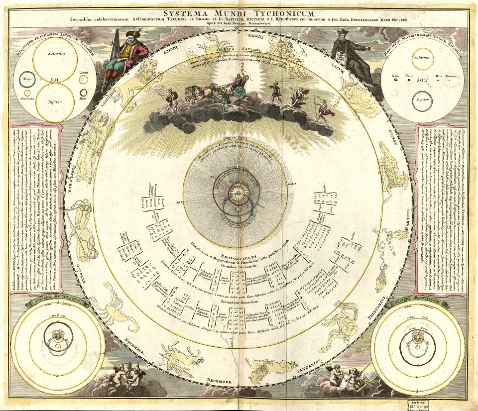
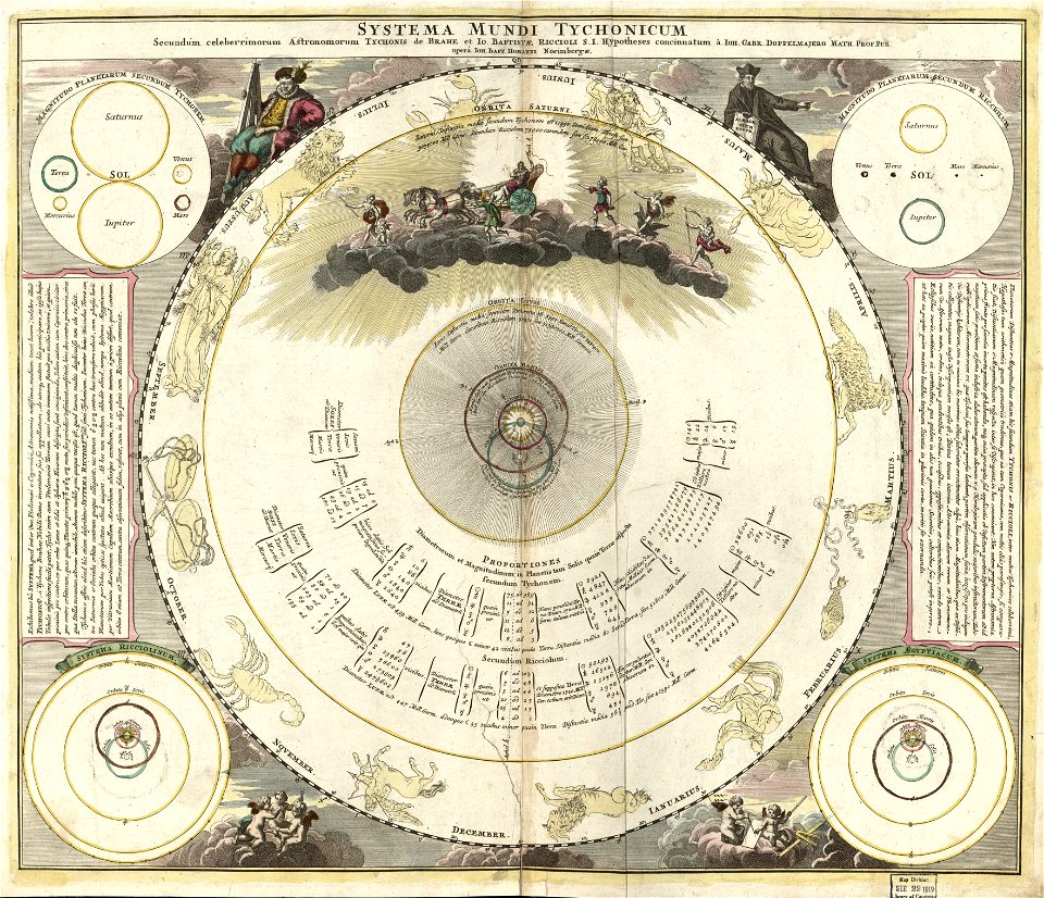
planet
maps
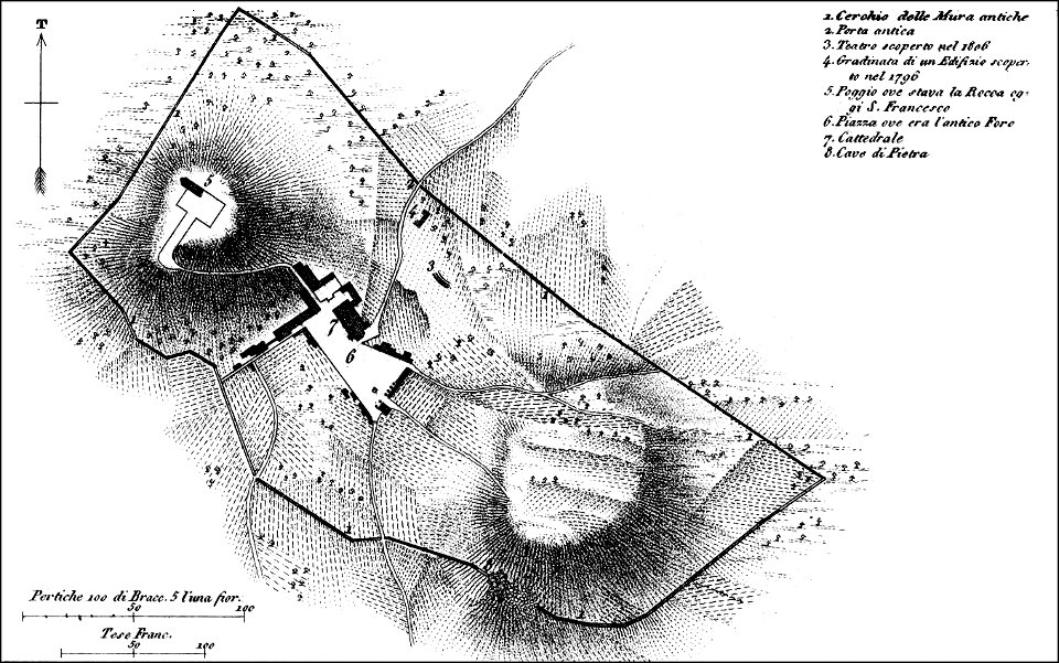
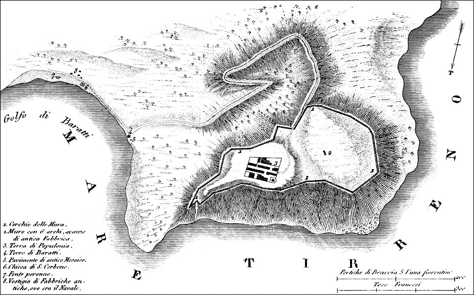
maps of archaeological sites in italy
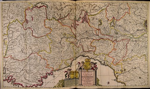
old maps of tuscany
maps of archaeological sites in italy
old maps of tuscany
cornell university library
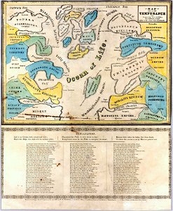
map on temperance
old maps of the peloponnese
maps by coronelli
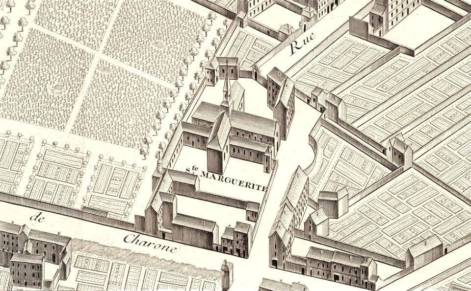
église sainte-marguerite (paris)
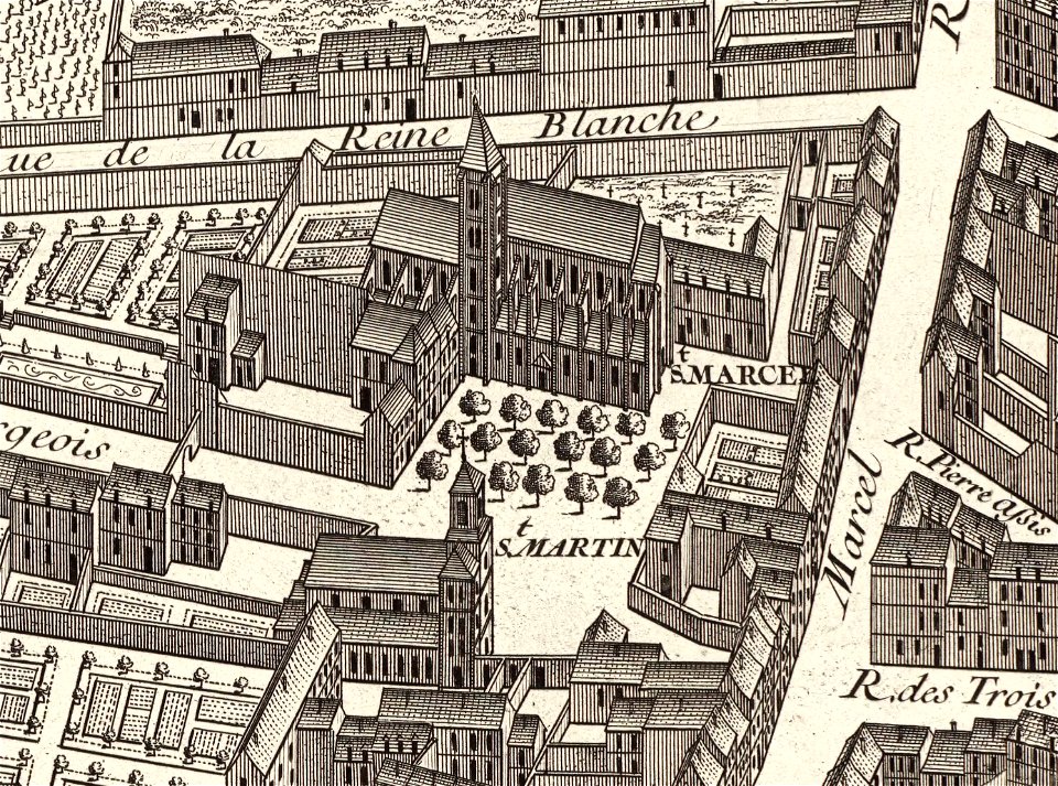
turgot map of paris
david rumsey historical map collection – derivative files
turgot map of paris
maps in the library of congress
1716 maps
maps in the library of congress
1716 maps
university of toronto wenceslas hollar digital collection
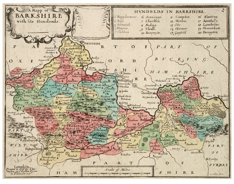
old county maps of berkshire
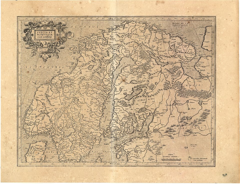
koninklijk nederlands aardrijkskundig genootschap
intaglio (printmaking)
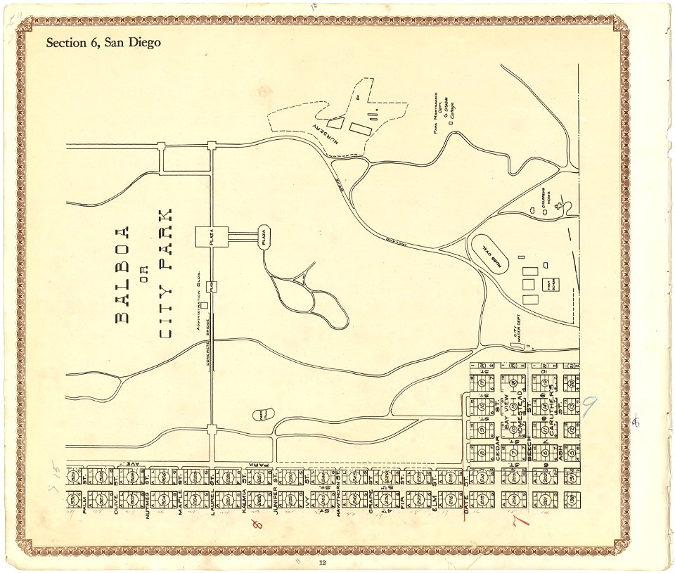
california
san diego
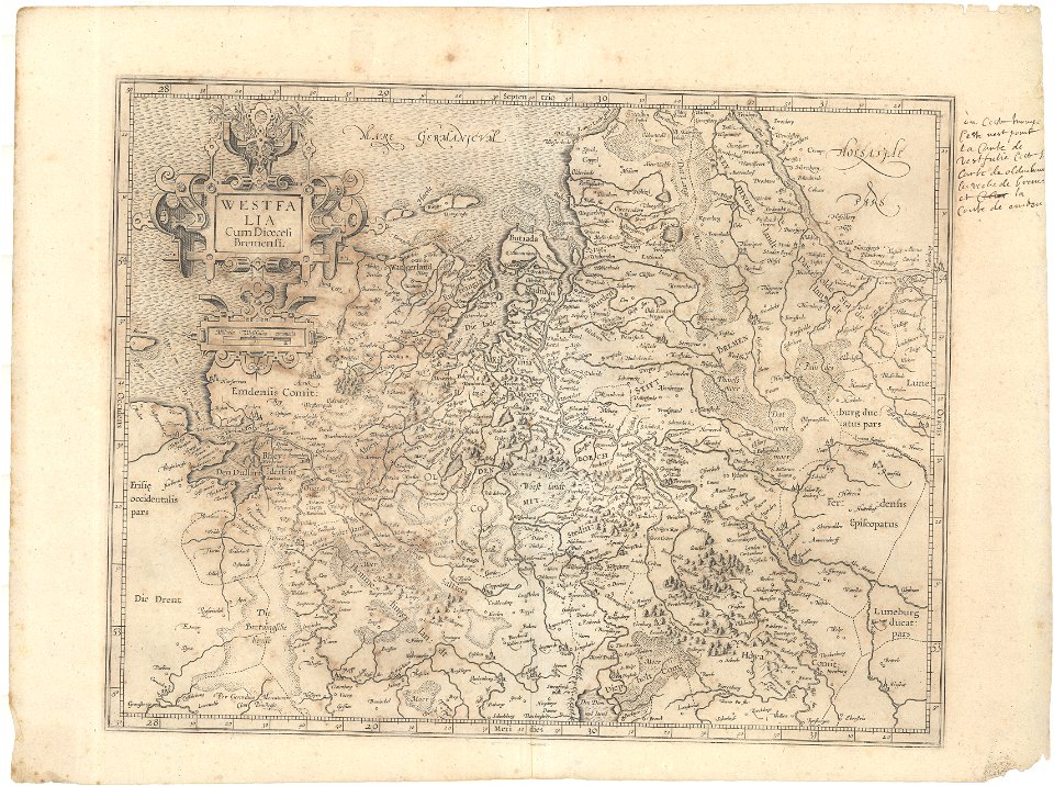
engravings of topographia saxoniae inferioris
maps of hamburg-langenhorn
images from the new york public library
new york city
atlantis magni tomus secundus (biblioteca comunale di trento)
maps made in the 17th century
rue de siam (brest
france
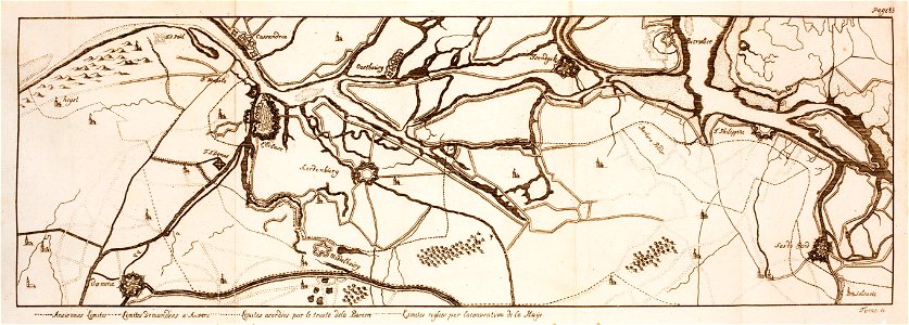
maps of the franco-dutch war
history of the french navy
american revolutionary war
scrimshaw
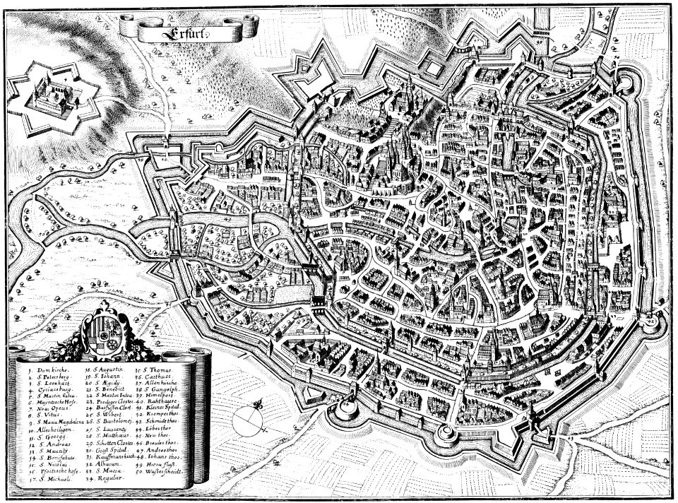
maps of erfurt
erfurt
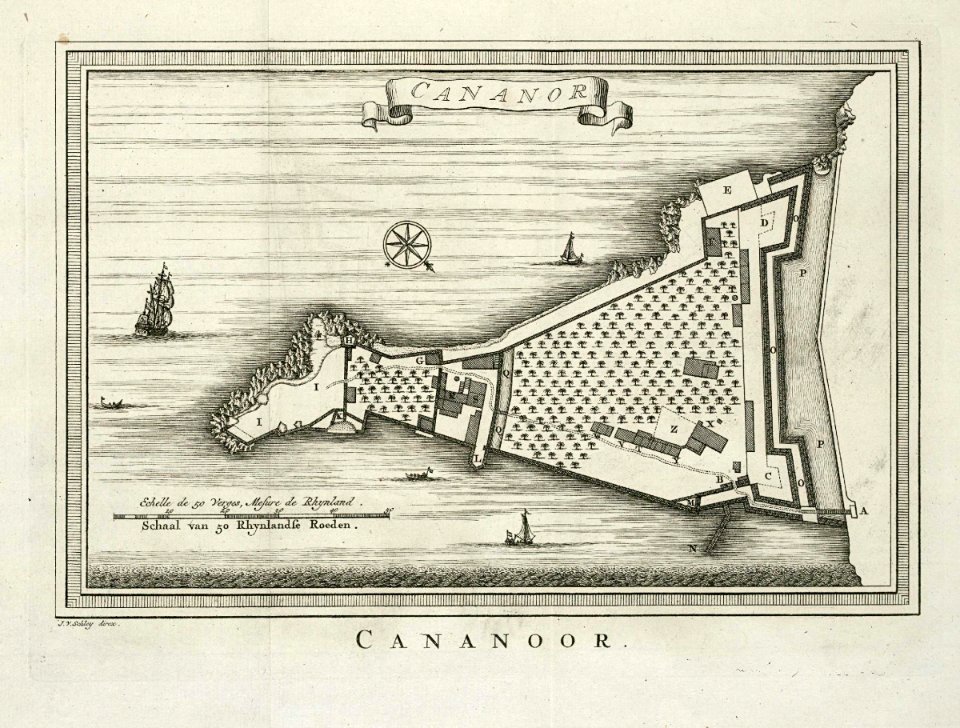
maps of the dutch east india company - india
historical images of st. angelo fort
tramway de rennes
1928 in bretagne
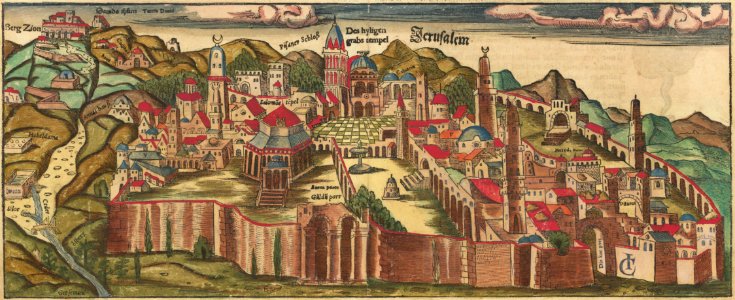
jerusalem in the 16th century
maps by sebastian münster
maps of the french and indian war
1768 maps
maps with cartouches
atlas van der hagen
maps with cartouches
atlas van der hagen
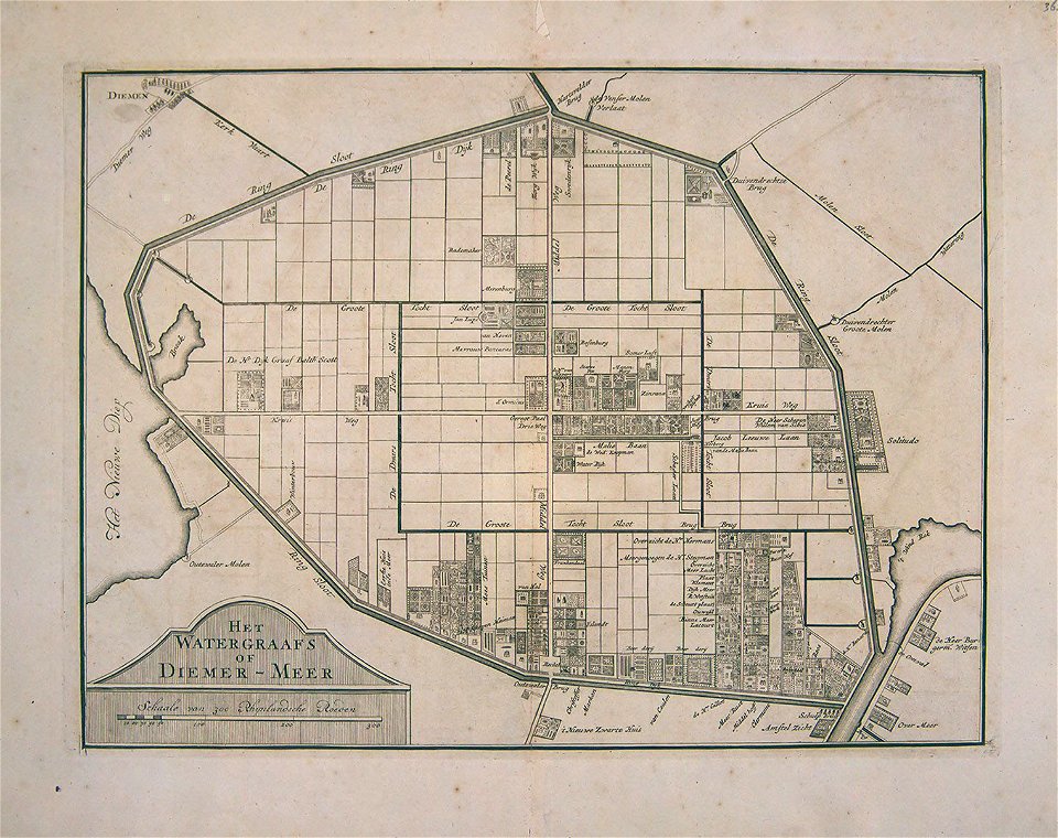
watergraafsmeer
diemen
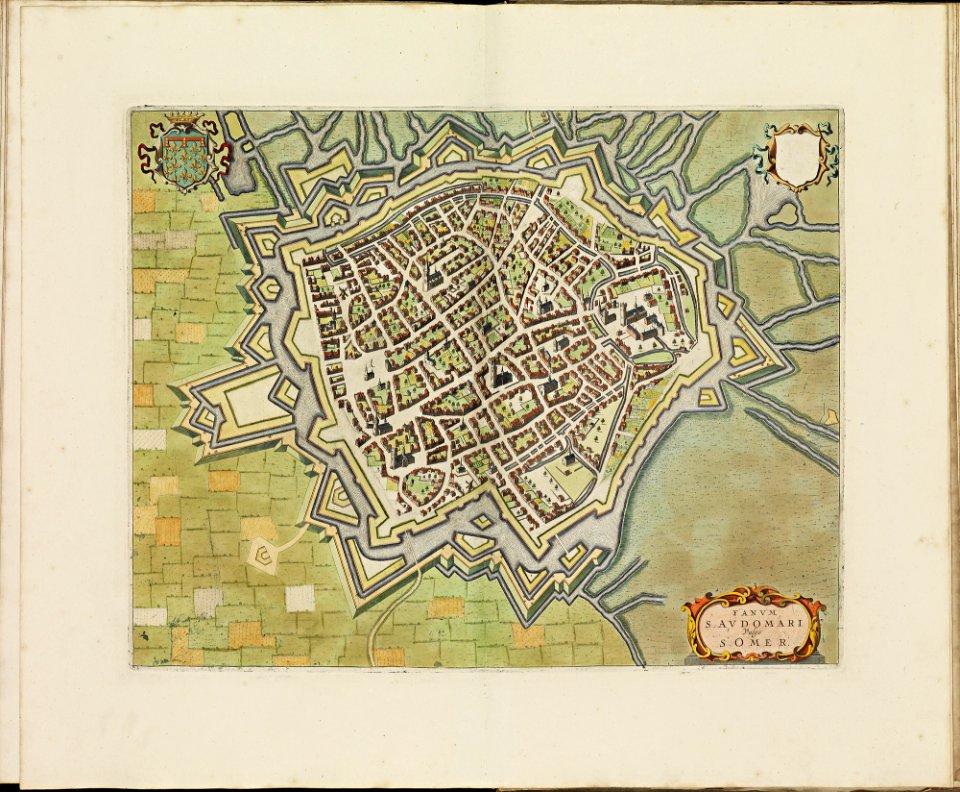
old maps of saint-omer
atlas de wit 1698
maps made in the 17th century
nicolaes visscher ii
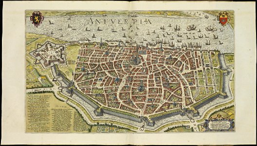
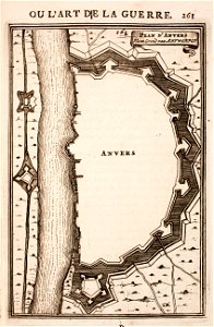
maps of antwerp city walls
frederick de wit
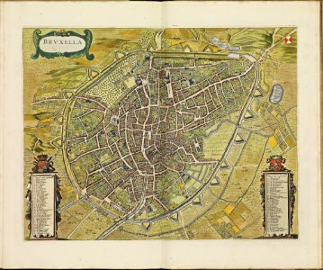
old maps of brussels
frederick de wit
octagons (architecture)
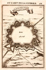
maps of ath city walls
koninklijk nederlands aardrijkskundig genootschap
intaglio (printmaking)
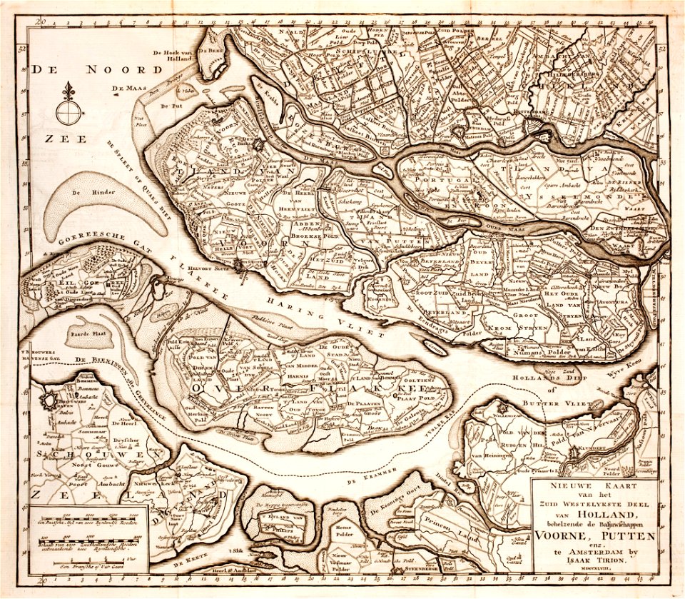
old maps of zeeland
old maps of holland
david rumsey historical map collection – derivative files
turgot map of paris
maps in the library of congress
1861 maps
maps of the eastern mediterranean
bodleian library
old maps of rennes
1922 maps
jean-baptiste martenot
1885 maps
islands of california
nicolas de fer
1640s maps of france
jan janssonius
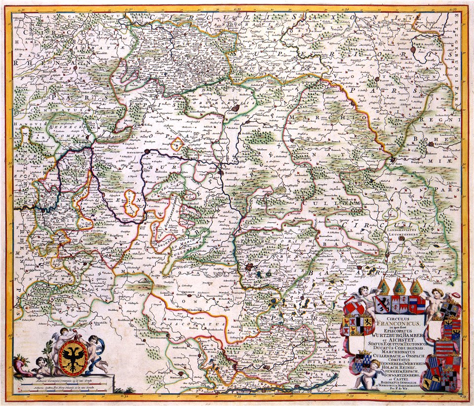
maps of territories in the burgundian circle
atlas novus (blaeu)
maps made in the 18th century
gerard valck
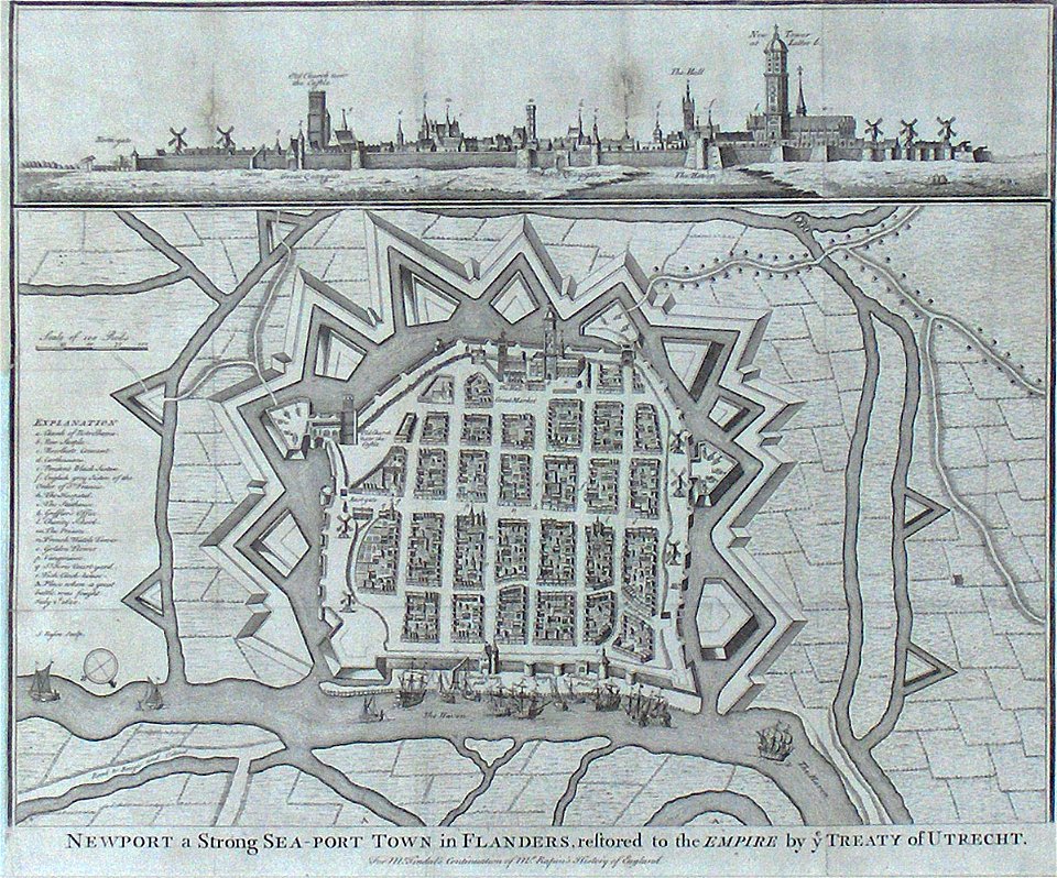
old maps of nieuwpoort
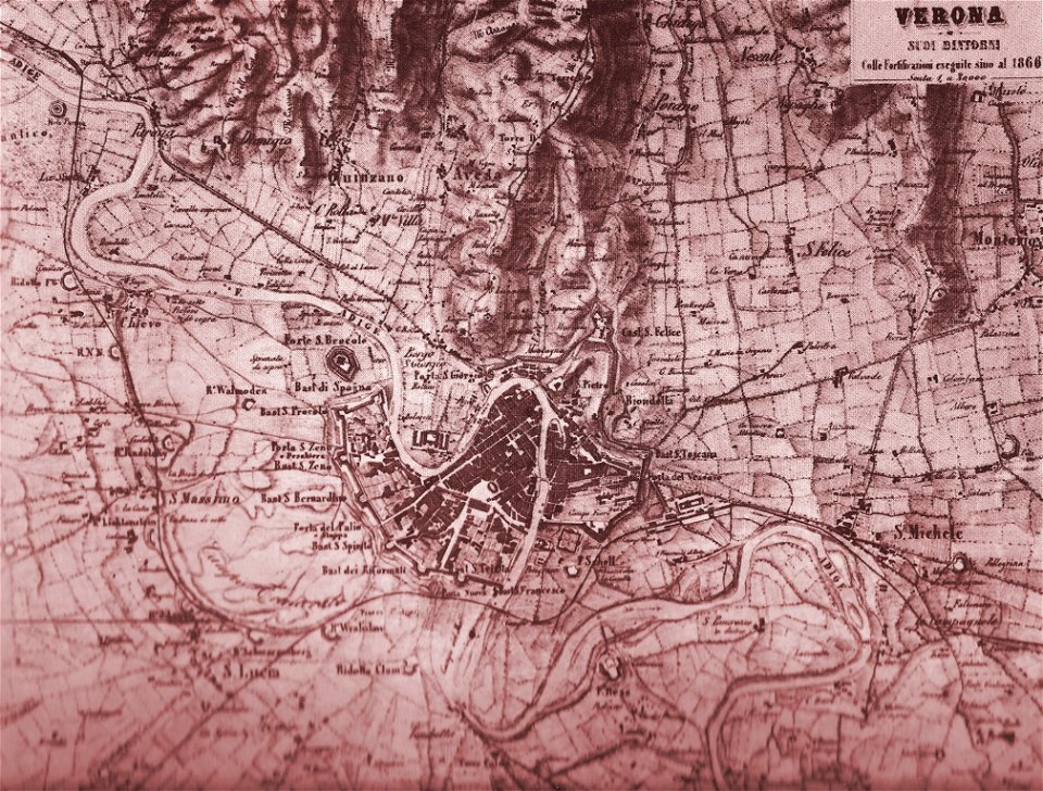
old maps of verona
maps with cartouches
old maps of hesse
17th-century maps of france
maps with cartouches
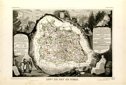
coats of arms of cities in puy-de-dôme
vercingetorix
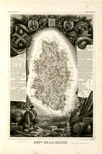
coats of arms of cities in meuse
nicolas oudinot (1767–1847)
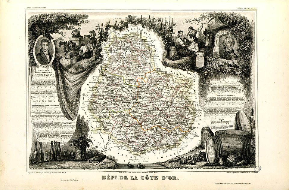
old maps of côte-d'or
lazare carnot
old maps of ardennes (department)
henri de la tour d'auvergne
historical images of pyrenees
robert batty (artist)
fonds ancely - bibliothèque municipale de toulouse - maps
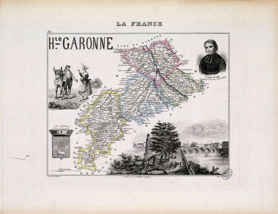
roch-ambroise cucurron sicard
maps made in the 18th century
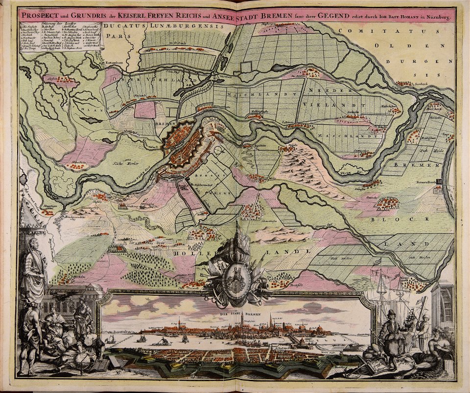
johann baptist homann
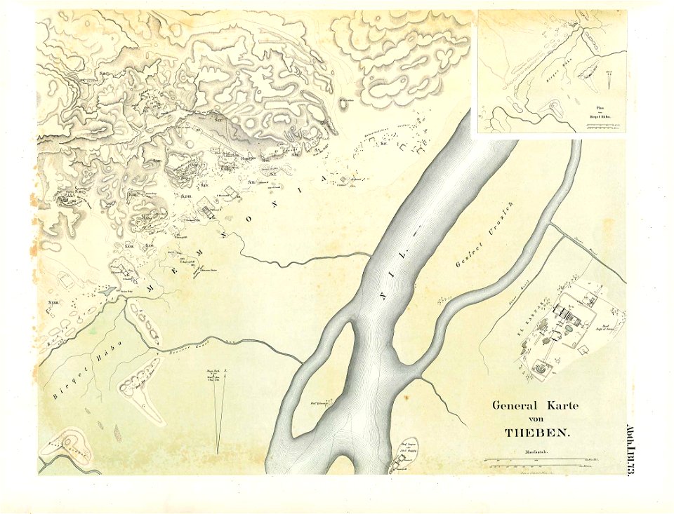
karnak temple complex
thebes
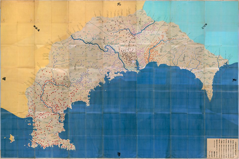
important cultural property of japan in tokyo
maps in the national archives of japan
watergraafsmeer
diemen
atlas van der hagen (volume 2)
maps with cartouches
maps with cartouches
atlas van der hagen
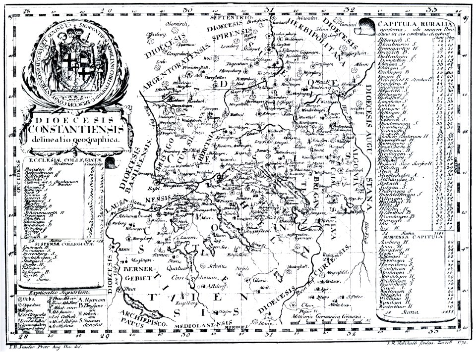
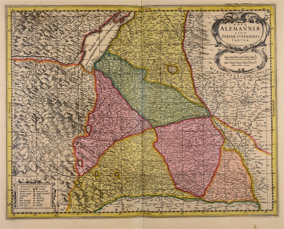
bishopric of constance
1779 in germany
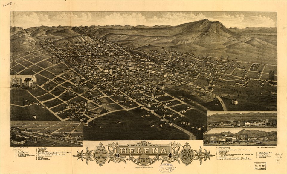
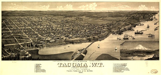
montana
helena
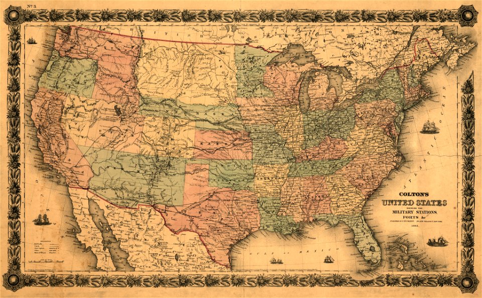
maps in the library of congress
1861 maps
old maps of tunisia
bodleian library
old maps of turkestan
bodleian library
old maps of turkestan
bodleian library
arabic-language manuscripts
bodleian library
prints from the peace palace library
old maps of siberia
engravings after peter paul rubens
harvard university
atlantis magni tomus tertius (biblioteca comunale di trento)
maps made in the 17th century
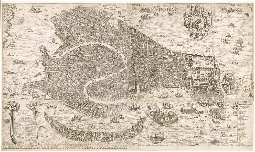
old maps of venice
stefano scolari
prints from the peace palace library
zeelandic flanders
maps in the national archives of japan
hyuga province
coats of arms on maps
thüringiae
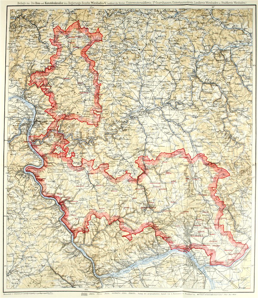
images from bau- und kunstdenkmäler des regierungsbezirks wiesbaden (volume 5)
german-language maps showing history of europe
alfred johannot
bridge of arts
prints from manesson travaux de mars at the peace palace library
fortifications in belgium
koninklijk nederlands aardrijkskundig genootschap
intaglio (printmaking)
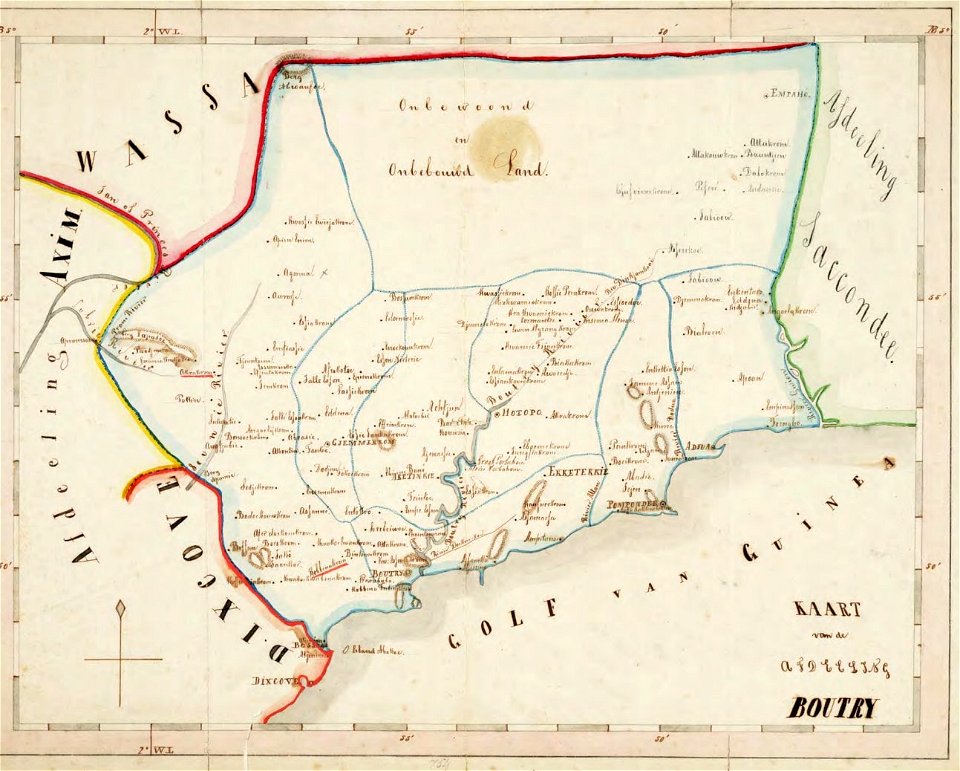
old maps of the dutch gold coast
1859 maps
atlantis magni tomus quartus (biblioteca comunale di trento)
maps made in the 17th century
atlantis magni tomus primus (biblioteca comunale di trento)
maps made in the 17th century
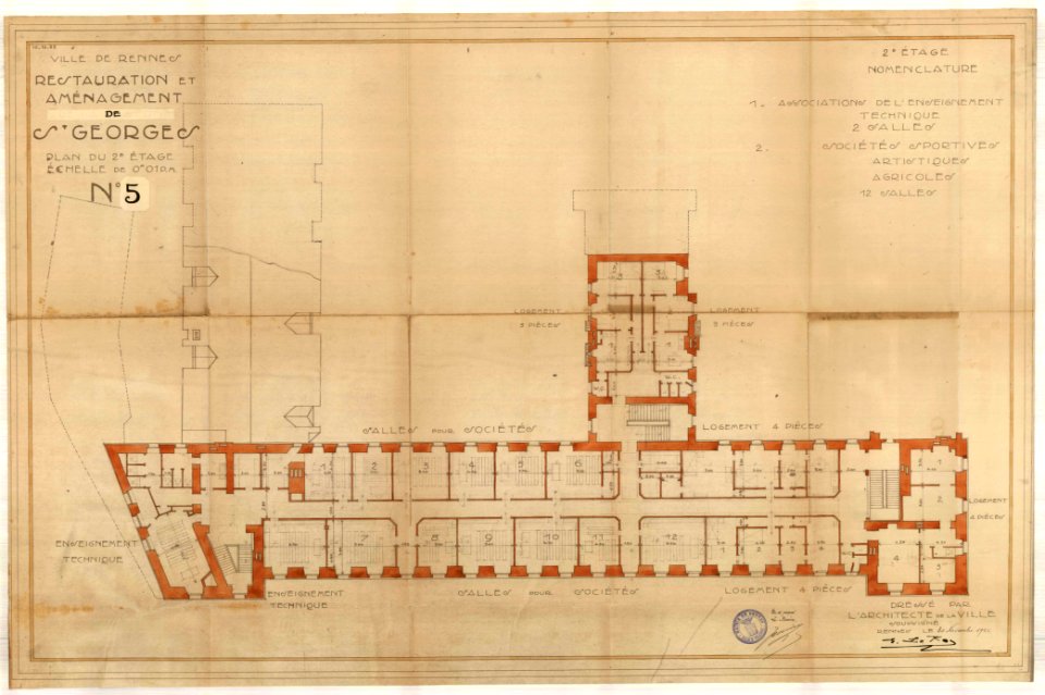
old maps of rennes
1922 maps
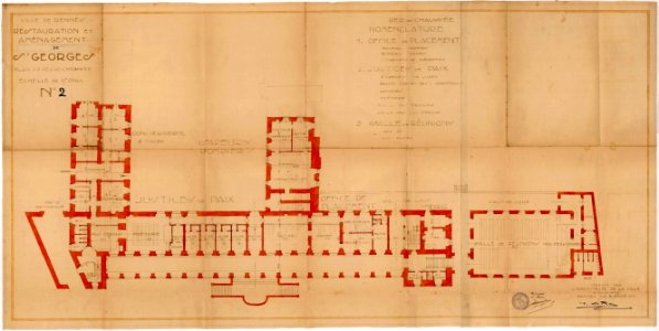
old maps of rennes
1922 maps
new york
deposits
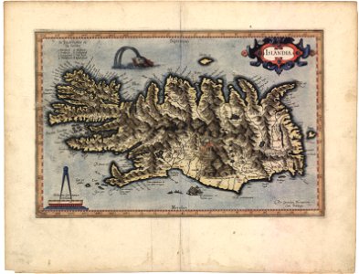
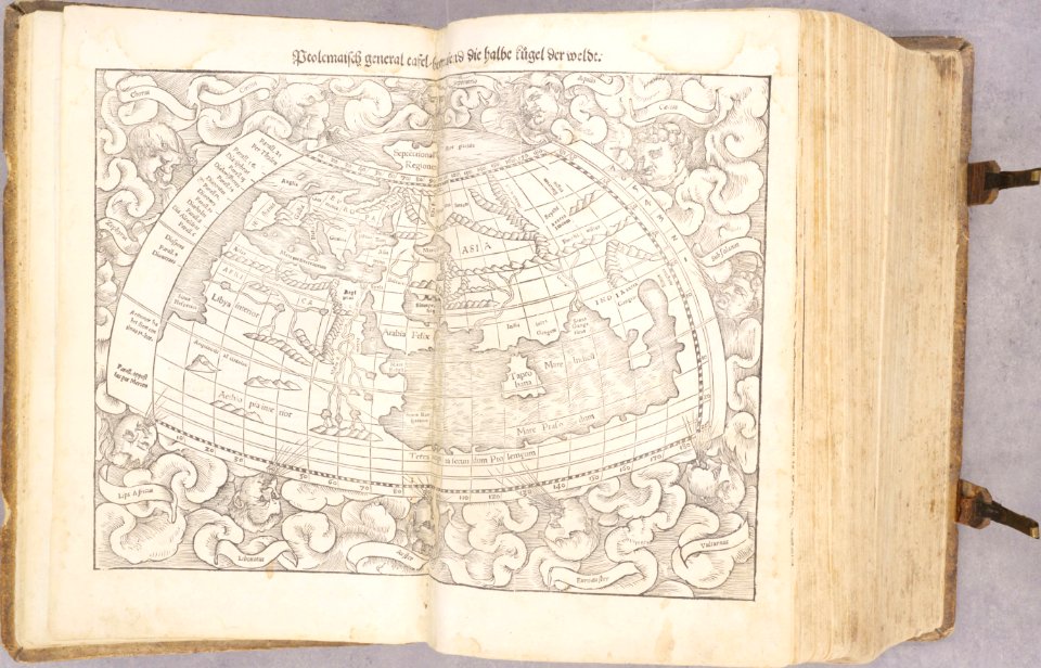
1540s maps of the world
ptolemaic world maps
johannes janssonius waasbergen
1672
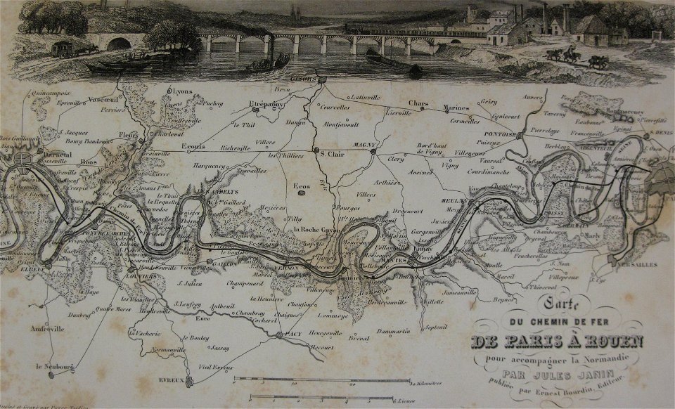
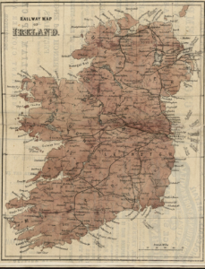
rail transport maps
cc-zero
maps made in the 17th century
jan janssonius
maps in the library of congress
1716 maps
maps in the library of congress
washington
atlantis magni tomus primus (biblioteca comunale di trento)
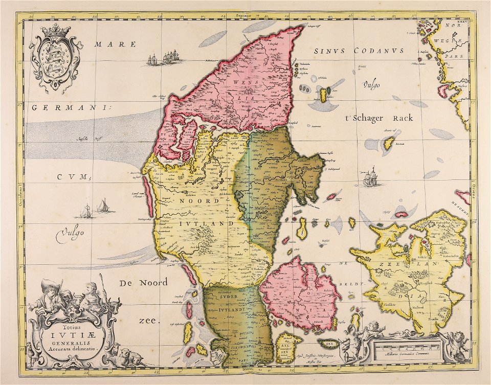
17th-century maps of denmark
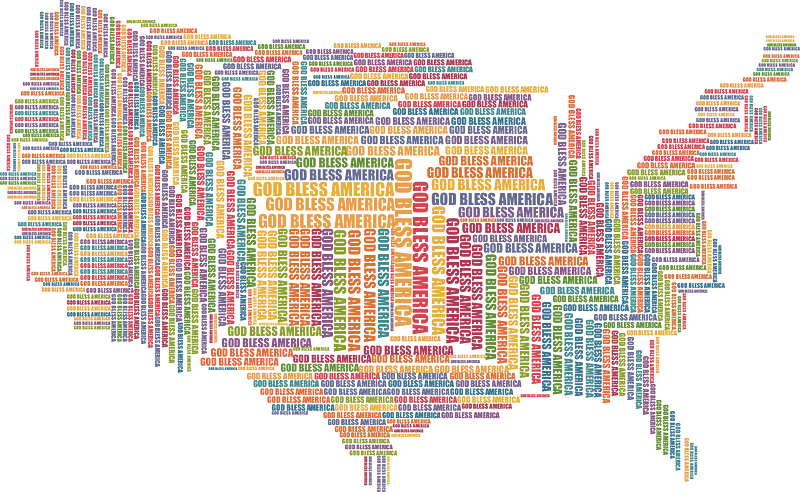
maps
usa
maps
flag
maps
flag
symbols for hydrogeological maps in karstic area
self-published work
city location
location
maps of éfaté island
maps of mechelen
mechelen
old maps of verona
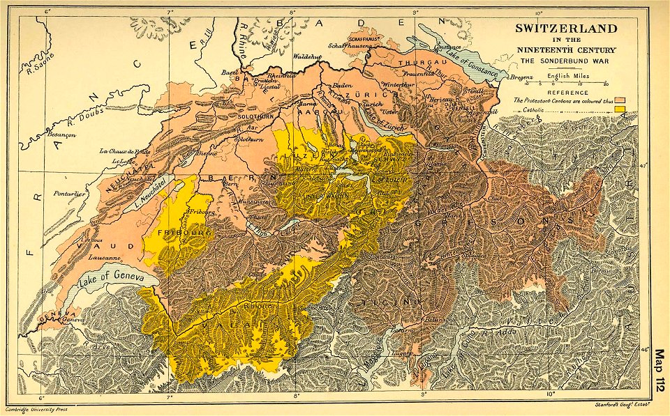
maps of the sonderbund war
maps of the duchy of bouillon
9401 - 9500 of 357,549
Next page
/ 3576