Log in
All resources
Create a design
Tools
357,549 Free Images of Maps
maps in the library of congress
maps by joseph hutchins colton
david rumsey historical map collection
1855 maps
1865 maps
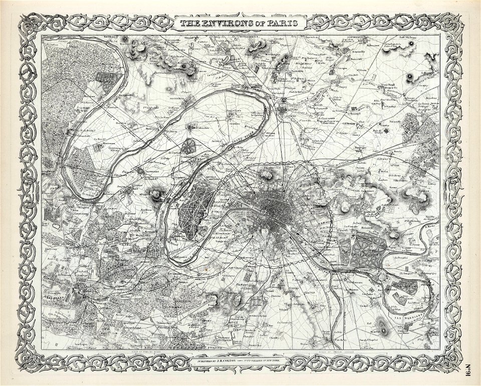
maps of paris from the david rumsey historical map collection
german-language maps
latin-language maps
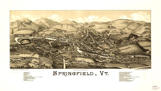
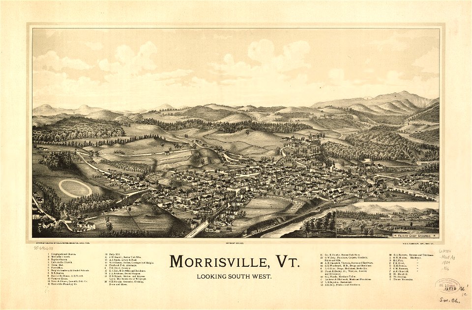
old maps of vermont
1889 maps
david rumsey historical map collection
maps by william faden
david rumsey historical map collection
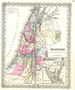
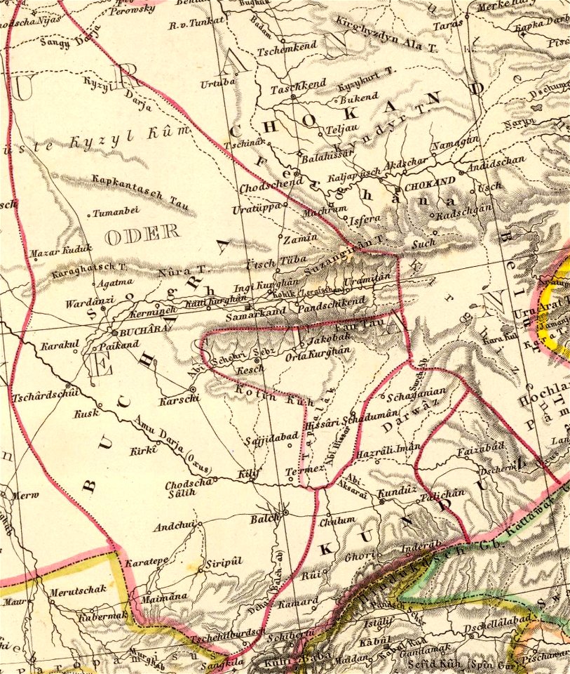
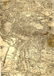
old maps of the middle east
david rumsey historical map collection
maps by william faden
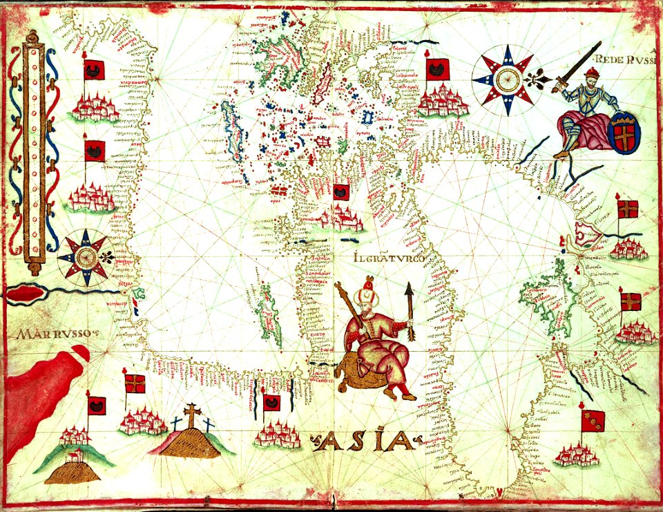
old maps of the sea of japan
maps by john thomson
1814 maps of north america
maps by john thomson
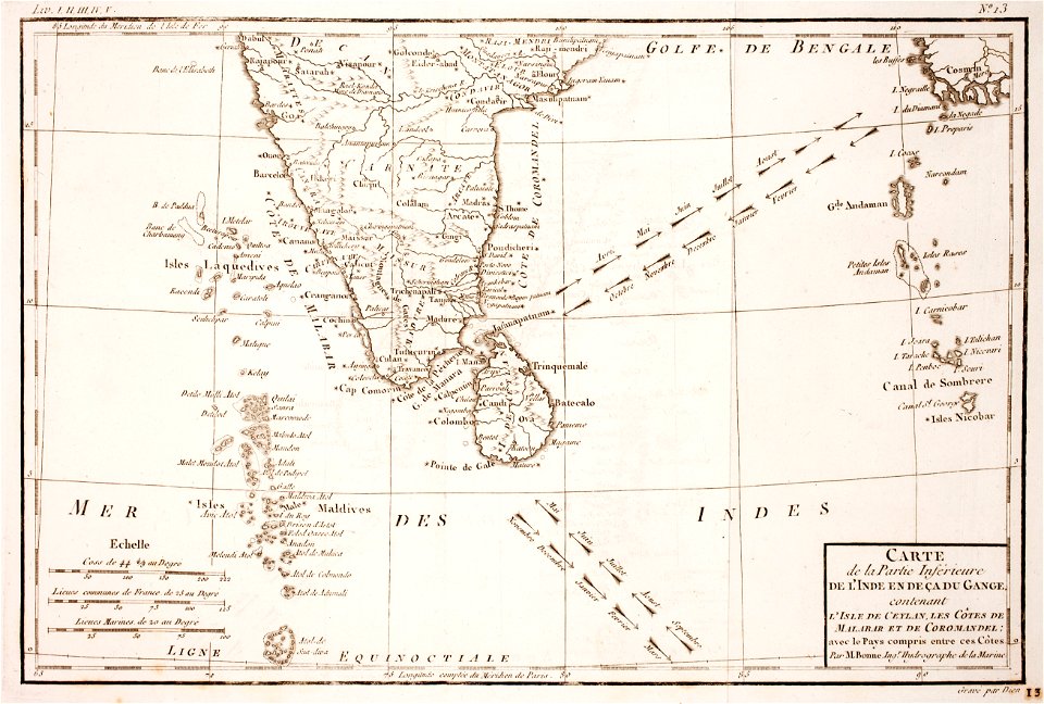
old maps of the indian ocean
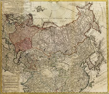
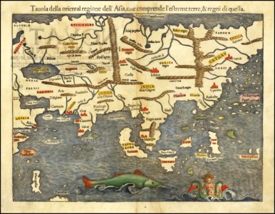
old maps of asia
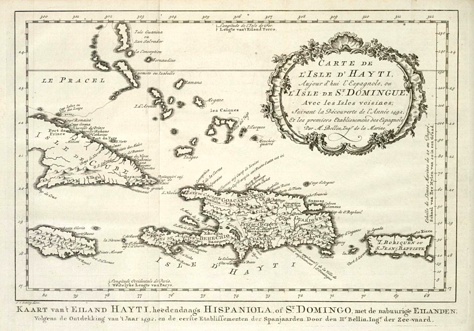
maps by jacques-nicolas bellin
1768
maps by benedetto bordon
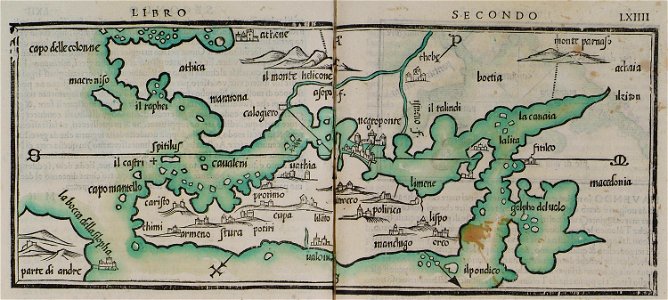
maps of euboea
maps made in the 18th century
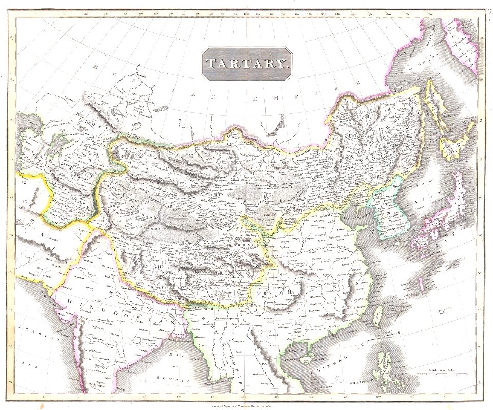
maps of tartary
old maps of asia
1855 maps
maps by joseph hutchins colton
1855 maps
david rumsey historical map collection
joan blaeu
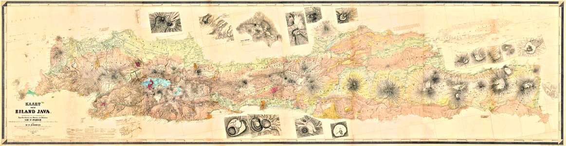
maps by franz wilhelm junghuhn
old maps of java
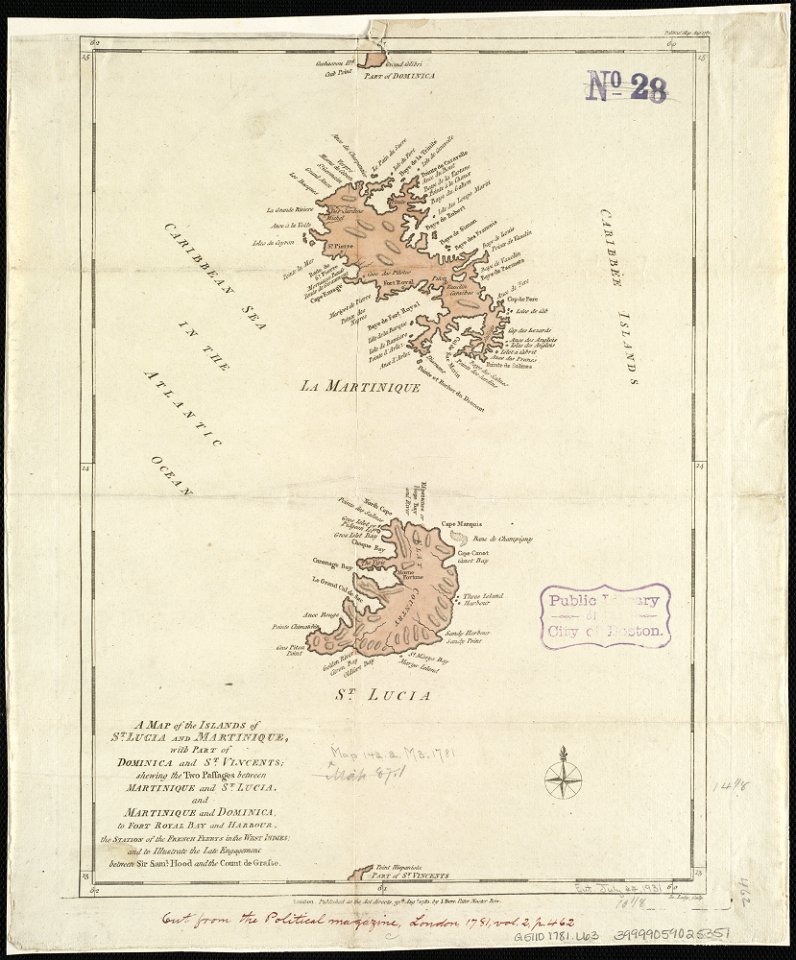
18th-century maps of martinique
john lodge (engraver)
1780 maps of wisconsin
1780 maps of montana
copper engraving
beavers in art
illustration
maps
maps by jodocus hondius
1606 maps
david rumsey historical map collection
german-language maps
david rumsey historical map collection
german-language maps
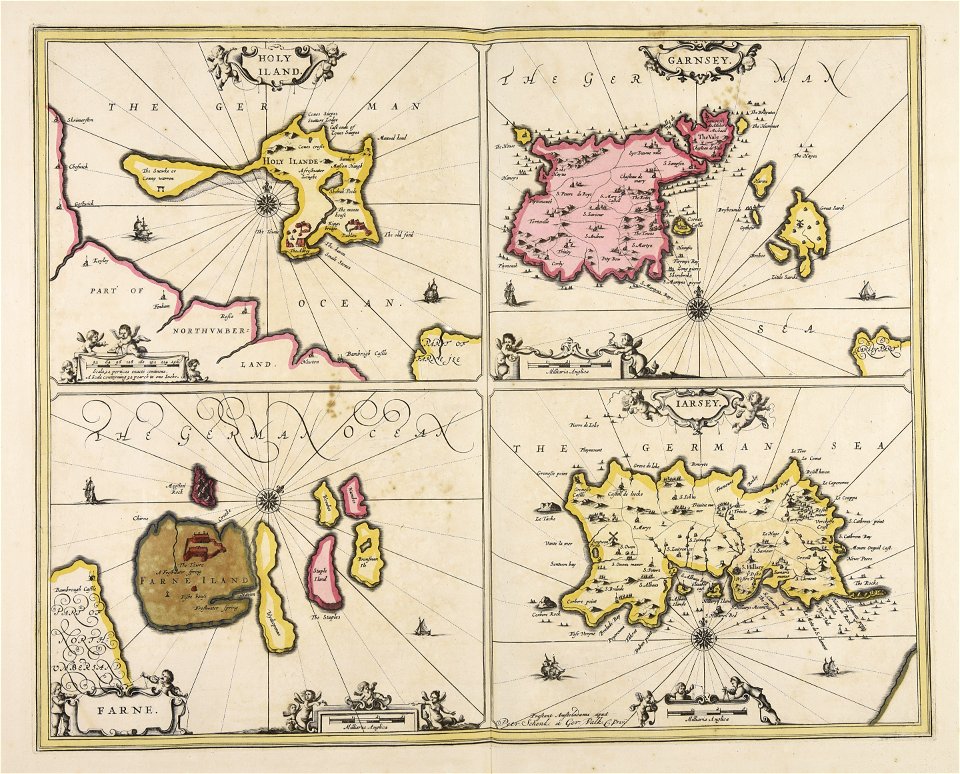
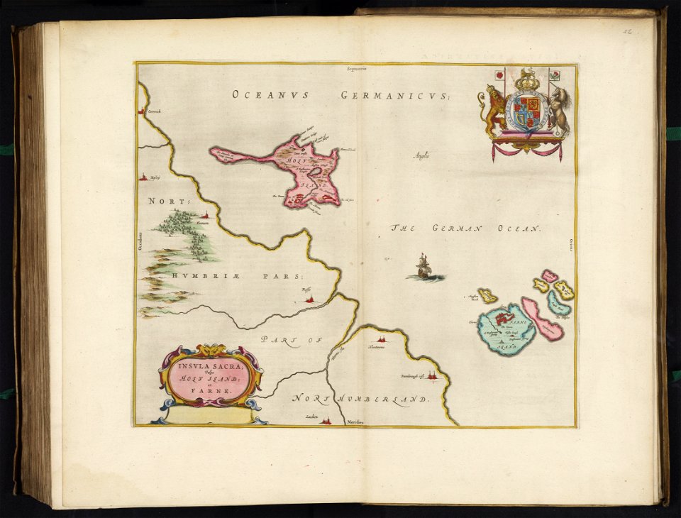
great britain
north sea
collections de la bibliothèque nationale et universitaire de strasbourg
german-language maps
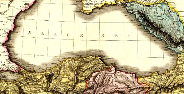
16th-century maps of the mediterranean sea
16th-century maps of the black sea
maps by george h. walker and company
maps in the library of congress
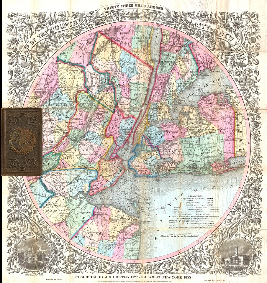
1865 in paris
1865 maps
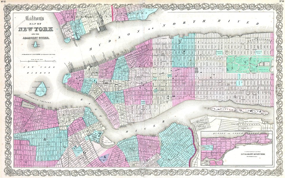
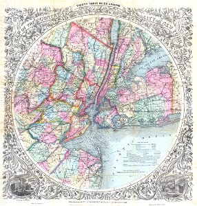
old maps of manhattan
new york city
brooklyn borough hall
new york city hall
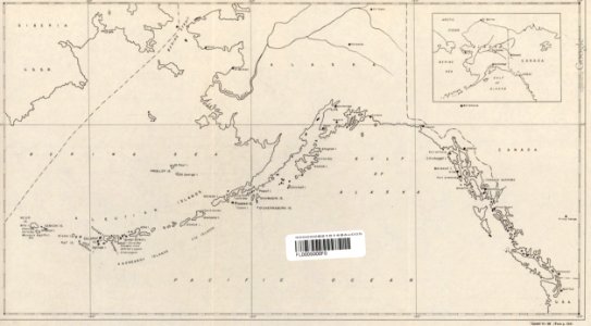
maps of the aleutian islands
1940s maps of alaska
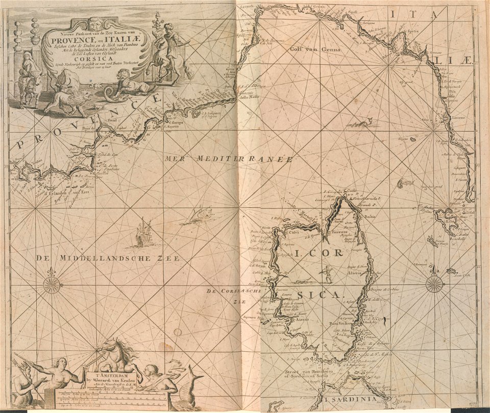
18th-century maps of liguria
old maps of corsica
maps by gerardus mercator
maps by jodocus hondius
maps by sebastian münster
1550 maps of asia
description de l'universe
maps of nubia
maps in the library of congress
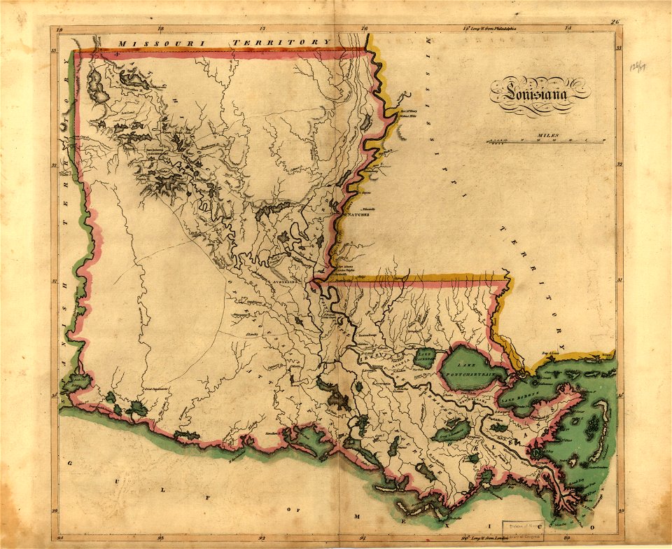
old maps of louisiana
maps by willem and johannes blaeu
atlas van loon
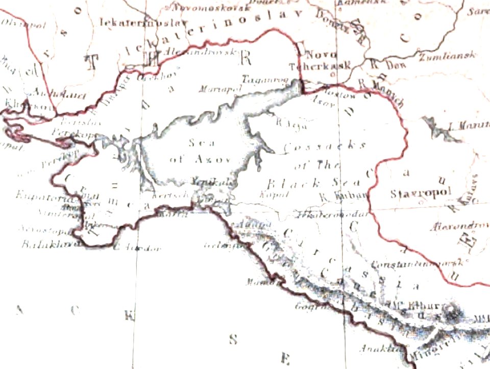
old maps of the sea of azov
maps of circassia
maps made in the 17th century
gerard valck
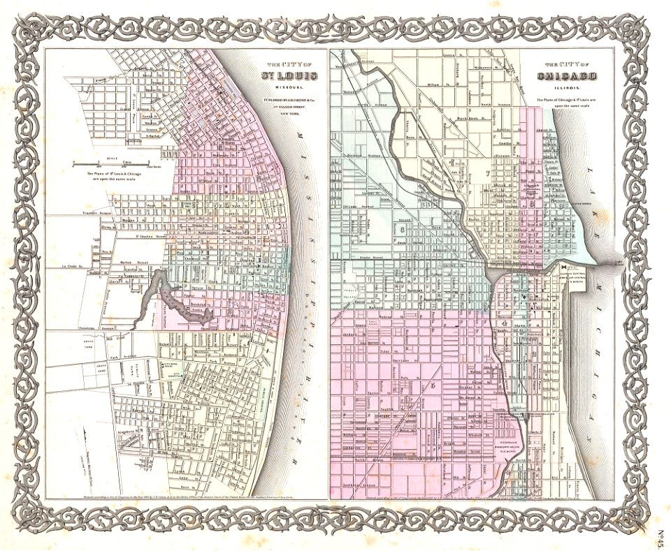
1850s maps of chicago
missouri
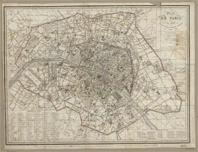
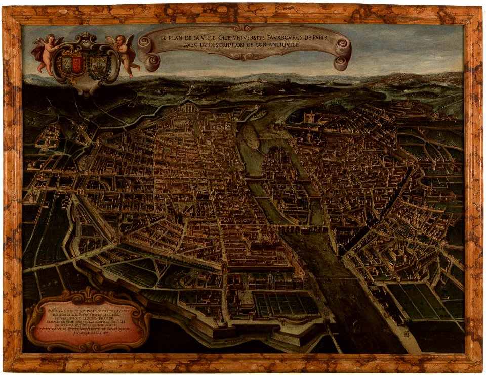
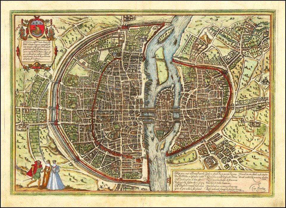
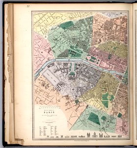
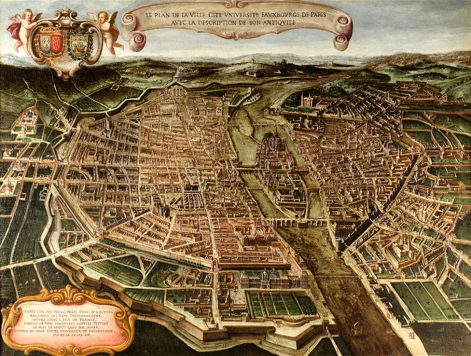
maps of paris from paris musées
1830s maps of paris
old maps of the arabian peninsula
maps of midian
maps of the andaman islands
18th-century maps of india
18th-century maps of the americas
maps by homannsche erben
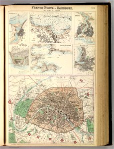
port of cherbourg
france
maps of isla margarita
pictorial maps
maps of paris from paris musées
paintings in musée carnavalet
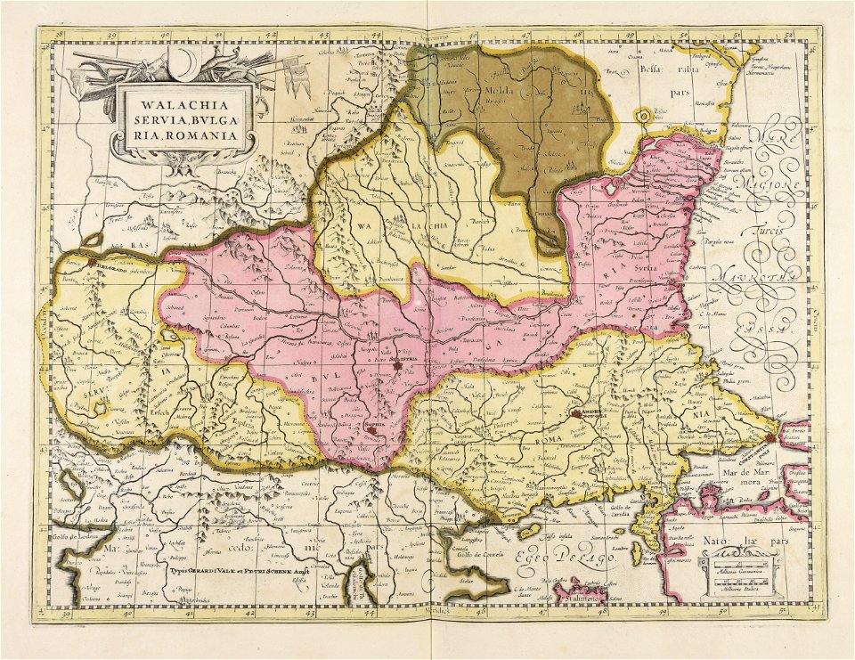
maps of romania
gerard valck
italian-language maps
1776 maps
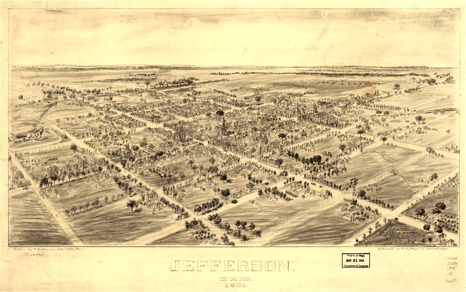
jefferson
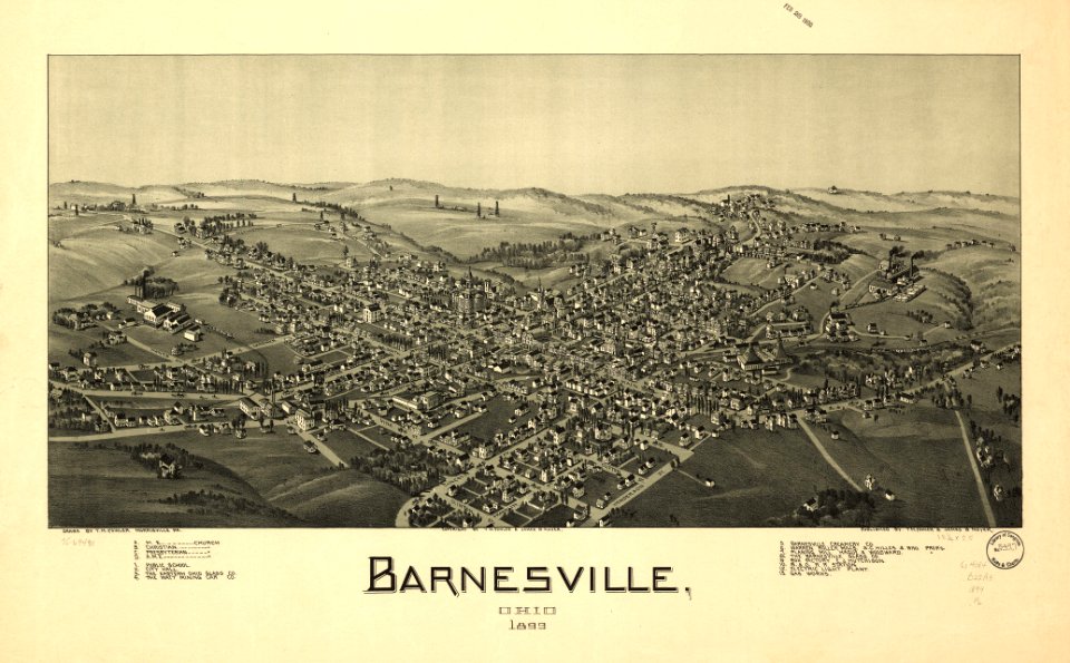
ohio
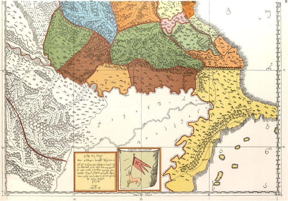
description of kingdom of georgia
its habits and canons
david rumsey historical map collection
1813 maps
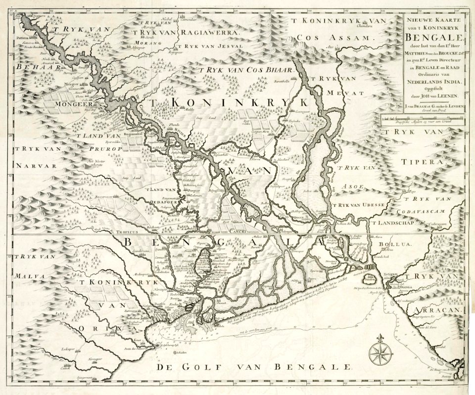
dutch bengal
1726 maps
maps in the library of congress
ohio
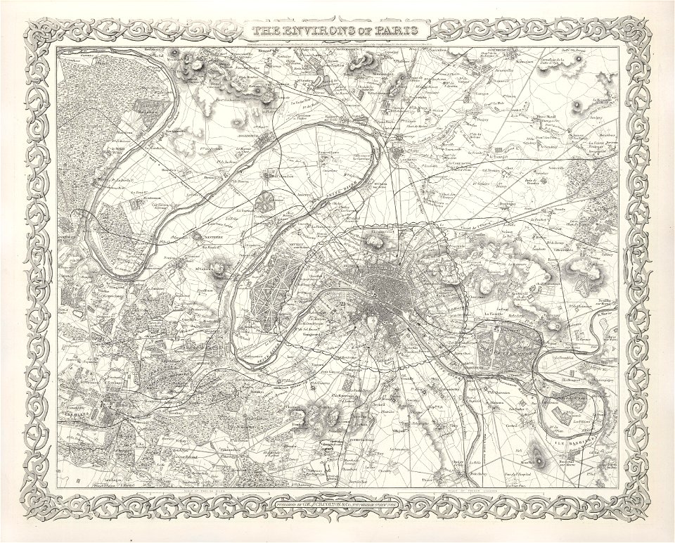
maps of paris from the barry lawrence ruderman antique maps inc.
maps of paris by braun & hogenberg
david rumsey historical map collection
joan blaeu
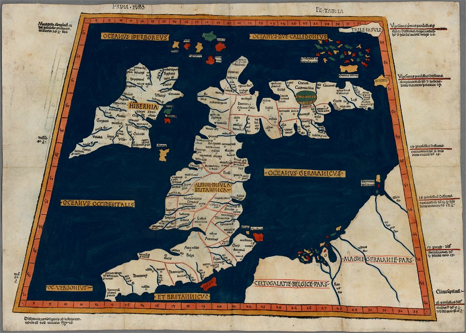
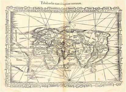
ptolemaic world maps
latin-language maps
43rd indiana infantry regiment
1855 maps
maps by joseph hutchins colton
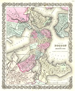
1855 in boston
maps by joseph hutchins colton
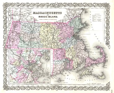
1855 maps of rhode island
19th-century maps of london
1855 maps
coats of arms on maps
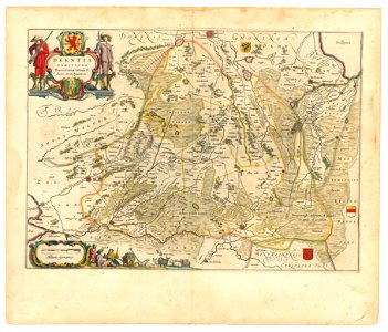
old maps of drenthe
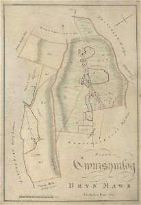
estate maps in the national library of wales
estate maps
description de l'universe
1683 maps of pakistan
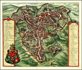
timeline of siena
old maps of siena
maps in the library of congress
old maps of vermont
maps in the library of congress
old maps of vermont
maps in the library of congress
old maps of connecticut
maps in the library of congress
old maps of vermont
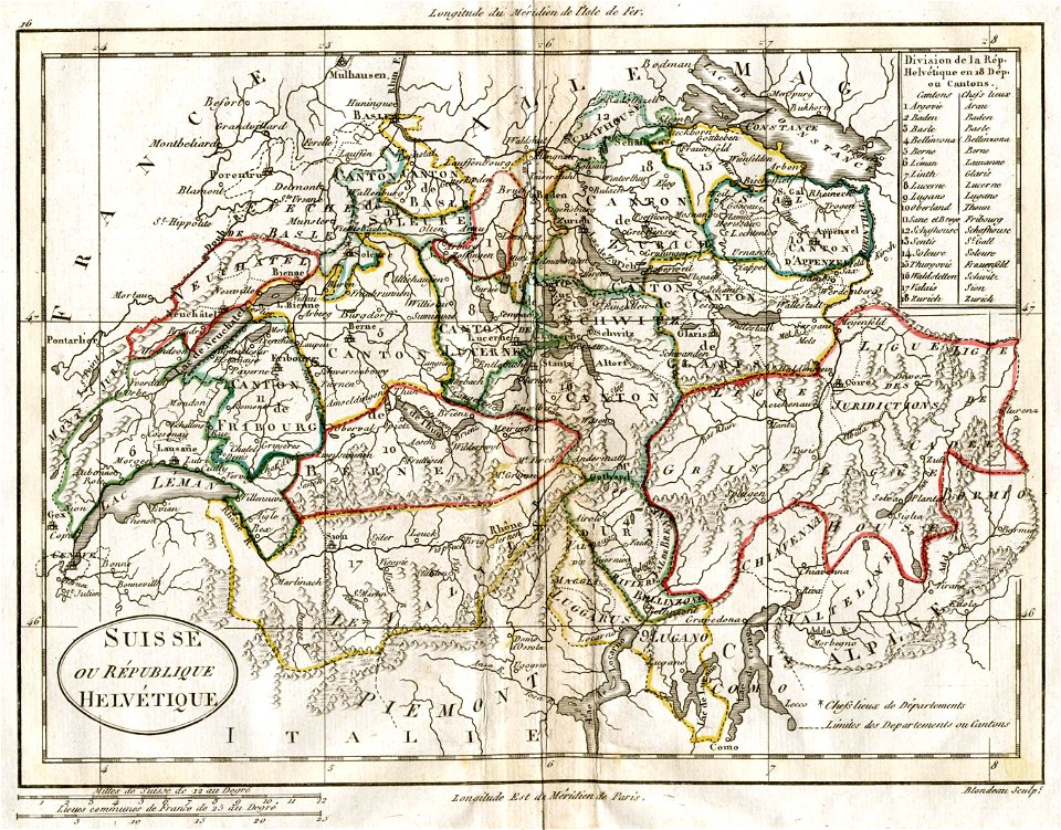
old maps of switzerland
1798 in switzerland
old maps of livorno
maps by coronelli
maps in the library of congress
old maps of vermont
maps in the library of congress
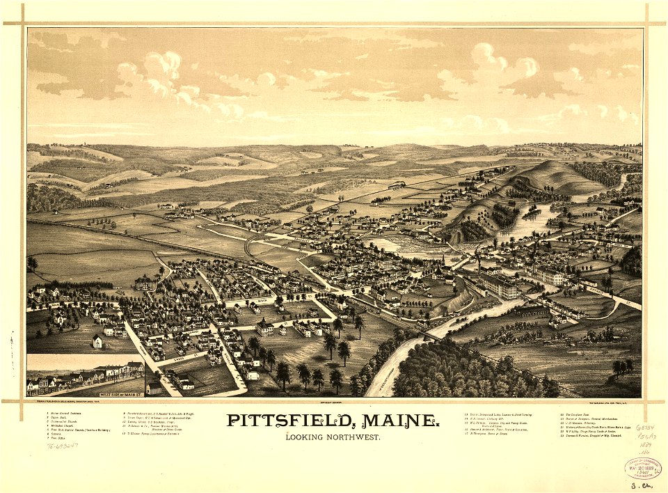
old maps of maine
maps in the library of congress
old maps of maine
maps with cartouches
braun & hogenberg
maps in the library of congress
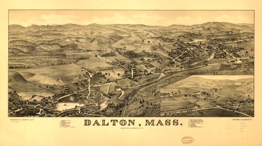
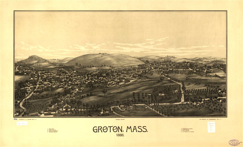
old maps of massachusetts
maps by matthäus seutter
old maps of madrid
maps in the library of congress
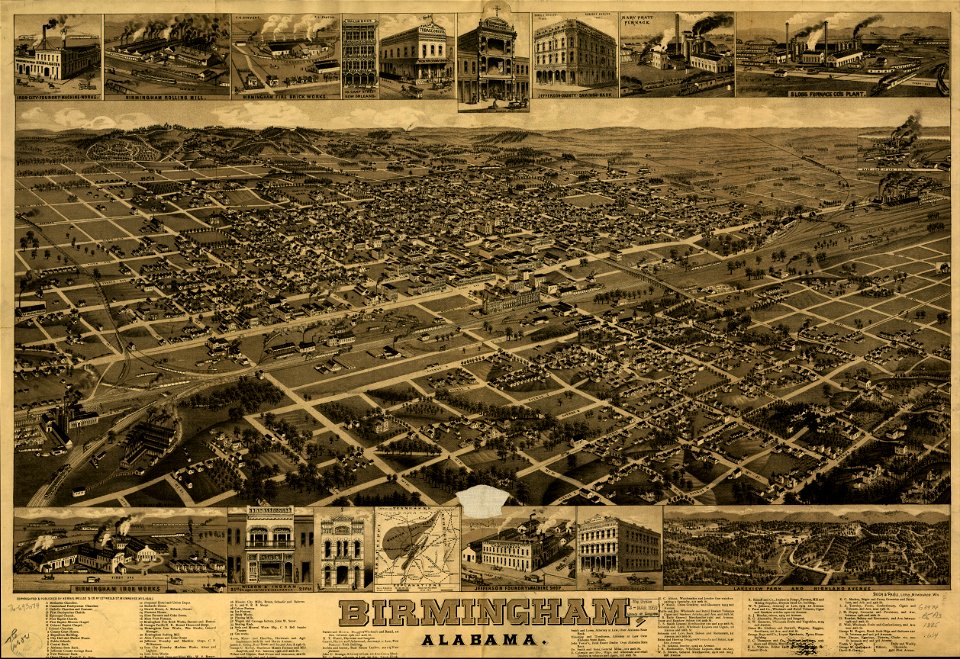
old maps of alabama
us states
maps
us states
maps
continent
maps
english-language maps
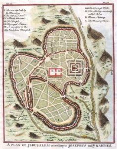
pool of siloam
old maps of gorée
1732 maps
maps by george h. walker and company
maps in the library of congress
maps in the library of congress
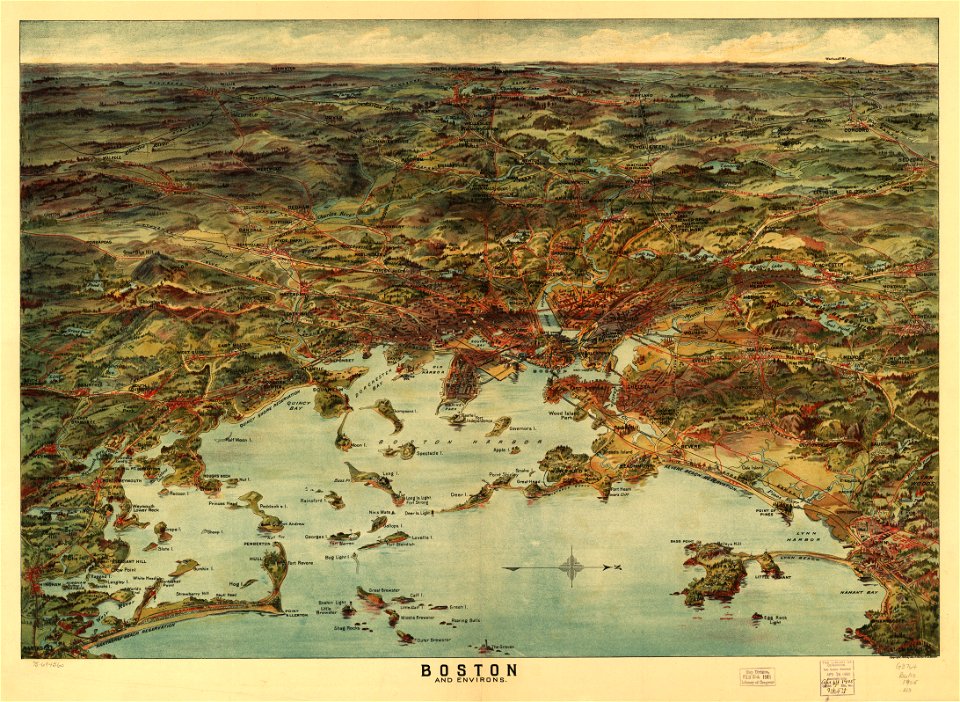
massachusetts
maps in the library of congress
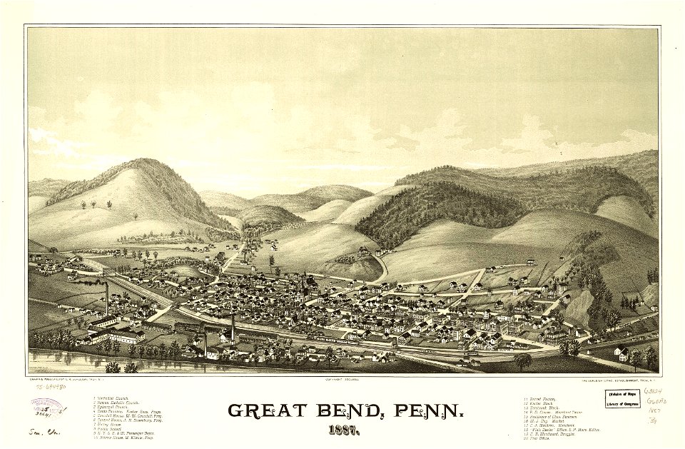
old maps of pennsylvania
maps in the library of congress
massachusetts
19th-century maps of the caucasus
1865 maps
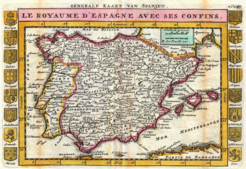
old maps of the iberian peninsula
johannes ratelband
maps by jacques-nicolas bellin
old maps of saint lucia
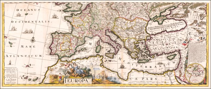
latin-language maps
carolus allard
administrative history of france
latin-language maps
maps of the ottoman empire in the 19th century
maps by joseph hutchins colton
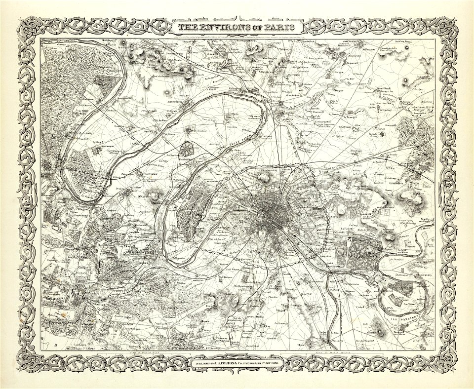
maps of paris from the david rumsey historical map collection
1856 maps
1874 in paris
1874 maps
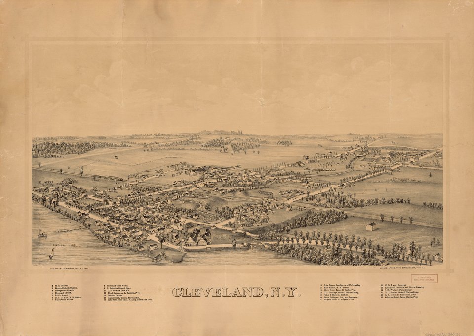
cleveland
new york
brooklyn borough hall
new york city hall
1865 in paris
1865 maps
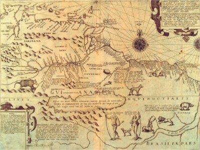
theodor de bry
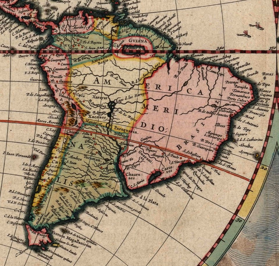
amazon
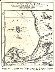
maps by jacques-nicolas bellin
table bay
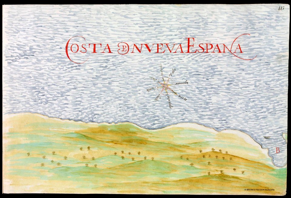
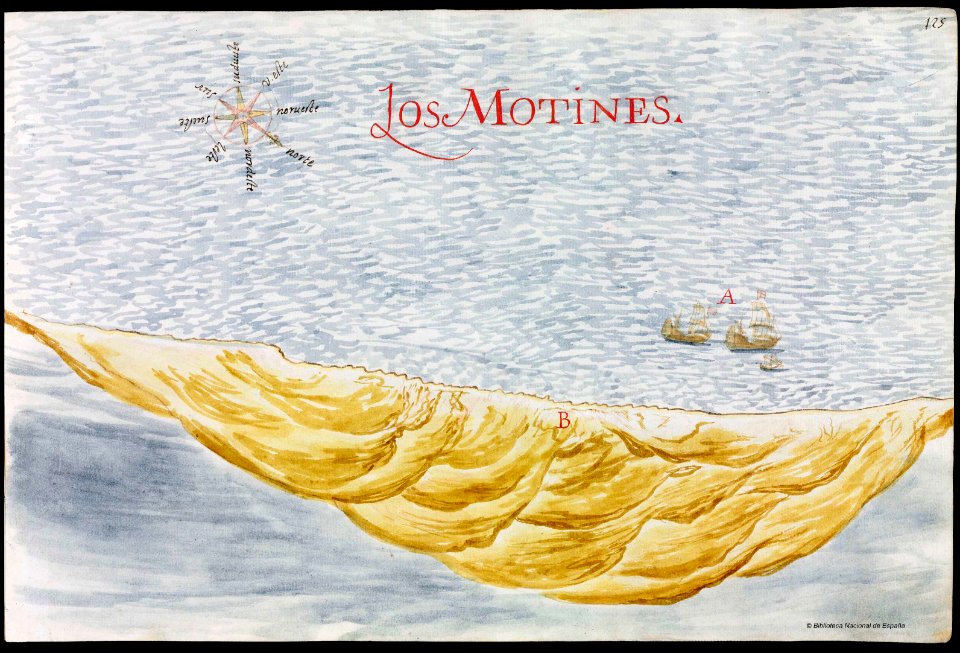
old maps of mexico
pictorial maps
old maps of mexico
pictorial maps
paintings in musée carnavalet
bird's eye view maps of paris
3801 - 3900 of 357,549
Next page
/ 3576