Log in
All resources
Create a design
Tools
357,630 Free Images of Maps
charts and maps of the royal museums greenwich
1682 maps
maps by pieter schenk (i)
maps in the library of congress
maps of the west-indische compagnie
gerard valck
maps made in the 17th century
atlantis magni tomus tertius (biblioteca comunale di trento)
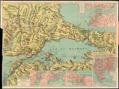
maps of world war i by the daily telegraph
maps with cartouches
old celestial maps
gerard valck
maps made in the 17th century
gerard valck
georgia
albany
maps made in the 17th century
gerard valck
maps made in the 17th century
old maps of westphalia
maps made in the 17th century
gerard valck
maps made in the 17th century
gerard valck
cosmographia claudii ptolomaei alexandrini
latin-language maps
maps in musée de la compagnie des indes
old maps of réunion
17th-century maps of france
maps with cartouches
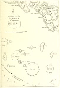
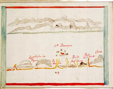
british battles on land and sea
1873 drawings
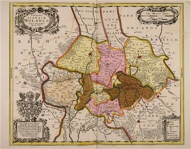
old maps of silesia
gerard valck
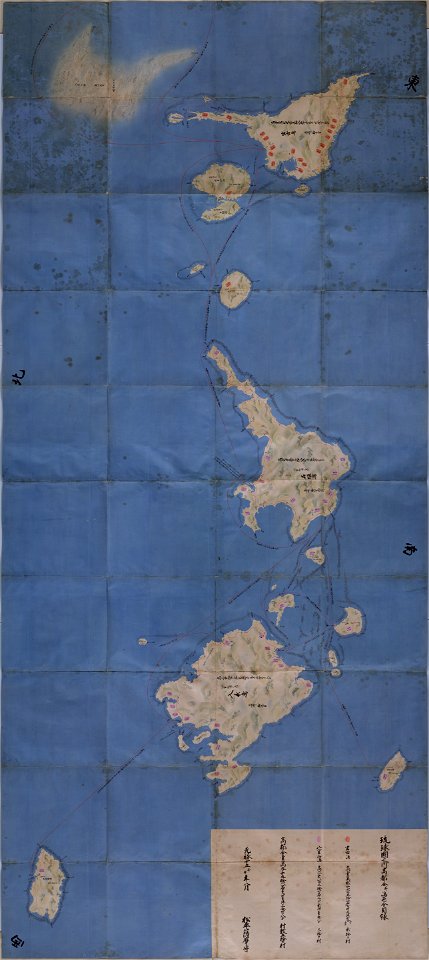
important cultural property of japan in tokyo
maps in the national archives of japan
maps made in the 17th century
gerard valck
hand-drawn maps and views of world war i battlefields by h.m.
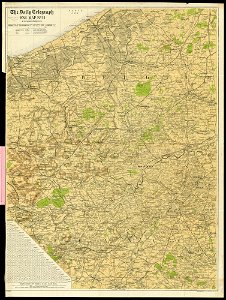
western front maps of world war i
maps made in the 17th century
gerard valck
maps made in the 17th century
gerard valck
maps by frederick de wit
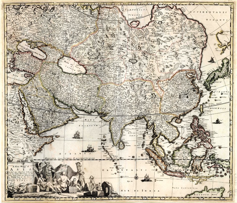
1680s maps of asia
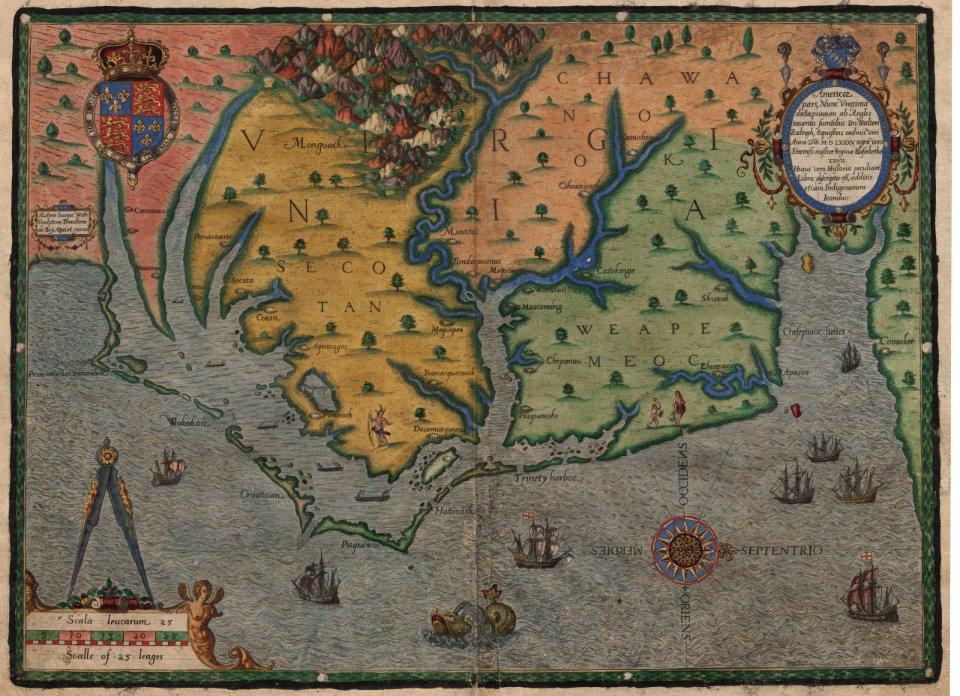
old maps of virginia
theodor de bry
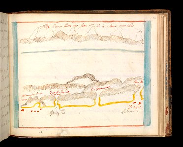
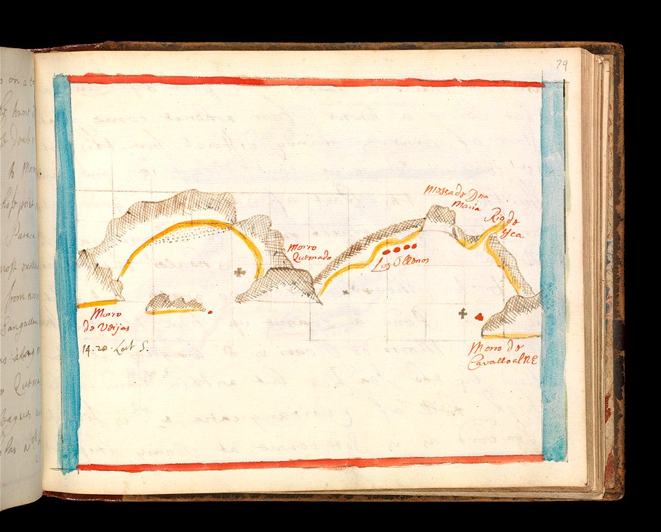
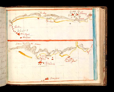
charts and maps of the royal museums greenwich
1682 maps
old maps of the dutch east india company
1680s
old maps of the dutch east india company
1750
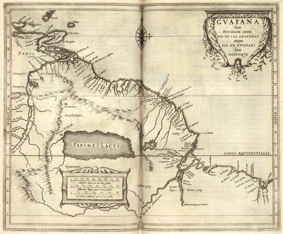
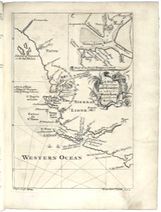
maps of the west-indische compagnie
1630
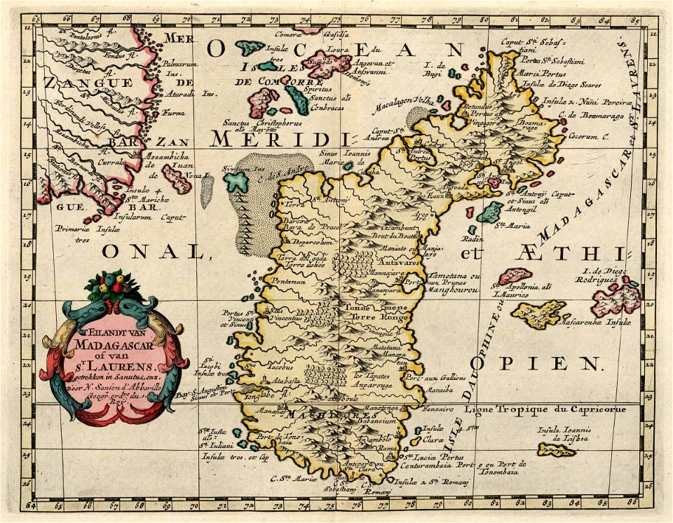
maps of the dutch east india company - madagascar
1705
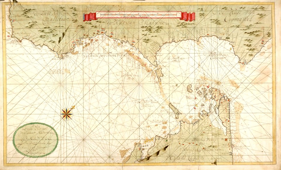
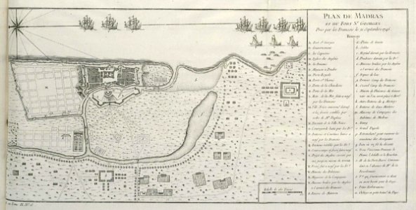
maps of the dutch east india company - india
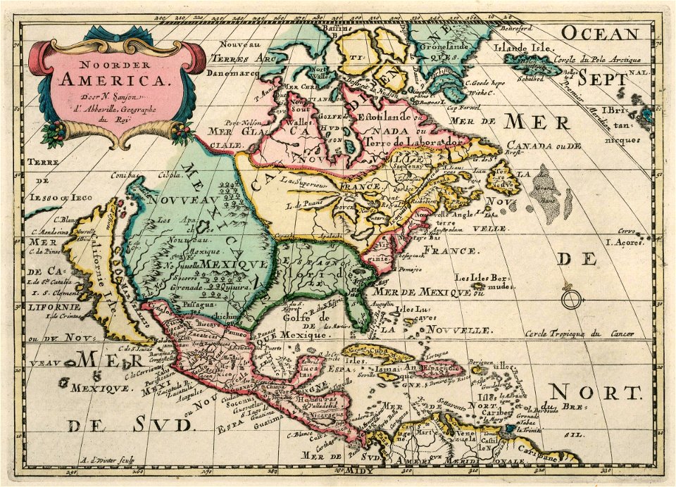
maps of the west-indische compagnie
1705
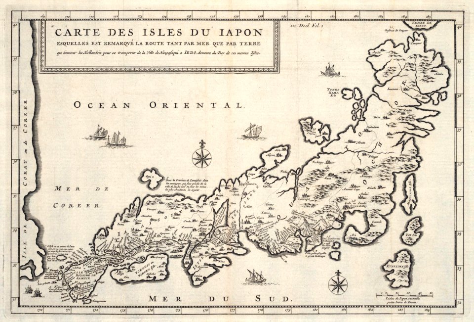
maps of the dutch east india company - japan
1718)
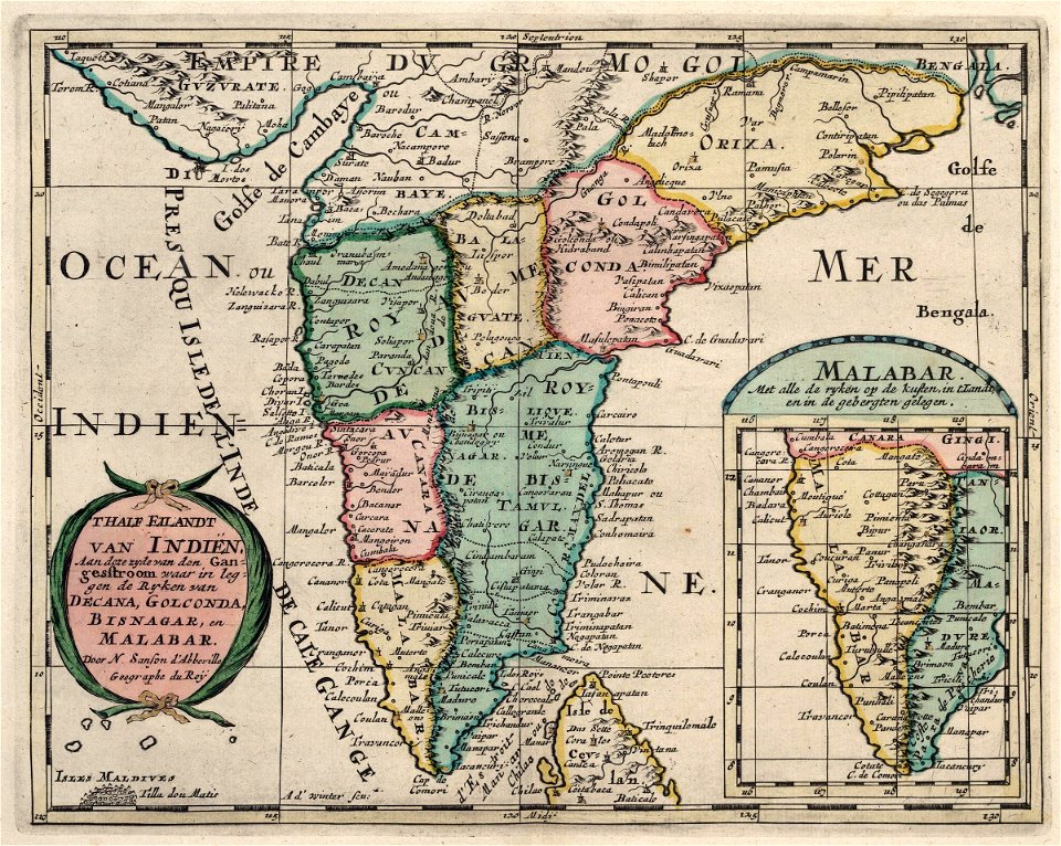
maps of the dutch east india company - india
1705
maps of the west-indische compagnie
1644
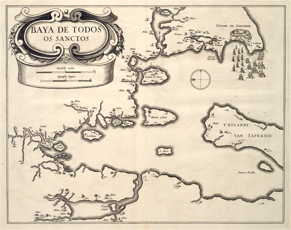
maps of the west-indische compagnie
1647
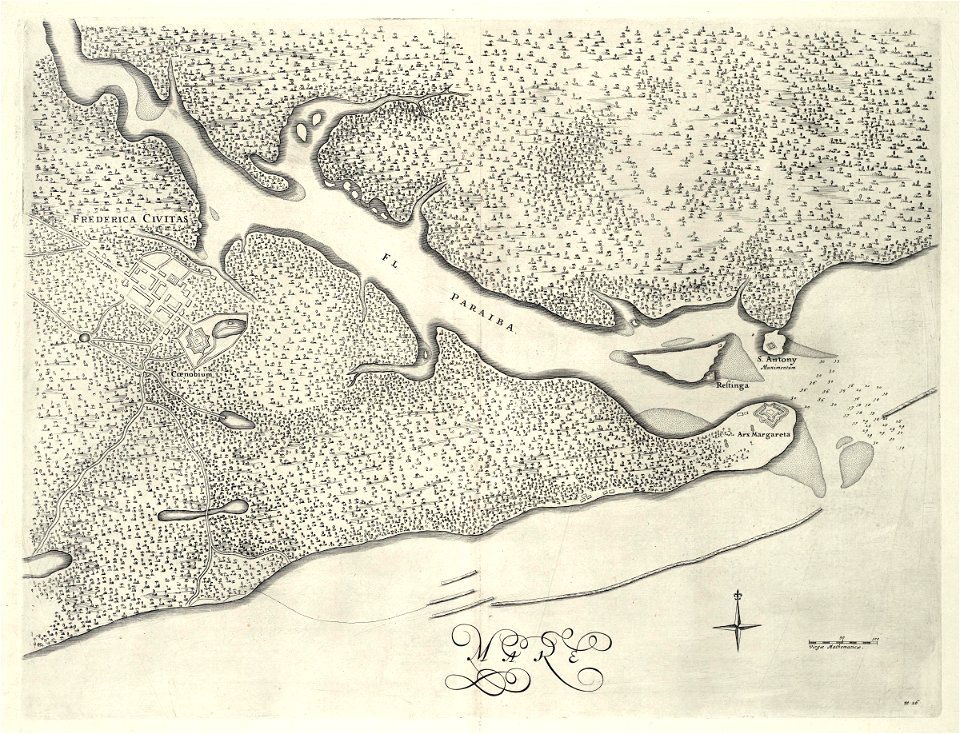
maps of the west-indische compagnie
1647
maps of the west-indische compagnie
1647
maps of the west-indische compagnie
1747)
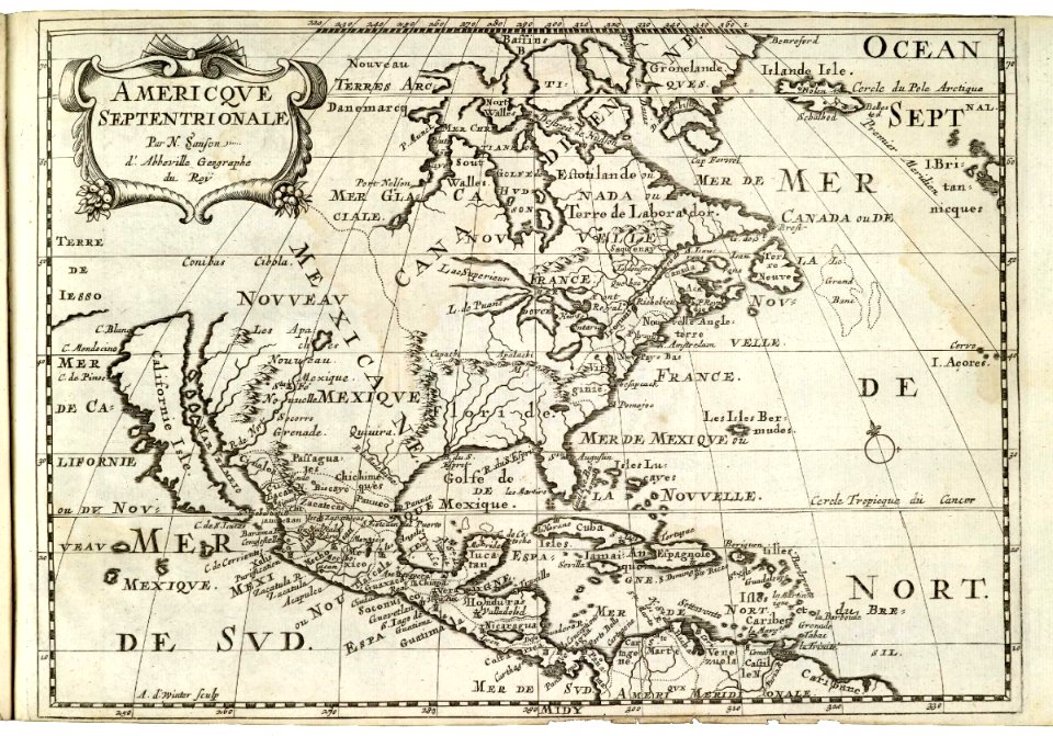
maps of the west-indische compagnie
1682)
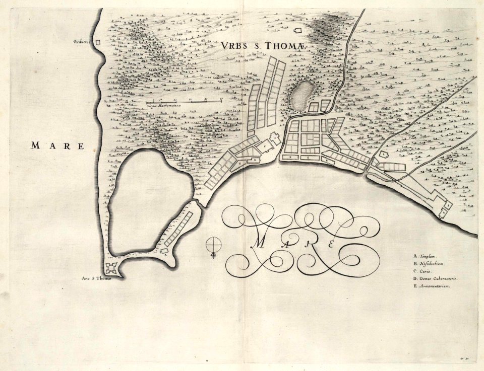
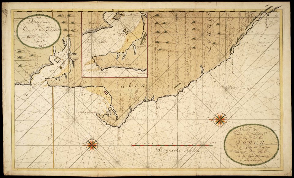
maps of the west-indische compagnie
1716
maps of the dutch east india company - india
1746
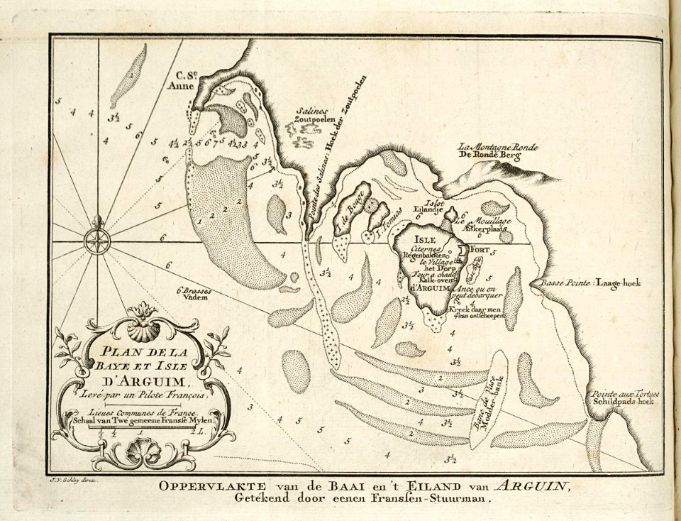
maps of the west-indische compagnie
1757
maps of the west-indische compagnie
1745
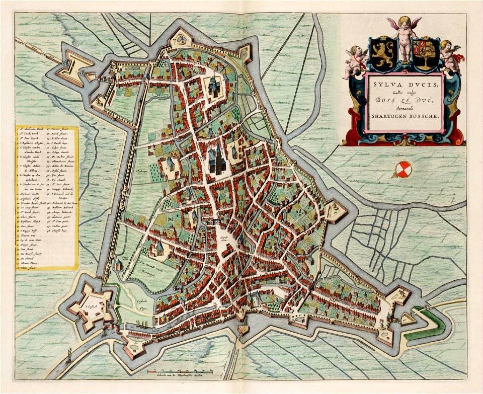
maps by willem and johannes blaeu
atlas van loon
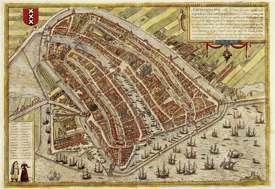
map of amsterdam by braun & hogenberg
coats of arms of amsterdam on maps
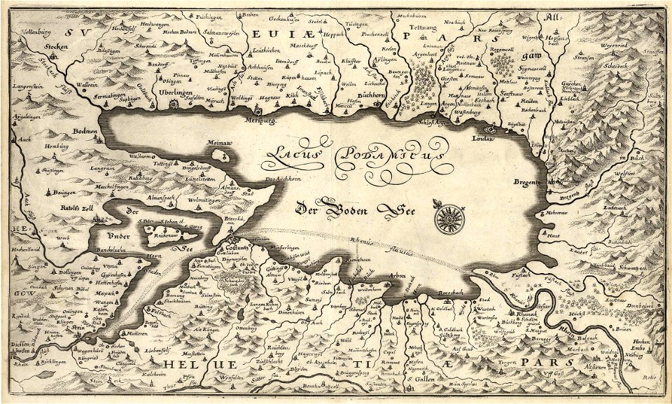
matthäus merian
1672 maps
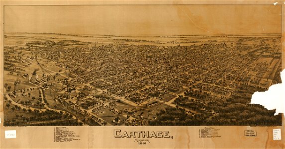
missouri
carthage
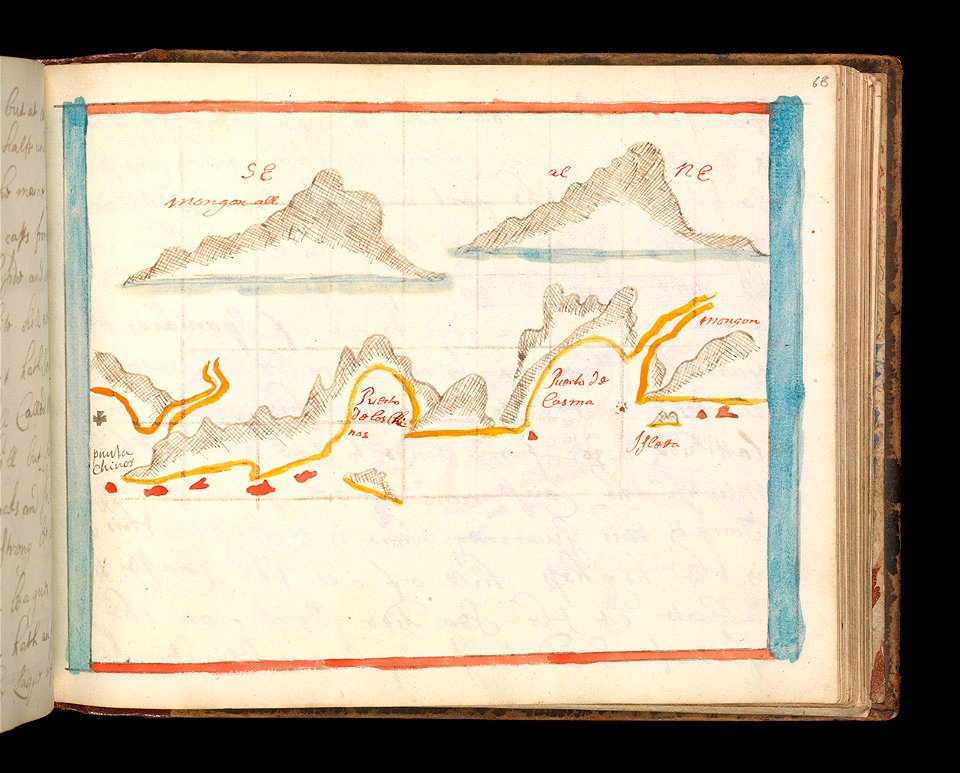
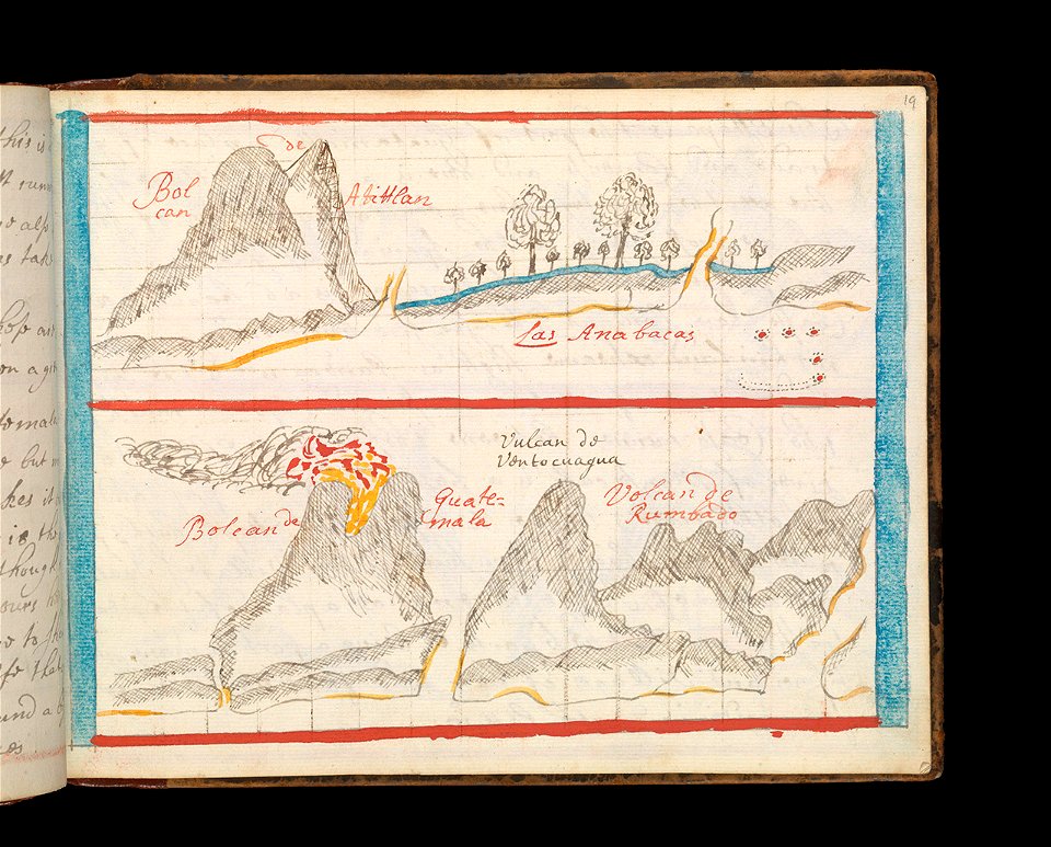
charts and maps of the royal museums greenwich
1682 maps
maps in the library of congress
1882 maps of ontario
charts and maps of the royal museums greenwich
1682 maps
charts and maps of the royal museums greenwich
1682 maps
charts and maps of the royal museums greenwich
1682 maps
charts and maps of the royal museums greenwich
1682 maps
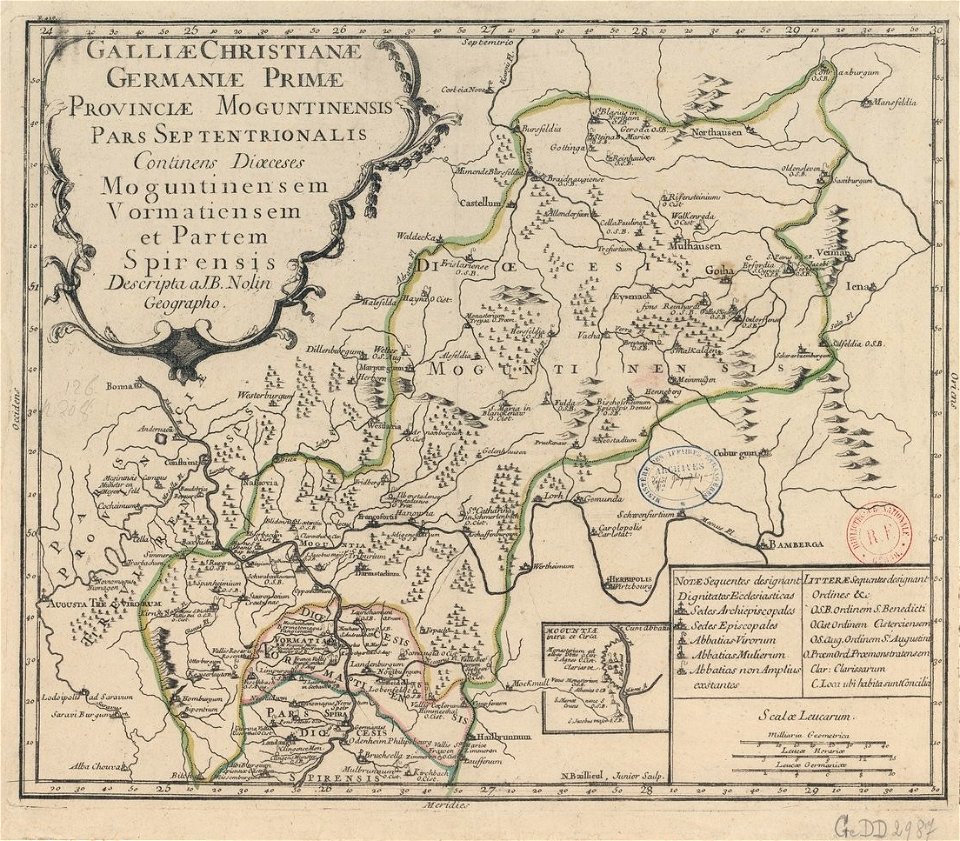
old maps published in the gallia christiana
maps of catholic dioceses of france
old maps published in the gallia christiana
maps of catholic dioceses of france
maps of world war i by the daily telegraph
maps of world war i by the daily telegraph
maps of world war i by the daily telegraph
maps of world war i by the daily telegraph
maps of world war i by the daily telegraph
maps of world war i by the daily telegraph
charts and maps of the royal museums greenwich
1682 maps
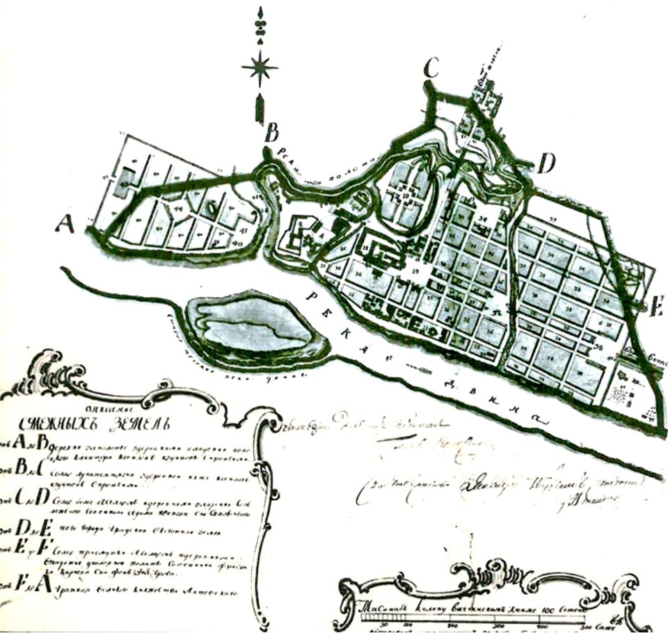
maps in russian state archives of ancient documents
old maps of polotsk
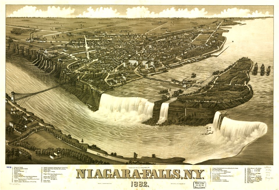
maps in the library of congress
1884 maps of new york (state)
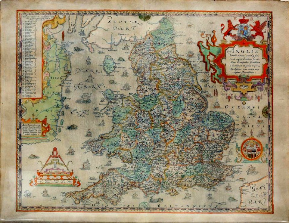
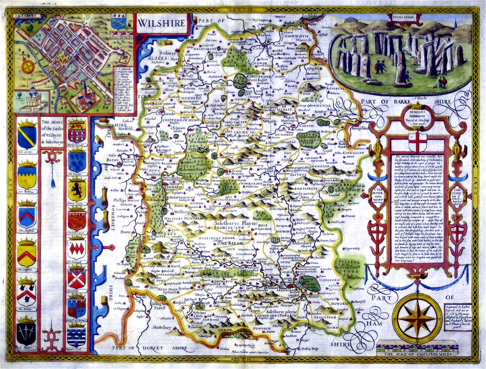
old maps of england
old maps of wales
maps in the library of congress
1884 maps of new york (state)
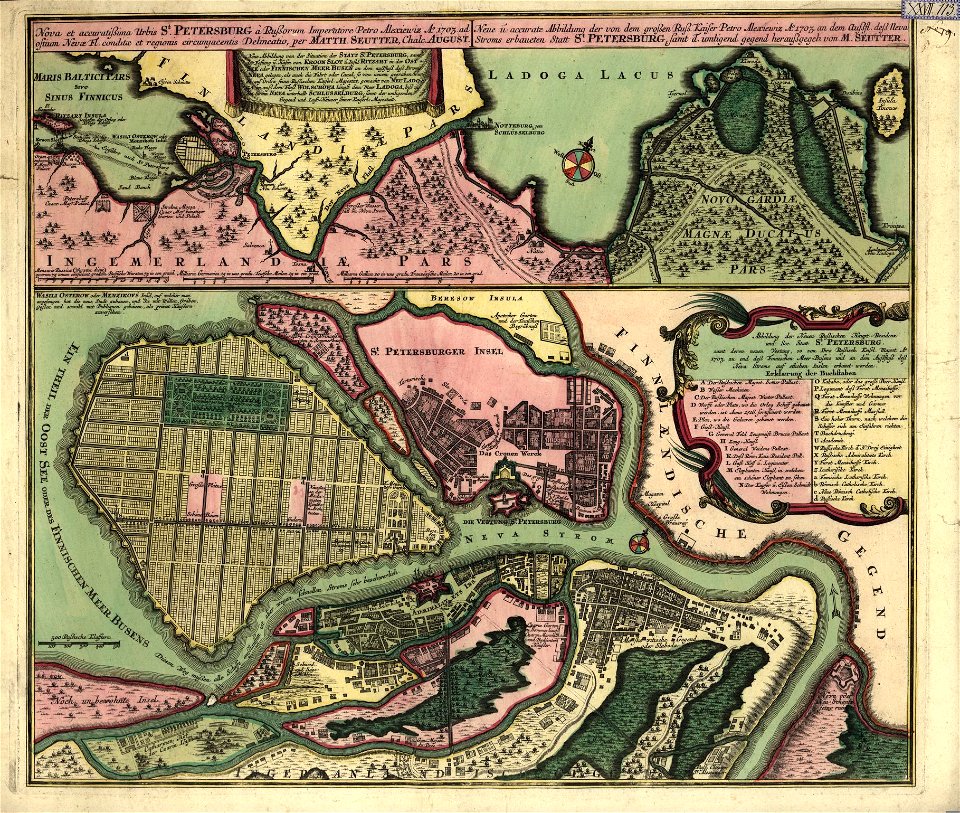
18th-century maps of saint petersburg
matthäus seutter
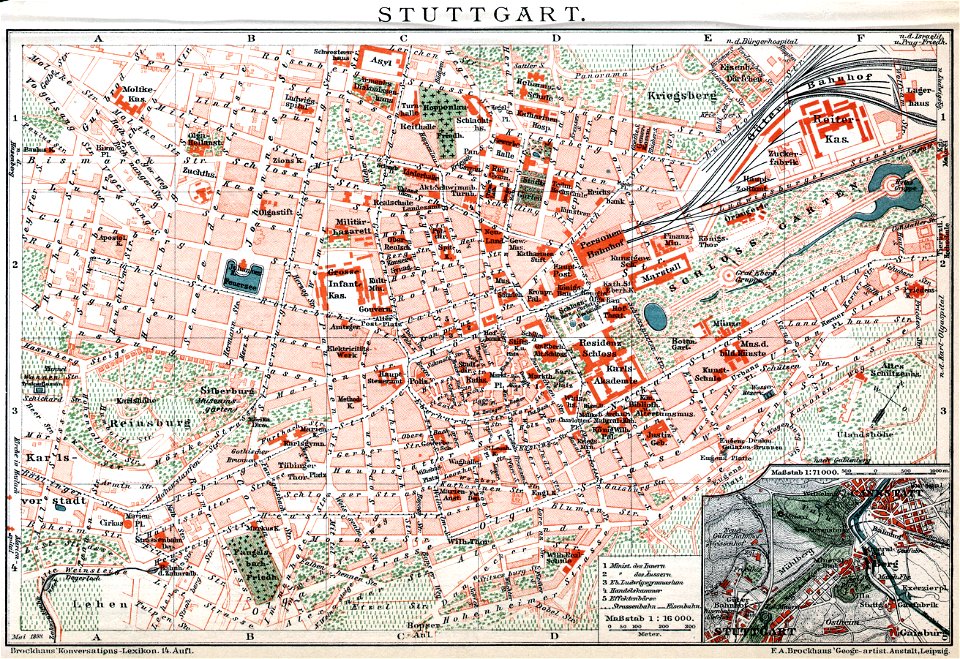
brockhaus' konversations-lexikon (1892)
maps by brockhaus
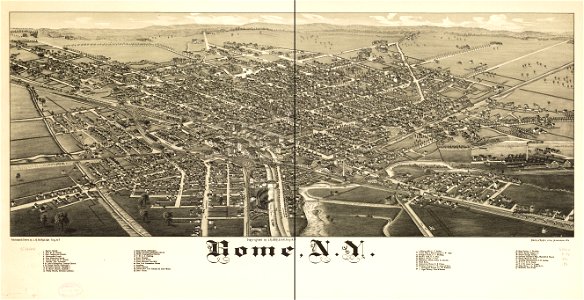
new york
rome
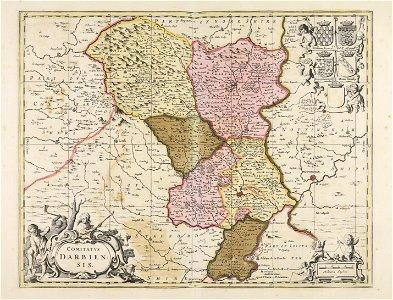
atlas of the russian empire (1800)
maps of volyn governorate
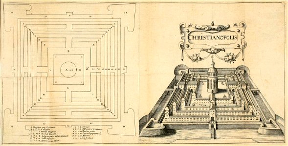
maps of fictional cities
maps in literature
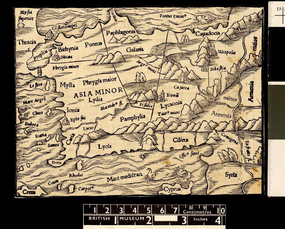
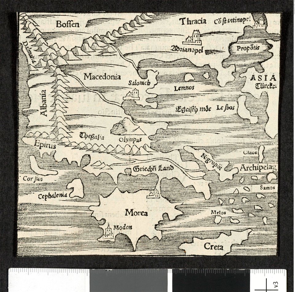
maps in the british museum
maps in the british museum
maps in the british museum
atlas of the russian empire (1792)
old maps of yaroslavl governorate
lepsius-projekt - maps
abydos
county maps of england by john speed
history of wiltshire
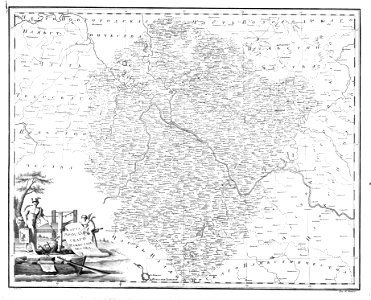
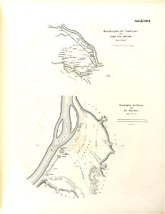
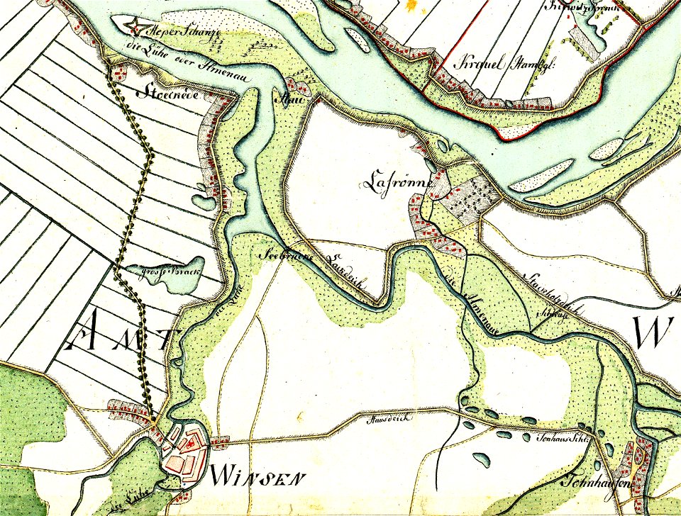
maps by gustav adolf von varendorf
maps of winsen (luhe)
charts and maps of the royal museums greenwich
1682 maps
historical maps of warsaw
1656 maps
charts and maps of the royal museums greenwich
1682 maps
maps in the library of congress
1890 maps of new york (state)
charts and maps of the royal museums greenwich
1682 maps
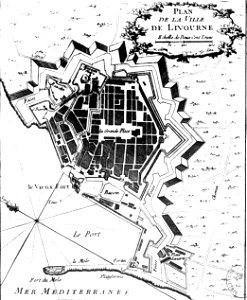
old maps of livorno
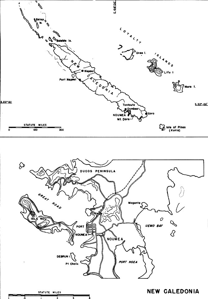
nouméa in world war ii
nouméa
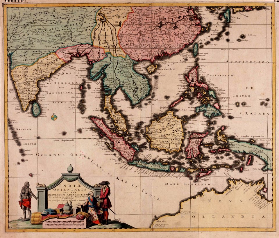
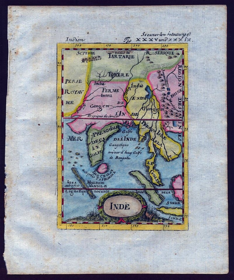
old maps of southeast asia
description de l'universe
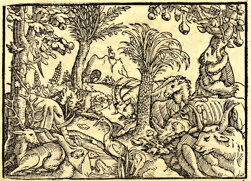
cosmographia (1600) by sebastian münster
1600s maps of egypt
charts and maps of the royal museums greenwich
1682 maps
charts and maps of the royal museums greenwich
1682 maps
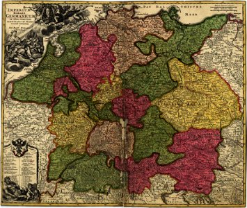
maps in the library of congress
18th-century maps of germany
old maps of flanders
old maps of france
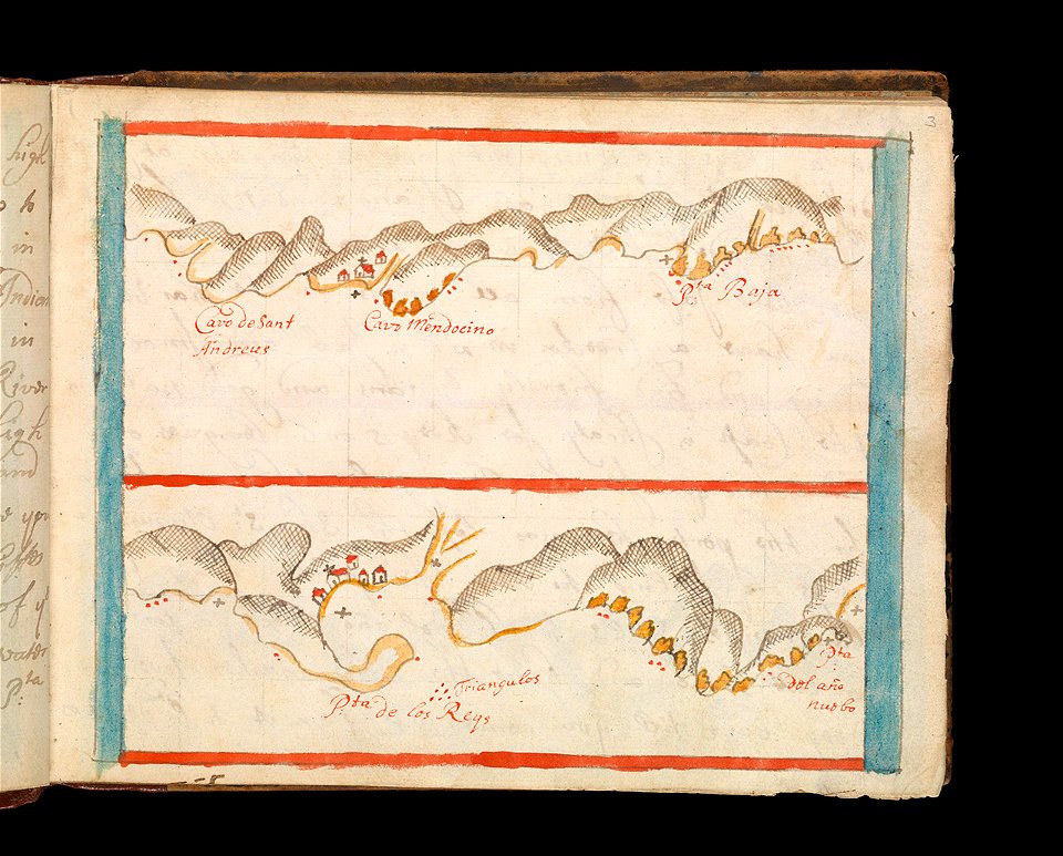
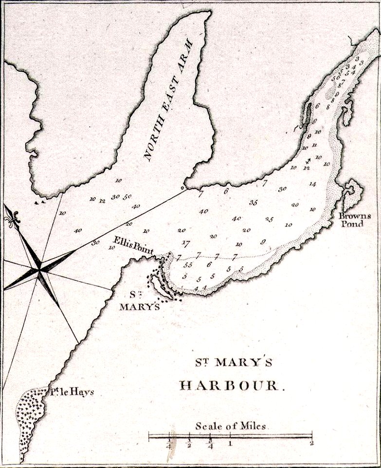
james cook (maps relating to)
old maps of newfoundland
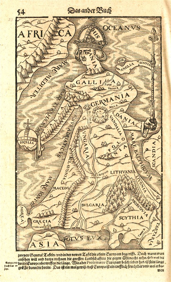
maps by sebastian münster
europa regina
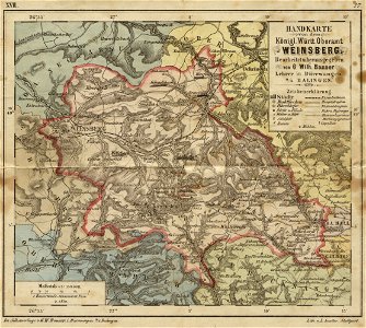
19th-century maps of baden-württemberg
history of weinsberg
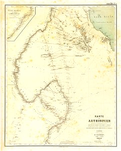
lepsius-projekt - maps
1850s maps of sudan
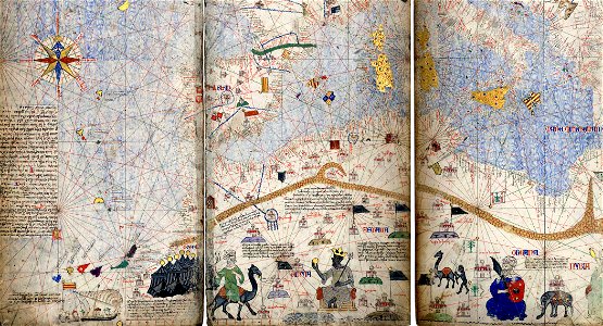
maps of the mali empire
catalan atlas
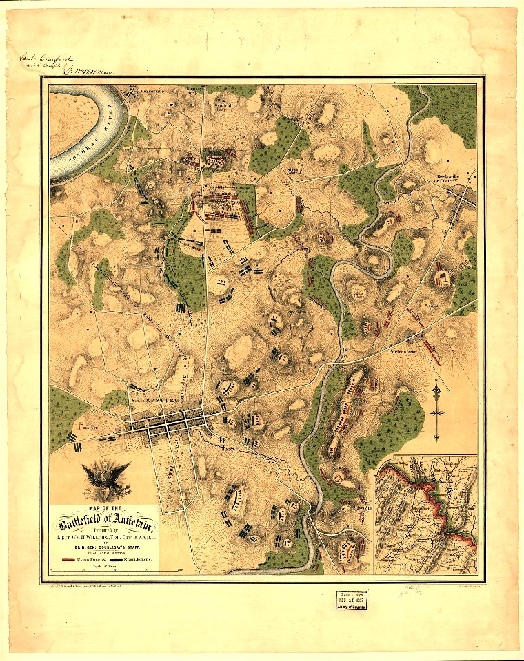
maps in the library of congress
p.s. duval & son
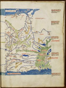
topographic maps of palestine
jerusalem
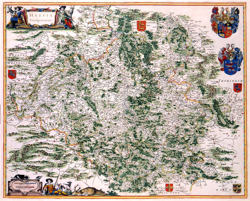
maps with cartouches
old maps of hesse
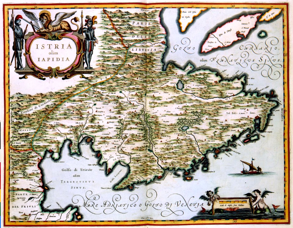
maps with cartouches
atlas van der hagen
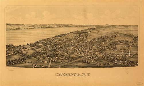
cazenovia
new york
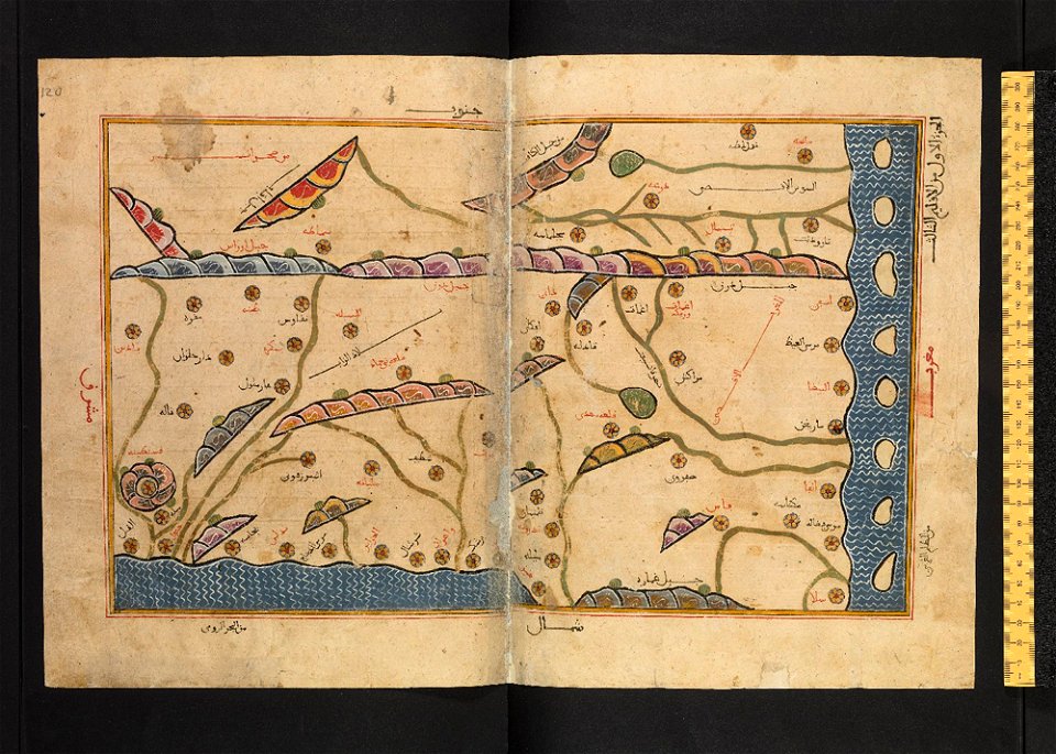
old maps of algeria
bodleian library
old maps of styria
gerard valck
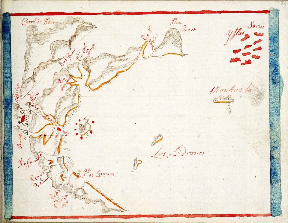
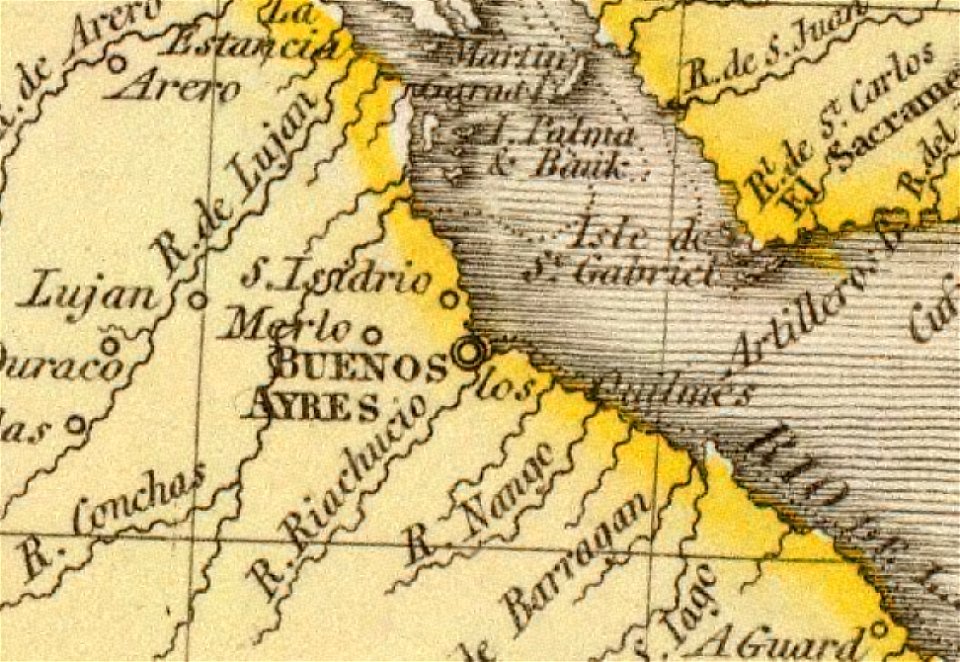
old maps of the río de la plata
1812 maps
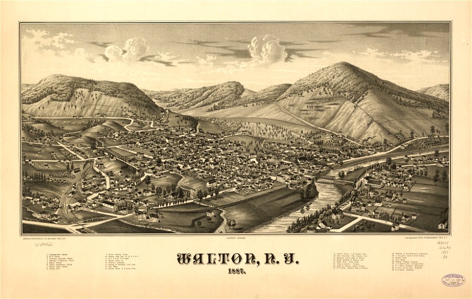
new york
walton
7101 - 7200 of 357,630
Next page
/ 3577