Log in
All resources
Create a design
Tools
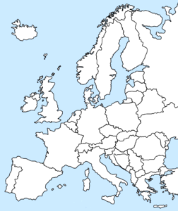
357,638 Free Images of Maps
maps in the library of congress
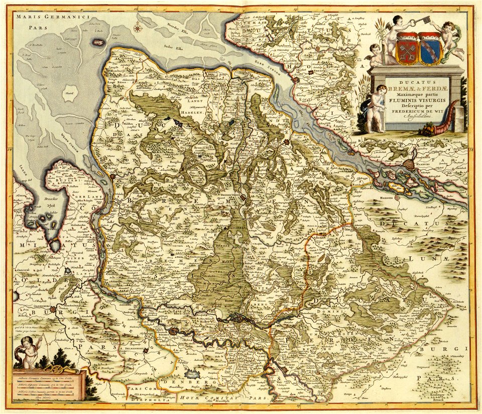
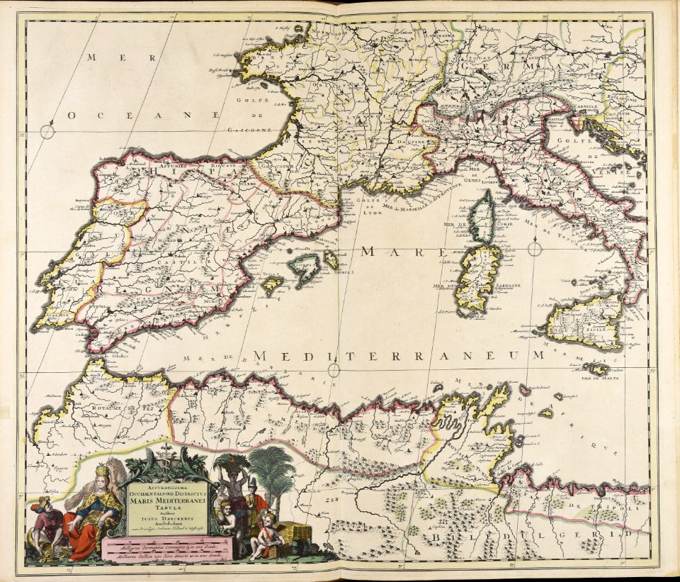
maps made in the 17th century
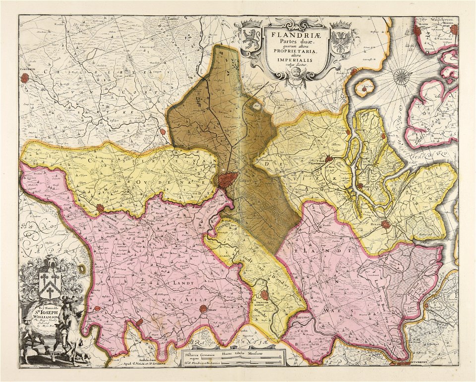
maps by pieter schenk (i)
gerard valck
fonds ancely - bibliothèque municipale de toulouse - maps
atlantis magni tomus secundus (biblioteca comunale di trento)
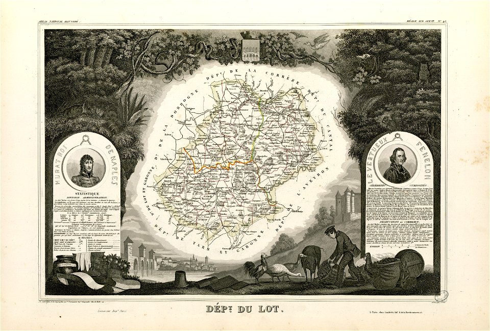
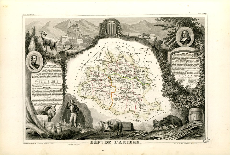
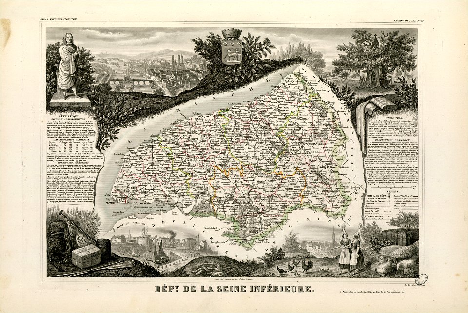
victor levasseur - maps of france
maps with cartouches
new york
maps from the mechanical curator collection
maps in the library of congress
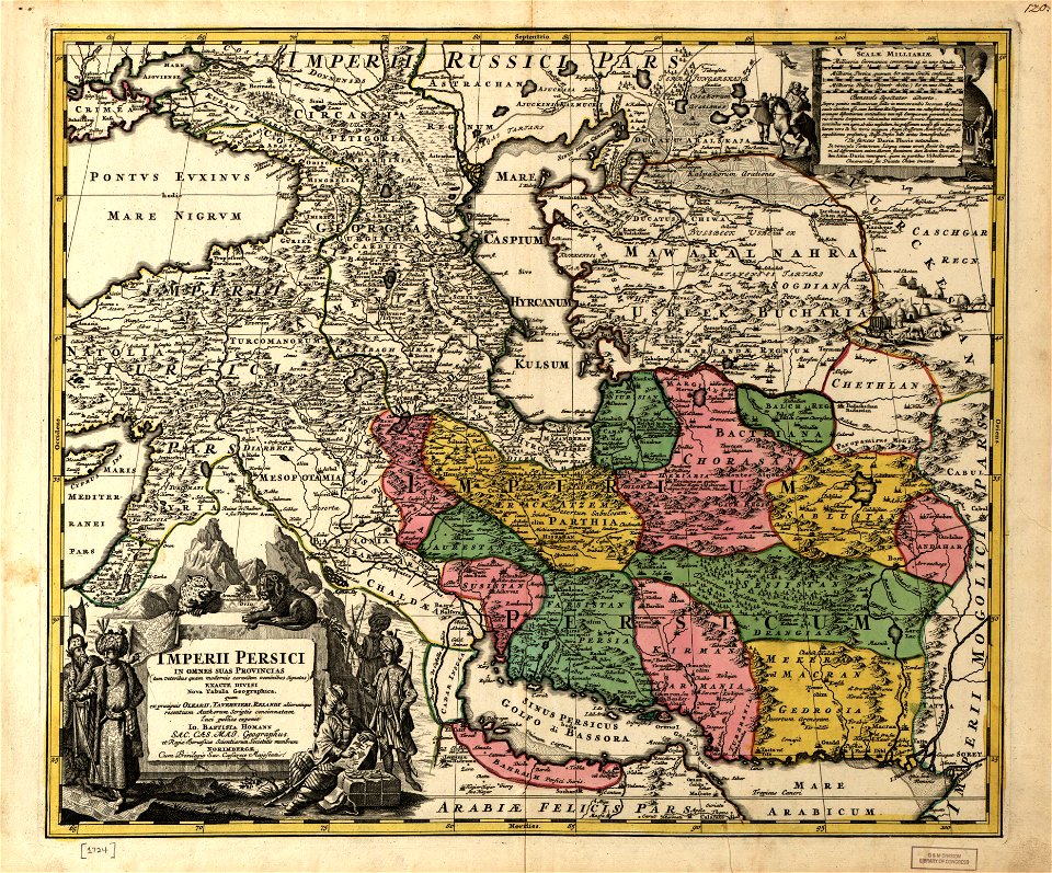
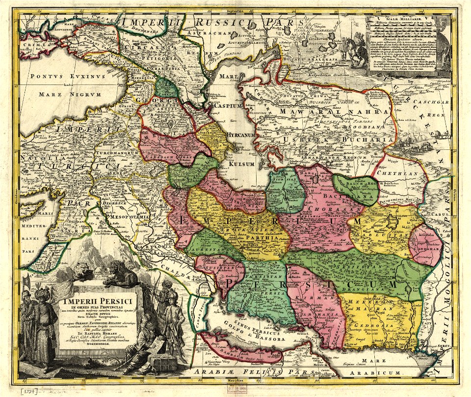
1724 maps of iran
maps in the library of congress
1724 maps of iran
paintings in the huntington library
vallard atlas
new york
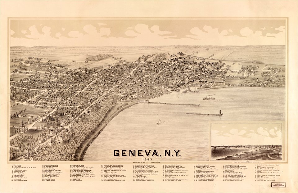
geneva
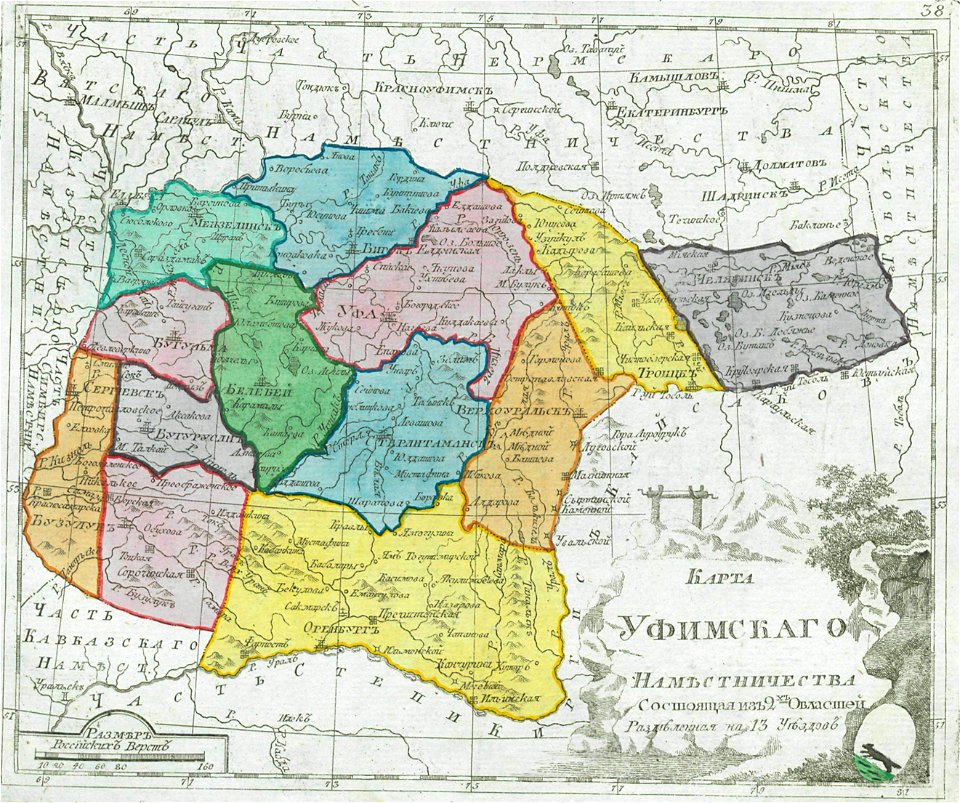
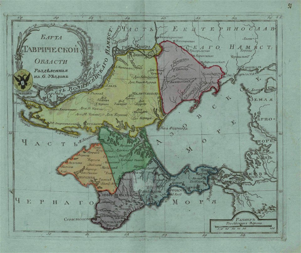
old maps of governorates of the russian empire
small atlas of the russian empire (1792)
old maps of oblasts of the russian empire
small atlas of the russian empire (1796)
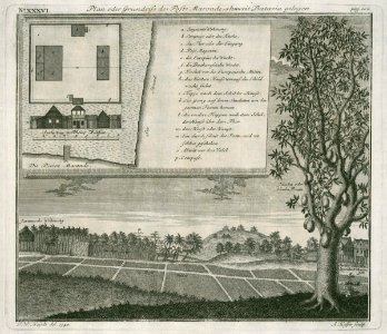
a map of the pontine marshes (rcin 912684)
new york
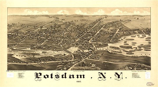
potsdam
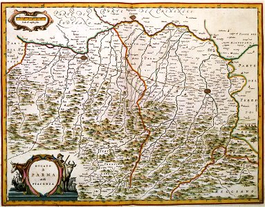
description des principales villes (1690)
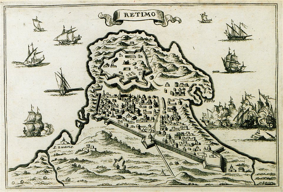
old maps of crete
maps by matthäus seutter
history of stuttgart
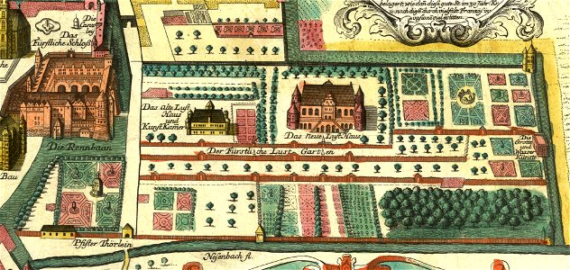
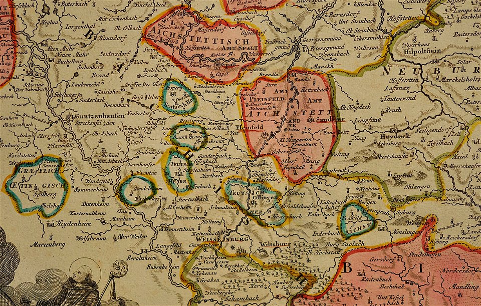
maps of the prince-bishopric of eichstätt
johann baptist homann
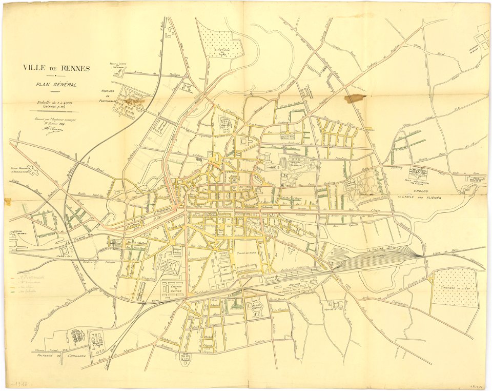
rennes in the 1910s
1914 maps
rennes in the 1850s
old maps of rennes
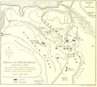
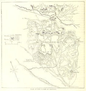
battle of inkerman
1895 drawings
maps from the mechanical curator collection
british battles on land and sea
new york
carthage
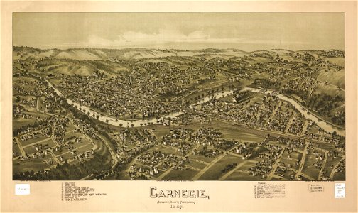
pennsylvania
carnegie
geographical atlas for the 5-6 grades of secondary school (1941)
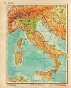
old maps of italy
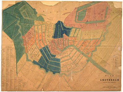
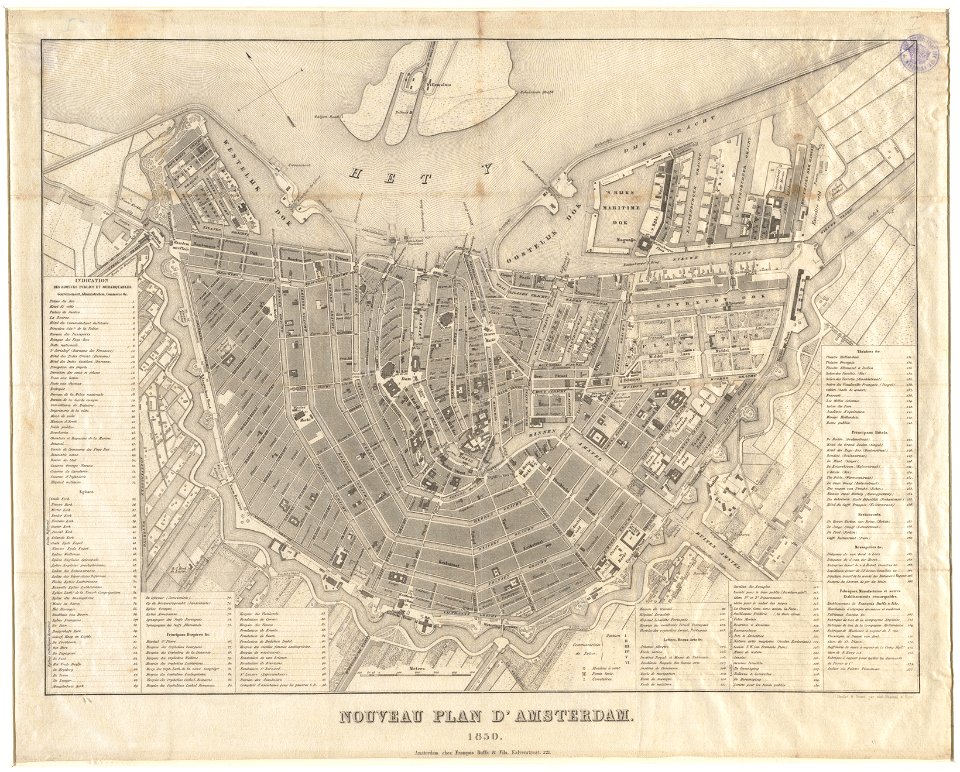
maps in the stadsarchief amsterdam
old maps of amsterdam
maps in the stadsarchief amsterdam
old maps of amsterdam
new york
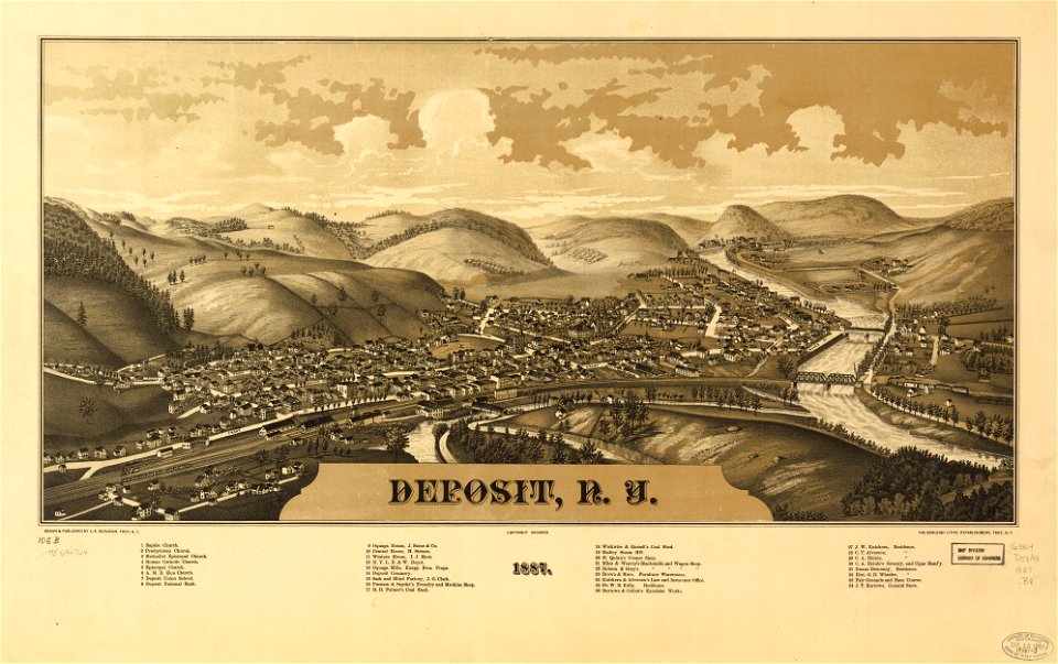
deposits
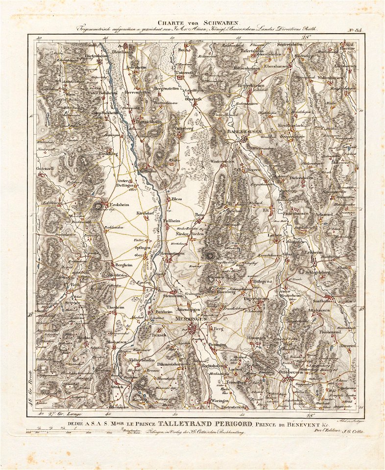
charte von schwaben (bohnenberger)
19th-century maps of bavaria
atlante veneto (raremaps.com) volume 1
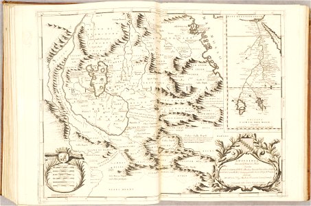
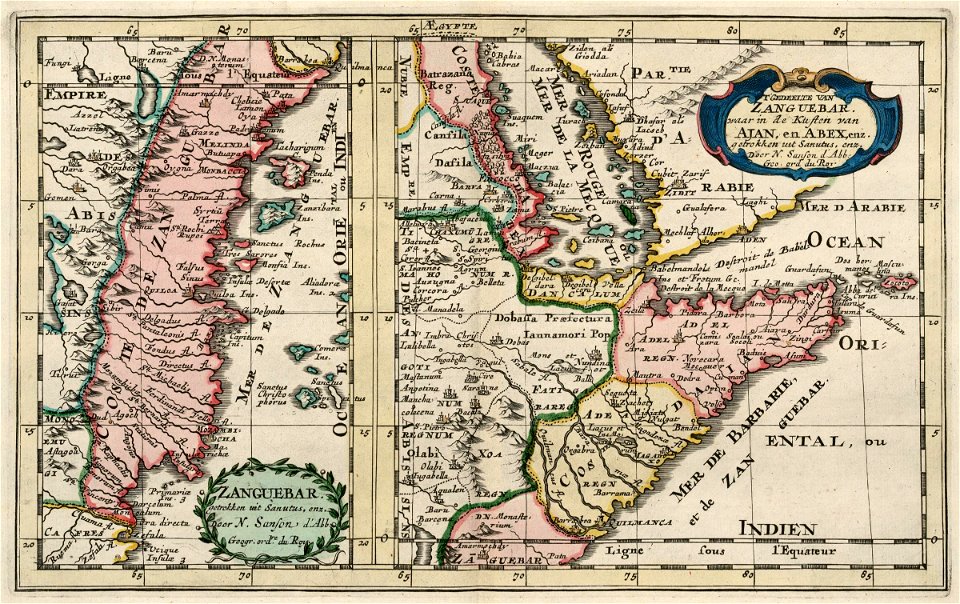
old maps of ethiopia
atlante veneto (raremaps.com) volume 2
maps of milan
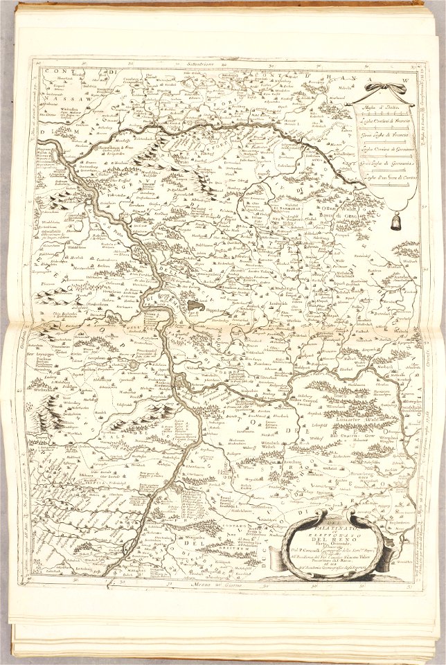
old maps of rhineland-palatinate
maps of the palatinate
stockholm
mälaren
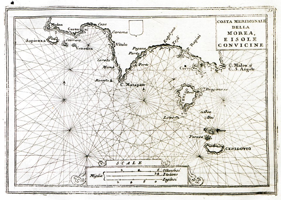
old maps of the peloponnese
maps by coronelli
gerard van keulen
1720s
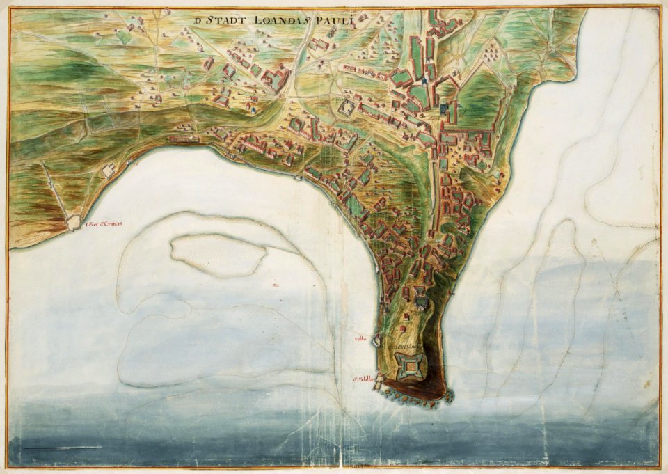
old maps of the dutch east india company - africa
1705
maps of the west-indische compagnie
1665
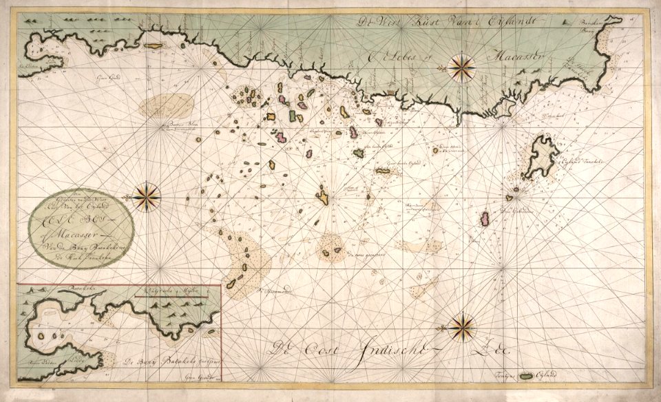
maps of the dutch east india company - indonesia
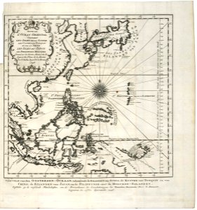
1740
old maps of the dutch east india company
1747)
old maps of the dutch east india company - africa
1747)
history of lorenzkirch
old maps of saxony
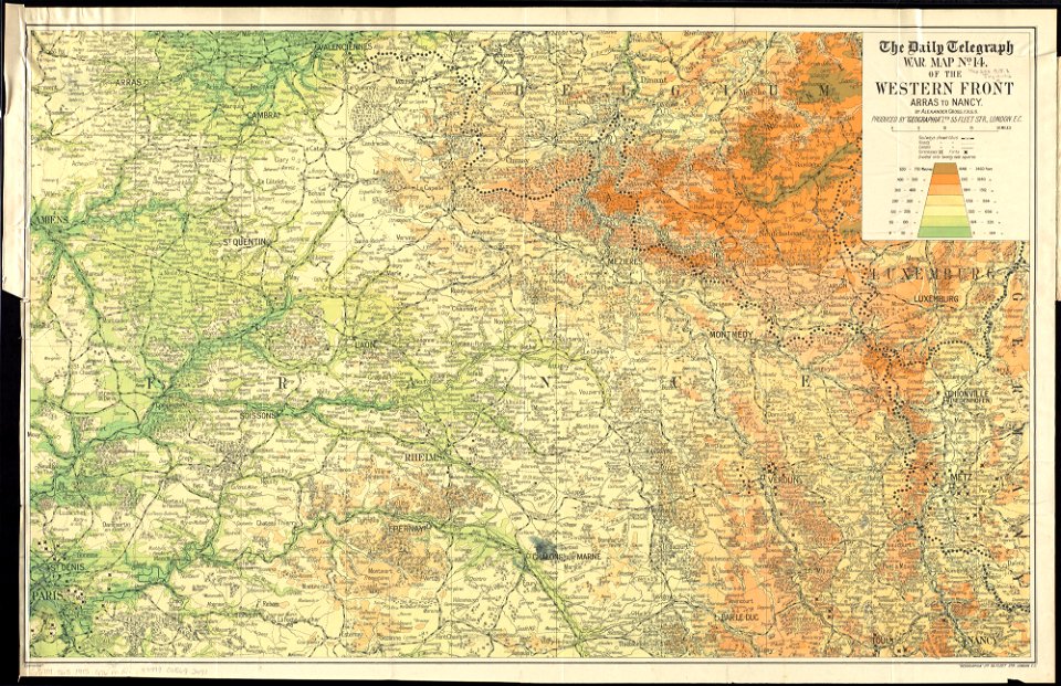
maps of world war i by the daily telegraph
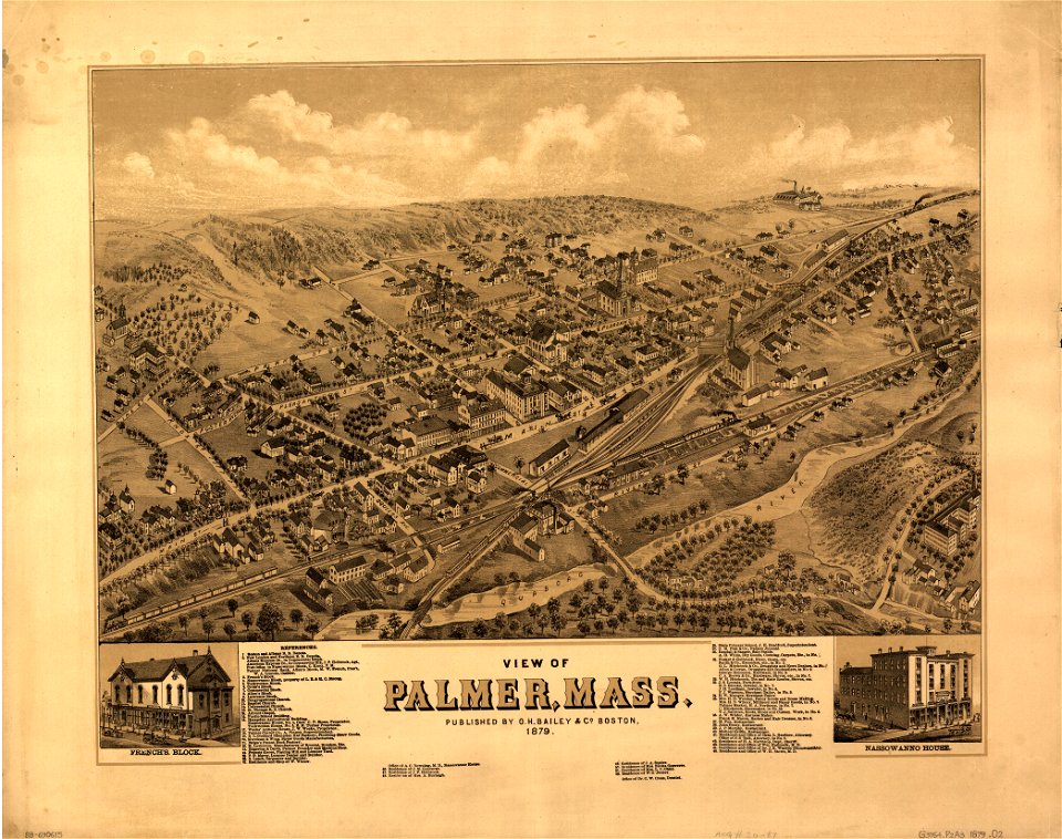
maps in the library of congress
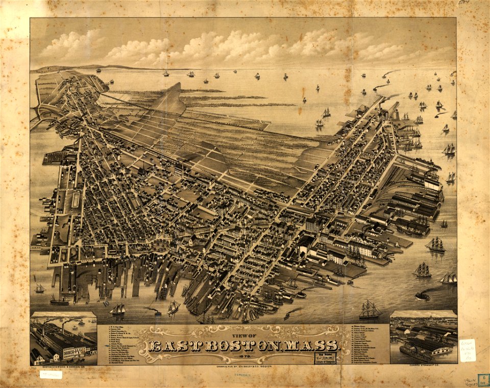
o. h. bailey
massachusetts
palmer
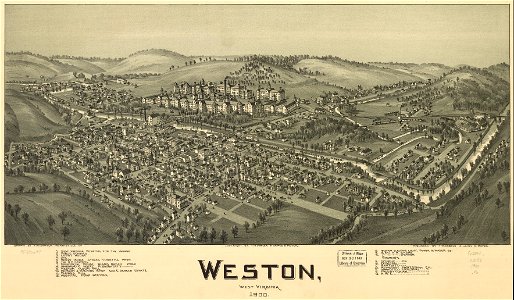
maps in the library of congress
o. h. bailey
west virginia
weston
west virginia
weston
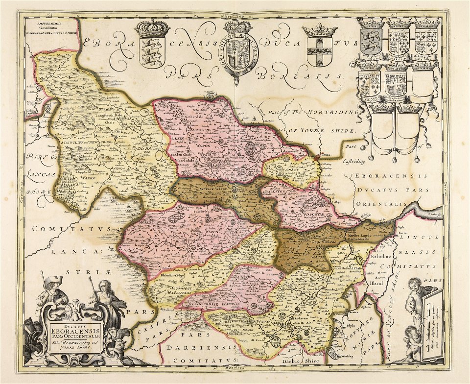
1830 vienna map series by carl graf vasquez
old maps of landstraße (vienna)
maps with cartouches
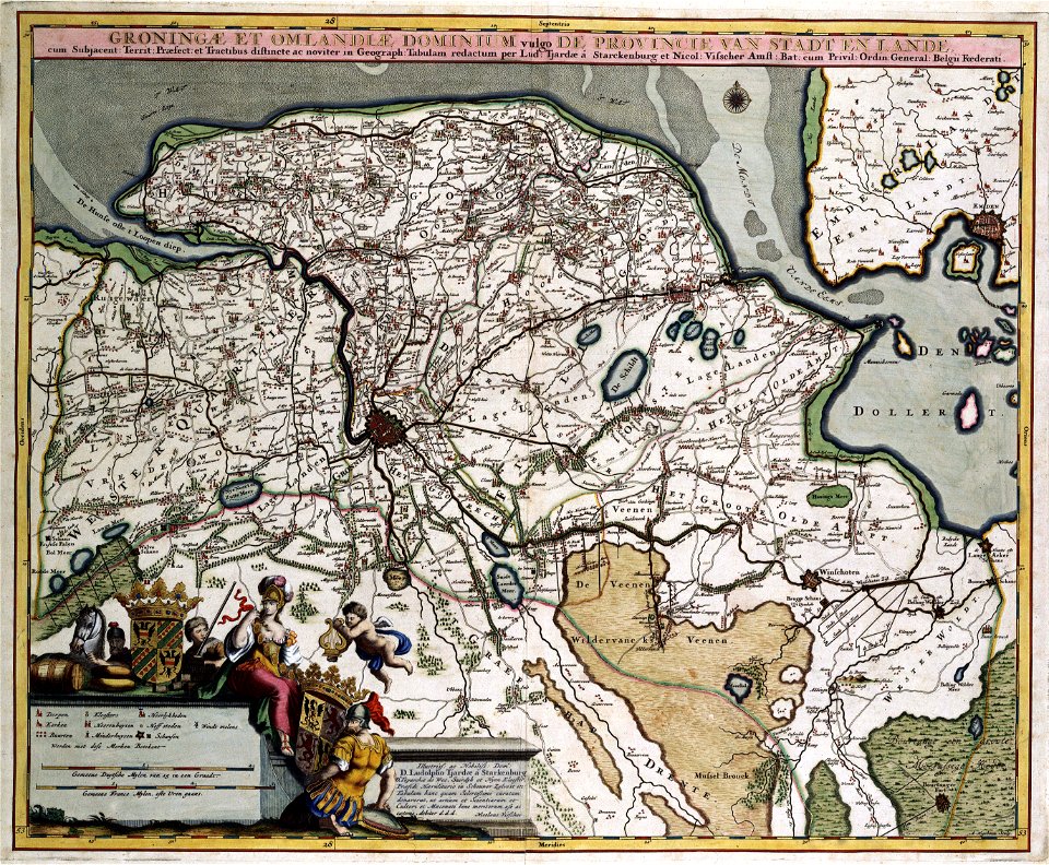
atlas van der hagen
old maps of groningen (province)
maps with cartouches
maps with cartouches
atlas van der hagen
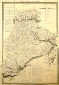
la rioja (spain) in the 19th century
cantabria in the 19th century
fonds ancely - bibliothèque municipale de toulouse - maps
pierre gorse
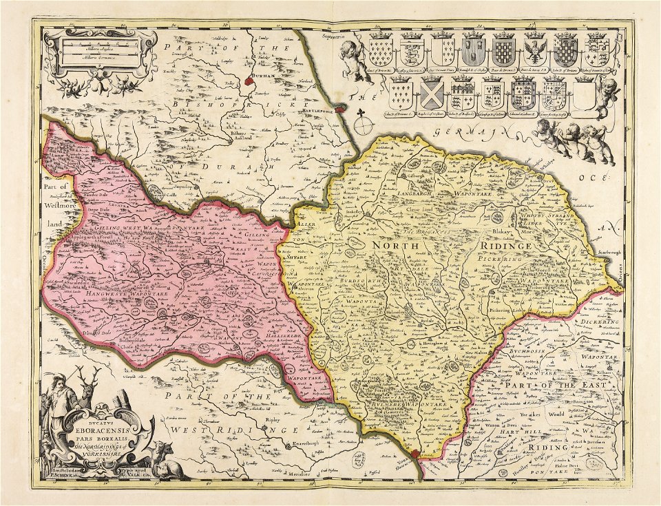
maps made in the 17th century
gerard valck
maps made in the 17th century
gerard valck
fonds ancely - bibliothèque municipale de toulouse - maps
joachim murat
fonds ancely - bibliothèque municipale de toulouse - maps
victor levasseur - maps of france
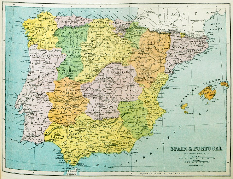
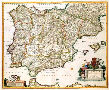
old maps of the iberian peninsula
1870 in spain
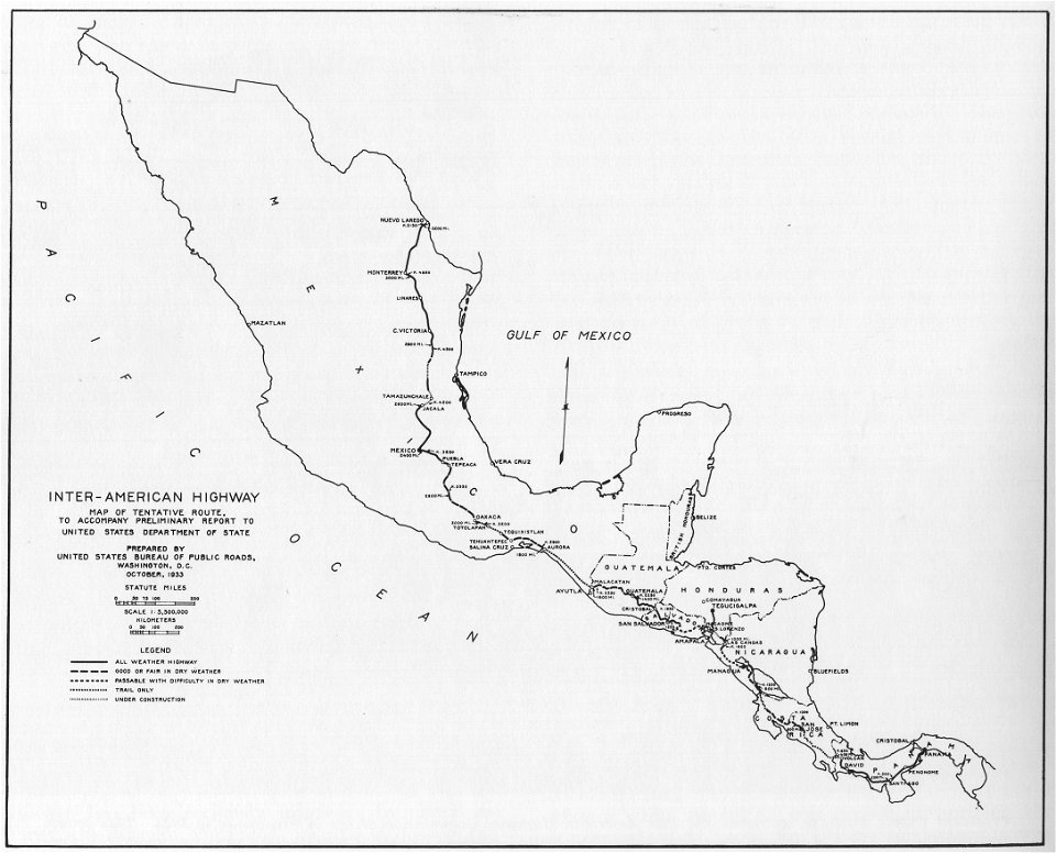
1933 in road transport
road map
maps made in the 17th century
cornelis danckerts (i)
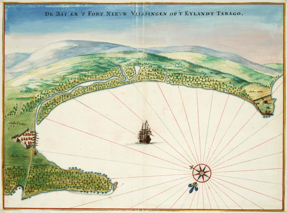
tobago
1665
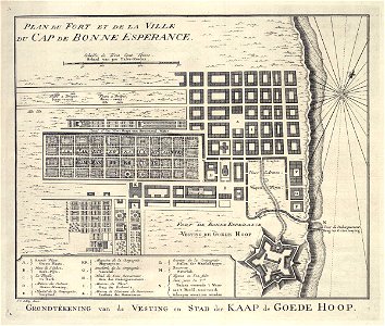
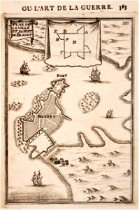
grand parade
cape town
maps in the library of congress
old maps of new york (state)
maps in the library of congress
old maps of new york (state)
gerard valck
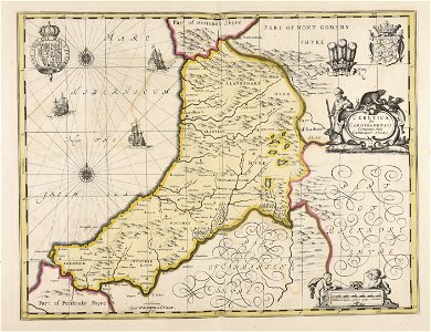
south wales
gerard valck
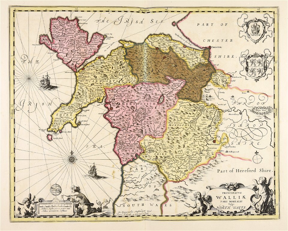
north wales
prints in the royal collection of the united kingdom
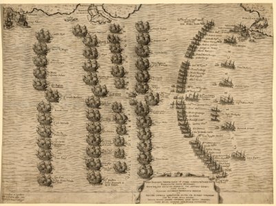
maps of battles of the thirty years' war
merksem
lillo
massachusetts
eastham
fish
maps
maps with cartouches
copper engraving
fonds ancely - bibliothèque municipale de toulouse - maps
victor levasseur - maps of france
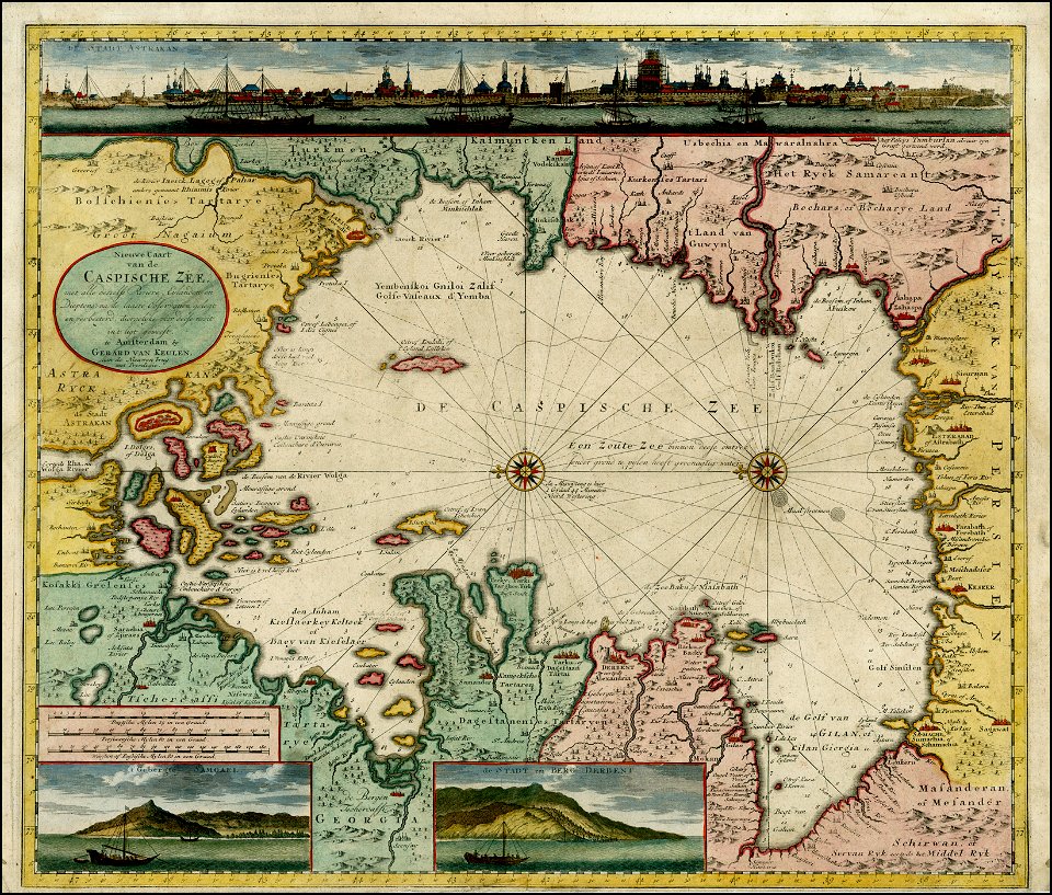
old maps of the caspian sea
1720 maps of georgia
history of mansfeld land
gerard valck
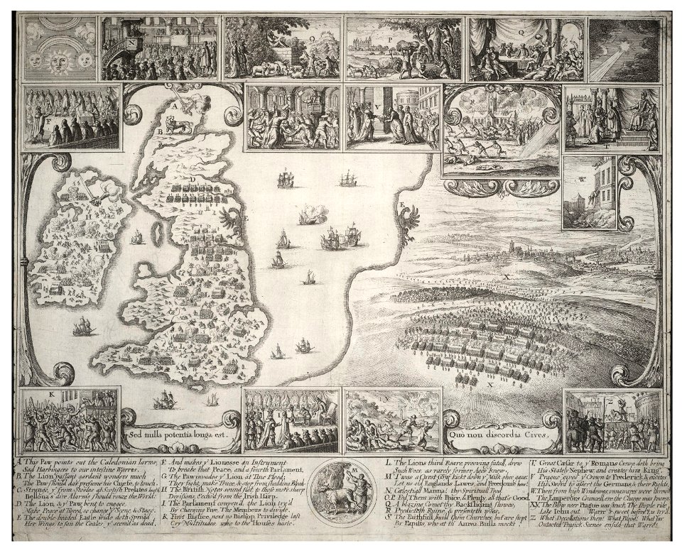
old maps of the british isles
maps made in the 18th century
atlantis magni tomus quintus (biblioteca comunale di trento)
maps made in the 18th century
new market square in rzeszów
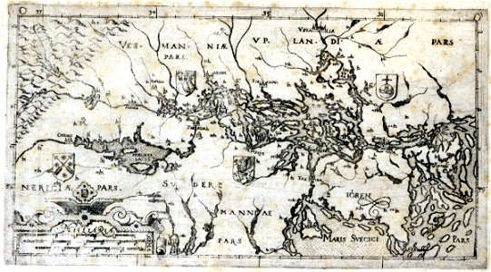
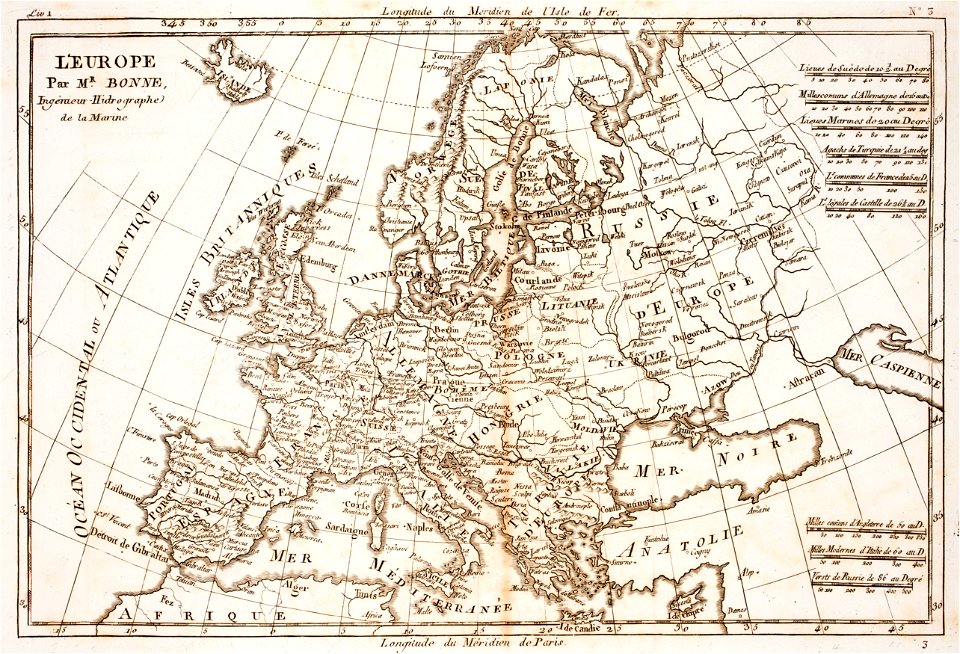
maps of 18th-century europe
travel
maps
maps
usa
countries
maps
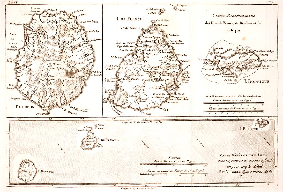
prints from bonne atlas de toutes les parties at the peace palace library
18th-century maps of europe
old maps of the iberian peninsula
nicolaes visscher ii
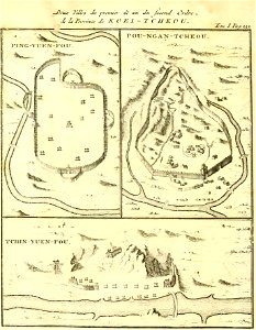
zhijin county
guizhou
george hayward
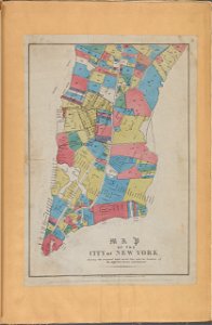
new york city
fonds ancely - bibliothèque municipale de toulouse - maps
victor levasseur - maps of france
fonds ancely - bibliothèque municipale de toulouse - maps
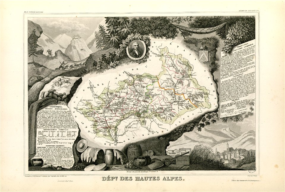
coats of arms of cities in hautes-alpes
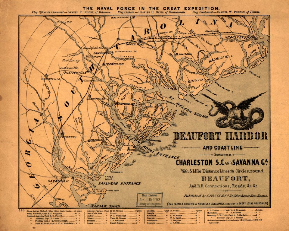
maps in the library of congress
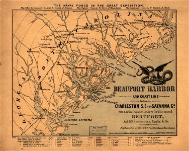
old maps of south carolina
geography
maps
maps
mail
background
maps
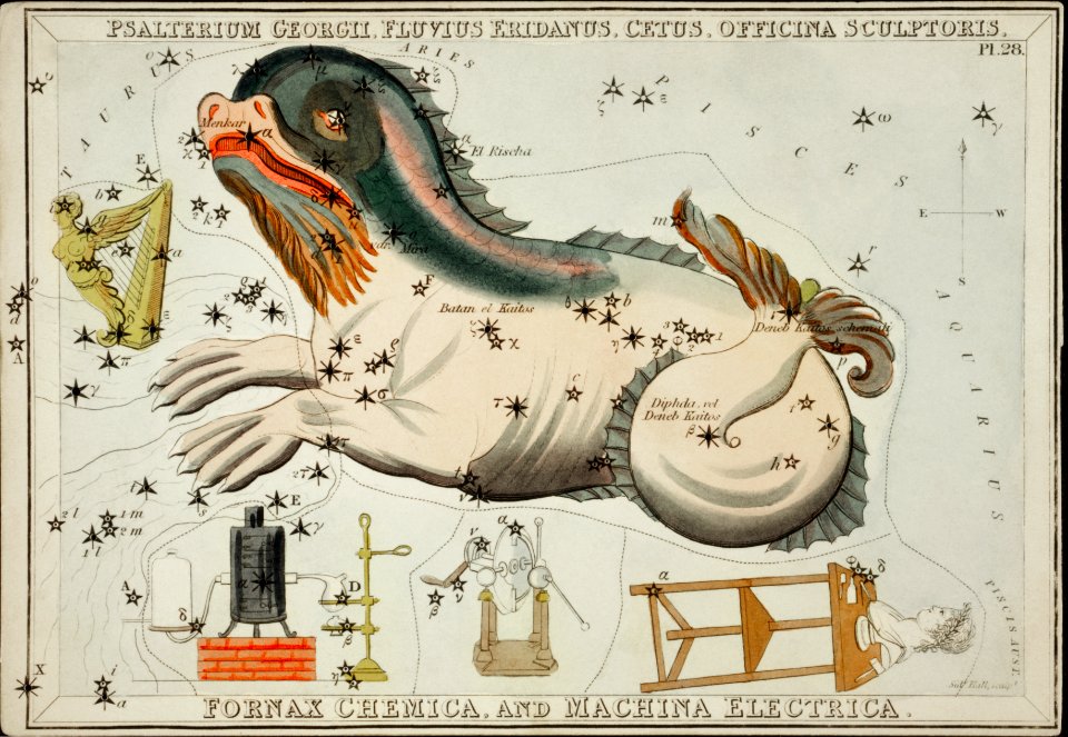
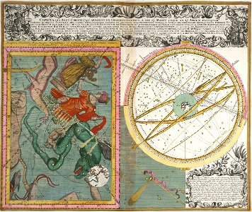
old celestial maps
maps with figures
maps made in the 17th century
gerard valck
fonds ancely - bibliothèque municipale de toulouse - maps
coats of arms of rouen
prints from bonne atlas de toutes les parties at the peace palace library
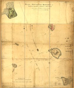
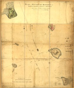
maps of rodrigues island
maps made in the 17th century
gerard valck
university of toronto wenceslas hollar digital collection
old maps of the british isles
david rumsey historical map collection – derivative files
turgot map of paris
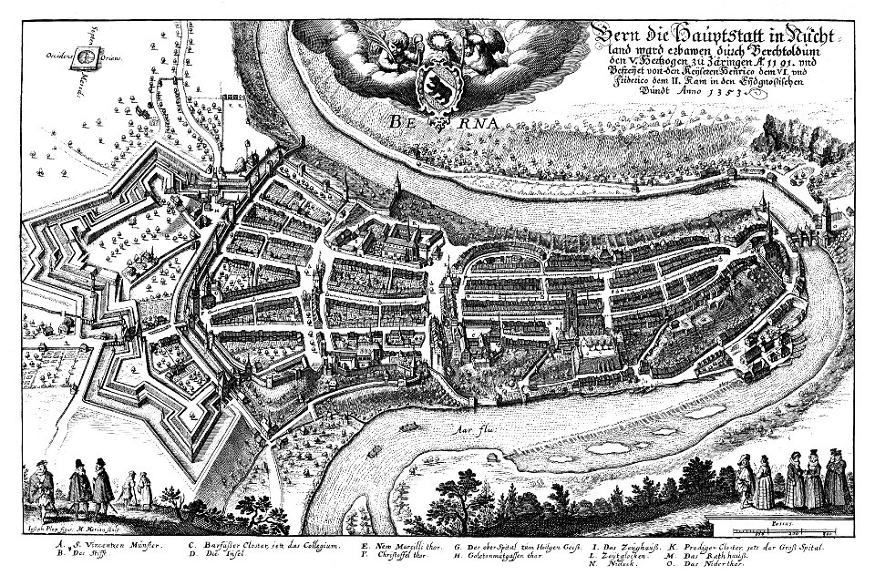
1638 in switzerland
bern
maps from the mechanical curator collection available to georeference
maps from the mechanical curator collection
dutch 17th-century prints in the rijksmuseum amsterdam
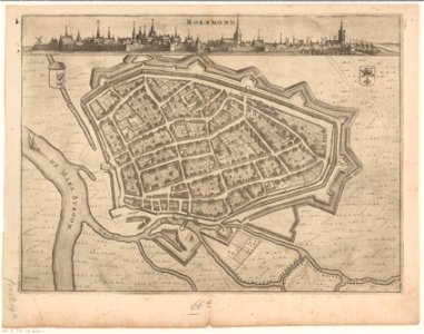
roermond in the 17th century
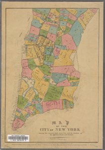
george hayward
new york city
1696 in bretagne
1696 maps
johann baptist homann
old maps of greece
maps in the library of congress
old maps of south carolina
maps made in the 17th century
gerard valck
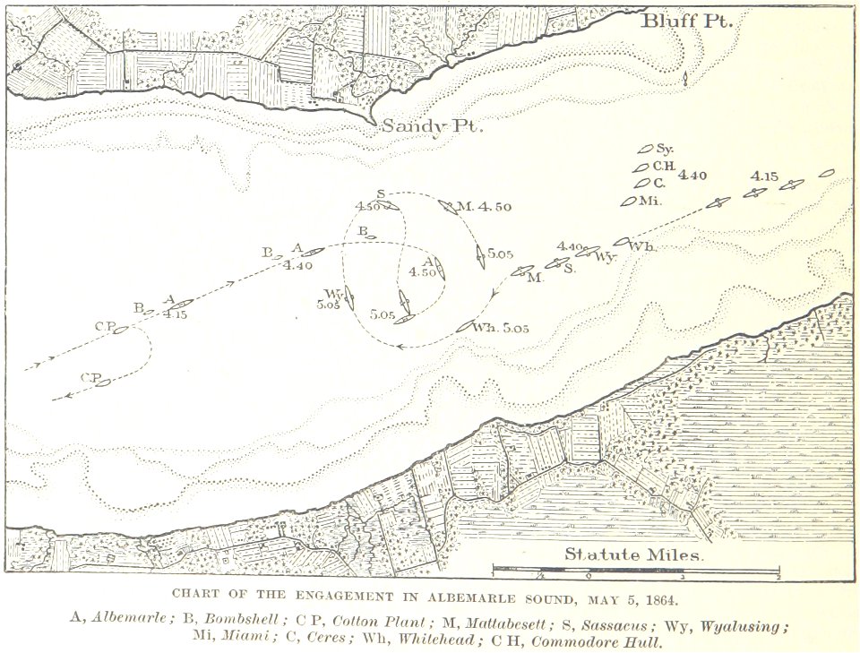
1862
1864
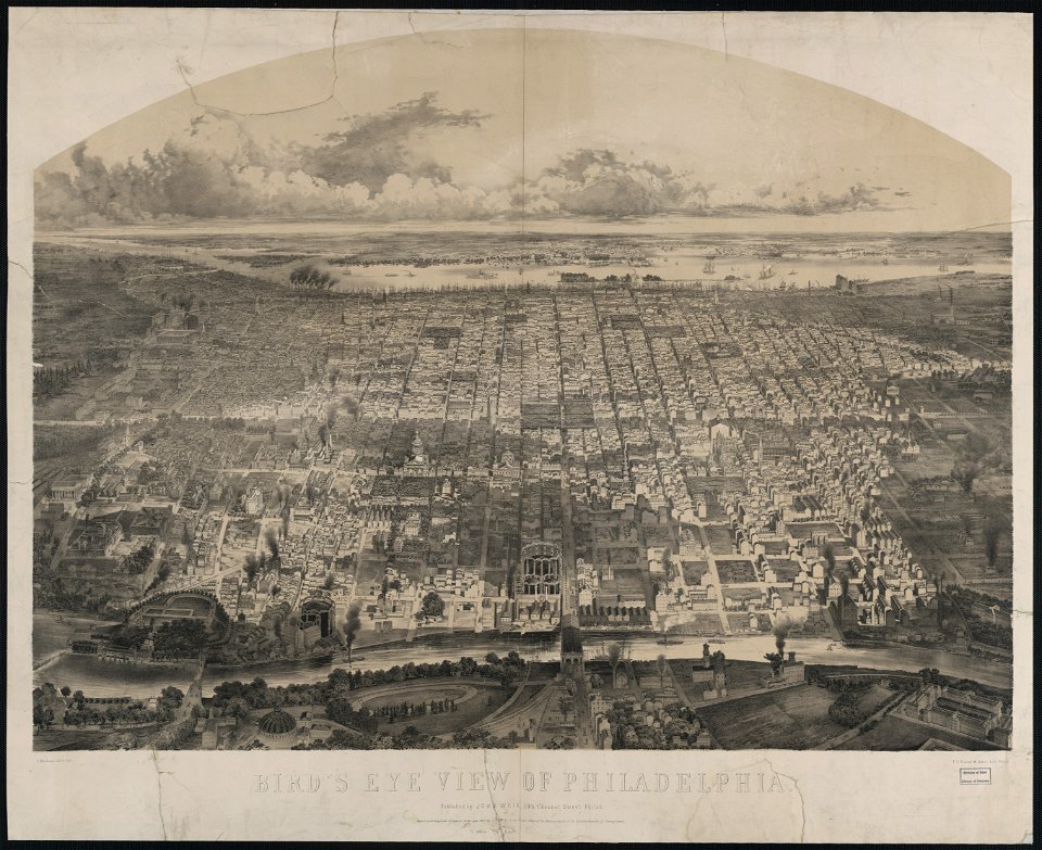
p.s. duval & son
philadelphia in art
8301 - 8400 of 357,638
Next page
/ 3577