Log in
All resources
Create a design
125 Free Artworks of Maps Of The Netherlands
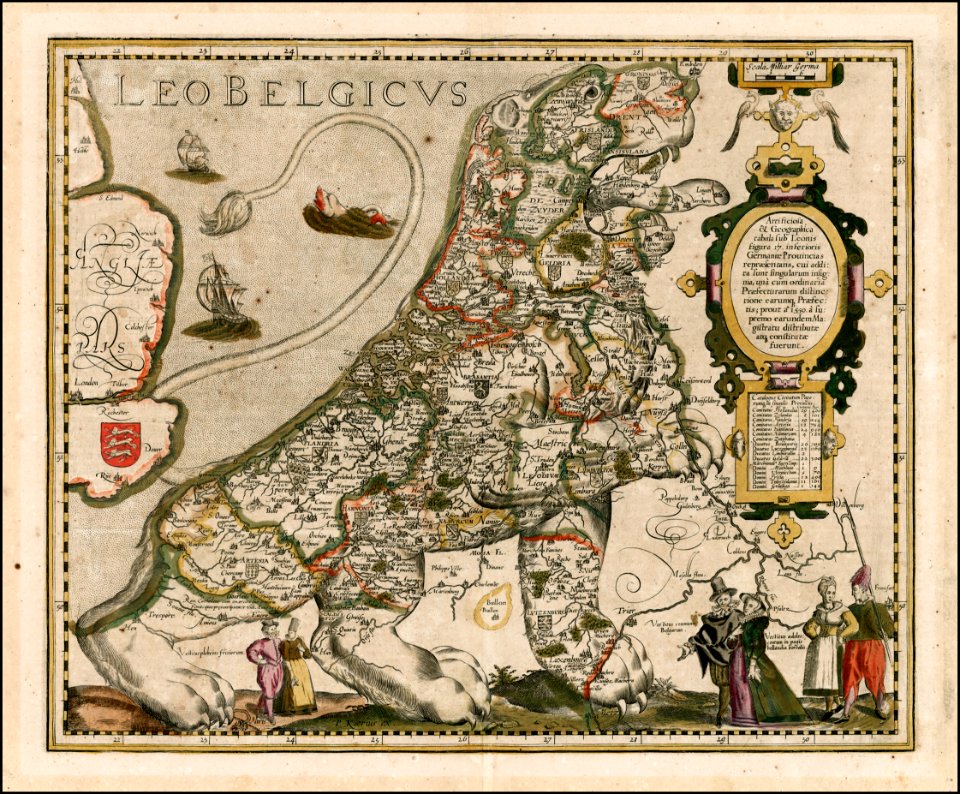
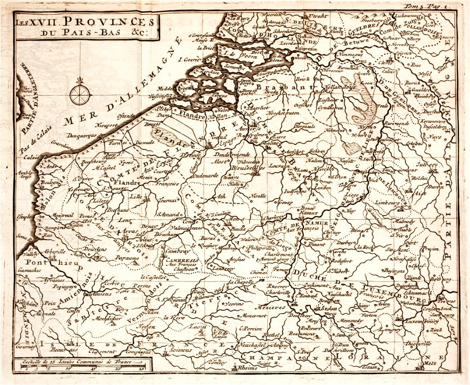
17th-century maps of the netherlands
maps with cartouches
atlas van der hagen (volume 2)
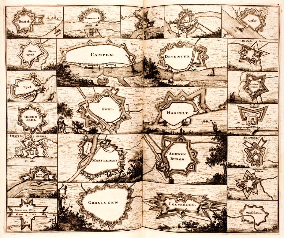
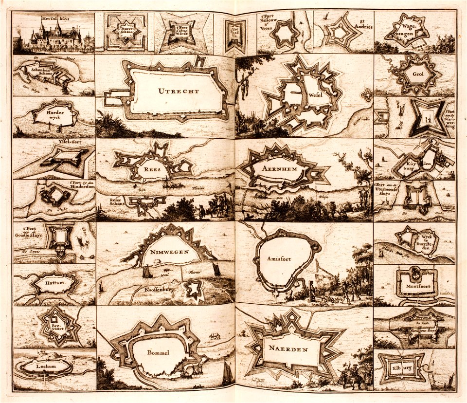
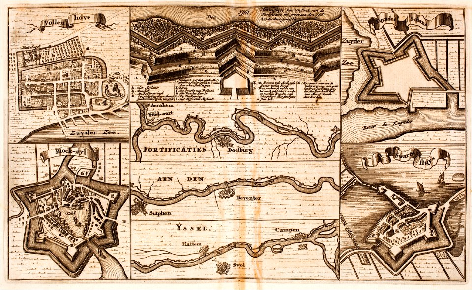
fortifications in the netherlands
atlas van der hagen
1690s maps of the netherlands
1680s maps of the netherlands
prints from lambert van den bos schauplatz des krieges at the peace palace library
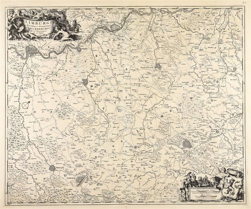
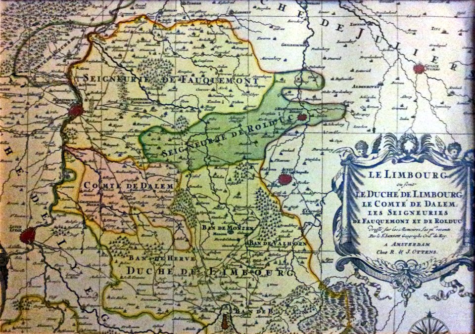
old maps of limburg
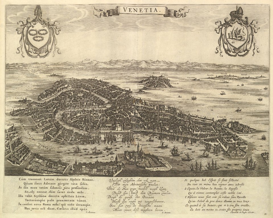
atlante veneto (raremaps.com) volume 2
1740s maps of belgium
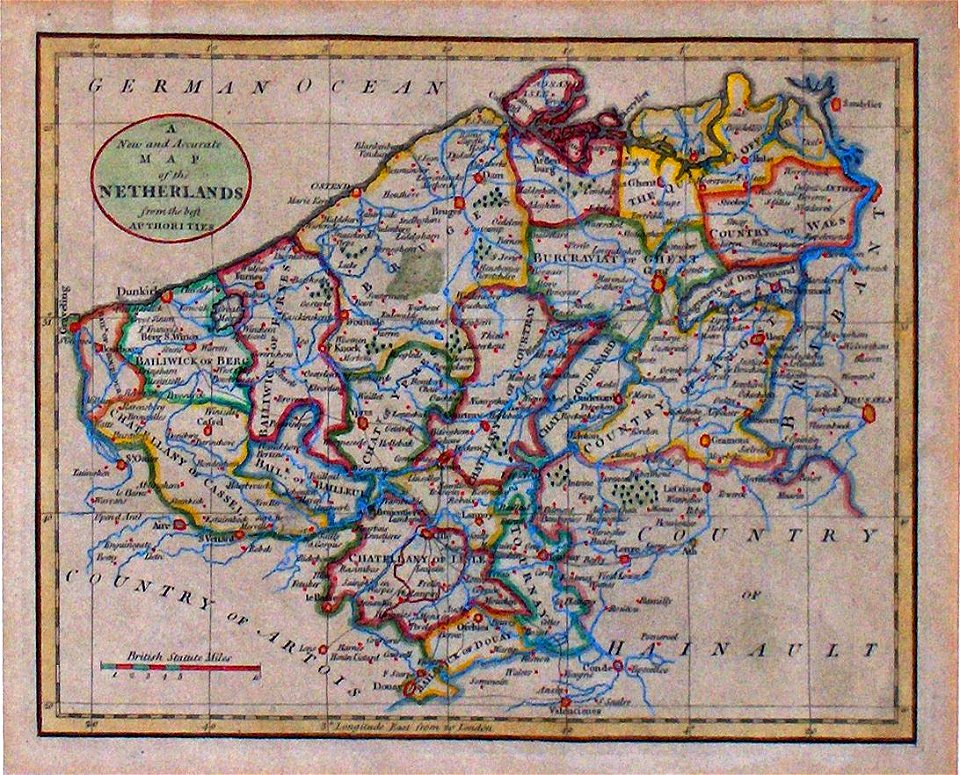
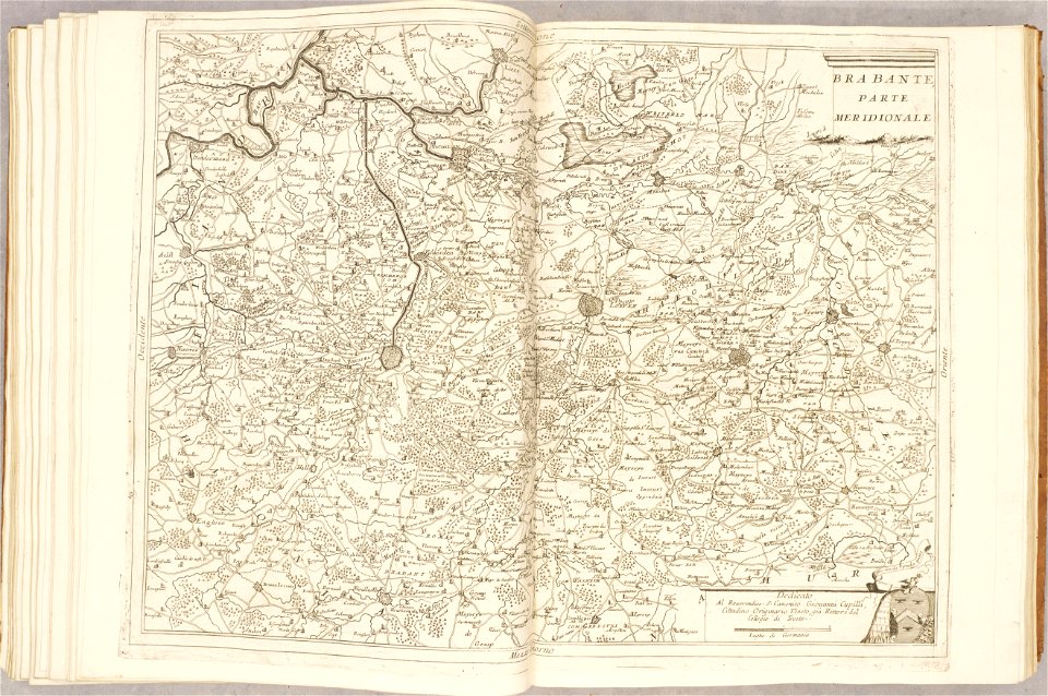
southern netherlands
17th-century maps of the netherlands
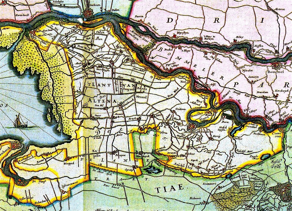
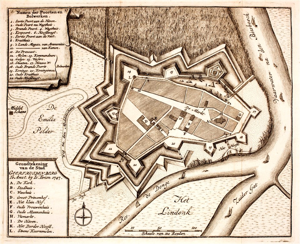
old maps of north brabant
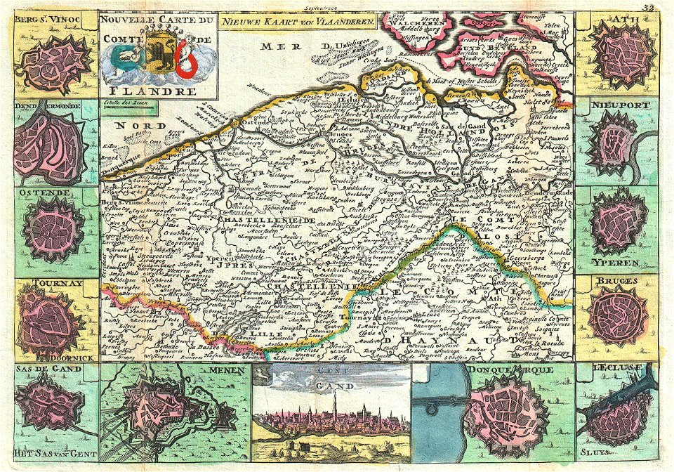
maps of the county of flanders
old maps of flanders
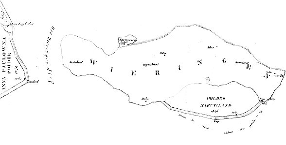
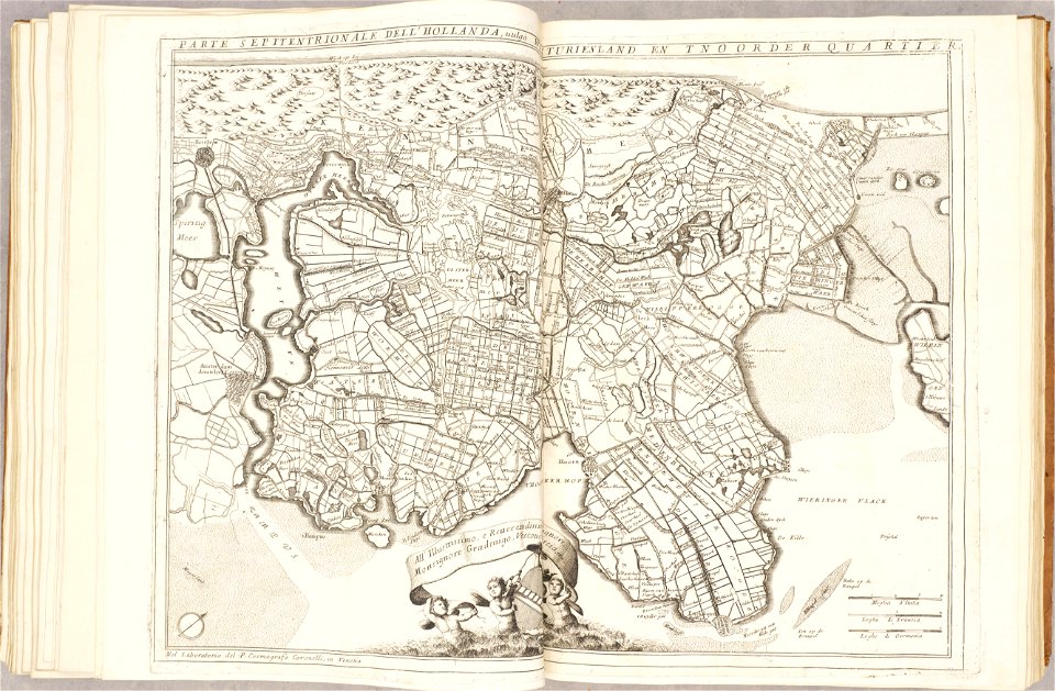
maps of wieringen
wieringen
french-language maps
1710 maps
french-language maps
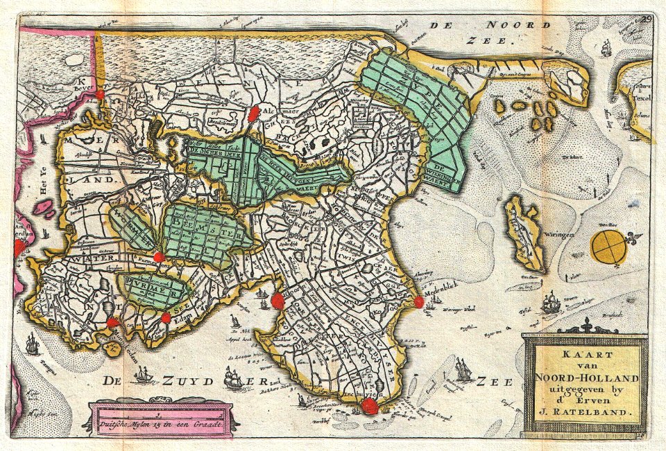
johannes ratelband
elementarwerk
1774 maps
cosmographia (1600) by sebastian münster
1600 maps of the netherlands
maps of the west-indische compagnie
1671
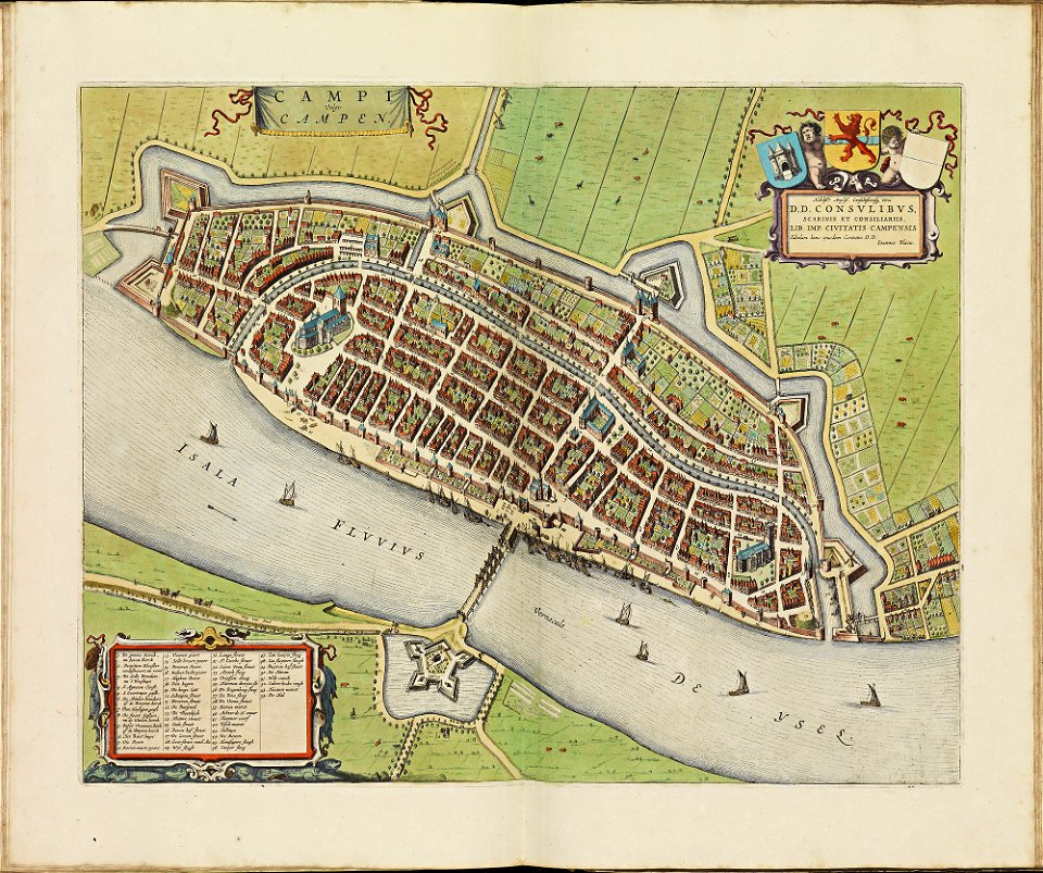
old maps of cities in the netherlands
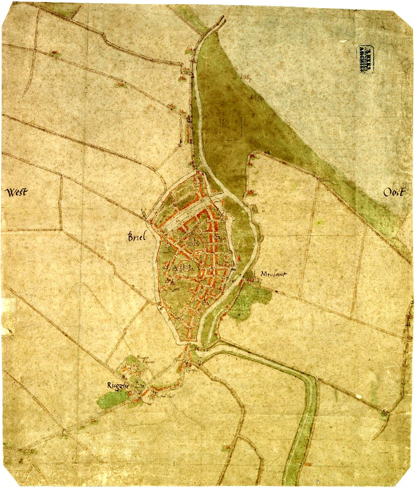
maps by jacob van deventer
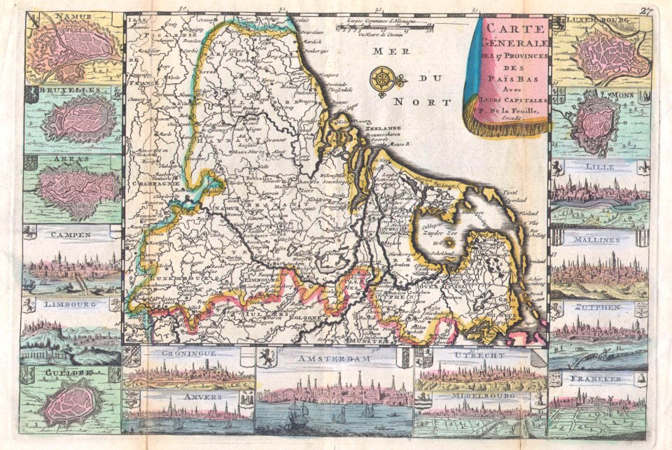
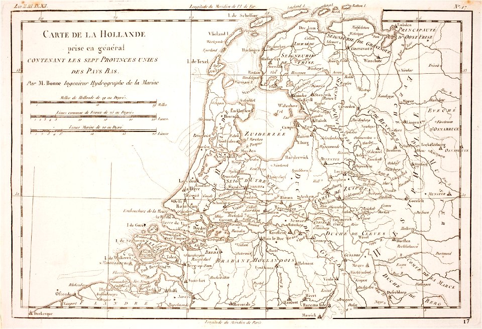
maps of the netherlands
fortification
maps by jacob van deventer
old maps of brielle
fortifications in the netherlands
netherlands
old maps of luxembourg
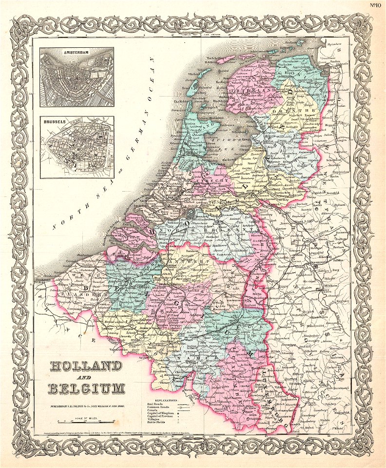
1855 maps
netherlands in the 1660s
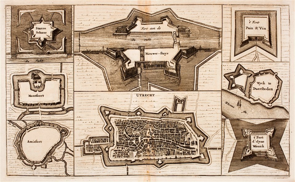
old maps of utrecht
pieter van der keere
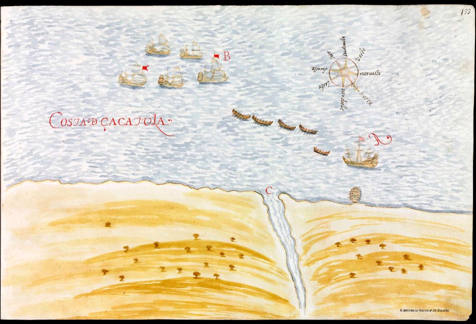
ships on maps
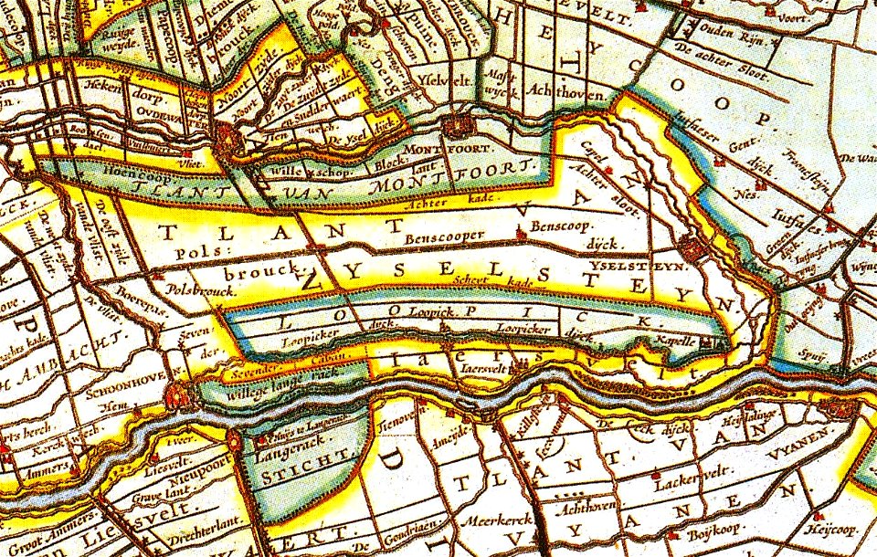
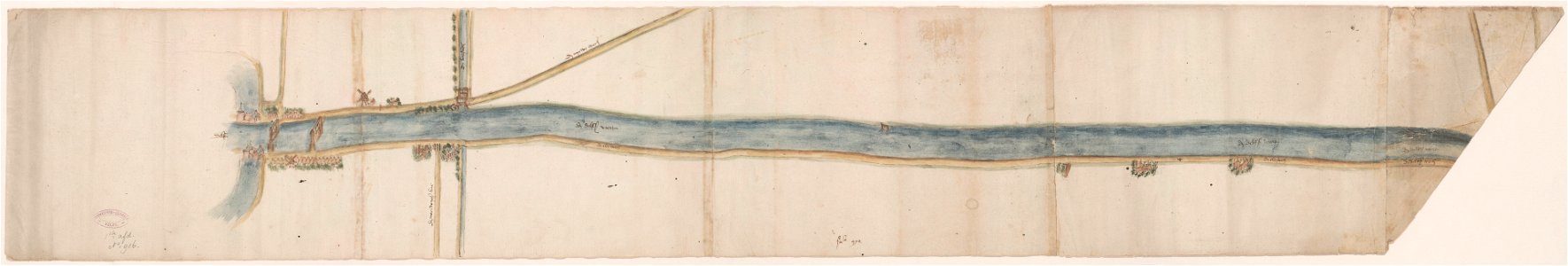
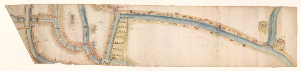
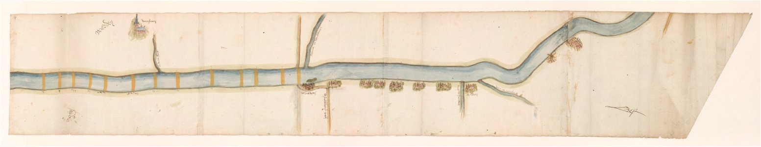
maps of waterways in the netherlands
collections of stadsarchief delft
maps of waterways in the netherlands
leiden
netherlands
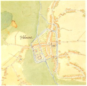
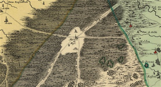
peel
maps of waterways in the netherlands
voorschoten
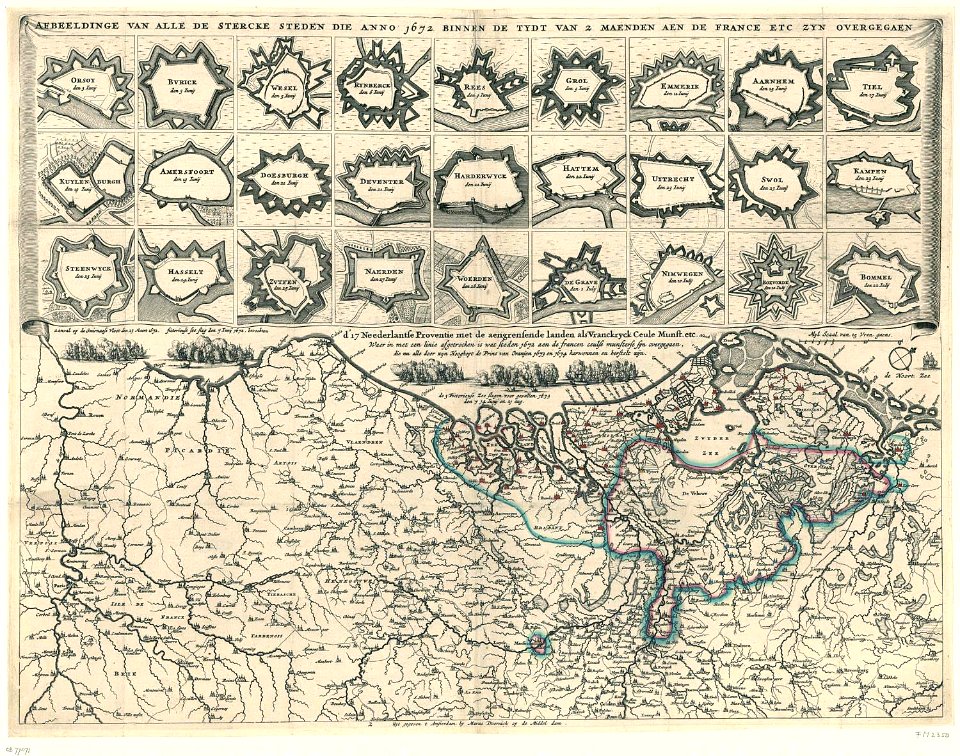
conflicts in 1672
netherlands
1690s maps of the netherlands
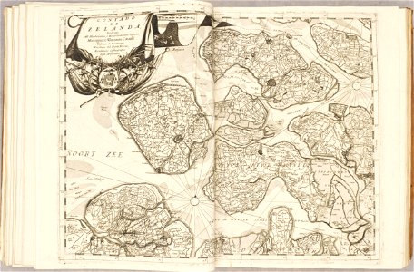
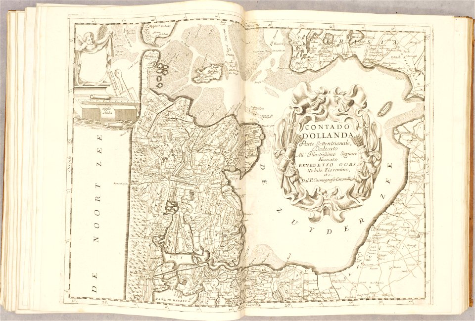
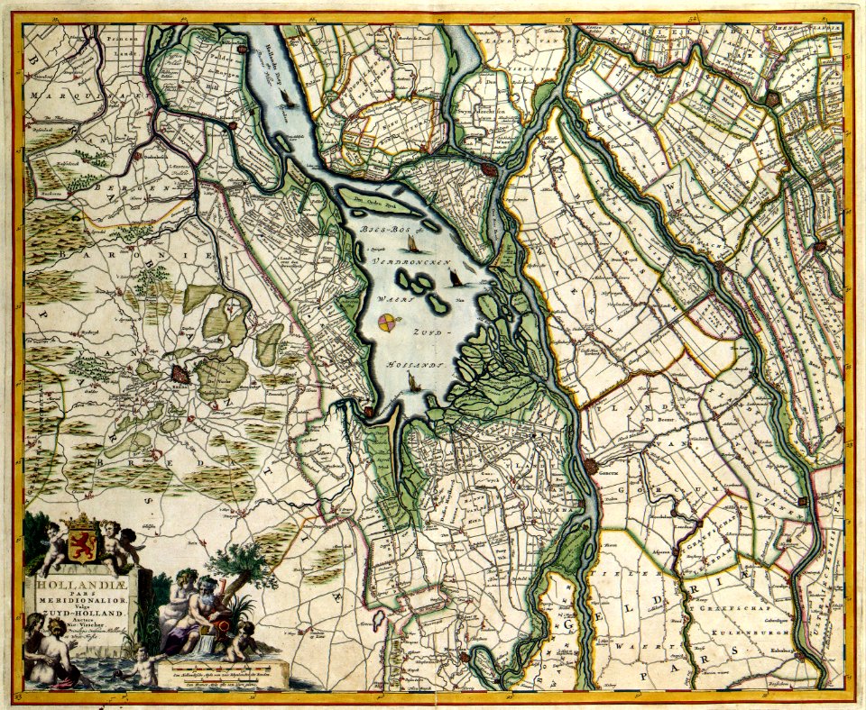
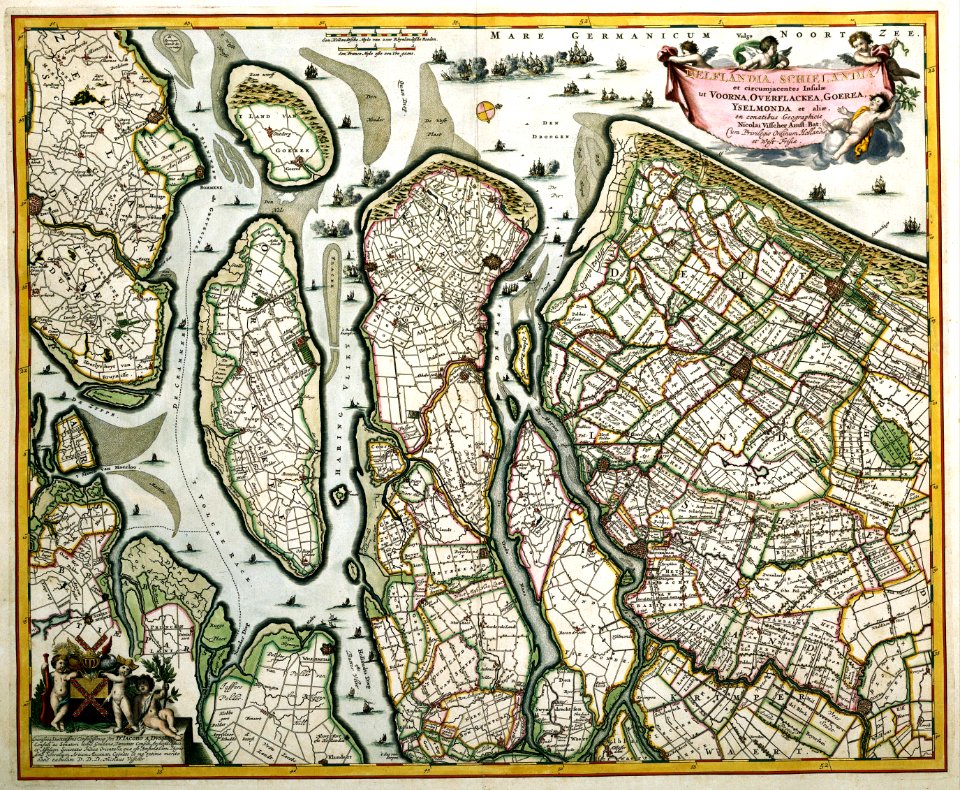
old maps of zeeland
1690s maps of the netherlands
old maps of zeeland
coats of arms of maastricht
coats of arms on maps
history of rail transport in the netherlands
enzyklopädie des eisenbahnwesens
johannes ratelband
jan goeree
copper engraving
gerard valck
leidschendam
voorburg
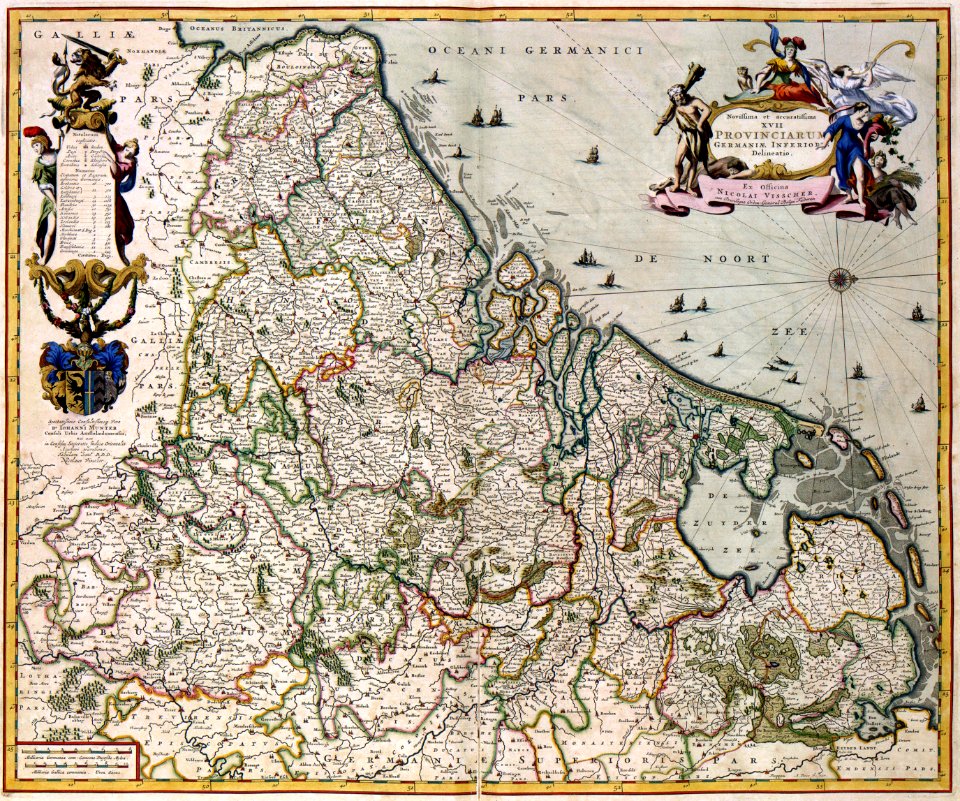
maps with cartouches
netherlands
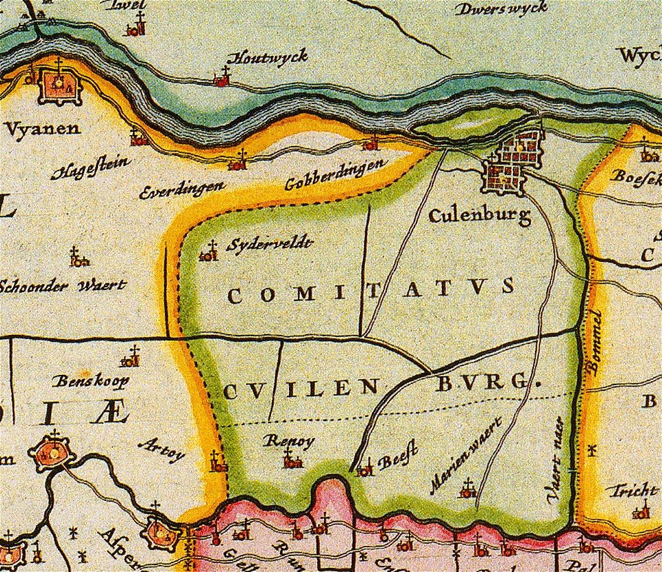
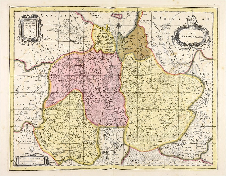
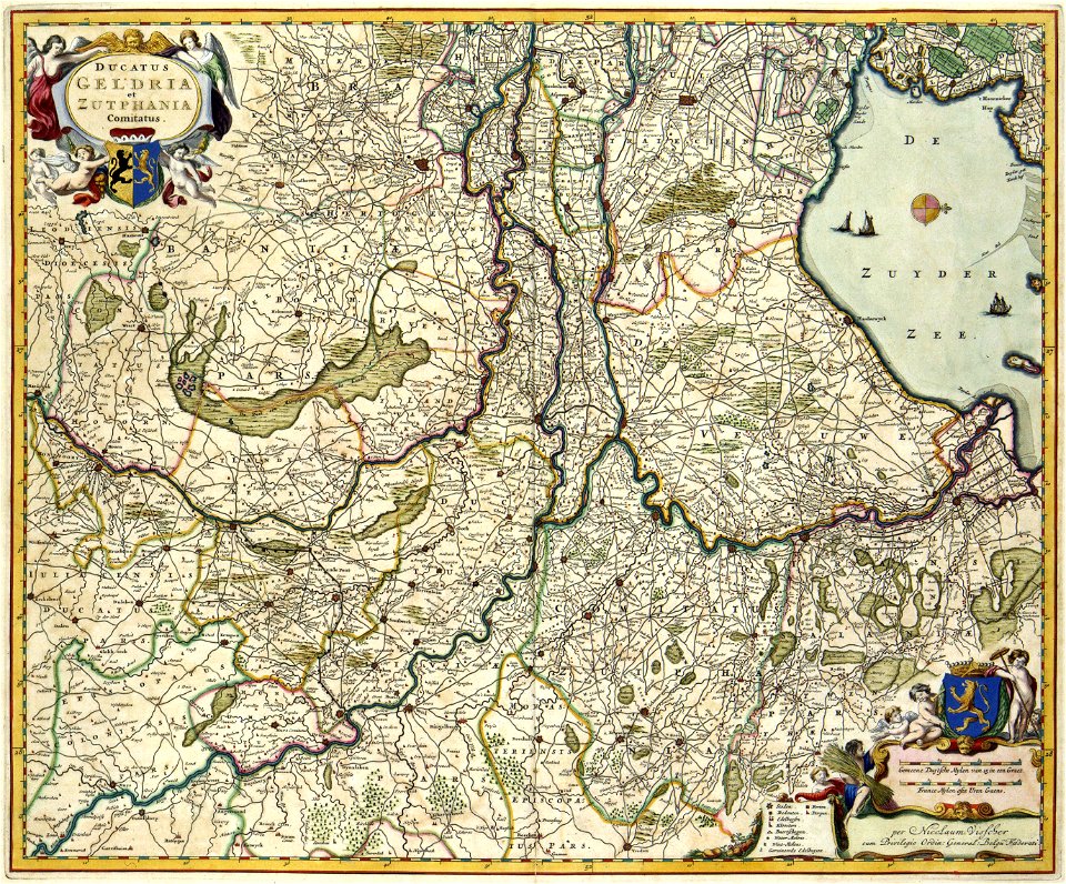
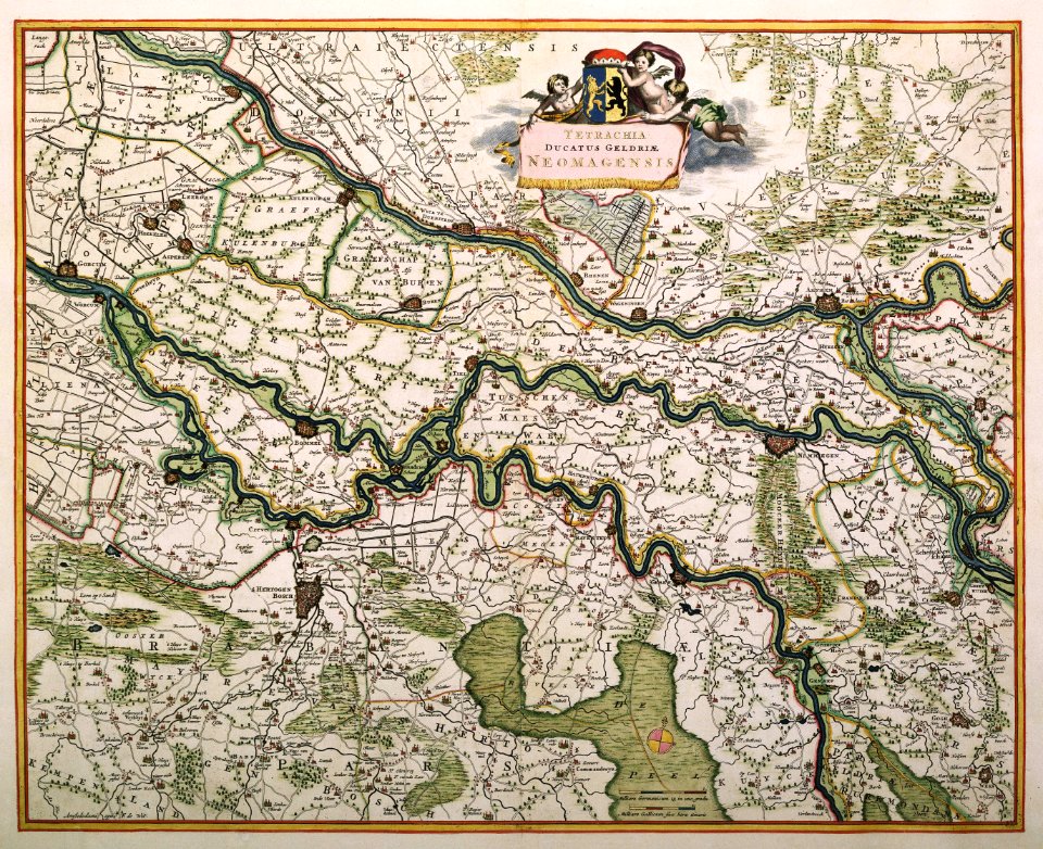
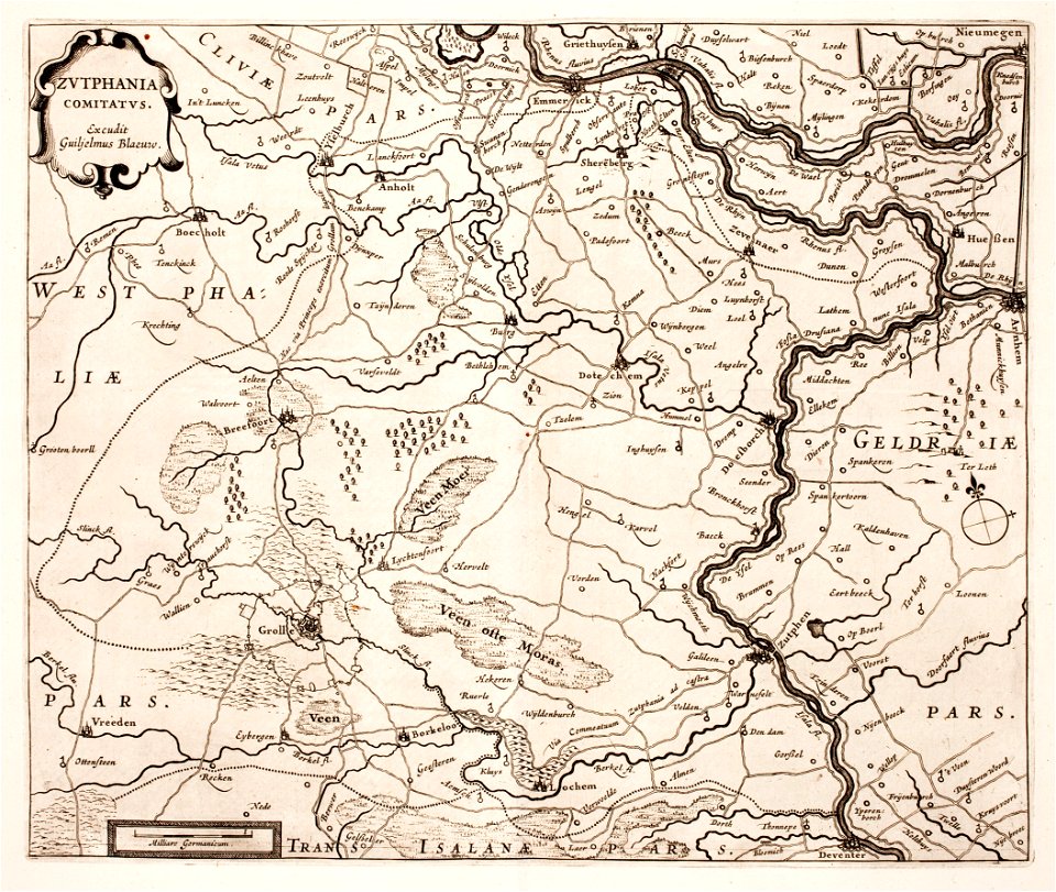
old maps of gelderland
gelderland
old maps of north holland
johannes ratelband
1700s maps of belgium
old maps of lorraine
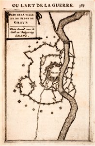
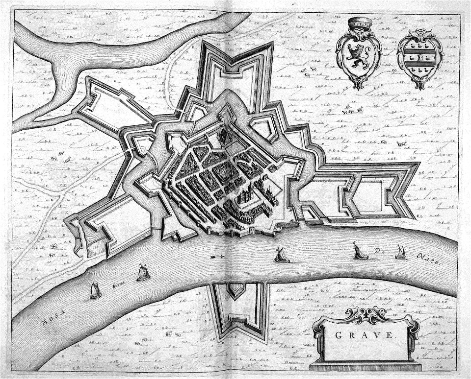
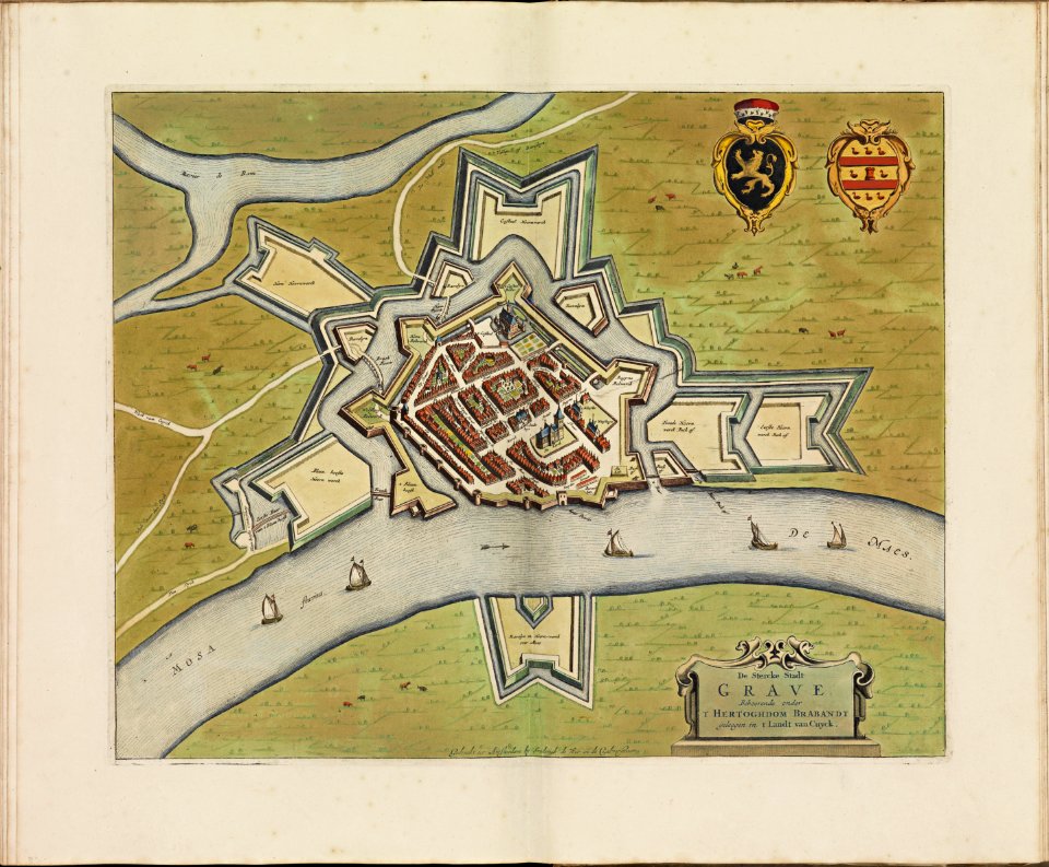
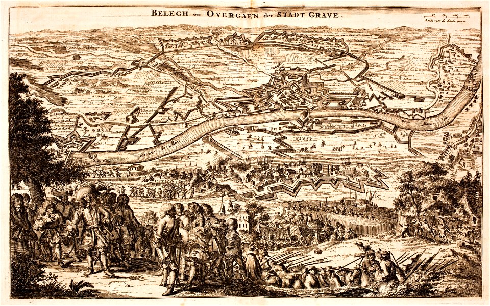
maps of grave
netherlands
netherlands in the 1660s
old maps of gelderland
maps of waterways in the netherlands
collections of stadsarchief delft
printing in the netherlands
asia in the 17th century
maps of the county of flanders
johannes ratelband
netherlands
gorredijk
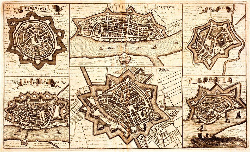
old maps of overijssel
old maps of drenthe
coats of arms on maps
guelder
old maps of north brabant
old maps of zeeland
atlante veneto (raremaps.com) volume 2
1690s maps of the netherlands
atlante veneto (raremaps.com) volume 2
1690s maps of the netherlands
atlante veneto (raremaps.com) volume 2
1690s maps of the netherlands
atlante veneto (raremaps.com) volume 2
1690s maps of the netherlands
prints from the peace palace library
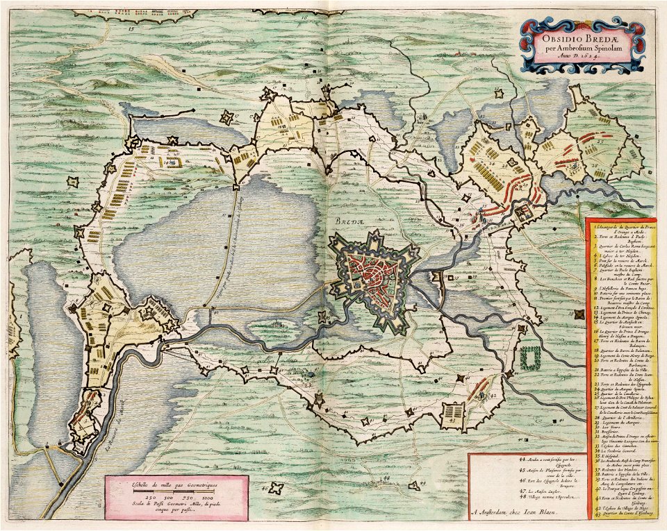
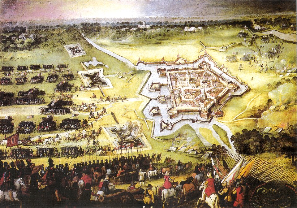
military history of the netherlands
coat of arms of germany
1642 maps of croatia
old maps of the spanish empire
old maps of regions of france
coats of arms of breda
netherlands
dutch 17th-century prints in the rijksmuseum amsterdam
netherlands
maps of the dutch republic
nicolaes van geelkercken
maps with cartouches
atlas van der hagen
history of eindhoven
eindhoven
coats of arms of breda
netherlands
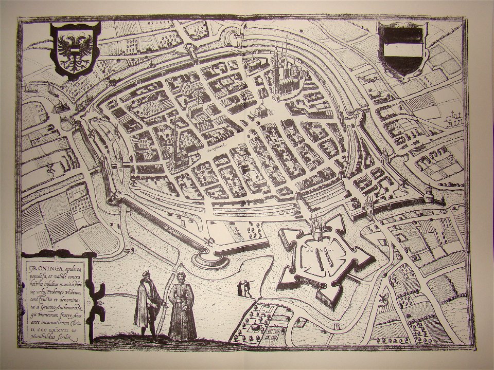
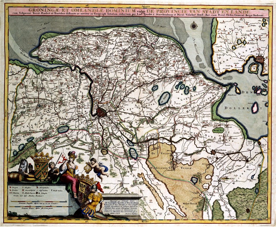
coats of arms of groningen (city)
braun & hogenberg
17th-century maps of the netherlands
maps with cartouches
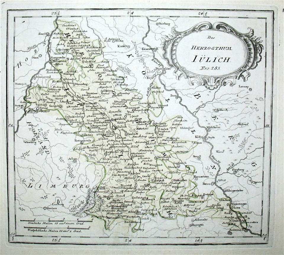
old maps of north rhine-westphalia
netherlands
maps with cartouches
old maps of zeeland
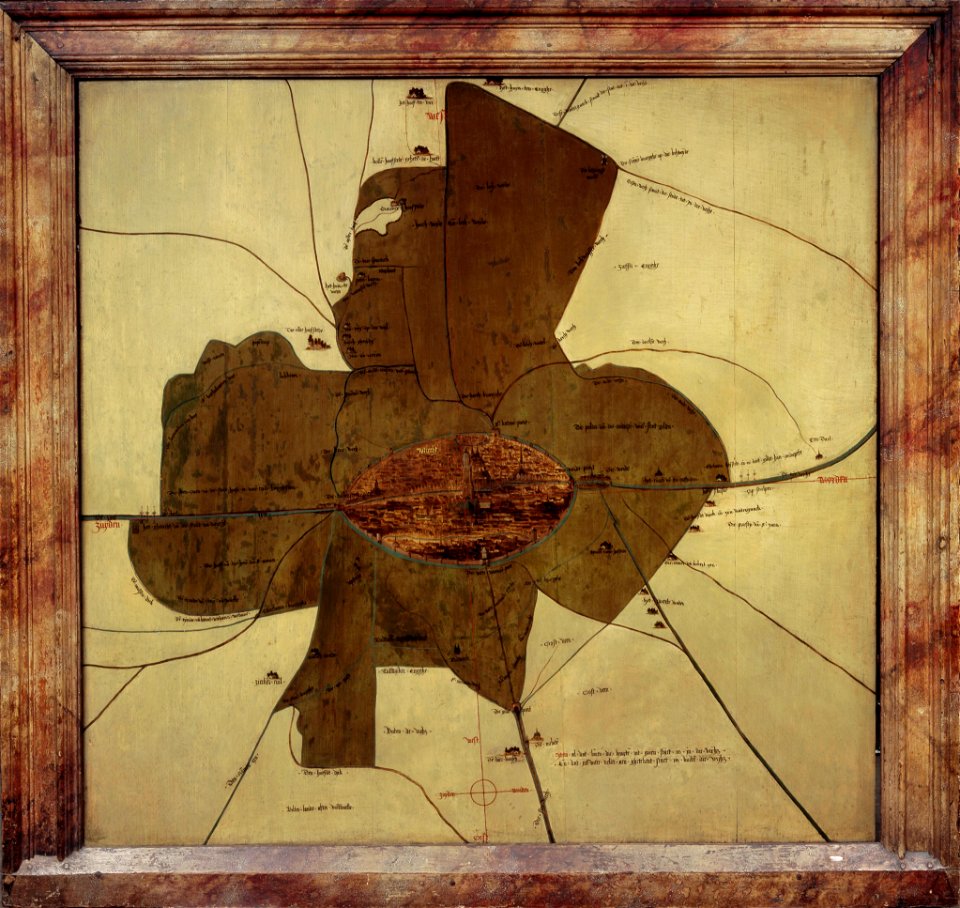
old manuscript maps
pictorial maps
old maps of groningen (province)
maps with cartouches
büderich (wesel)
netherlands
netherlands
wesel
17th-century maps of the netherlands
maps with cartouches
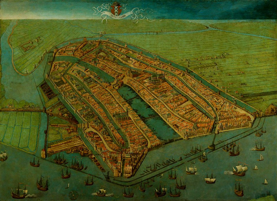
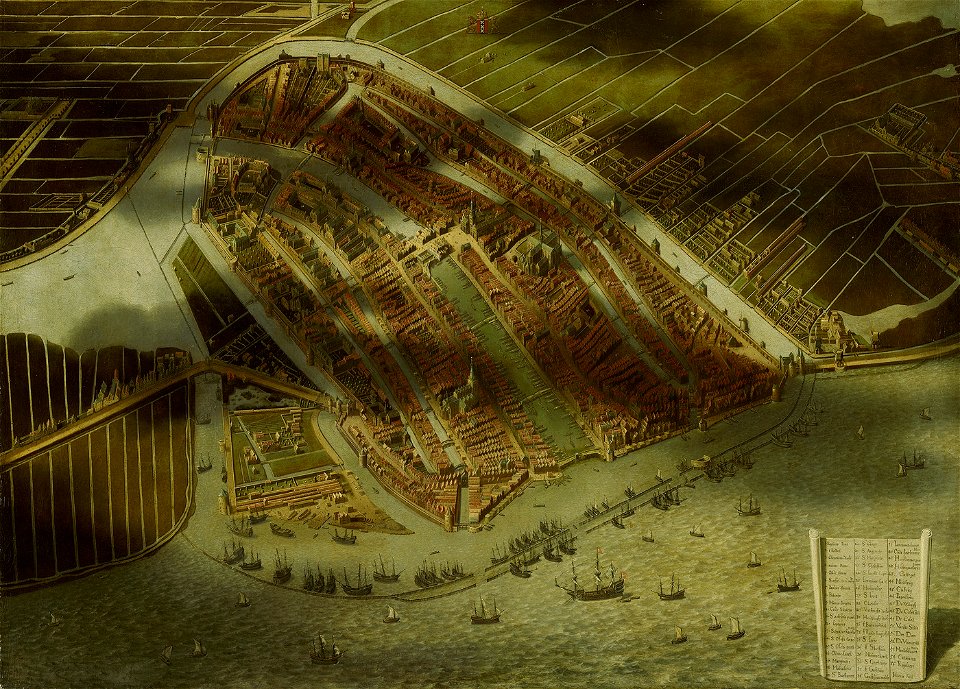
16th-century oil on panel paintings in the netherlands
paintings of amsterdam
maps of battles of the netherlands
hugh mackay (general)
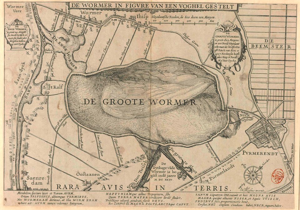
animal shape
purmerend
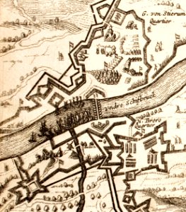
circumvallatielinie (groenlo)
coats of arms on maps
prints from dankaerts historis at the peace palace library
17th-century maps of maastricht
atlas de wit 1698
netherlands
atlantis magni tomus secundus (biblioteca comunale di trento)
nicolaes visscher ii
17th-century maps of the netherlands
maps with cartouches
17th-century maps of the netherlands
maps with cartouches
17th-century maps of the netherlands
maps with cartouches
old maps of mexico
pictorial maps
netherlands
the hague
maps with cartouches
atlas van der hagen
fortifications in the netherlands
history of tiel
maps made in the 17th century
netherlands
maps with cartouches
atlas van der hagen
netherlands
limburg
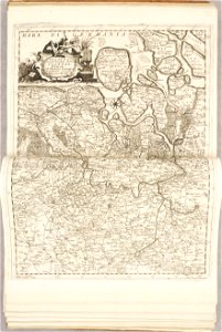
maps by willem and johannes blaeu
circumvallation
elburg
wesel
1780 maps of the netherlands
1780 maps of germany
fortifications in the netherlands
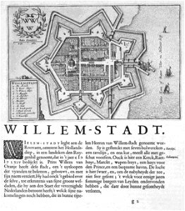
geertruidenberg
frederick de wit
netherlands
fortifications in the netherlands
wijk bij duurstede
maps by pieter schenk (i)
gerard valck
17th-century maps of maastricht
maastricht
maps with cartouches
atlas van der hagen
maps by willem and johannes blaeu
circumvallation
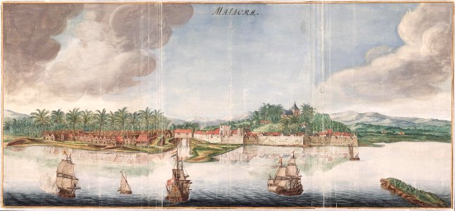
sailing ships of the netherlands
1665
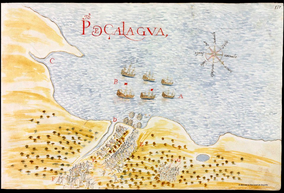
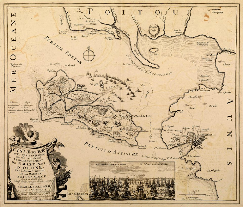
sainte-marie-de-ré
bombardment
fortifications in the netherlands
zwartsluis
artworks without wikidata item
17th-century prints
topographical paintings in the amsterdam museum
paintings of amsterdam
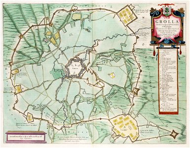
prints from hugo de groot grollæ obsidio at the peace palace library
1620s maps of the netherlands
topographical paintings in the centraal museum
16th-century paintings in the centraal museum
maps with cartouches
atlas van der hagen
franco-dutch war
netherlands
17th-century fortress plans
cityscapes in art
1 - 100 of 125
Next page
/ 2